Another Rainy Week Ahead

It’s been a little crazy with all of the rain lately, and it’s going to continue for one more week before a pattern shift occurs to begin drying things out. At the time of this early blog release, storms should be moving through the state Saturday night. Then, additional rounds develop and move across from Monday night through next weekend. Flooding will be a concern.
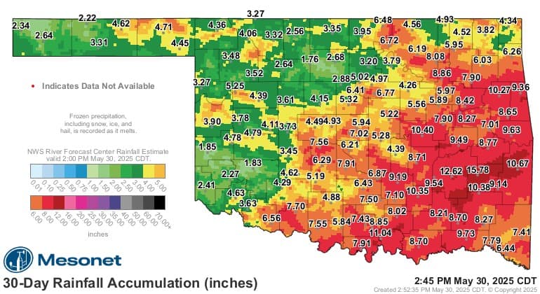
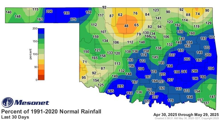
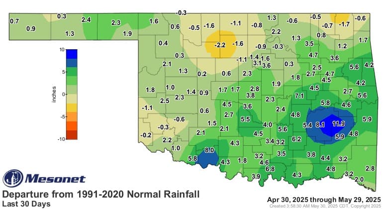
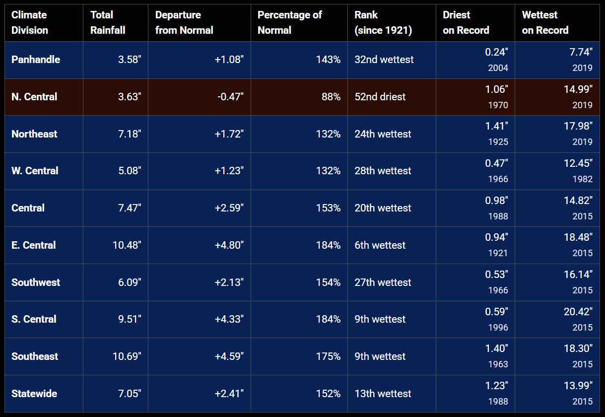
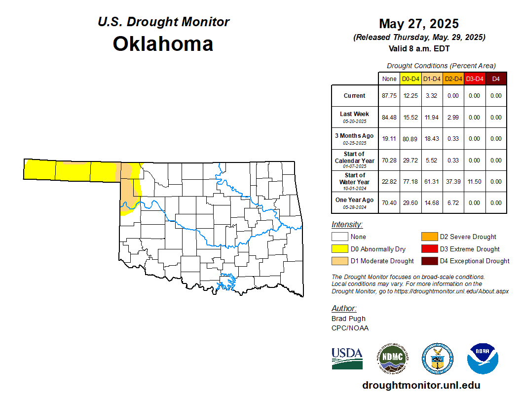
First, let’s recap how much rain we’ve seen and the status of the drought. Drought? What’s that? Exactly!

Ferguson Roof Systems is offering an AT's Weather special!
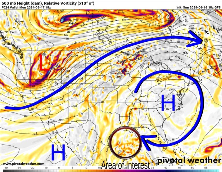
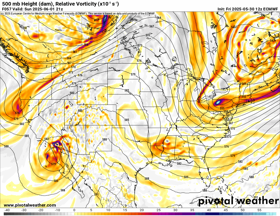
We’ve passed the peak of our severe weather season, and although we still do get some severe storms this time of year, they wind down pretty quickly over the coming days as a summer-time ridge starts to build overhead. The Jetstream will be active this week before the pattern adjusts the following week. During the animation, you can count the disturbances rolling through with the brighter yellow/red color regions.
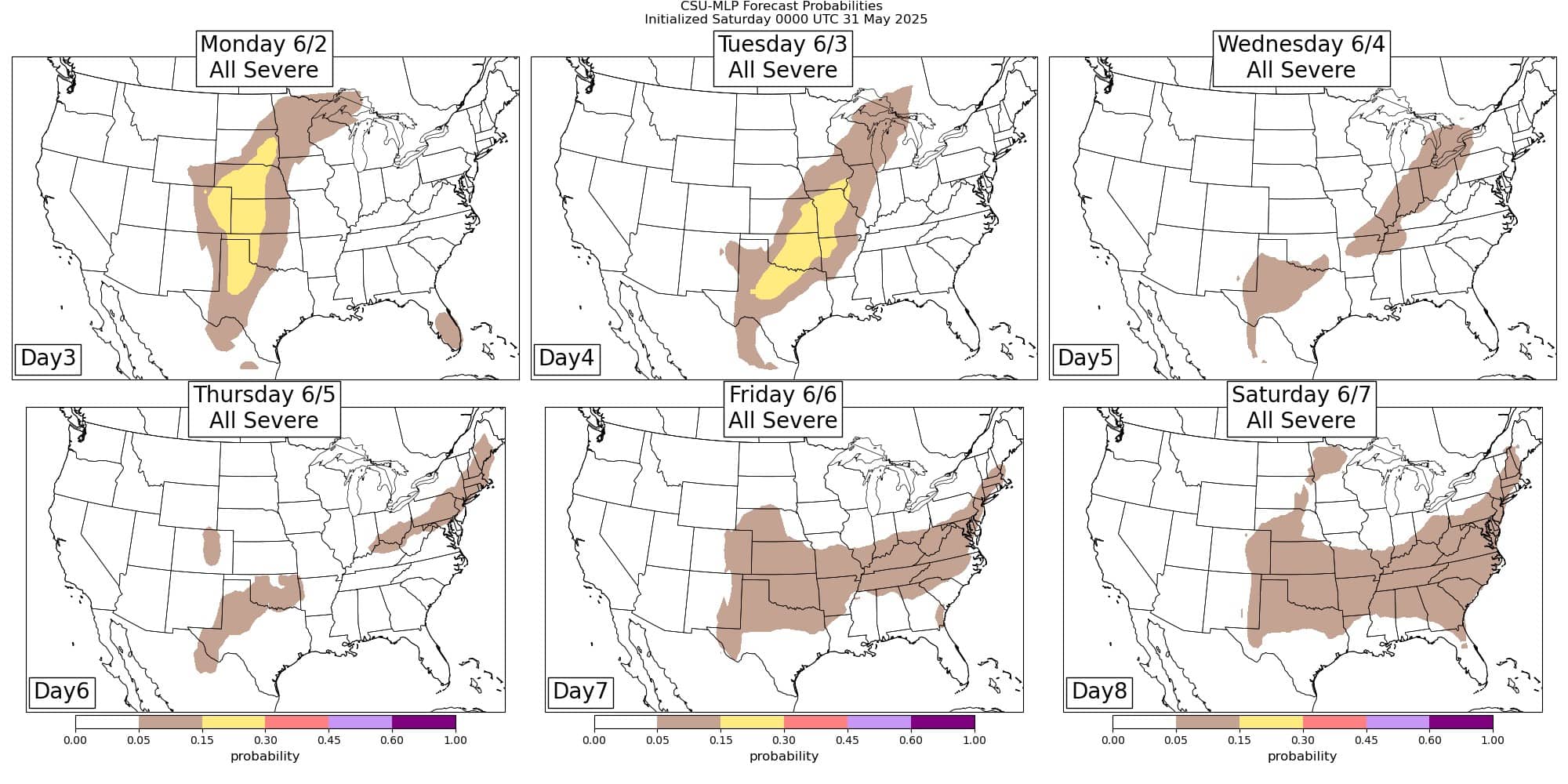
Back to severe weather, a strong CAP will be in place Monday across the state as storms develop across the Texas Panhandle. They will weaken as they cross over into Oklahoma during the evening hours. On Tuesday, we will likely start the day with scattered showers or weak thunderstorms, and they will expand throughout the day. A cold front will move in from the north, triggering additional development through the night. With so many storms around, this should limit insulation, thereby reducing the magnitude of the severe weather. Hail and wind will be the primary threats as usual. A tornado would be a freak occurrence. After Tuesday, the front retreats northward and is then met with another cold front Wednesday into Thursday. Followed by another weak front on Friday and one on Saturday. This time of year, the fronts barely make it, and if the boundary washes out, we become stagnant, humid, with weak surface winds, and occasional showers and storms.
Ferguson Roof Systems is offering an AT's Weather special!

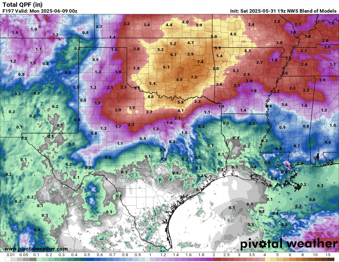
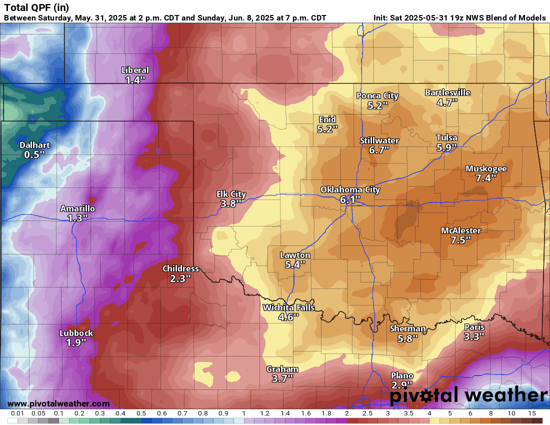
Flashing flooding will likely be a concern as well with the rain this coming week. Amounts are excessive in the model blend. Keep in mind that this will not take into account any severe storms that move across the same track or move very slowly. In those cases, you can pick up quite a bit more. So expect some isolated amounts that are higher than what is shown below.
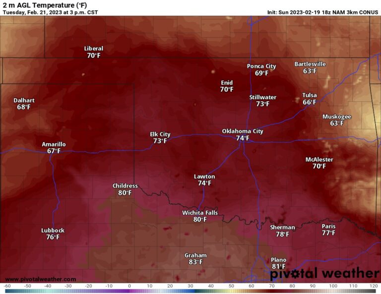
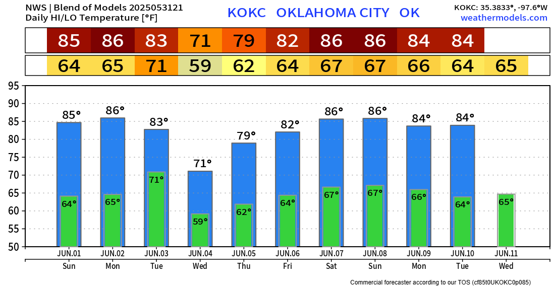
Temperatures will be about normal this time of year, outside of the rain events.

Be sure to mention Aaron Tuttle when you call (405) 820-1193!
I’ll try to update throughout the week, but I’ll be mostly out of pocket due to prior commitments. Always use my free weather app, ATsWeatherToGo, on the Apple and Google app stores to track storms. It will tell you if a tornado is coming well before the actual warning is issued by the NWS. You can read more about it here: App Overview. -AT