Snow Monday, then a Thaw, but Icy Trouble Looms
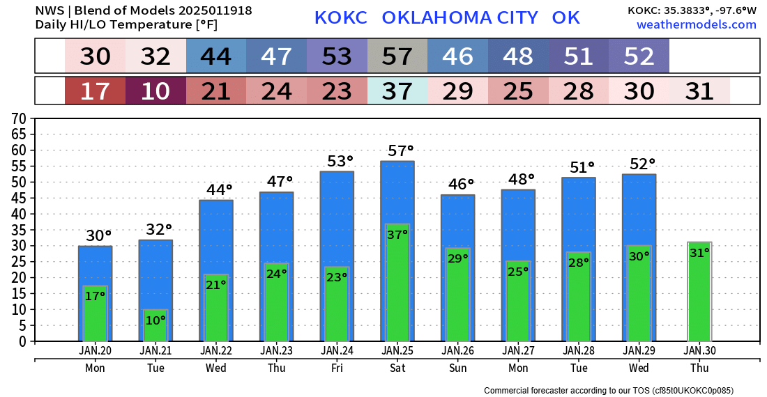
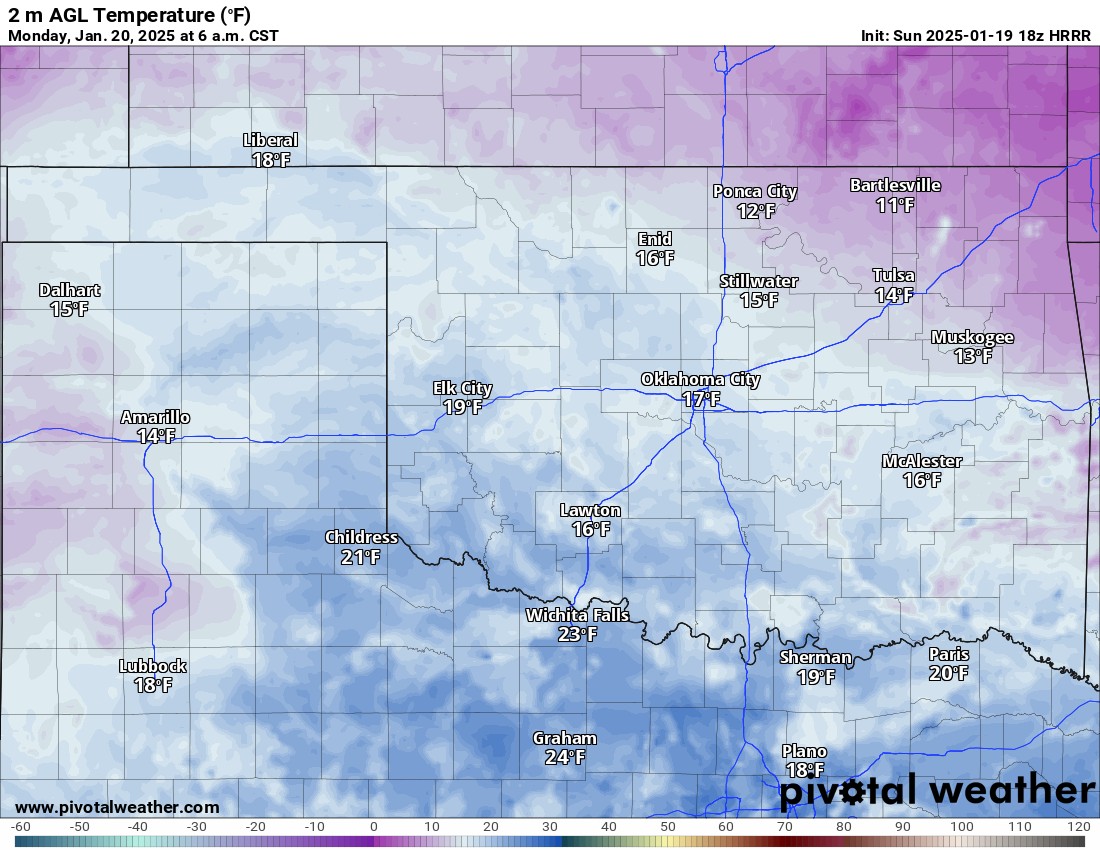
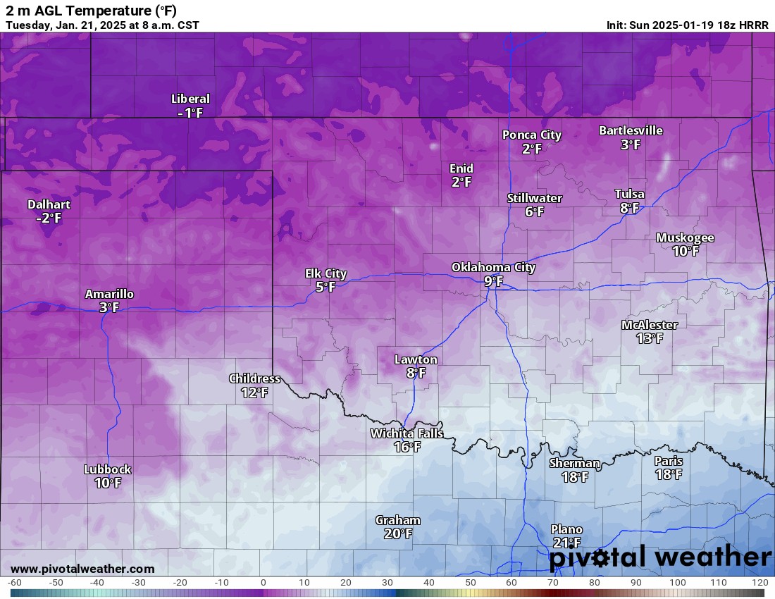
The long-announced arctic blast arrived over the weekend and although frigid, we’ve been colder in recent past winters. Teens and single digits will grip the state Monday and Tuesday morning before things start to moderate. In the long term, there may be a classic setup for another Oklahoma ice storm. More on that below.
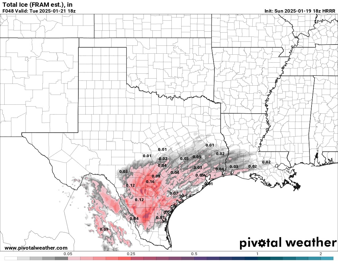
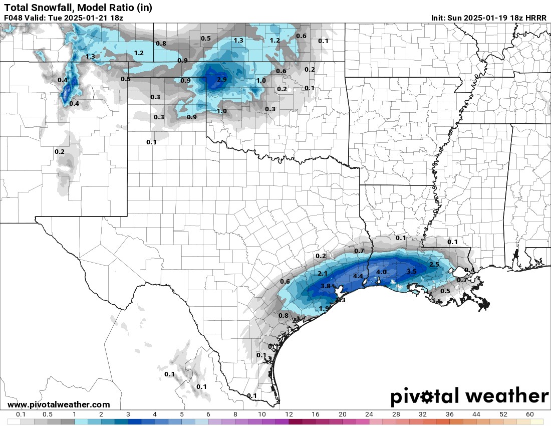
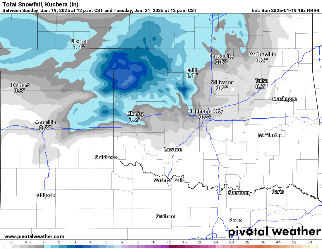
Our first storm system moving through Monday is a long-wave upper trough. Models had struggled for a few days to close it off with more of an upper low or keep it in its current configuration as it passed by. The difference is in the amount of precipitation. As a trough axis, the lift is weaker and the moisture is less. So in other words, less snow. Where the trough has more of an influence is on its southern end. This part of the disturbance will greatly enhance the gulf moisture in S/SE TX producing a significant winter storm for those folks. That means places like Houston and New Orleans see snow for the first time in a long time.
 Restoration and Disaster Cleanup Service
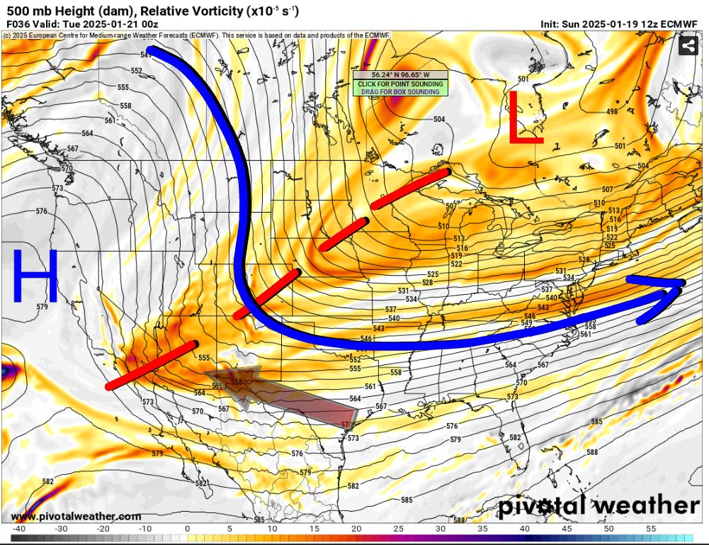

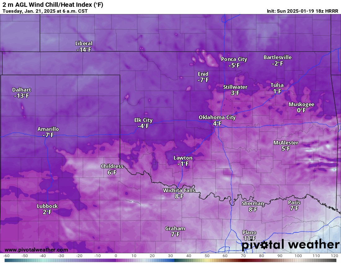
Temperatures are going to be cold and if your home is susceptible to pipes freezing, the next couple of mornings will be problematic. Since daytime temperatures will get out of the teens and into the 20s or so, city infrastructure should remain mostly intact regarding pipes bursting. A reinforcing front will move through during the day Monday with the snow which will drive those temperatures down again by Tuesday morning into the single digits. Wind chill values will be below zero for several by then as well.
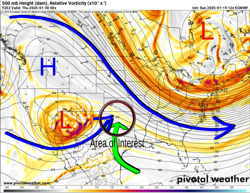
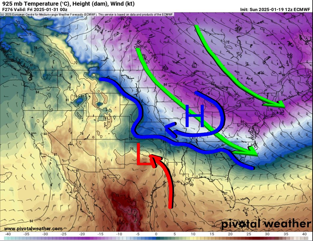
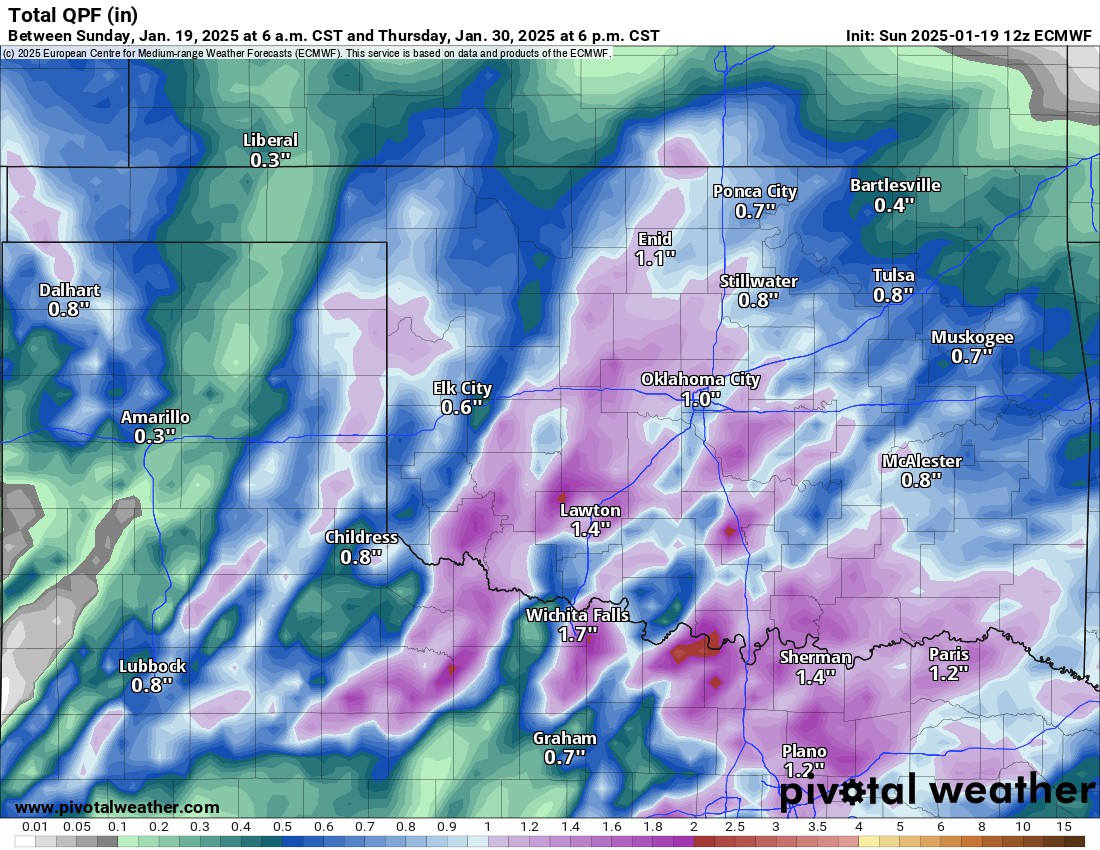
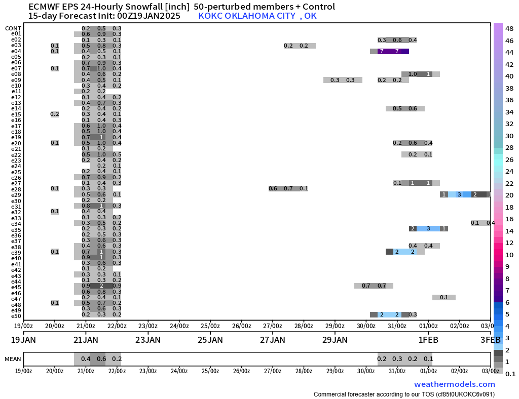
After the moderating temperatures this week, a pattern change occurs for the following. Although this is beyond the scope of this week’s forecast, it’s worth mentioning as something to keep an eye on. The pattern is a classic setup for an Oklahoma ice storm. The devil is in the details and we may not know how cold the temperatures will be until a couple of days before the event. All I can say is, you better hope we have a cold rain at 40 degrees, rather than an icy mess at 28 degrees. As of today, models indicate that the glancing blows of Arctic air we receive will moderate quickly before the storm arrives. While this can be true, the opposite can also. There are model spreads that keep us below freezing. There is plenty of time to sound the alarms if trends turn cold. The amount of rainfall is impressive, nearly 1 inch. Now imagine that is all freezing rain. Not a good thing! The Euro ensemble shows a signal for snow around the 30th, so the data supports a close examination.
Restoration and Disaster Cleanup Service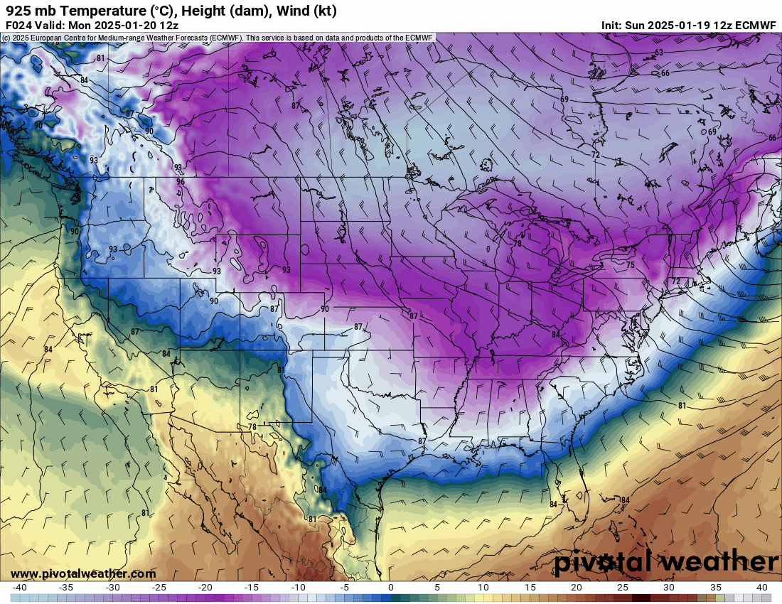
Thankfully we’ll see a warming trend for the most part. Keep in mind that at any given time, one of these cold fronts can slip into Oklahoma providing a much colder day than otherwise anticipated. It happens quite often in a pattern such as this. They typically backdoor in from KS and MO and hit NE OK first then ooze SSW into C OK. I’ll keep an eye out for trends. -AT