Fire Weather Season is Here
The rain we received over the weekend won’t be enough to temper the high fire danger. As we move towards our Spring season, wildfire concerns ramp up until the stormy weather kicks in.
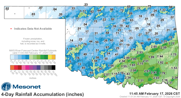
Rainfall amounts were decent across the SE but poor in other locations that needed it. Models went too far on the promised amounts, with widespread 1-2″ for most of the state.

Ferguson Roof Systems is offering an AT's Weather special!
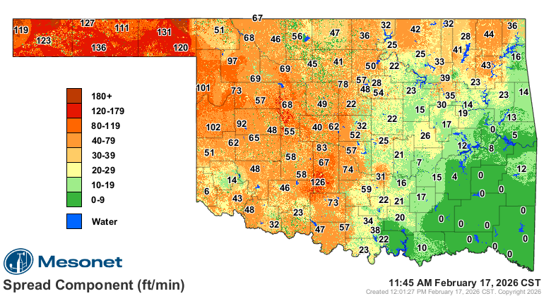
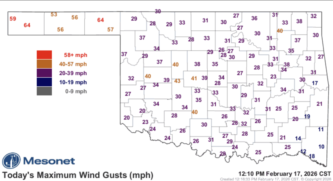
Until things begin to green up, they’ll dry out. Which means the spread index will increase in intensity. The higher the number, the easier it is for wildfires to spread. This is a function of the dry vegetation, low humidity, and high winds. Wind gusts have already exceeded 60 mph in the panhandle today.
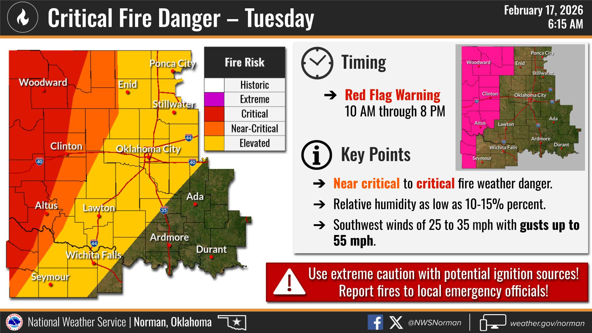
The fire danger extends from C OK today to the west and will continue tomorrow and Thursday as well. You can find more wildfire information under the menu tab on my website: https://aarontuttleweather.com/wildfire-information/

Be sure to mention Aaron Tuttle when you call (405) 820-1193!
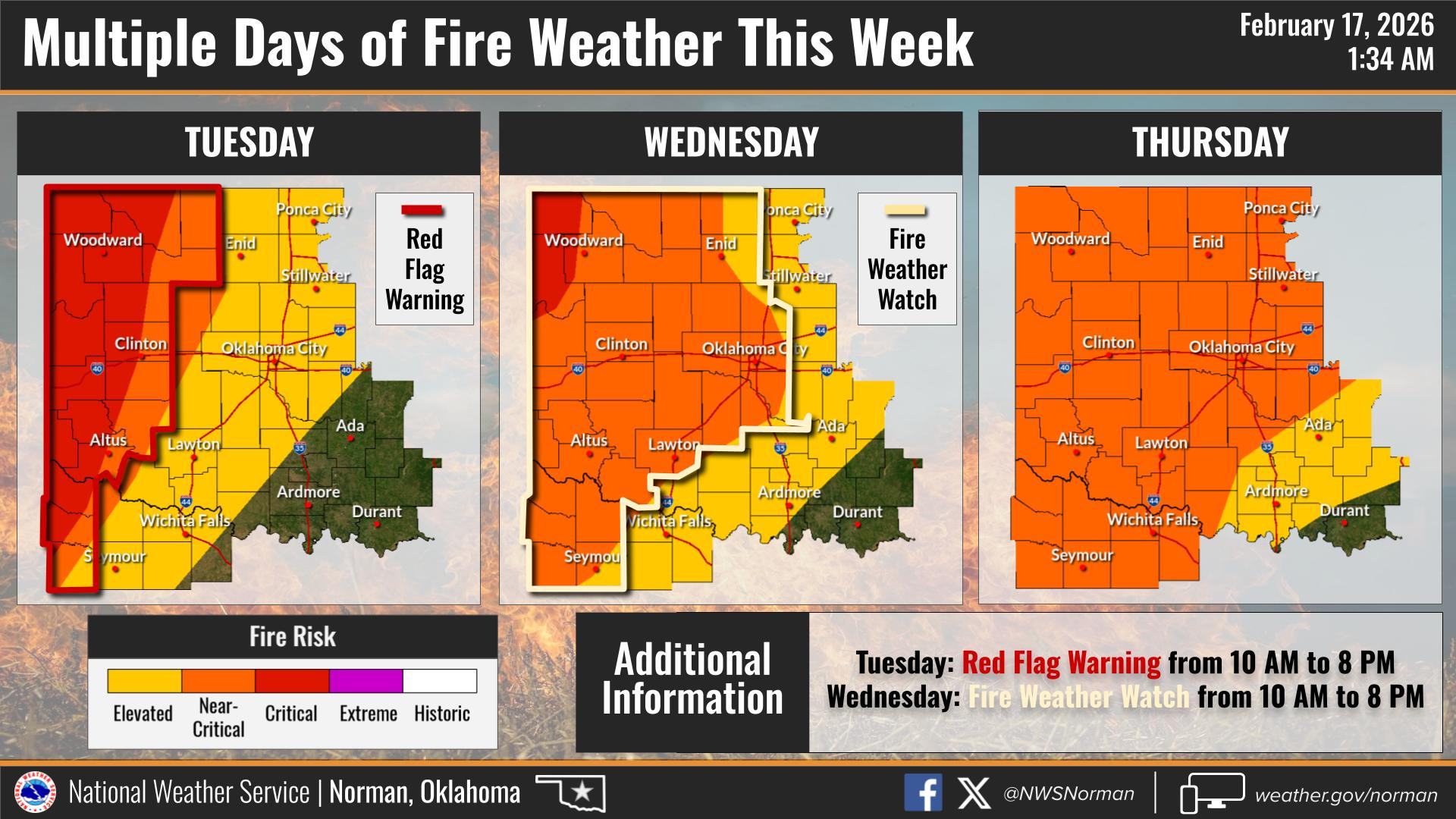
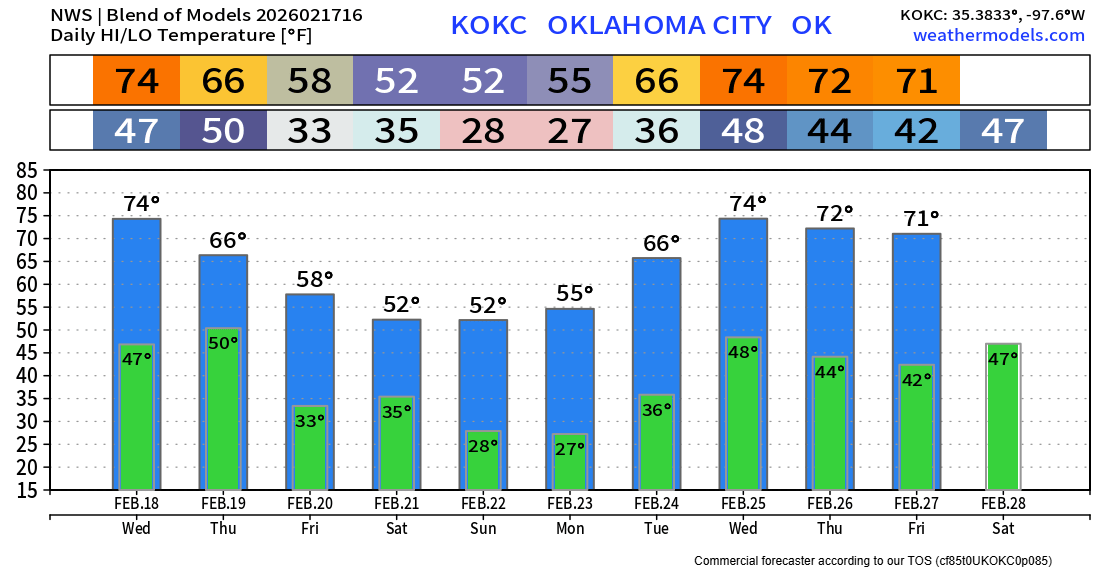
There are a couple of cold fronts that will move in at the end of the week and over the weekend, knocking our temperatures down a bit. No signs of any significant rainfall through the weekend.