Severe Weather Returns This Week
We escaped the latter half of March, but April will start out like it should, with some severe weather across the state. The good news is the rainfall it will bring.
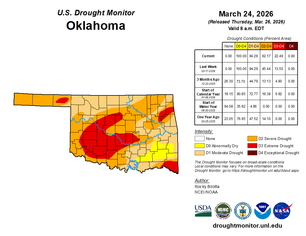
As before, our drought continues to expand. So the timing of the rain is much needed. Our plants, trees, and grass are thirsty for it! The wind will be ridiculous all week, so get used to it.
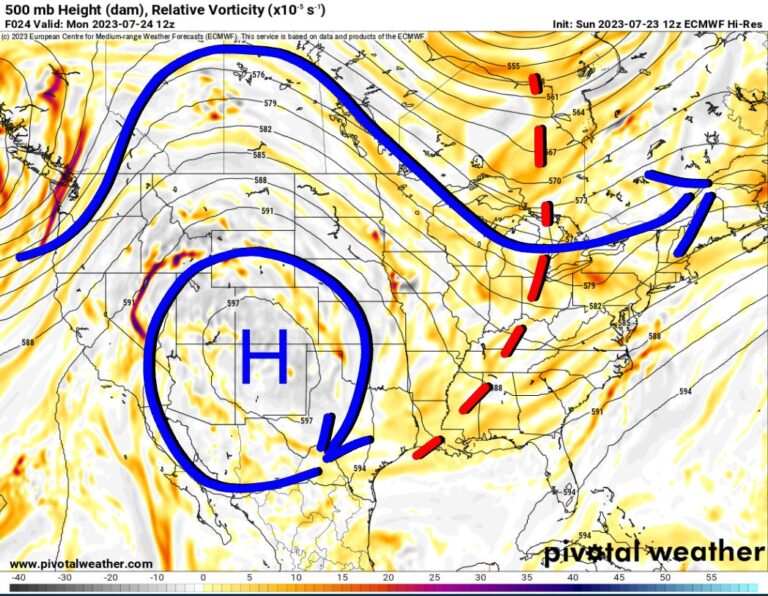
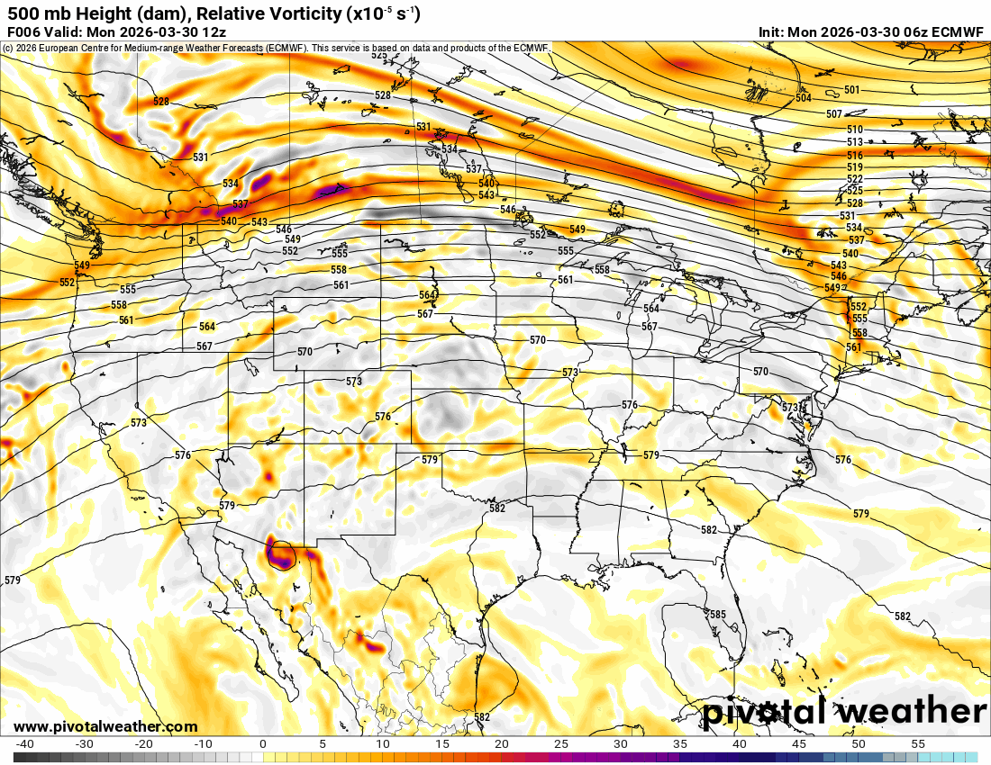
The Jetstream shows two systems, one arriving on Wednesday and the other on Friday. Each will trigger showers and storms.
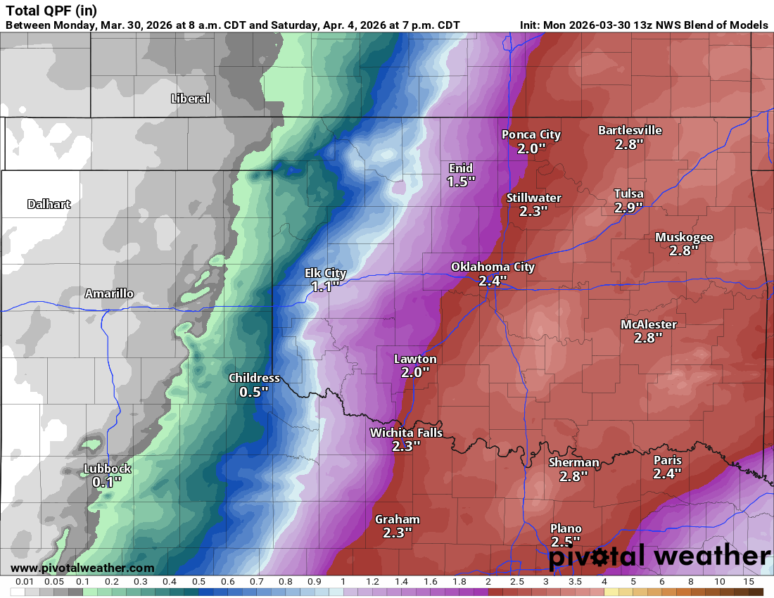
The rainfall looks fairly decent this week. I’m a little cautious, however, about these averaged rainfall totals. One can hope!

Be sure to mention Aaron Tuttle when you call (405) 820-1193!
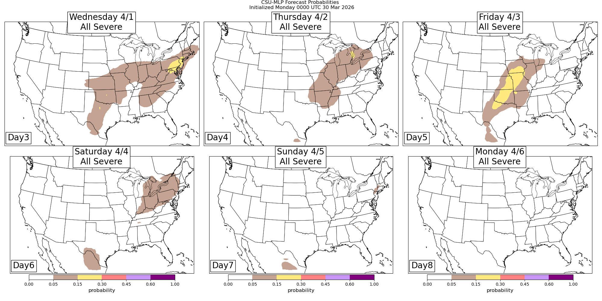
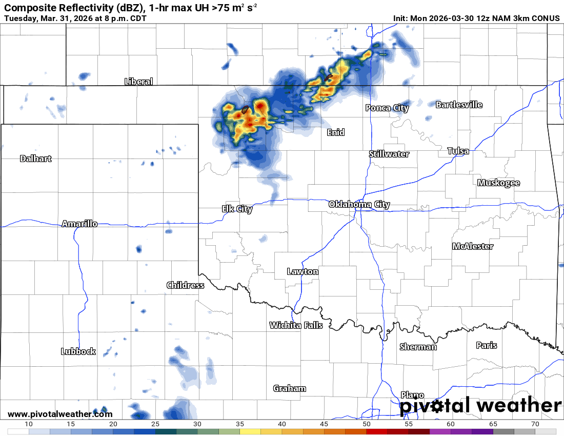
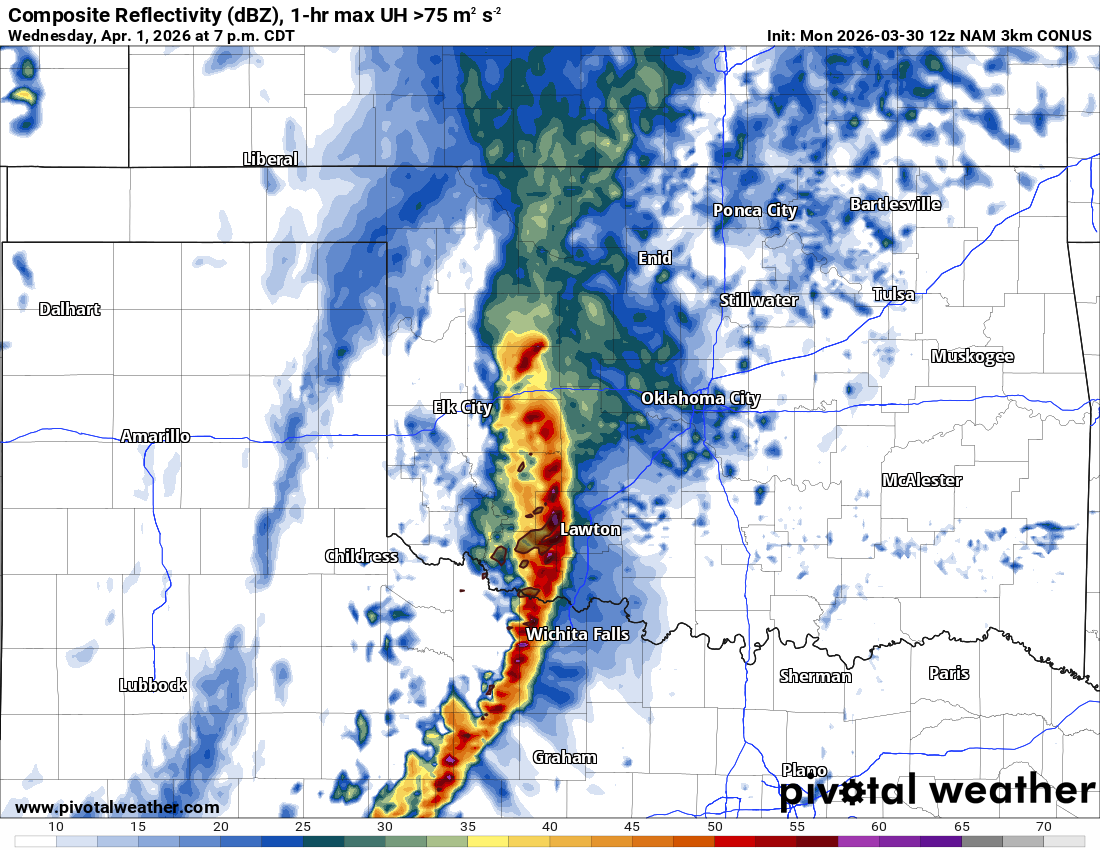
Let’s discuss the timing of the storms and the severe weather aspect. Our first round of weak storms with wind and hail will focus across the NW 1/3 of OK on Tuesday afternoon and evening along a weak cold front. The other area will be across the E TX panhandle along the dryline. These will shift eastward but fall apart after sunset. The round on Wednesday should be a high-based squall line traveling from SW to E/NE across Oklahoma during the late afternoon/evening. Wind and hail will be the primary threats again. Sometimes you can squeeze out a QLCS tornado along the leading edge. Friday will be our last round of severe storms as they should develop by late afternoon. There may be a supercell/tornado threat with these. A cold front will swing through the state Friday night, triggering our last round to exit by Saturday morning, leading to a nice weekend.

With respect to the severe weather details, the SPC does not have Friday in a risk. However, the AI models do. I would expect there to be a risk issued over the coming days.
 Restoration and Disaster Cleanup Service
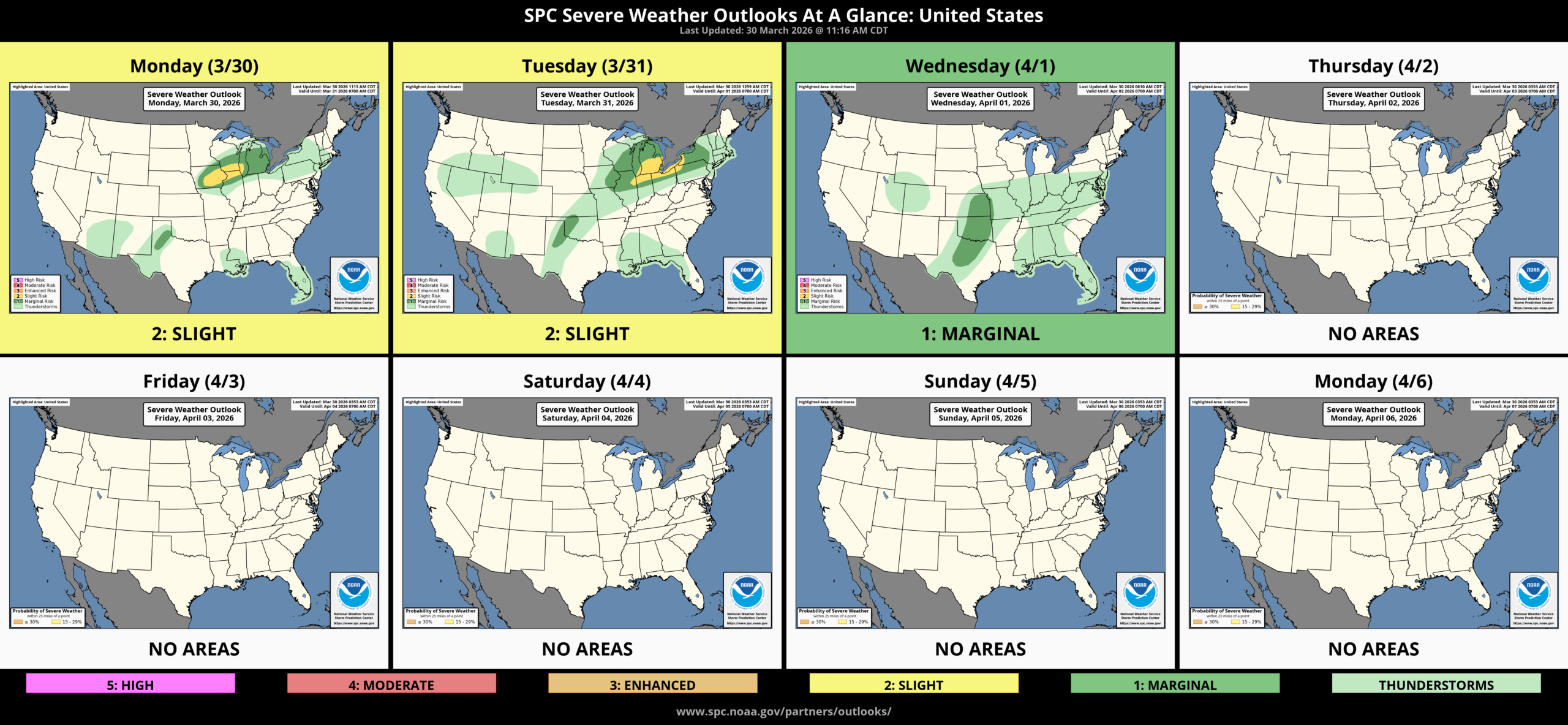
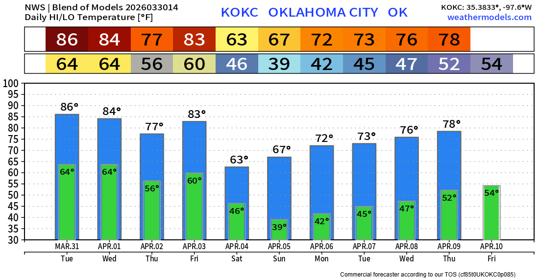
As far as temperatures are concerned, more warm weather is here. A cool down for the weekend and beyond, and notice those low temperatures for sensitive vegitation.