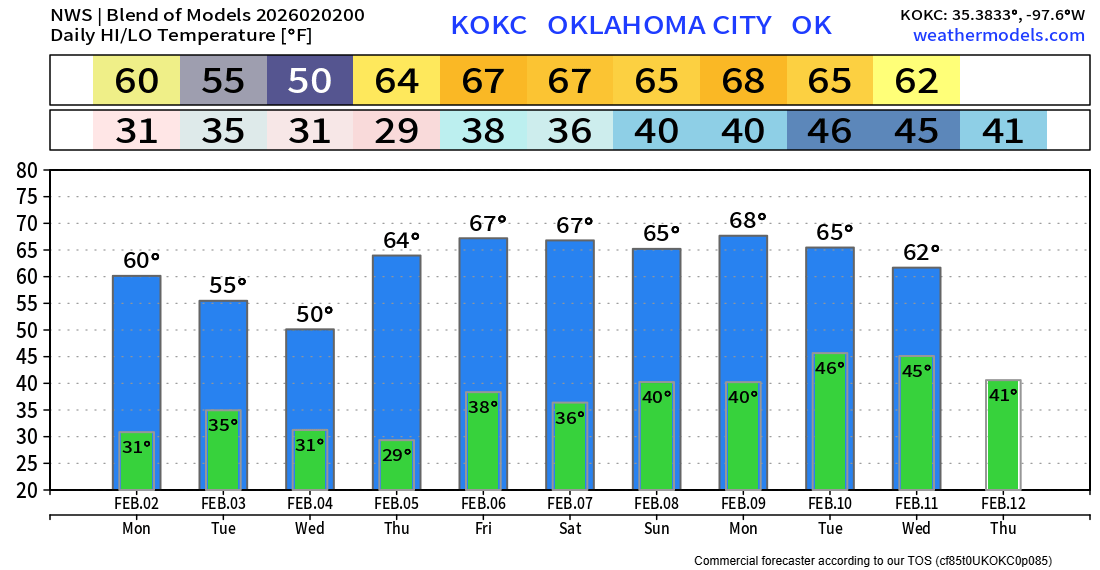
Midweek Winter Mix Then Above Normal
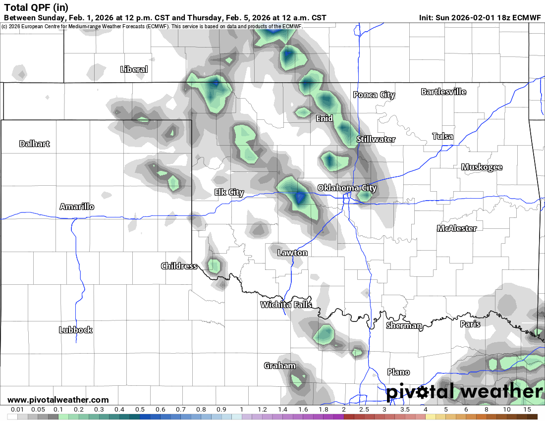
The highlight this week will be an upper shortwave trough swinging through early Wednesday morning, generating some cloud cover and a light rain/snow mix moving quickly across the state. Otherwise, we’re in for a nice warm-up!
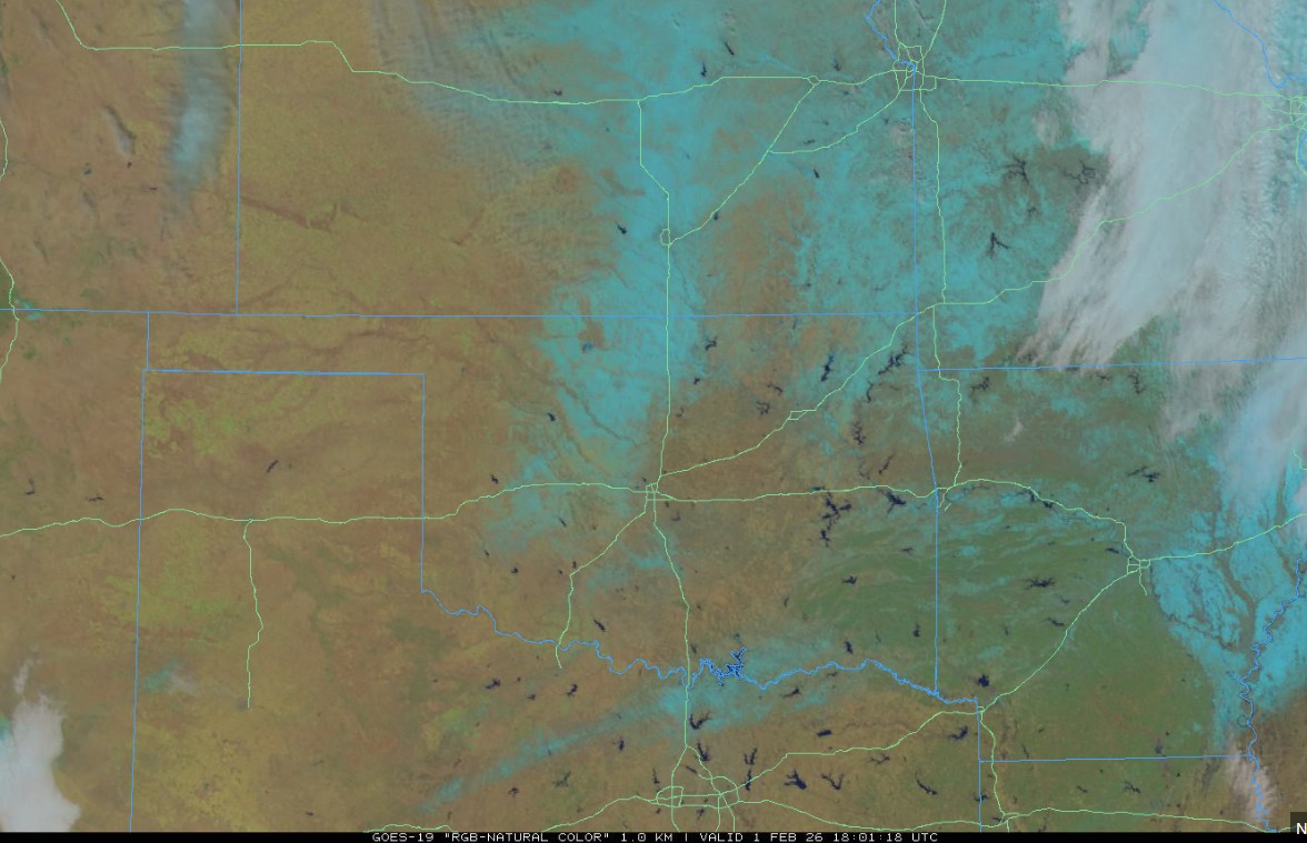
Before we look at the forecast, take a look at the satellite image from this afternoon. All that bluish color is still snowfall left on the ground. Hard to imagine we’re a week past that storm system and it’s still lingering. Pockets in shaded areas behind fences and in between houses will remain for a few more days. I’d expect it to be all gone by this coming weekend.
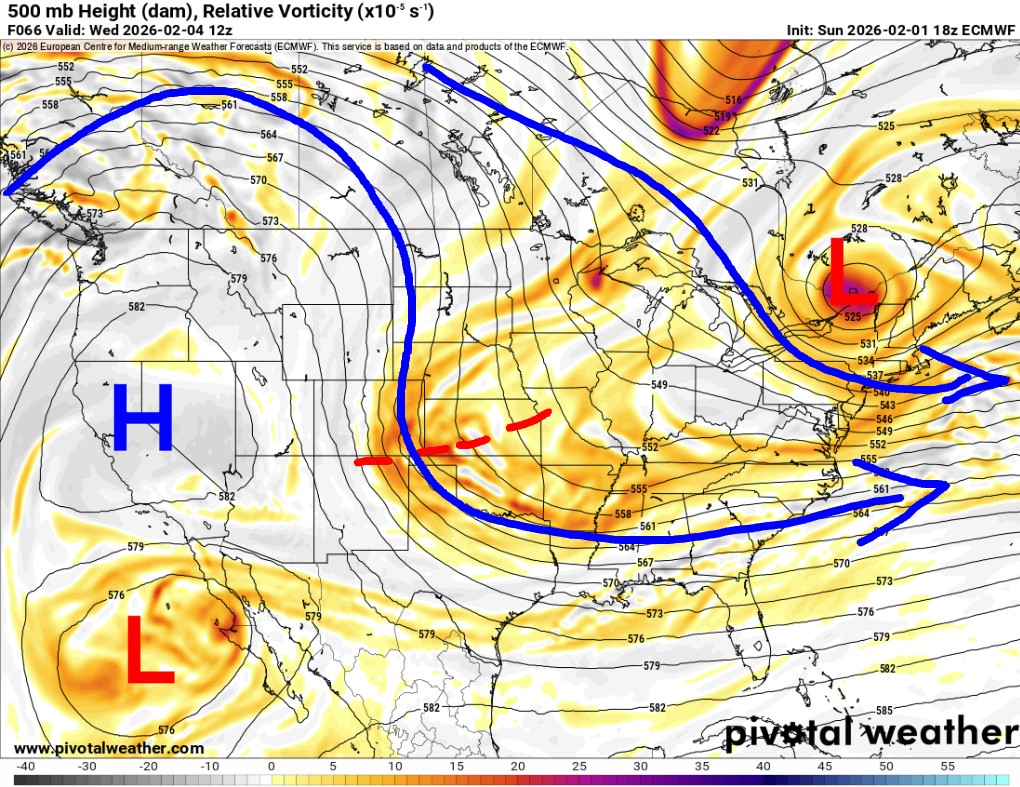
The Jetstream pattern shows that the upper disturbance I mentioned is swinging through early Wednesday. With a big ridge out west, that should bring us some cold air, but Canada isn’t loaded up right now, so it’ll be a weak cool shot for Wednesday, then we warm.
Take a look at the departure from normal animation. Do you notice how many red waves move through the country? Yes, a nice break from the extreme cold! This pattern lasts through the middle of the month. Then we’ll see what happens after that.
 Restoration and Disaster Cleanup Service
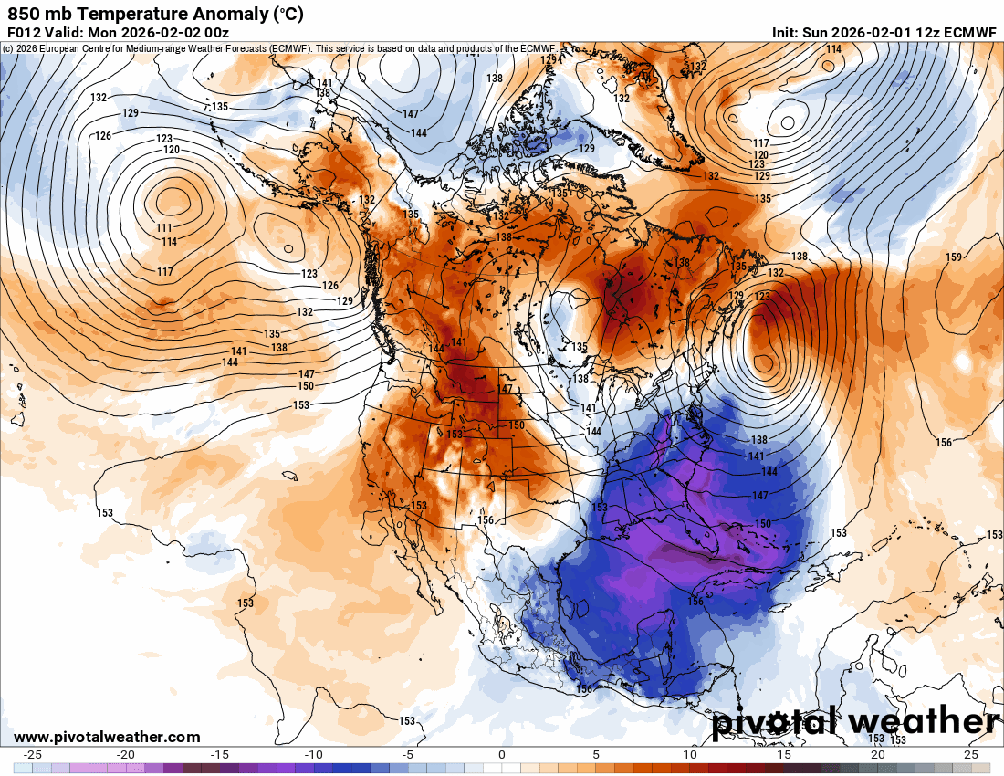
The light wintry mix won’t amount to much. Expect mostly a rain/snow mix with little to no snow accumulation. The activity will develop Tuesday night and move out Wednesday morning.

After a brief cooldown, the moderating trend begins! -AT