Fire Weather Continues and Arctic Sneak Attack
This week will be dominated by mostly dry and milder conditions, leading to a continued fire weather danger. A front will bring a few showers across the state Thursday morning, and an arctic front may slip in for our weekend.
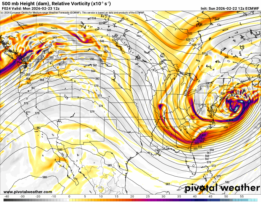
The Jetstream animation shows a fairly quiet zonal flow aloft. This can allow either a nice warmup or strong cold fronts to sneak across the Kansas border.
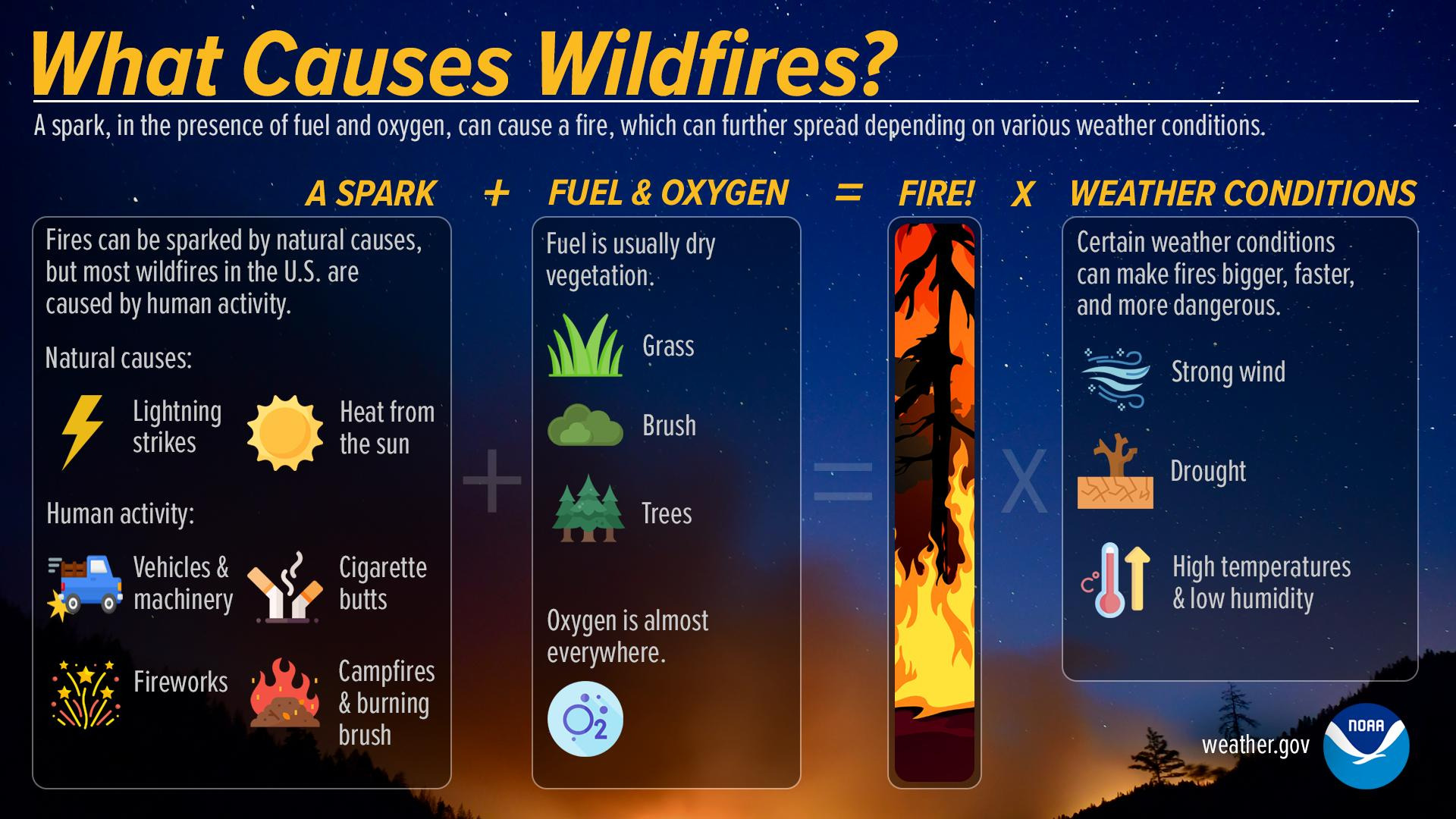
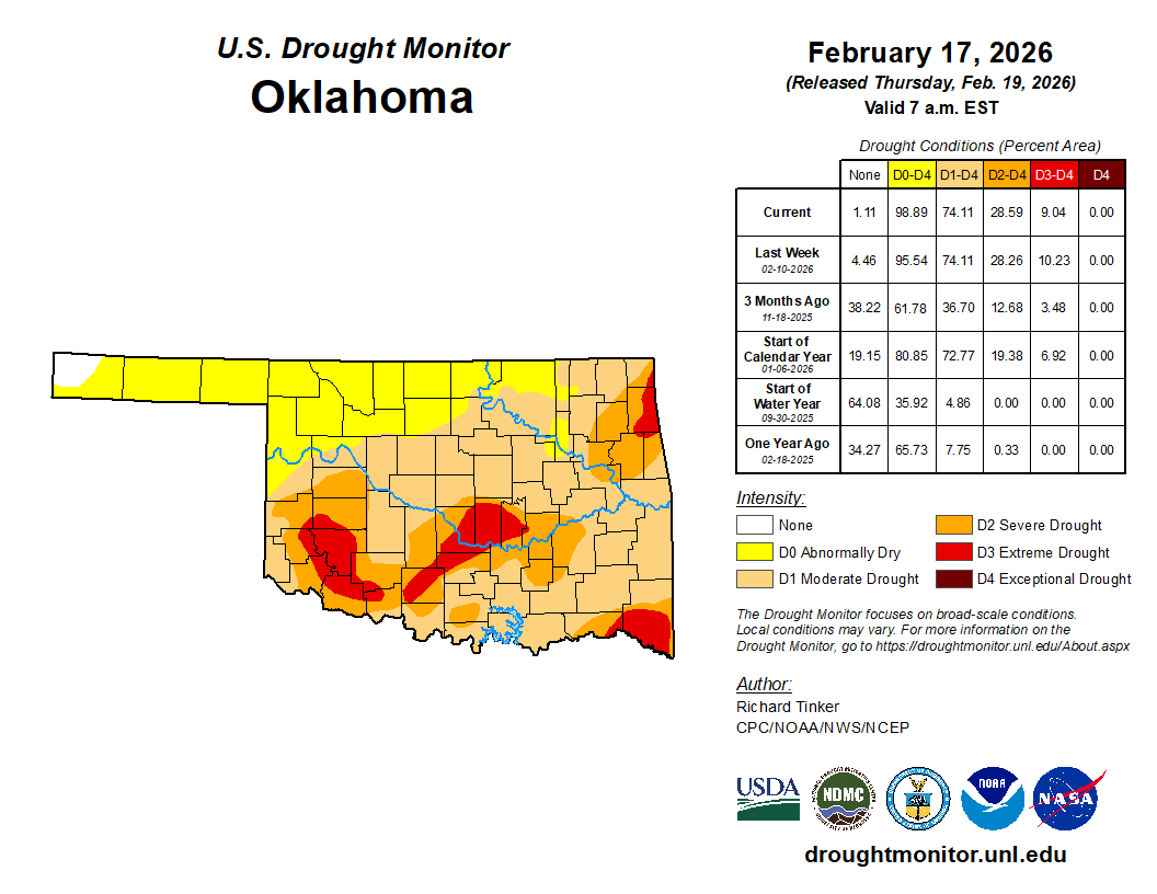
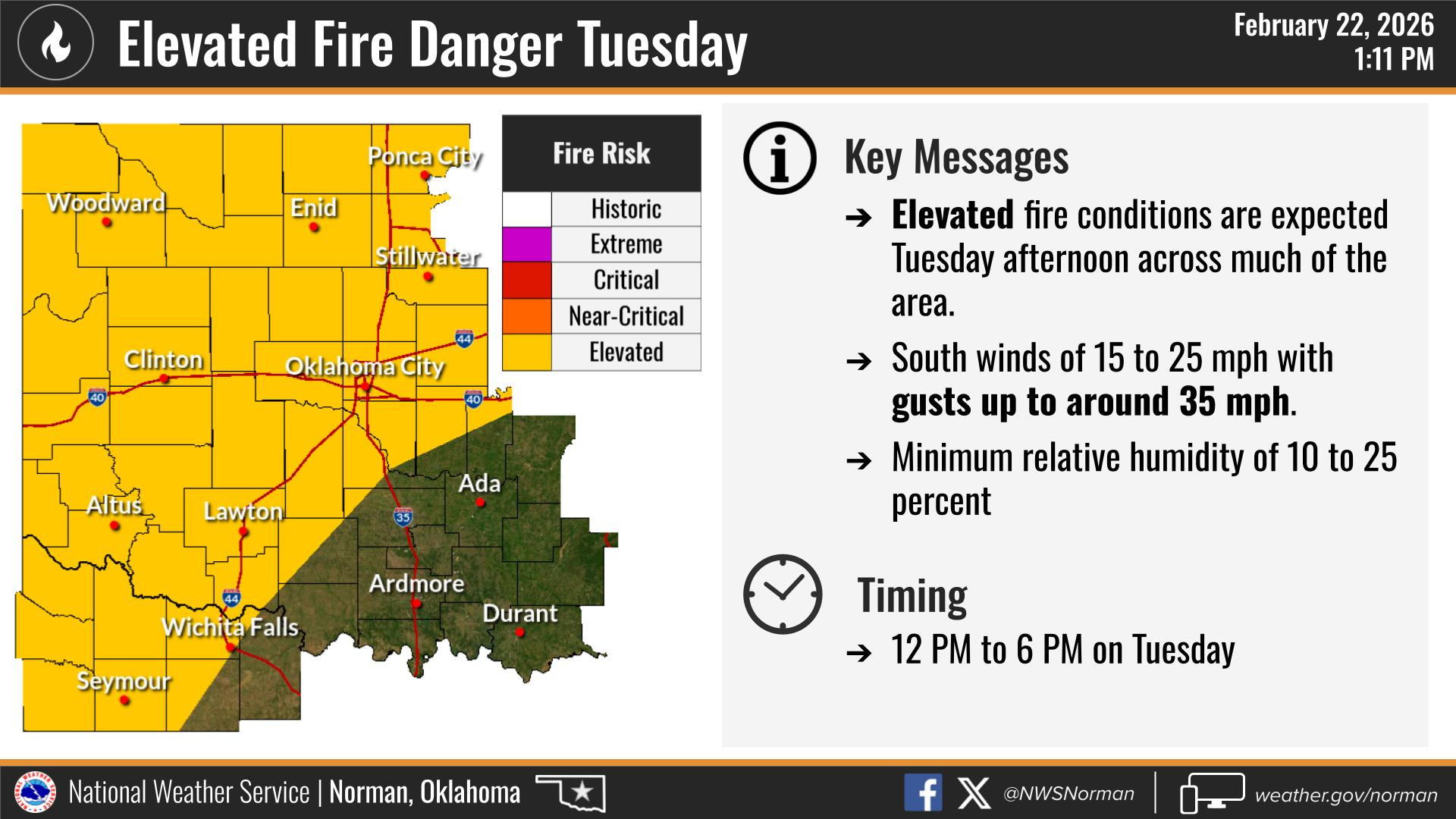
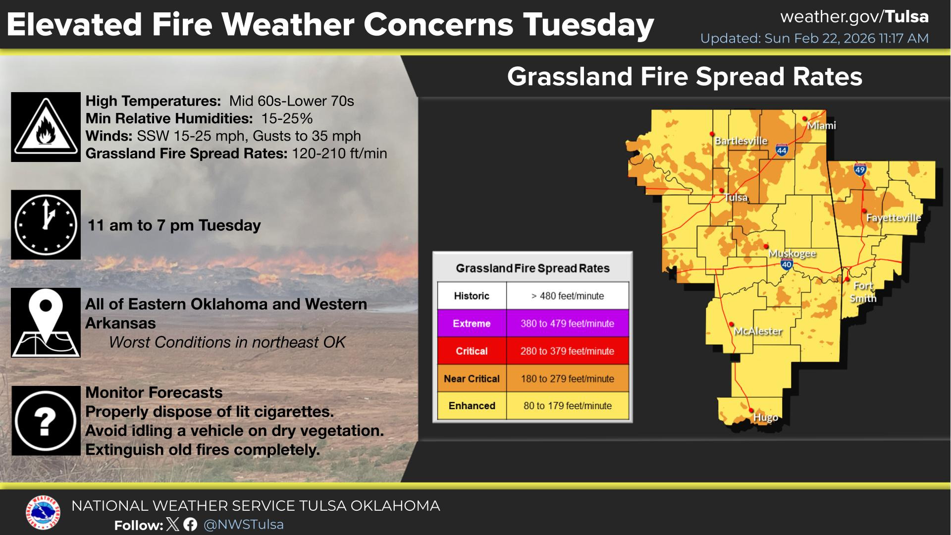
The drought continues to expand, and with the dry conditions, the fire danger will persist, the greatest on Tuesday. The NWS put together an excellent graphic regarding fire weather.
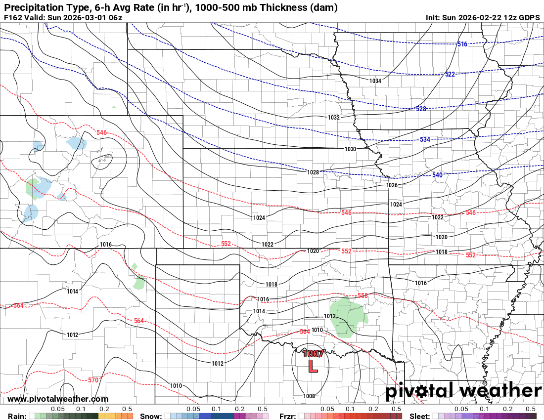
A weak front will bring in a few showers across the state Thursday morning, but it won’t amount to anything significant.

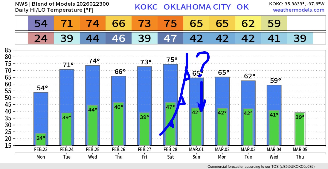
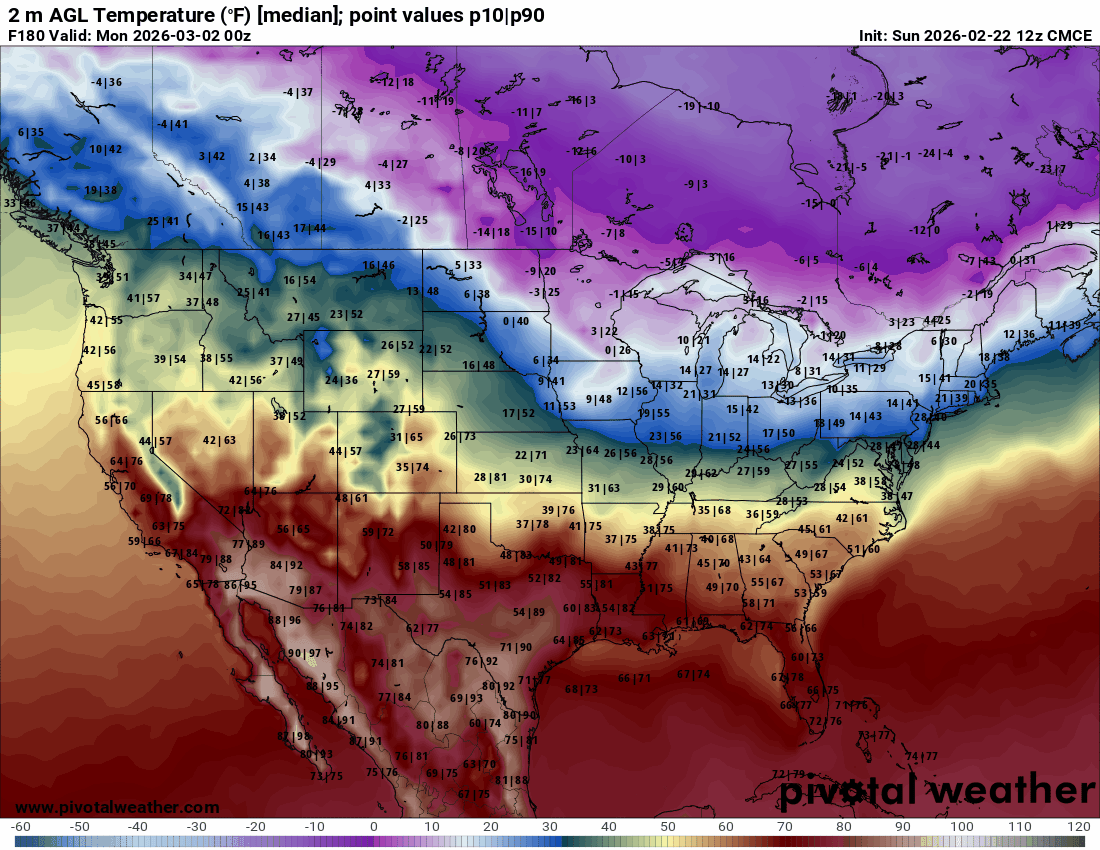
The big question is going to be this upcoming weekend. Prior model runs were much more bullish on a strong arctic airmass moving in Saturday night. Newer data backed off a bit, and now the global models are divided into two camps for Sunday. The Euro and Canadian models are cold, and the American and German models are warm. If you look at the ensemble runs from each of these, notice how they all have wild extremes. Meaning high temperatures Sunday in the 20s/30s or 70s/80s. That’s a 50-degree temperature spread in each model! Prior data had also indicated a little bit of wintry precipitation. As of now, only the Canadian model is keeping that hope alive for NE OK. The signal will settle one way or the other by midweek. Just know that Saturday is a guaranteed nice day for outdoor activity, while Sunday is a wildcard at this time.
The temperature trend over the coming days is mostly on the warm side of things. But don’t get excited and start planting early. There are indications we may get a pretty good cold snap after the 1st week of March.

Ferguson Roof Systems is offering an AT's Weather special!