Fire, Rain, Flooding, and Severe Storms This Week
The highlight for this week is the big pattern change that will bring an upper-level storm system across the desert southwest and keep Oklahoma in a southwest flow aloft. This brings disturbances across the area and those generate showers and storms.
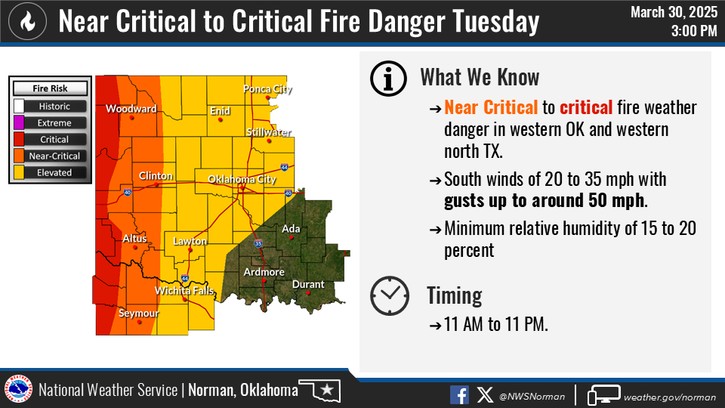
Before moisture works in, there will be a threat of wildfires across far western Oklahoma on Tuesday.

Be sure to mention Aaron Tuttle when you call (405) 820-1193!
The Jetstream animation shows the brighter colors working across the area coming in waves through the weekend. If there was a higher quality of deep gulf moisture to work with and if the cold fronts that come in weren’t so strong, we’d be having multiple rounds of severe storms. So be glad this pattern set up the first week of April and not in May.
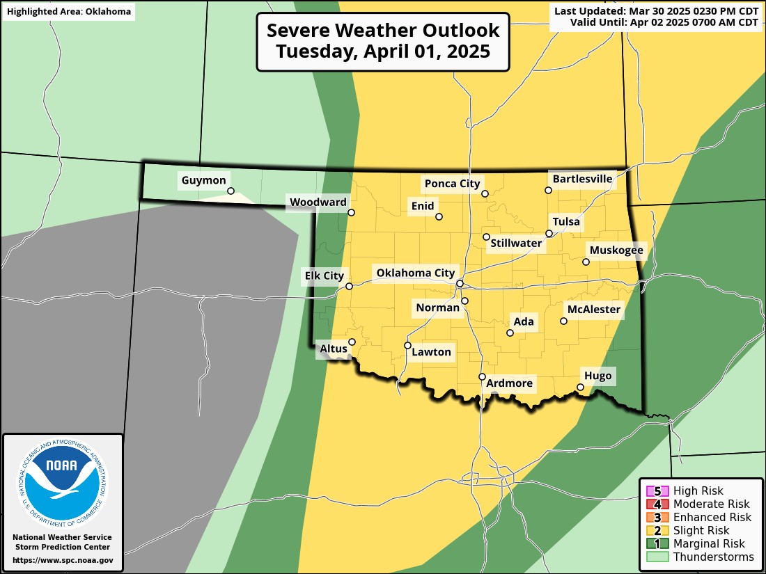
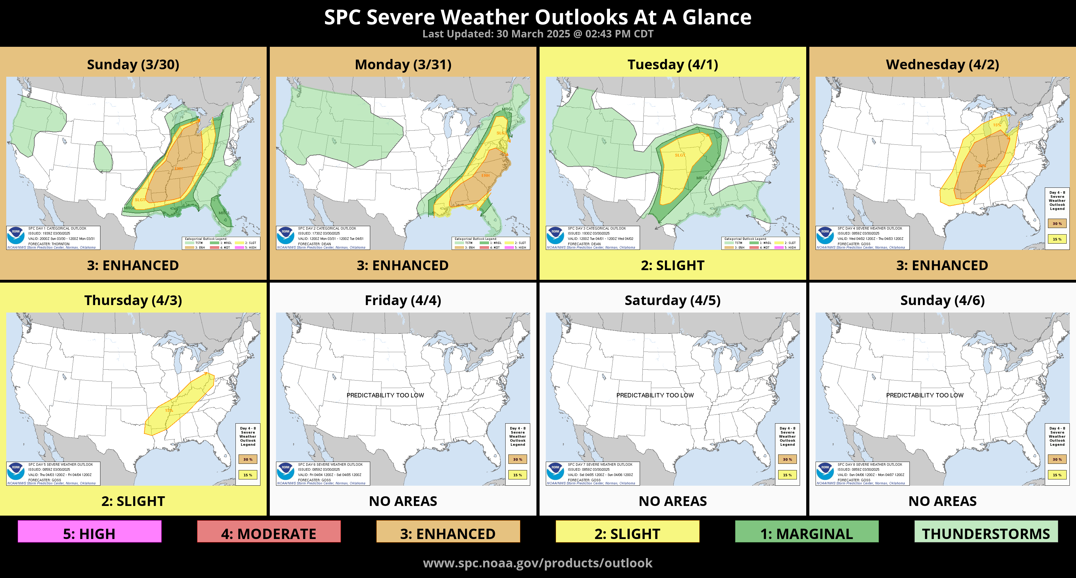
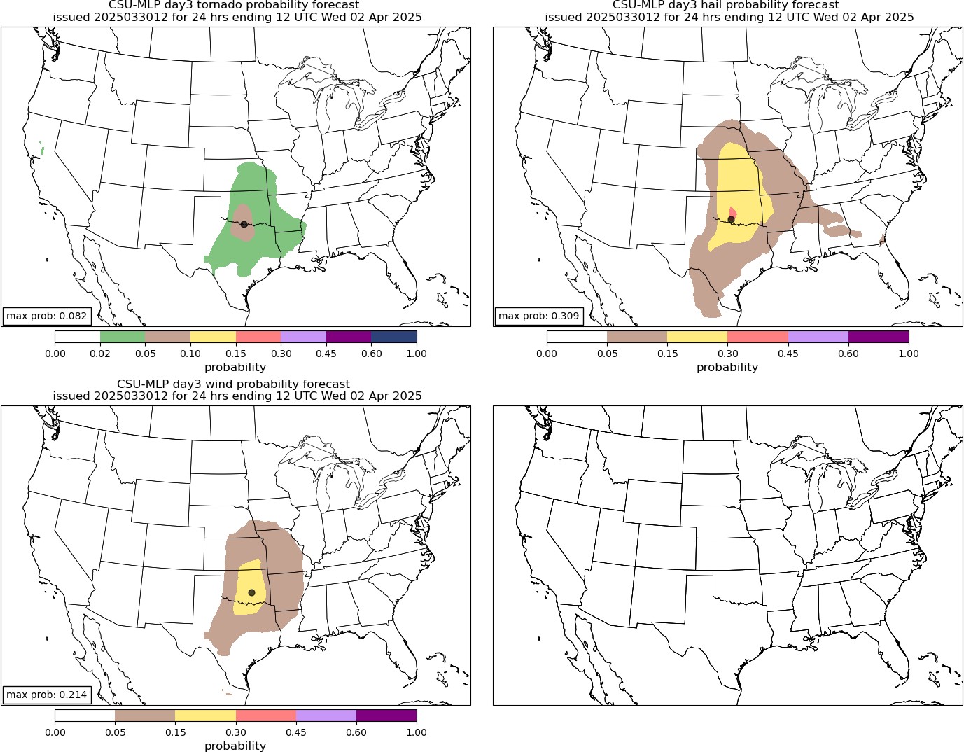
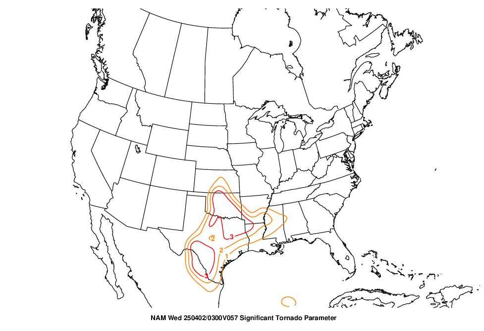
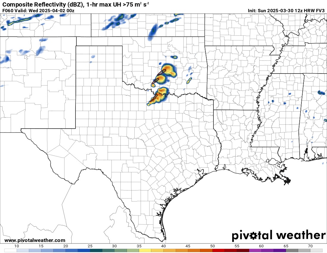
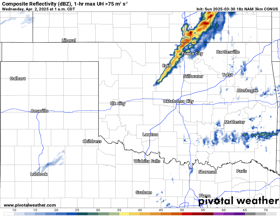
The Storm Prediction Center has highlighted what they believe will be days with severe weather. Most of Oklahoma is expected to be in a risk late Tuesday through Wednesday morning. If we compare to analogs and the AI models, there is the potential for supercell storms that could produce tornadoes. There is only one CAM model that places potentially tornadic storms in SC OK at this time. The 3km NAM suggests the CAP will hold and storms will hold off until the cold front moves through after midnight. Additional CAM models will analyze the conditions once we are within the 48-hour window.
Be sure to mention Aaron Tuttle when you call (405) 820-1193!
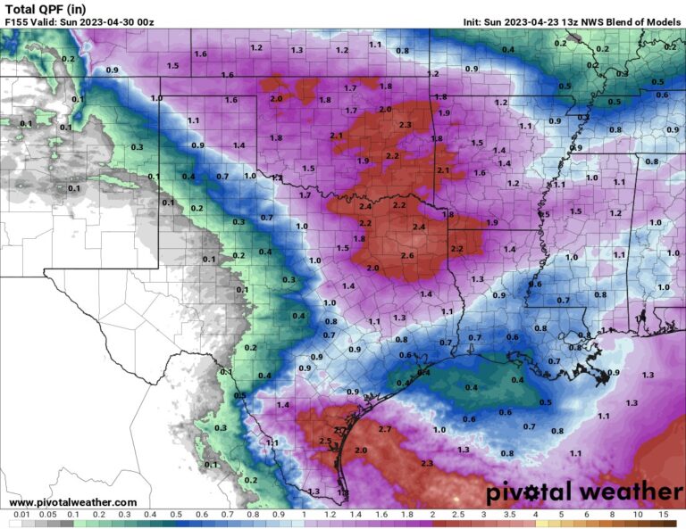
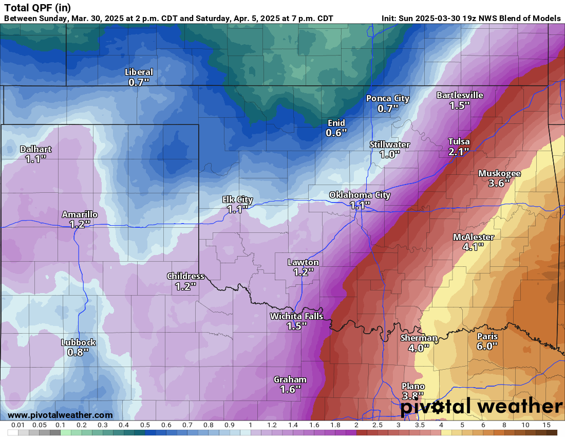
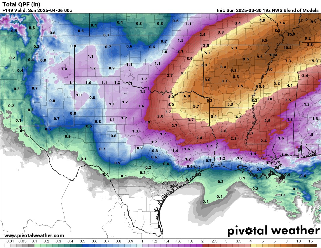
The rainfall animation from the European model showcases the multiple rounds of rain throughout the week. The hardest hit area for rainfall will be across SE OK. Flash flooding might be a problem by late Friday and Saturday. Much greater amounts are expected across Arkansas and areas east from there.

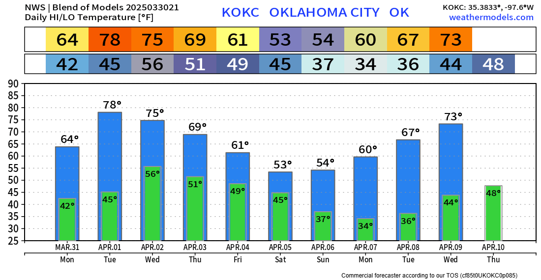
Regarding temperatures, expect it to be a little cooler for a while. OKC trend is posted below. Pay attention next Monday morning for a frost or freeze! I’ll broadcast live tornado coverage on Tuesday if tornadoes develop. -AT
Be sure to mention Aaron Tuttle when you call (405) 820-1193!