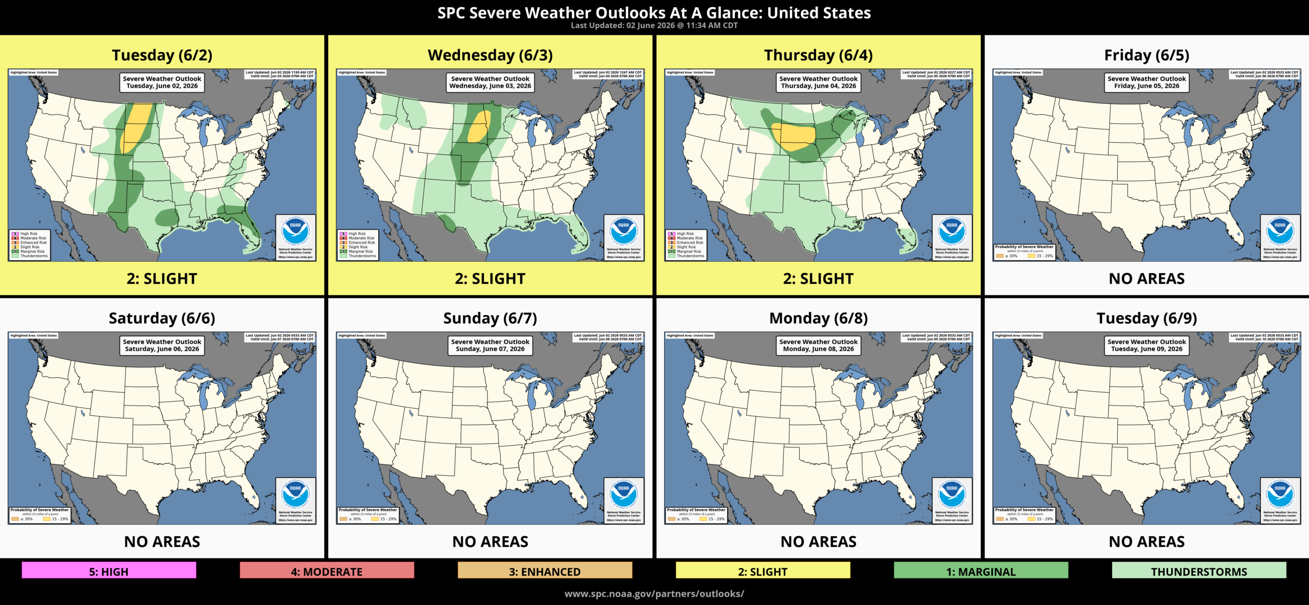
Wet Pattern Continues
The weather pattern will be cooler and wet through the weekend into early next week.
My apologies for getting this forecast out late. Last week ended up being an unplanned staycation to finish my bedroom hardwood floor and accent wall project. That wasn’t as easy as I thought it would be. As we finished up Sunday, Jodi got the call that her mom was in the ICU at a heart hospital back in Canada, so she got an early flight out on Monday (last update wasn’t good). On top of that, Little Lary tore his CCL (ACL) on Sunday, and Penelope is going into heat, which is making it worse for his good leg. I took Larry to the urgent care vet yesterday, and I’m trying to get surgery scheduled asap. Finally, my Aggie graduate ring of 30 years was stolen at work when I accidentally left it at the office overnight, and of course, I had a week of work to get caught up on. Life has been interesting to say the least over the last few days.
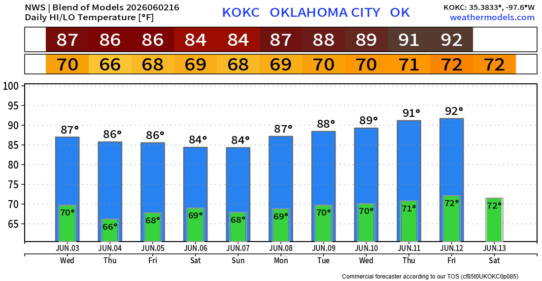
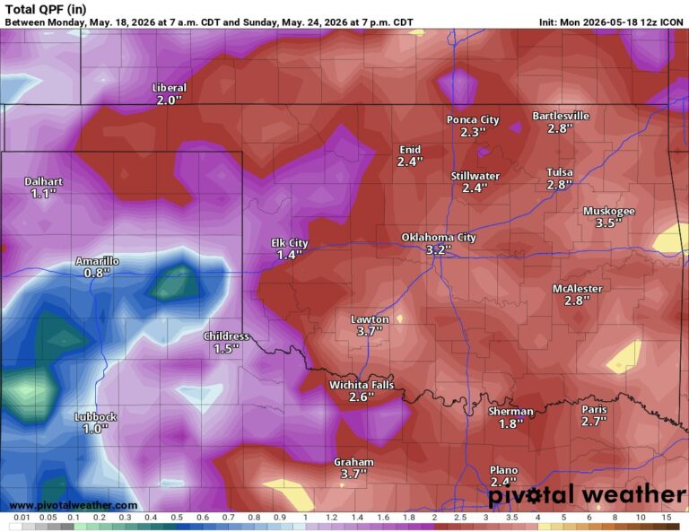
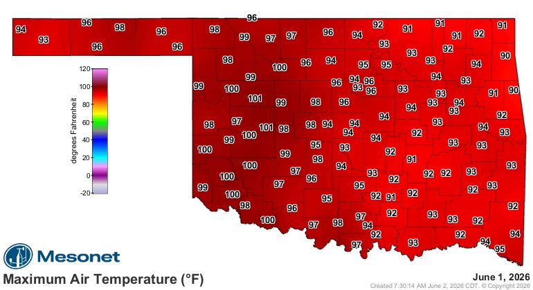
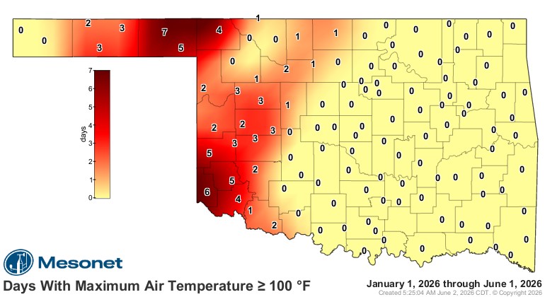
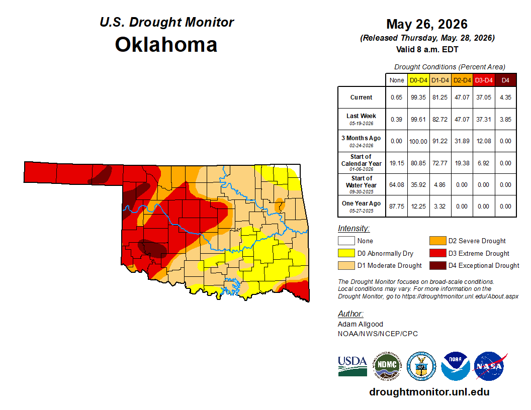
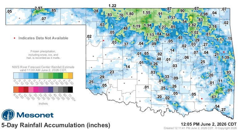
Recapping last week and the past few days…Temperatures were in the 90s and 100s over the past couple of days. Rainfall amounts were decent in a few areas. The drought is still hanging tough as well.
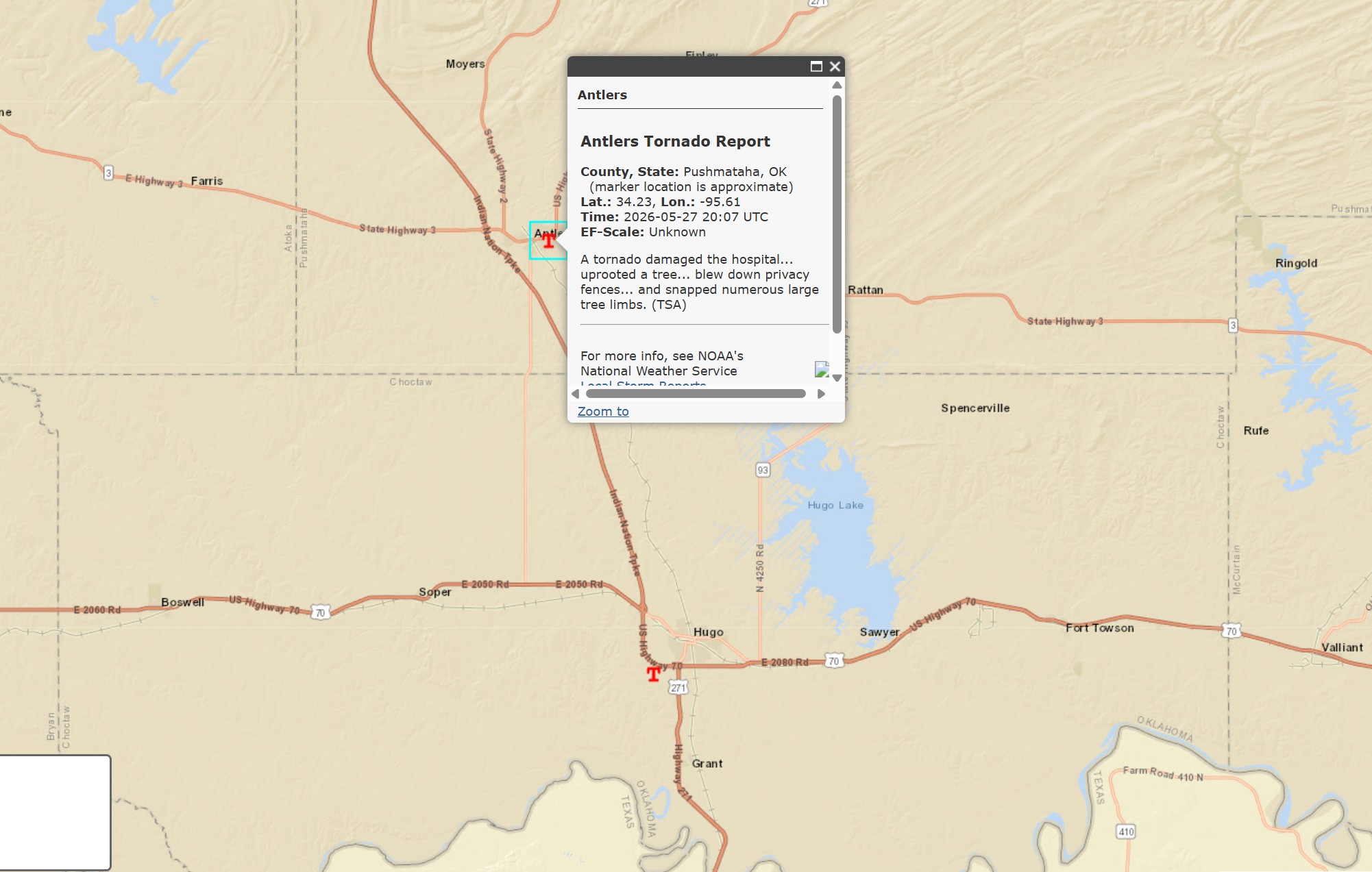
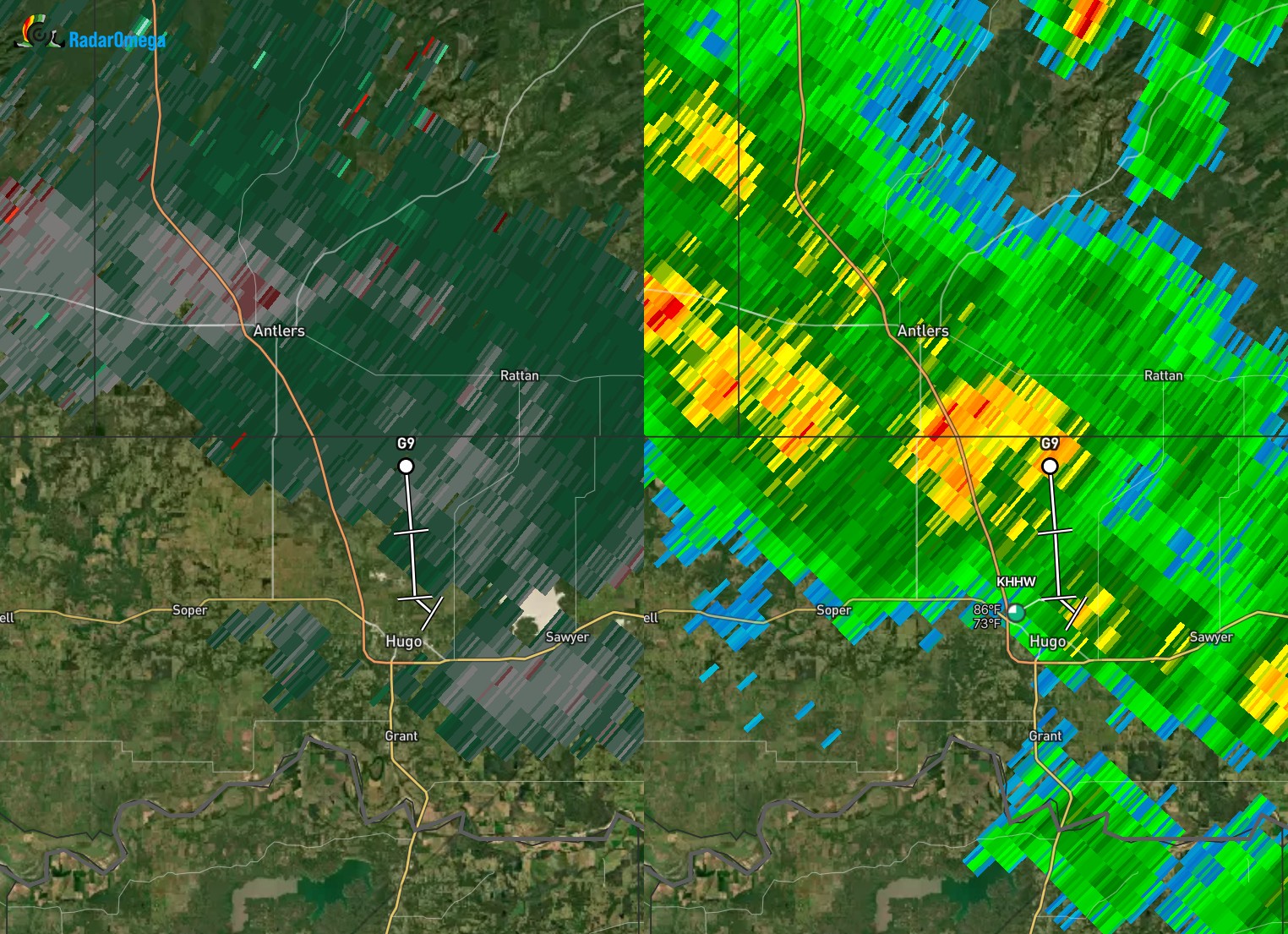
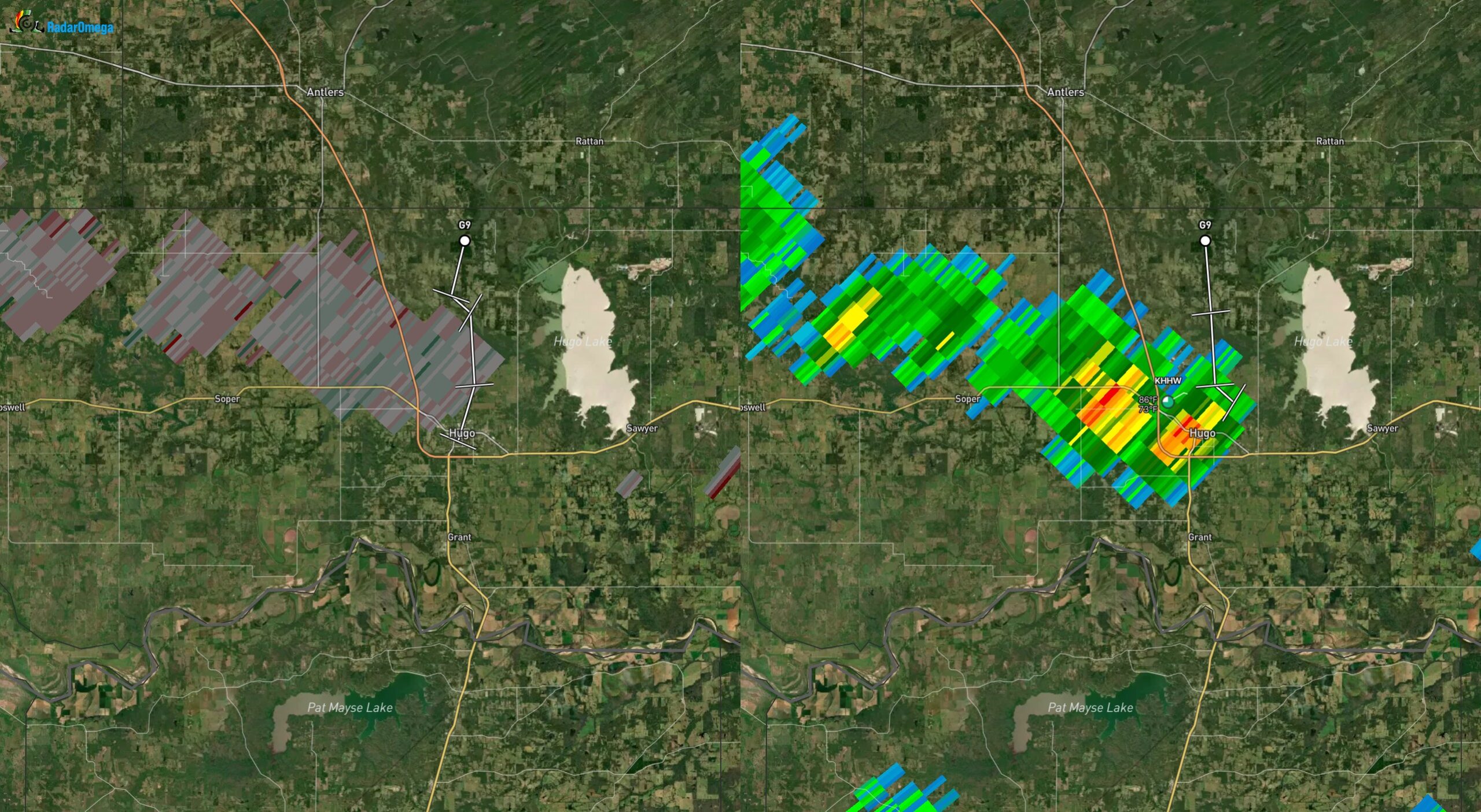
I think I jinxed us regarding the zero occurrence of tornadoes in May. Somehow, we managed to squeeze out two weak tornadoes in far SE OK in Antlers and Hugo on Wednesday afternoon. They were literally invisible on radar in what appeared to be generic showers. I’ve posted the locations below, along with their respective reflectivity and velocity radar data. The beam is quite high this far away, 11,000-14,000 ft elevation, so the rotation would be undetectable.
 Restoration and Disaster Cleanup Service
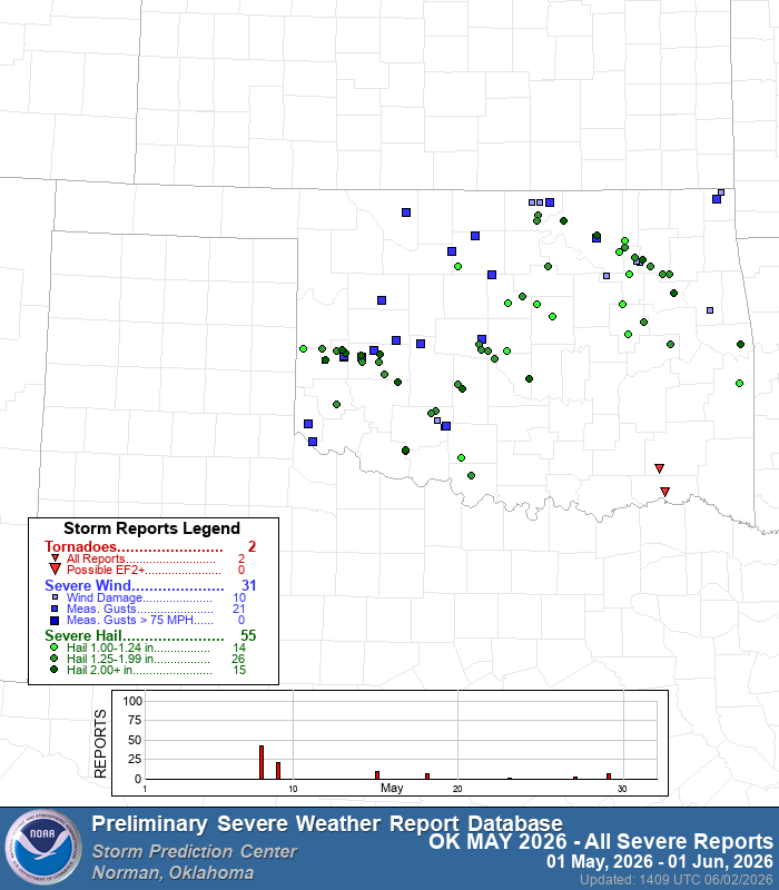
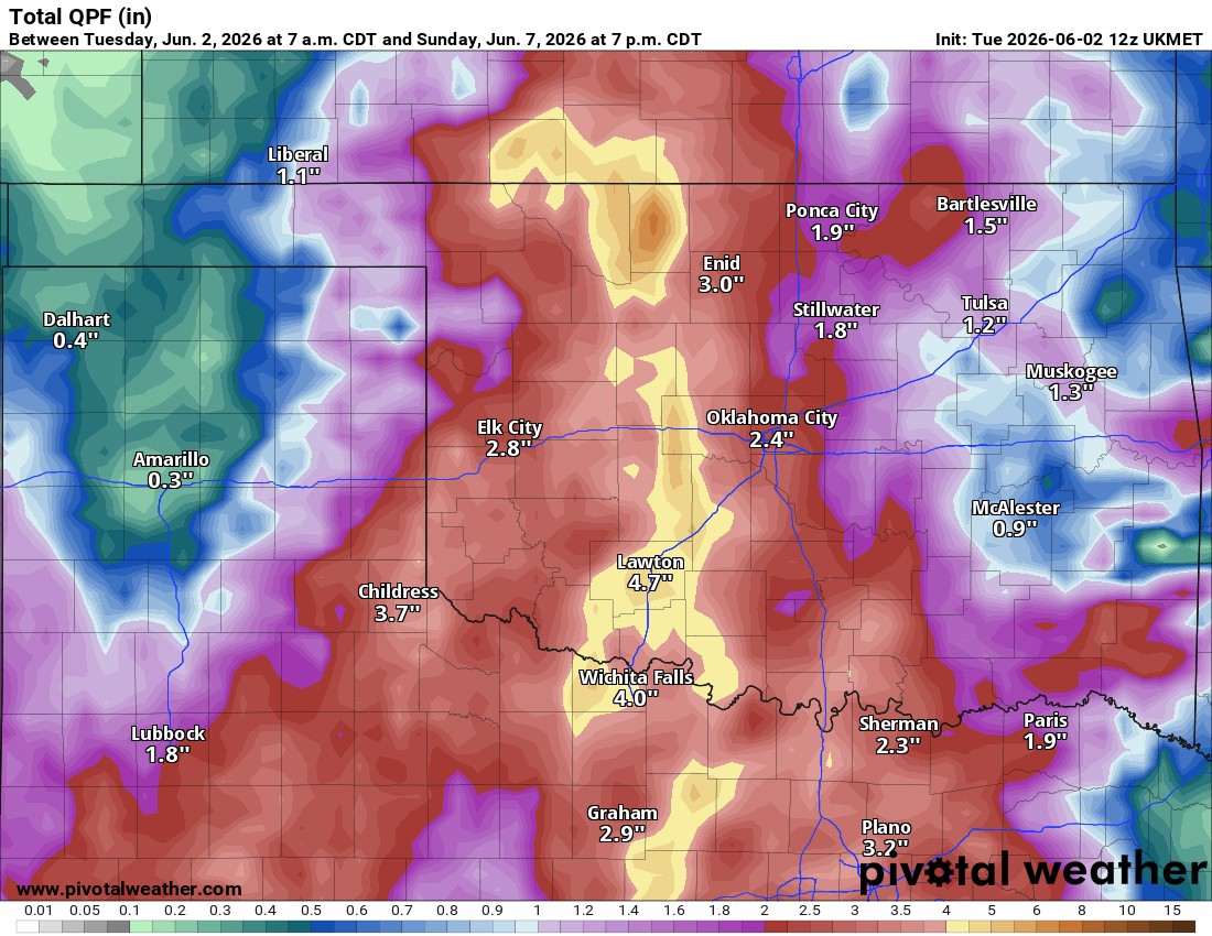
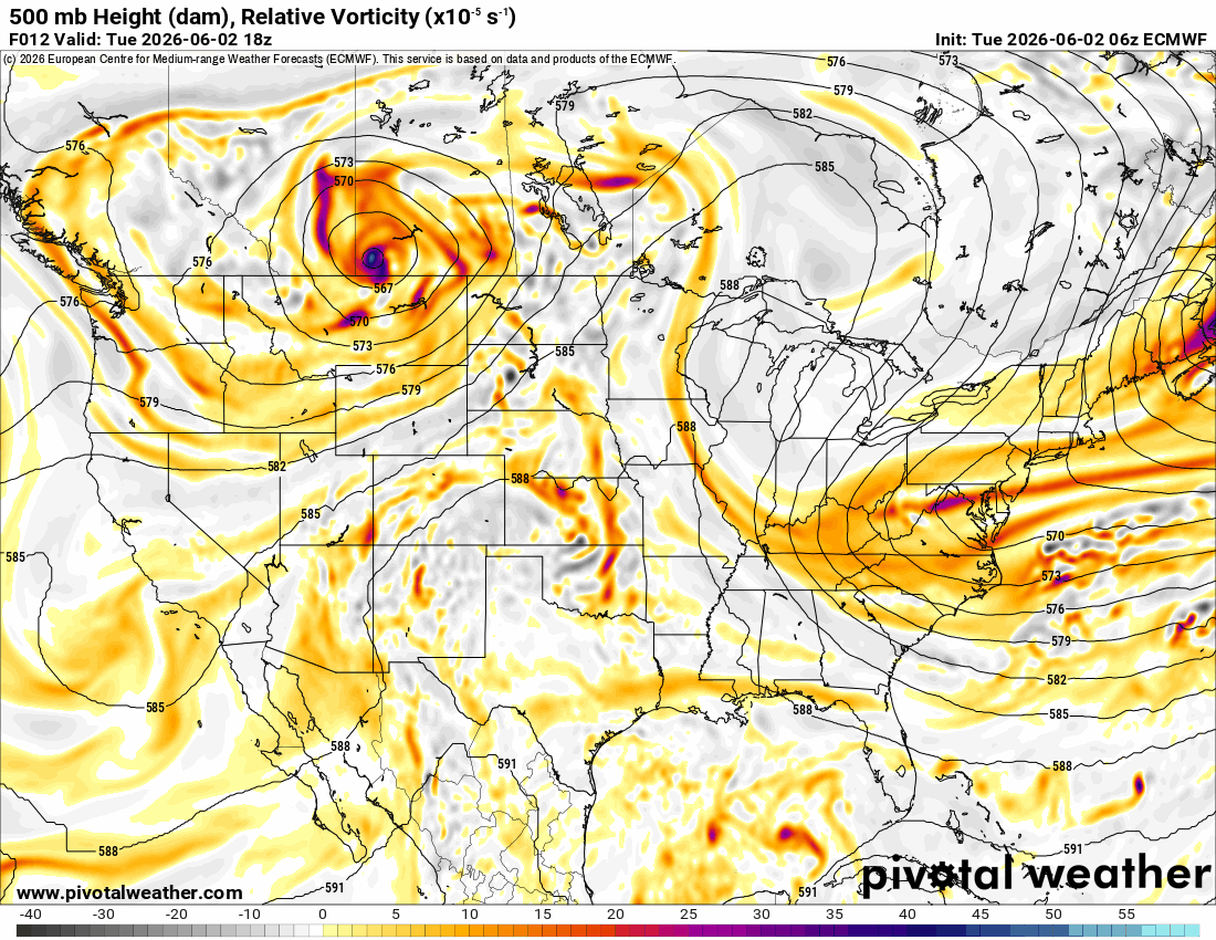
The current pattern has a weak upper flow in the Jetstream overhead, which will bring across weak disturbances. A stronger upper low will move through Saturday/Sunday, providing the most coverage of rainfall. Until then, isolated to scattered activity is expected through Friday. There will be several dry hours, as most of it will be daytime heating-related. Severe weather should be sparse with marginally severe storms at times. Wind shear is weak with hail and wind.
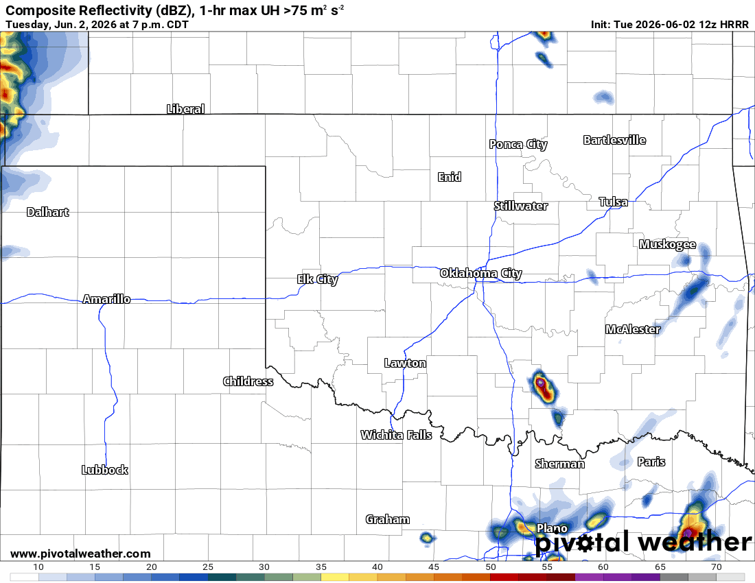

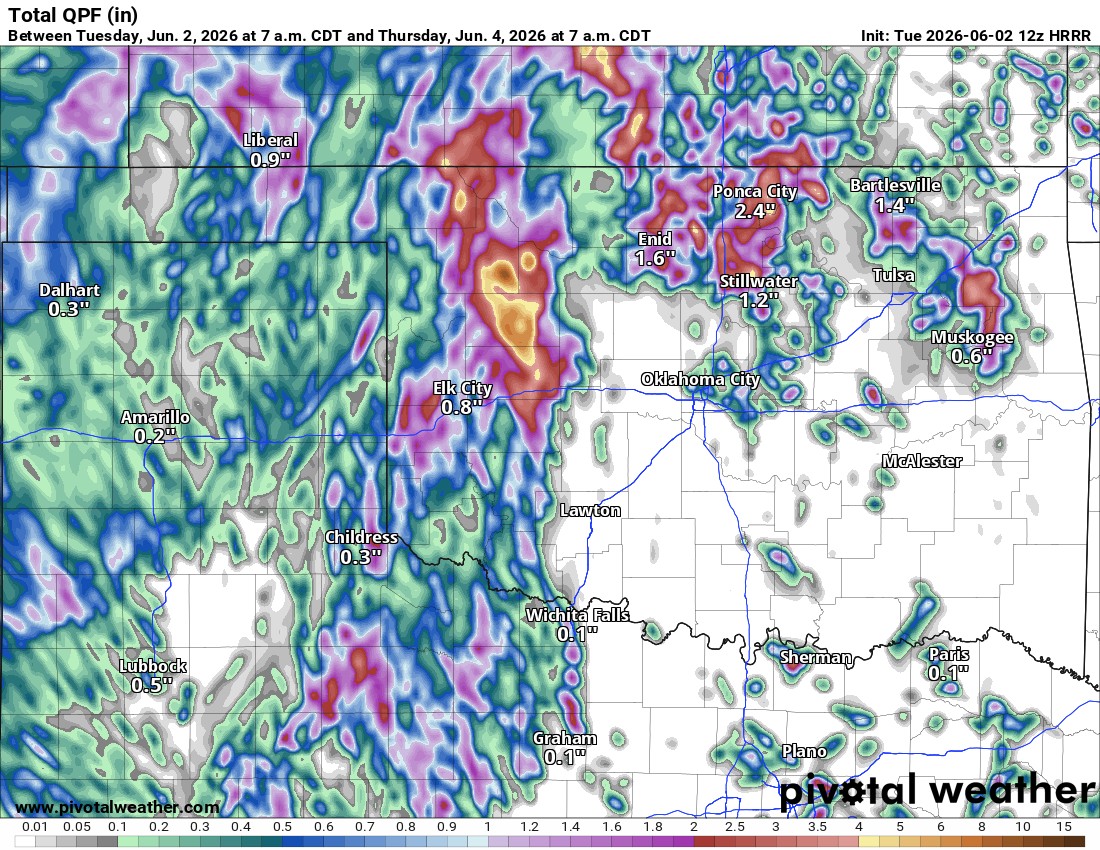
The SPC Outlook doesn’t have any significant threats planned for our area. Rainfall amounts could be excessive, though. The hi-res model through Wednesday shows remote areas may receive 7″ of rainfall. That’s flash flooding output, so be aware. Long-term global models are projecting more conservative statewide totals, but even so, they still hint at flooding.
Temperatures will be about 10 degrees cooler over the next several days, so the plants will get a break along with the much-needed rainfall.