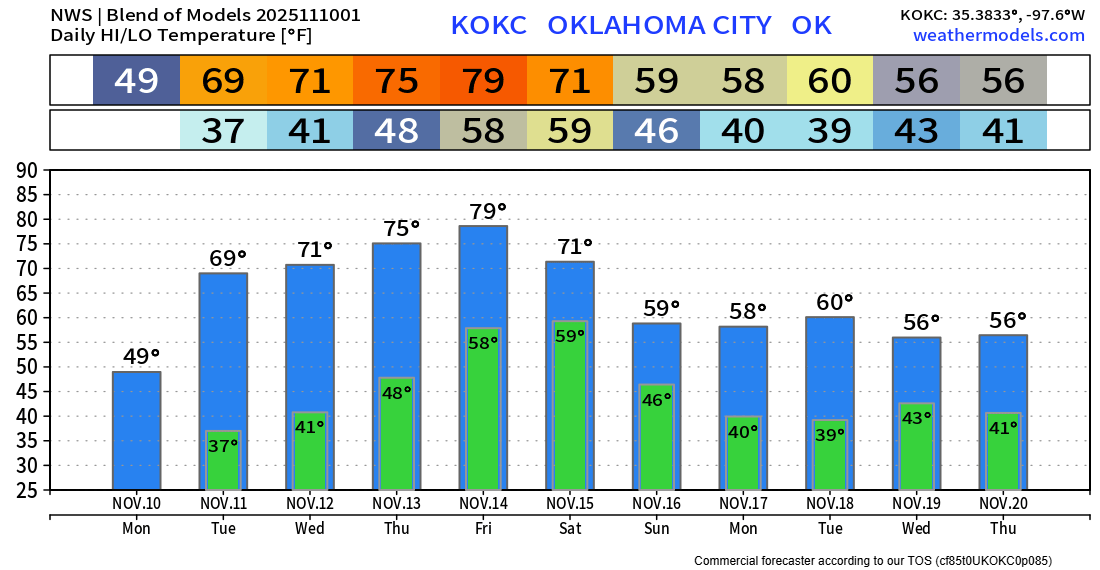
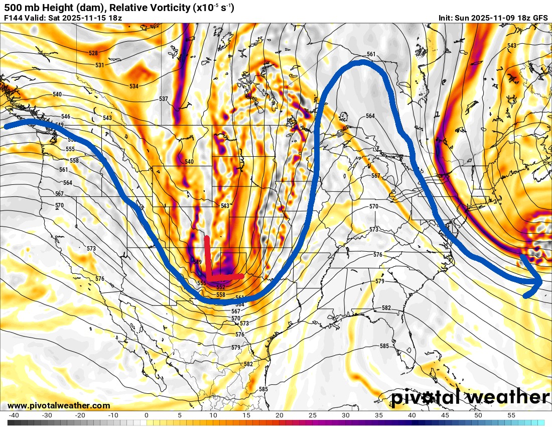
Warmer Weather and Severe Storms Return
Our glancing blow of that cold Canadian air will be short-lived. A rapid warming trend will ensue, which will lead to the possibility of severe storms across the eastern half of Oklahoma this Saturday.
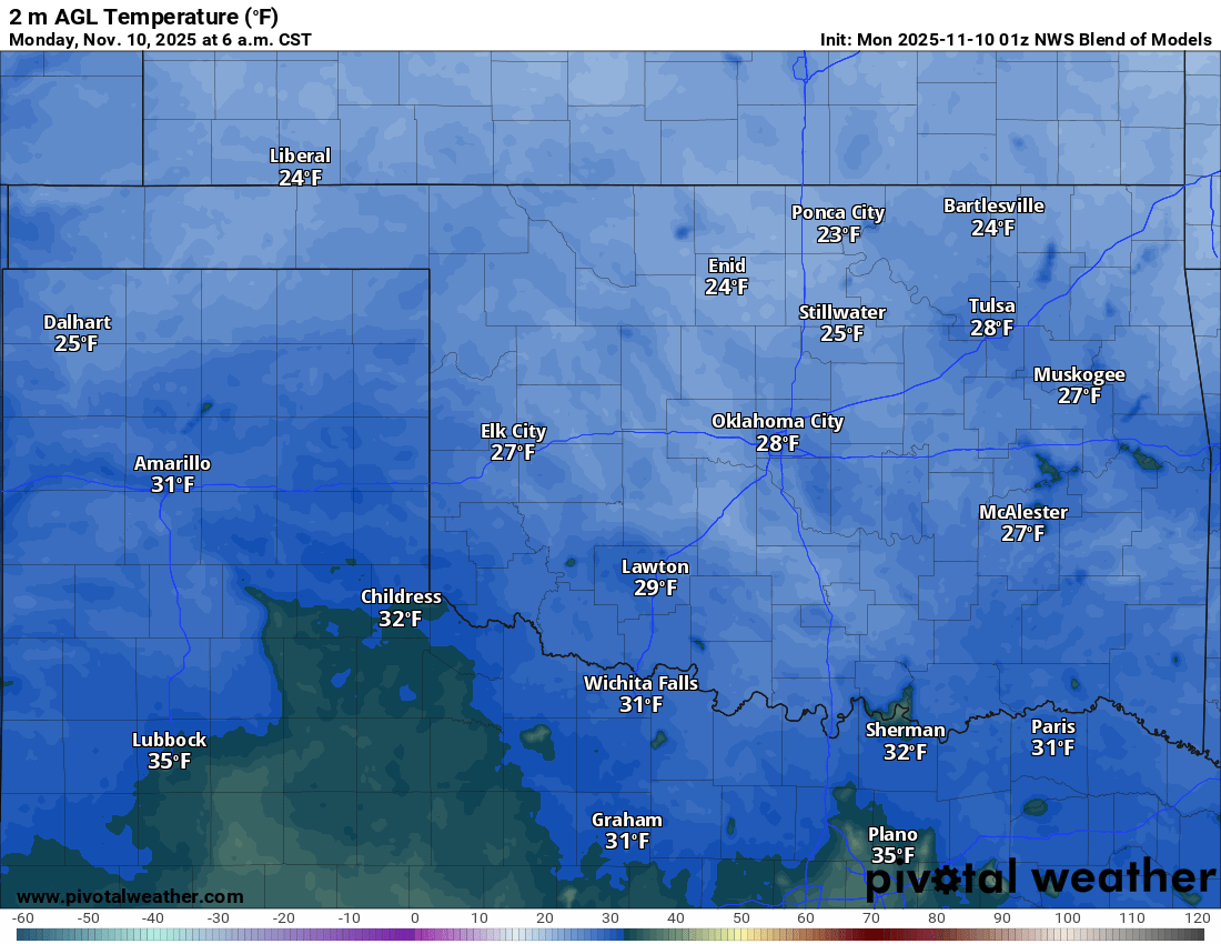
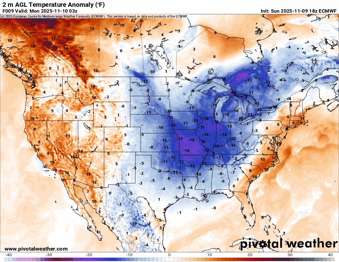
The cold airmass is significant for early November as the plunge moves from the N Plains southward and eastward through Tuesday.

Ferguson Roof Systems is offering an AT's Weather special!
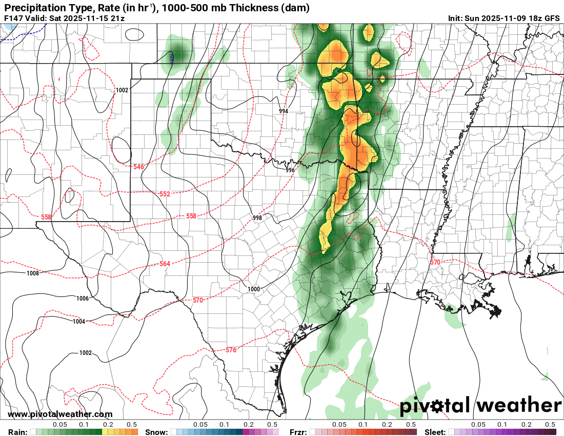
The Jetstream pattern will bring a strong upper-level trough into Oklahoma on Saturday. There should be enough moisture and shear present to generate widespread showers and storms, with a few of those being severe. The timing and positioning of the system will determine if half the state will get the activity or just the very far eastern counties, with the bulk of it in Arkansas. Stay tuned.
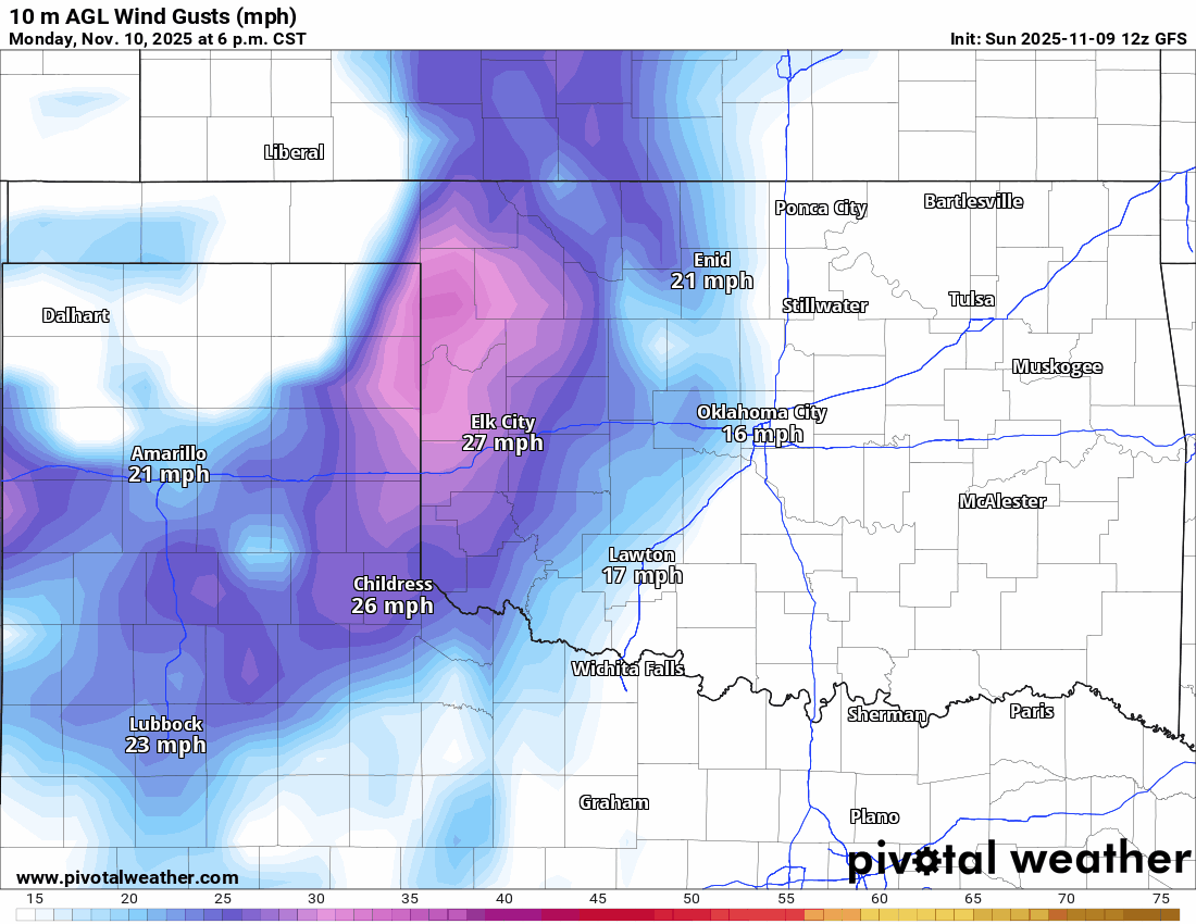
Temperatures are definitely cold to start the week, as Monday morning will experience a widespread hard freeze across the majority of the state. The winds will get cranking again for most days as well. The cold air will be replaced by temperatures above normal again.
Ferguson Roof Systems is offering an AT's Weather special!
Temperatures in the extended show that after this week, the pleasantries are over. Get out the coats and jackets from the following week onward. -AT