Much Needed Rain Returns and SSW Thanksgiving Preview!
The colder temperatures will be delayed a bit longer this week, so enjoy the last bit of warmer weather and significant rainfall coming up. After that, seasonal temperatures return before the bottom drops out for Thanksgiving due to a Sudden Stratospheric Warming Event.
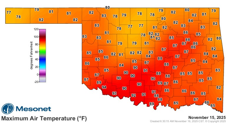
We actually had record temperatures this past Friday and Saturday. It’s not out of the norm to see a day in November that is quite warm. 90s though, gross!
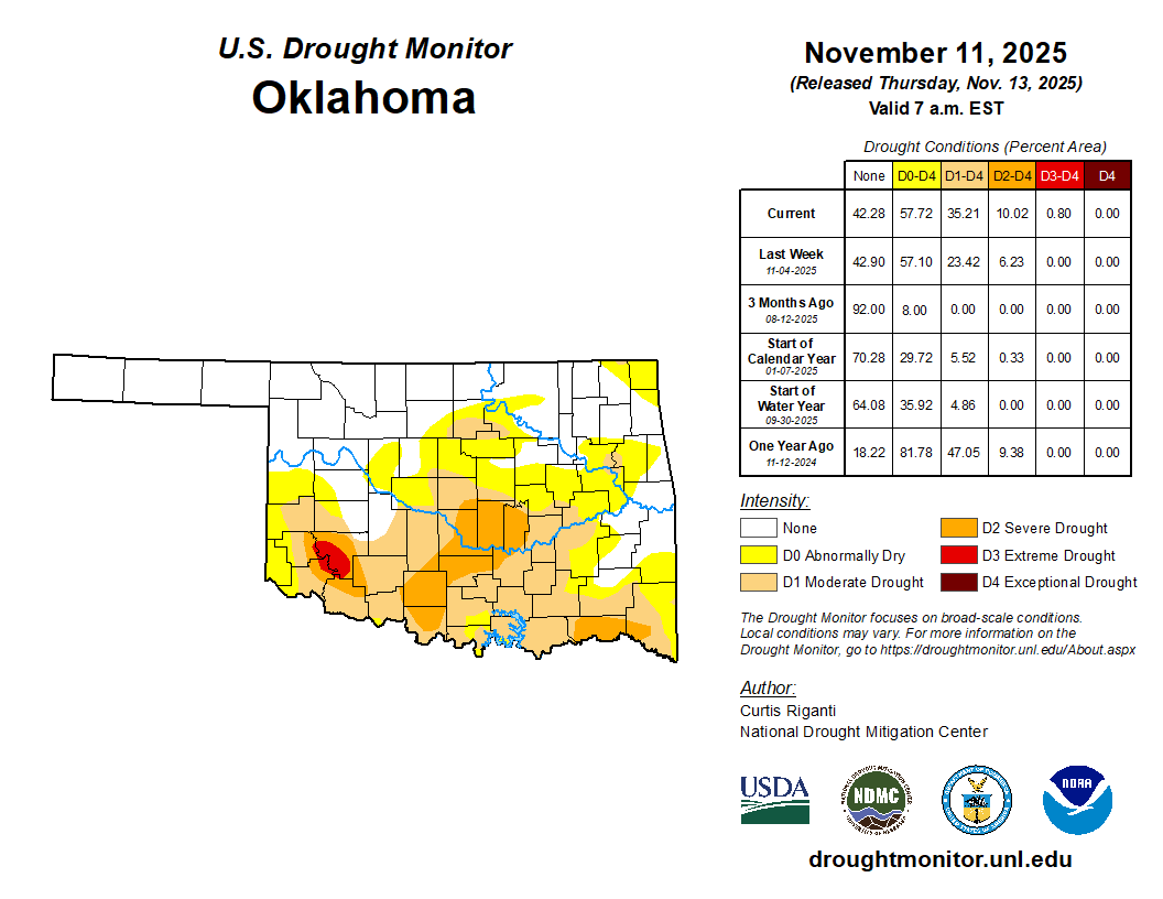
The drought has increased in coverage and intensity, but rain is coming to help put this on hold.
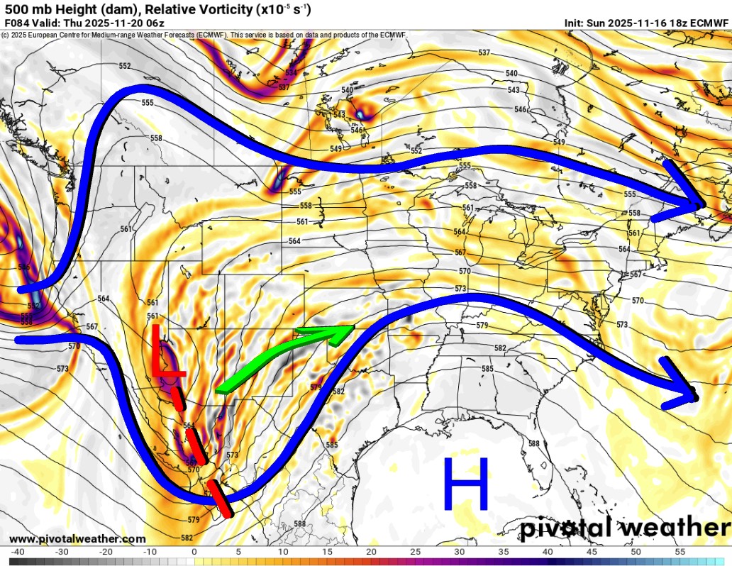
The Jetstream pattern shows a strong upper-level storm system moving through the SW US and into Oklahoma starting Wednesday night. It will clear the state on Friday, taking the clouds and rain along with it. The split flow in winter has a northern jet and a southern (subtropical) jet. Often, we will watch the northern jet move from a traditional westerly flow, as indicated below, to one that dips due south out of Canada to drive in cold arctic air. Then we watch for that southern jet to stay active and bring us a system to override the cold air at the surface. Those are the fun events that bring us ice or snow during the season.

Be sure to mention Aaron Tuttle when you call (405) 820-1193!
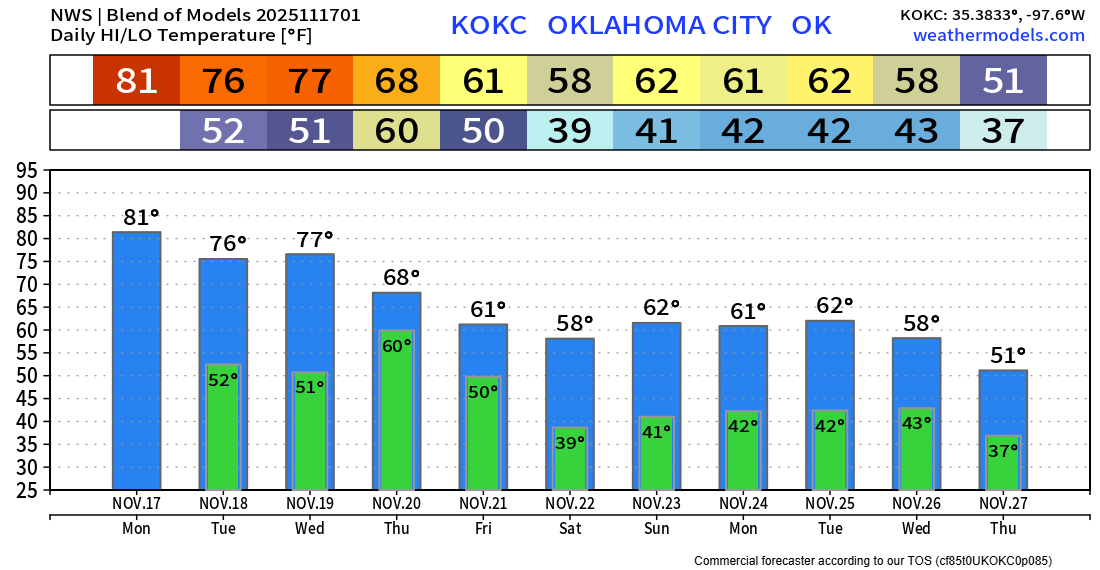
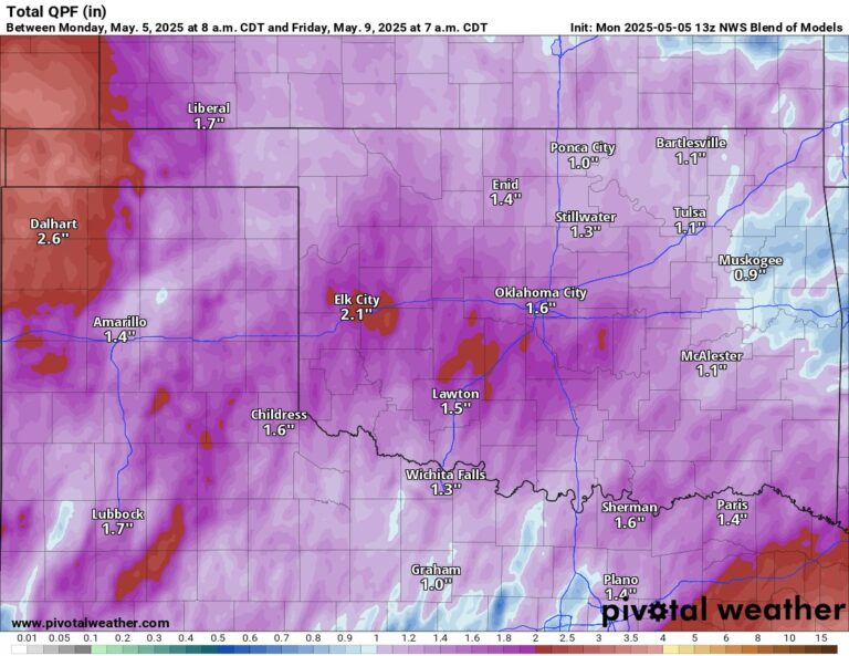
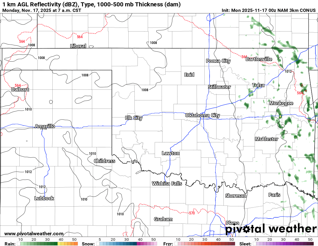
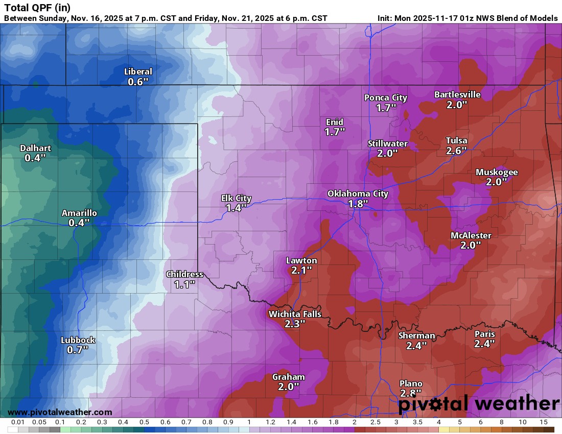
There will be a few light showers across E OK Monday morning as return moisture moves through, but nothing significant. Otherwise, rainfall should kick in as early as Wednesday evening with the new storm system and continue through Friday morning. Rainfall totals will be significant as well. The conservative model blend is used below, but some indications are that we could see brief flash flooding with isolated areas getting as much as 4″ of rainfall.

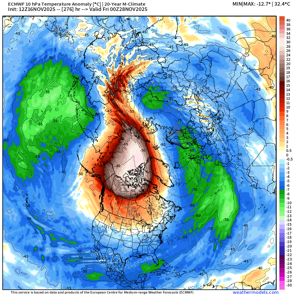
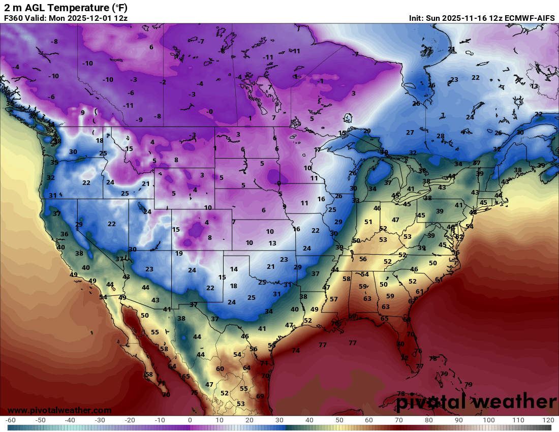
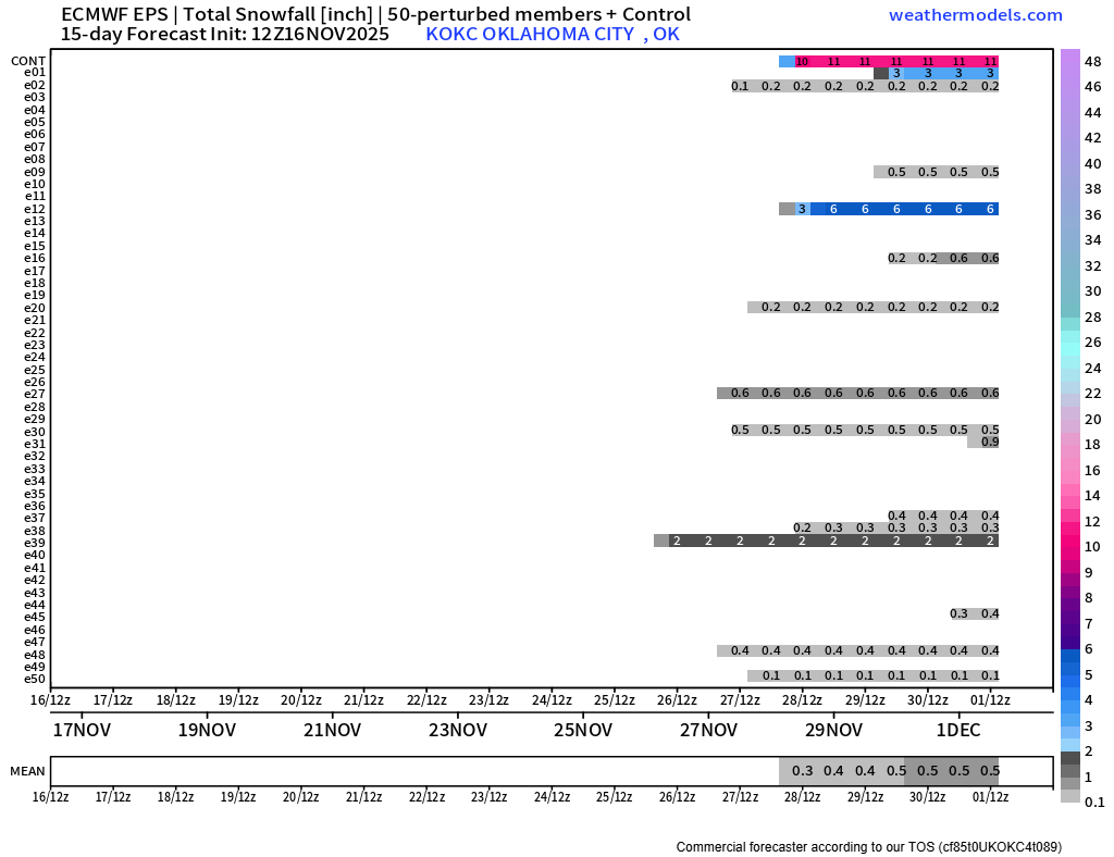
Thanksgiving is coming up, and it looks like we’re going to have a little fun around here. That SSW event I mentioned earlier is when a massive blob of above-normal temperatures occurs at the highest levels of the atmosphere. That causes a release of cold air at the surface to spill southward. Where the blob sets up is where the coldest air will be, and it’s usually in Canada. Sometimes, however, it dips further south or expands outward into the US. As this happens, a cold Arctic highs drop southward. Models are having a difficult time deciding if it’s going to be cold, cool, or mild across Oklahoma. Over the coming days, this will get worked out, but for fun, take a look at the temperature spread on the map. As cold as 35 degrees Thanksgiving afternoon or as warm as 66 degrees! Talk about polar opposites! The extended outlook model runs from the Euro and American, both indicate cold temperatures are coming at the end of the month. The Euro ensembles are also throwing in a few snow signals during this timeframe as well. So get ready!
 Restoration and Disaster Cleanup Service
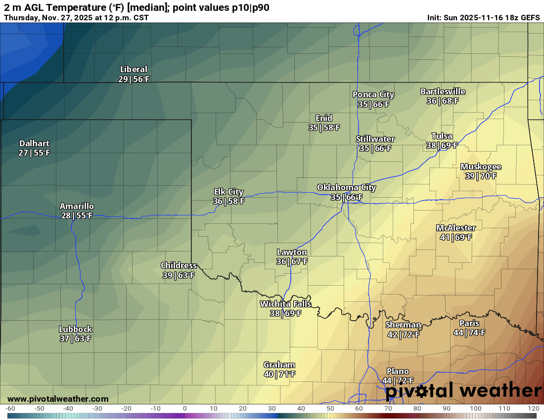
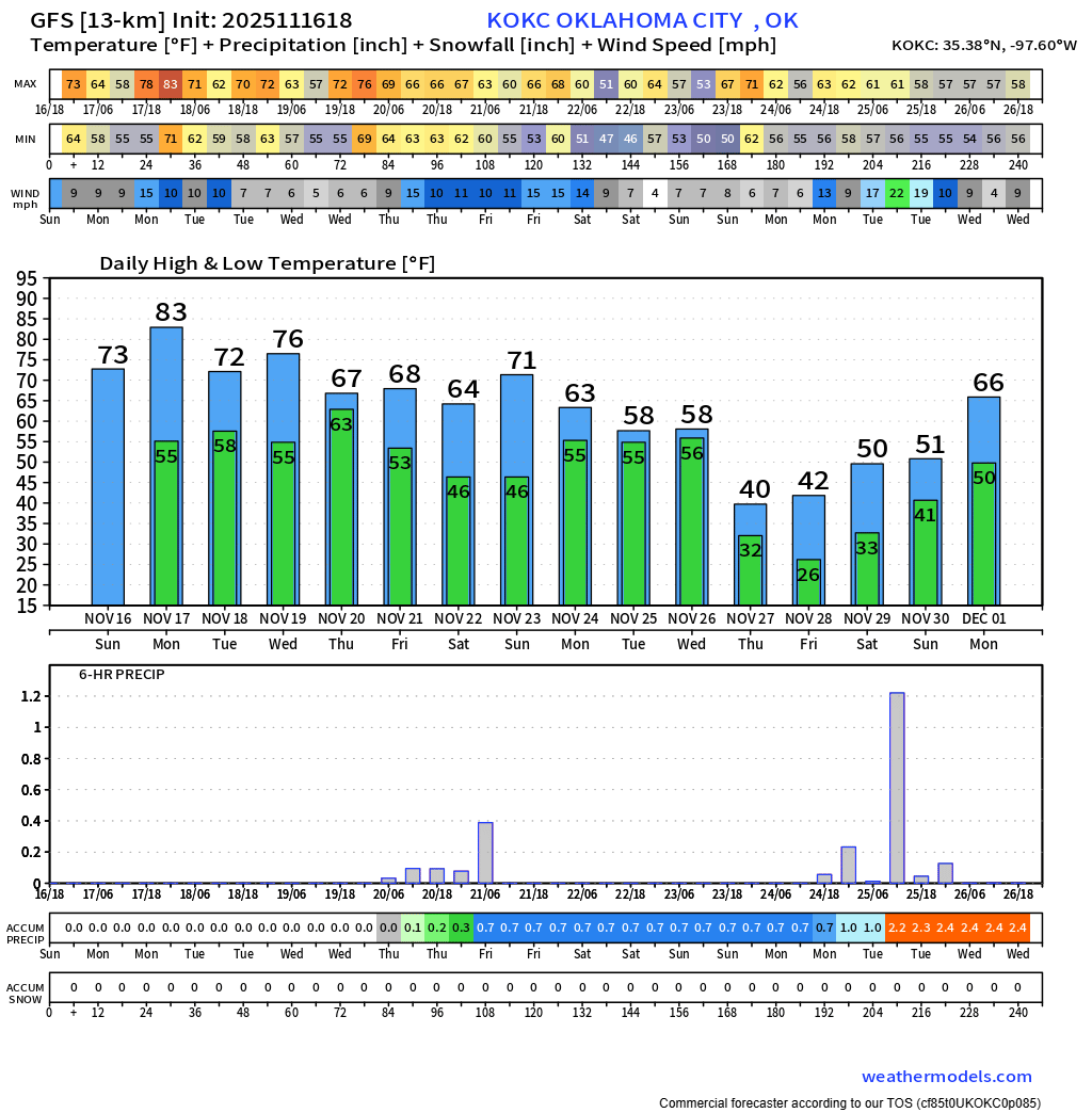
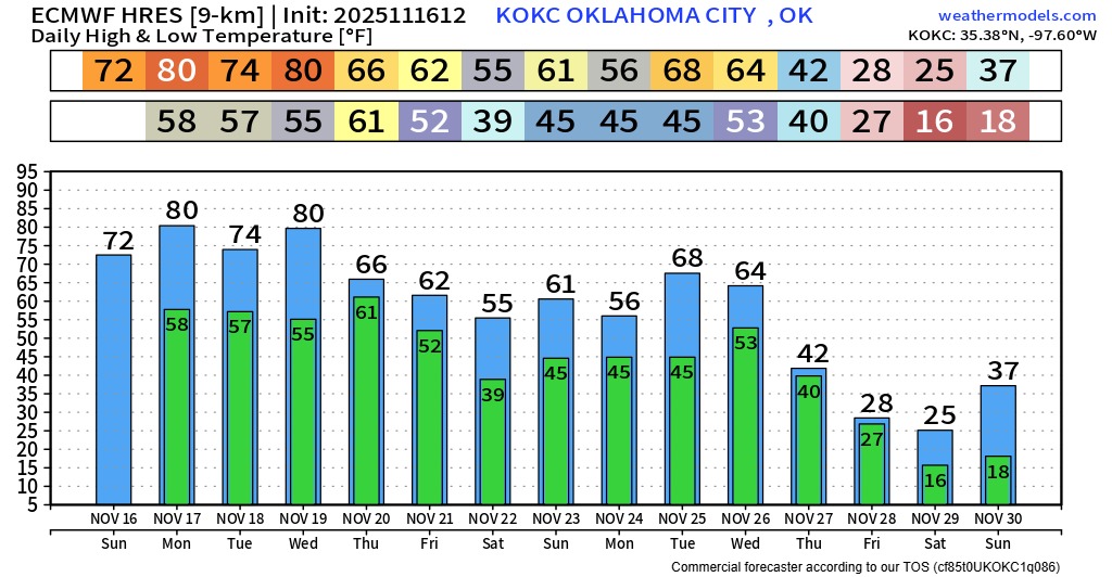
Meanwhile, the temperature trend here in OKC will be quite nice for a few more days. Enjoy the rain! -AT