Icy Morning Drive Monday and Thursday
I can’t go live yet, waiting on computer parts, but did post a video forecast for those interested on my socials. We have our first in a series of winter storms coming through Oklahoma and the surrounding areas. The first arrives late tonight.
The Jetstream shows one system coming in for Monday and another for Thursday. Both of them are weak and in a sheared configuration, rather than a strong upper cut-off low. They are also on a more northern track. This equates to lighter wintry precipitation amounts across Oklahoma.

Ferguson Roof Systems is offering an AT's Weather special!
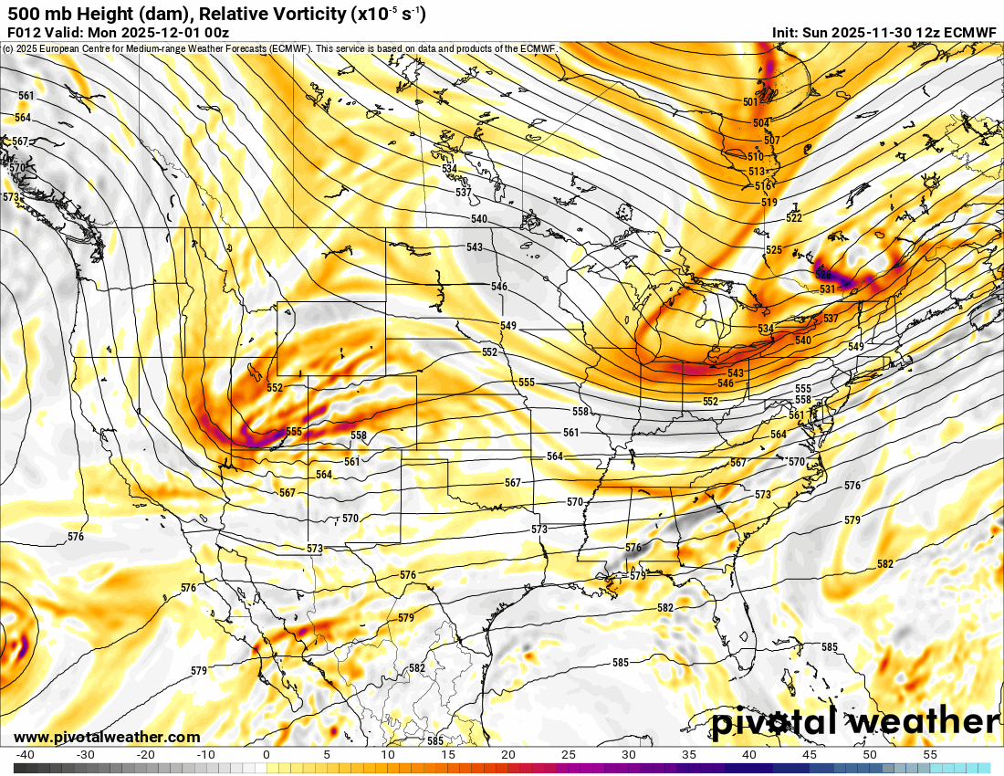
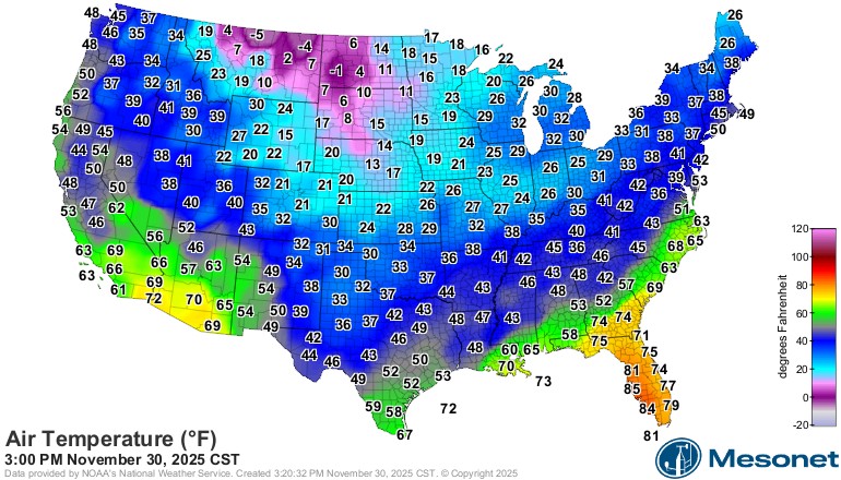
The arctic air definitely made it through. The weekend was a little rough, and the cold air will be here to jump-start our Monday morning.

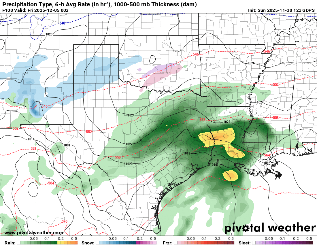
The precipitation animation shows the wintry mix in different colors moving through the state overnight and during the day on Monday. Watch for slick roadways as we should see light freezing rain/drizzle/sleet/snow move through many areas.
 Restoration and Disaster Cleanup Service
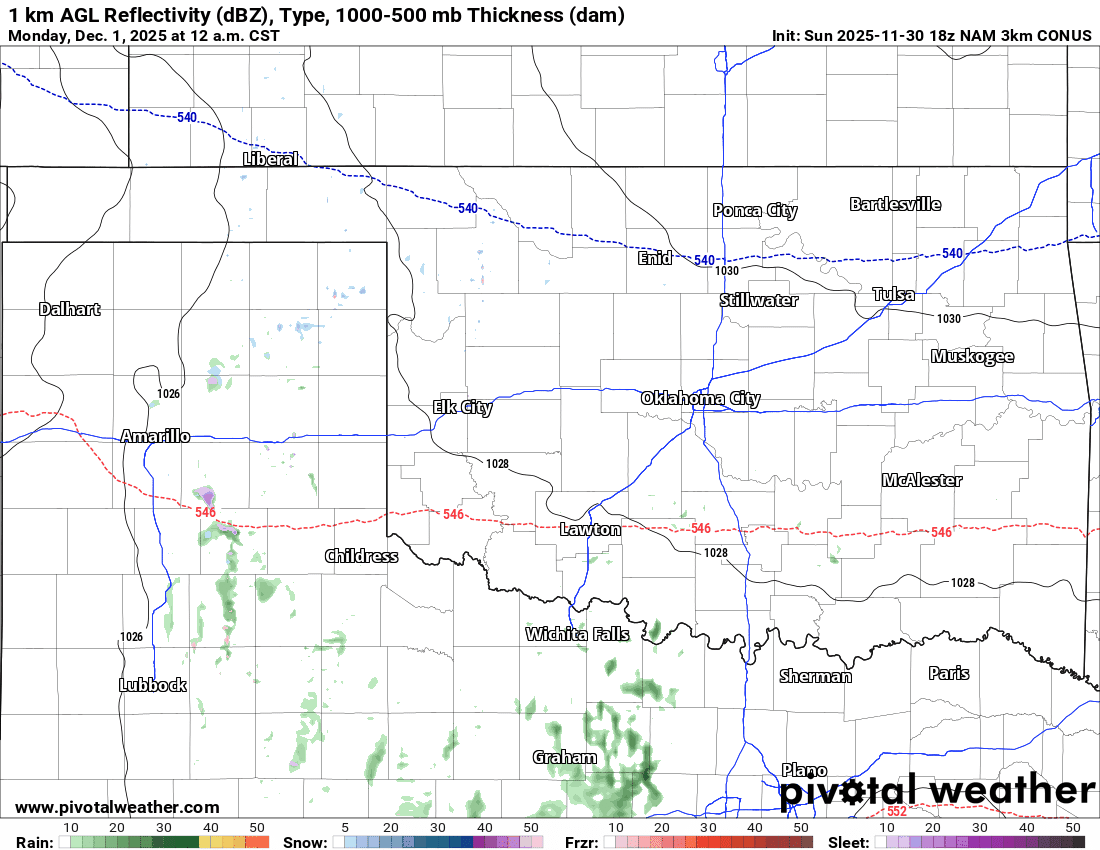
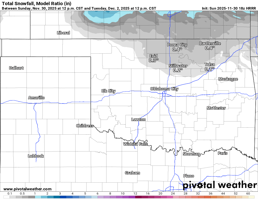
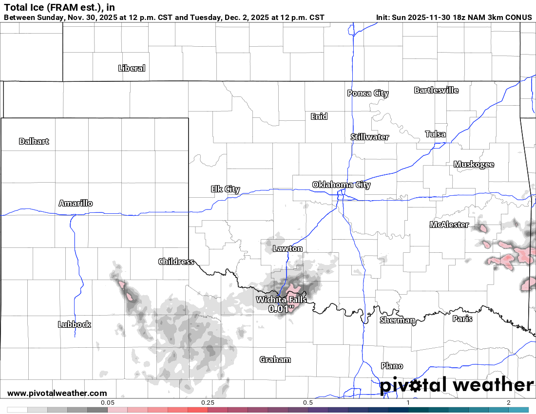
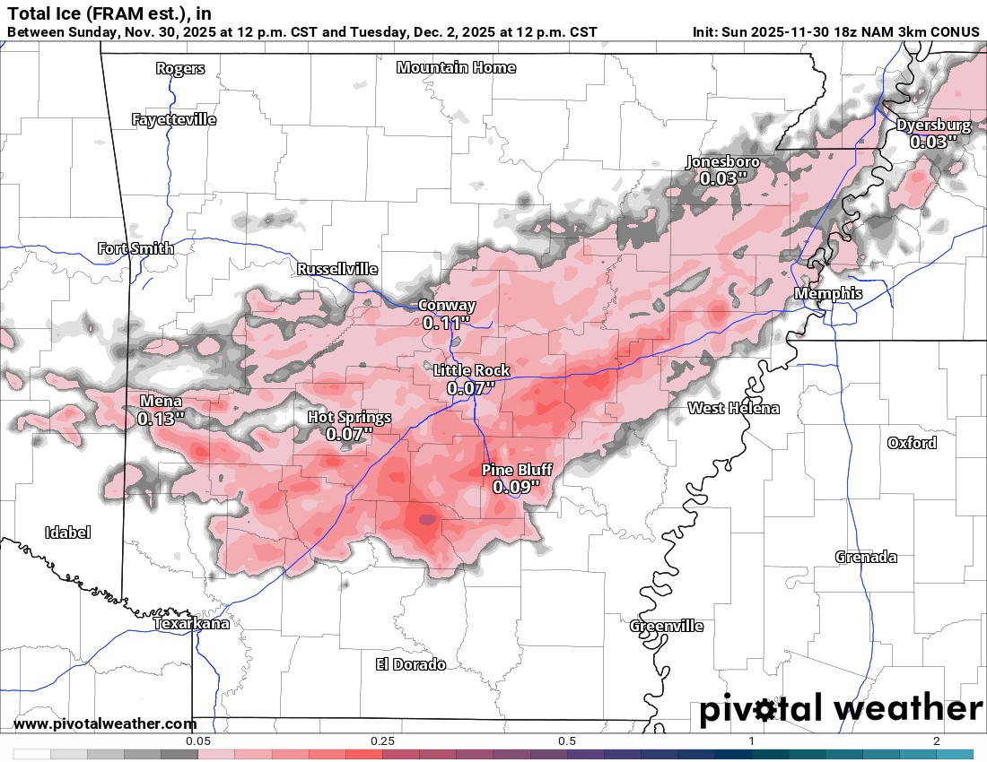
Regarding amounts, models aren’t doing well at highlighting the threat. Doesn’t take much, but for what it’s worth, here’s the output for ice and snow. Expect at least flurries or light dusting across C OK, including the OKC metro, and very light ice accumulations as well. Just enough to cause those slippery bridges and overpasses. Arkansas looks to take the brunt of the ice accumulation. Not enough for power outages, but definitely enough for travel issues.
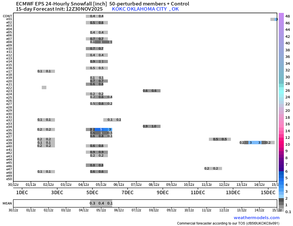
Thursday’s system will be watched to see if any new trends emerge. Otherwise, expect a repeat of Monday on Thursday. The Euro has a little better snow accumulation signal for OKC with this one. We’ll see.
Ferguson Roof Systems is offering an AT's Weather special!
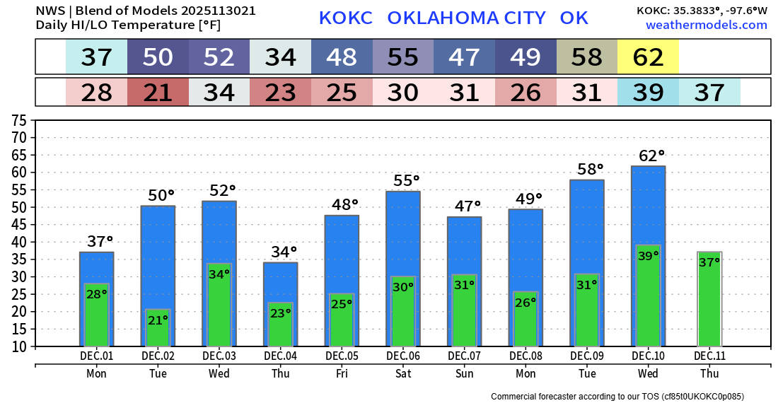
The OKC temperature trend is posted below. Stay warm and safe out there! -AT