Freezing Fog, Strong Winds, and Another Arctic Front
This week will have a few highlights. Not mentioned in the title is a break from the cold as well!
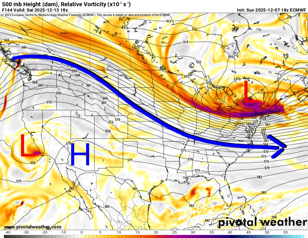
The Jetstream across the country is going to be in a NW Flow aloft for the week. This typically sends cold shots of arctic air across the Northern Plains and into the Northeast. Every now and then, we’ll get a glancing shot. That will happen on Friday night and Saturday.

Ferguson Roof Systems is offering an AT's Weather special!
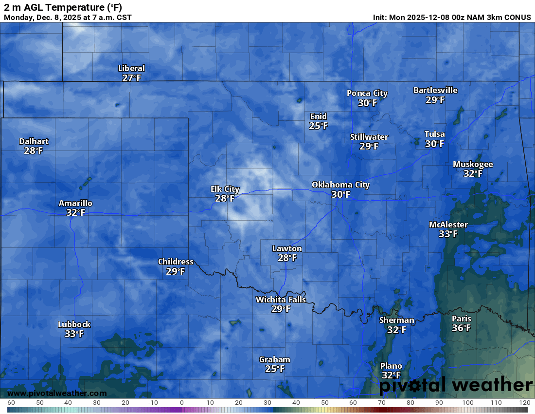
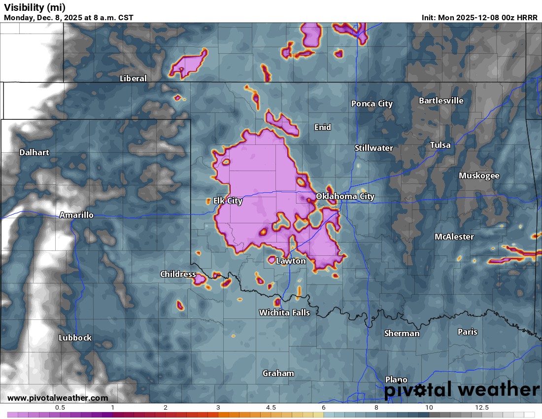
Up first, we’ll start our week with another morning of low clouds, low visibility, fog, and freezing fog. So be very careful on roadways during your morning drive if you encounter any type of moisture. Temperatures will be below freezing across most areas. Be sure to use my free weather app, ATsWeatherToGo, for these types of conditions. It will send you alerts, so you are not caught off guard.
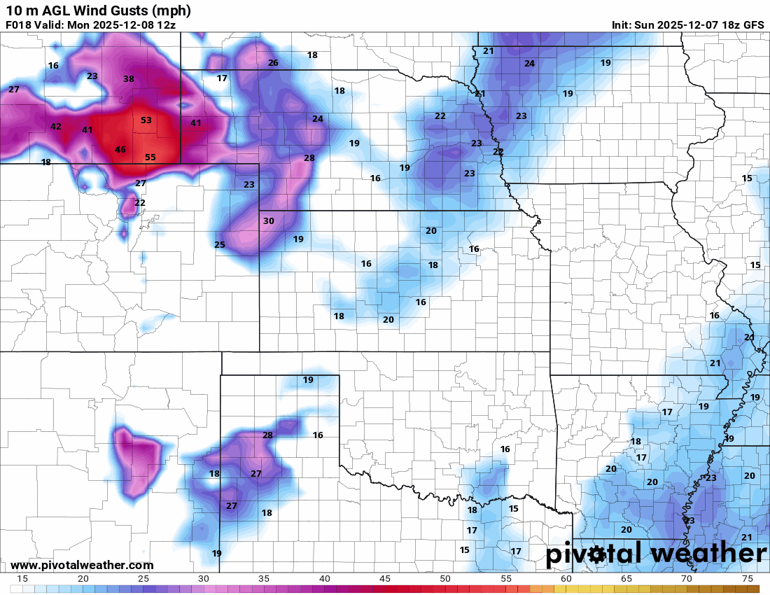
The wind will get cranking this week, as many storm systems move through the country. Just about every day, we’ll have gusty winds in Oklahoma.
Ferguson Roof Systems is offering an AT's Weather special!
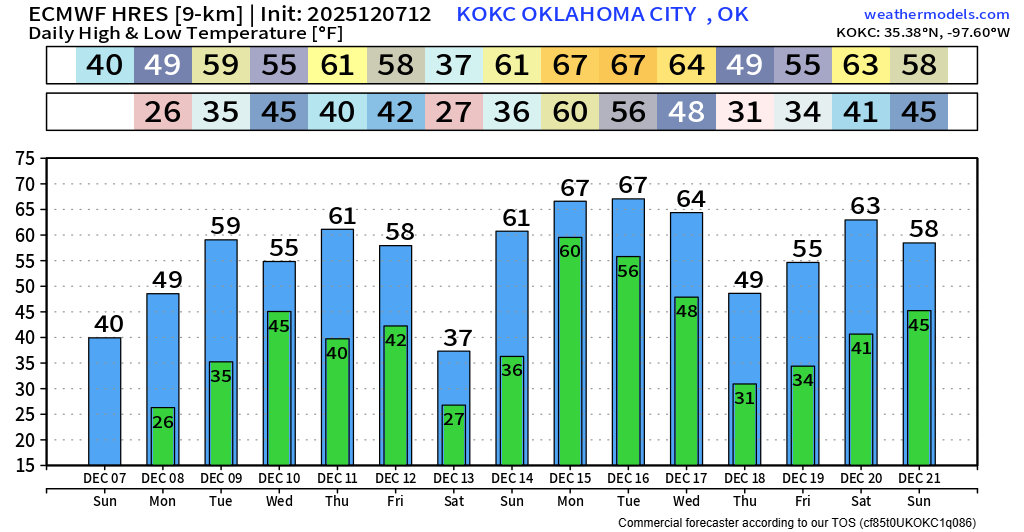
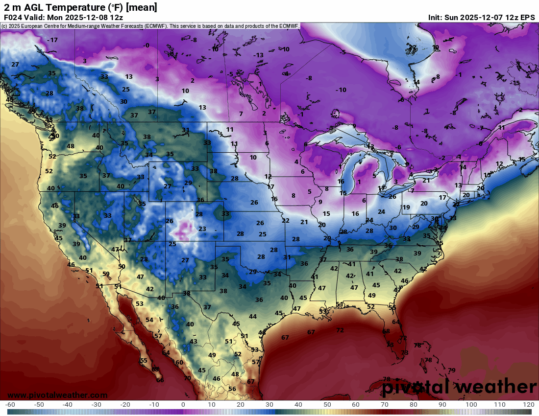
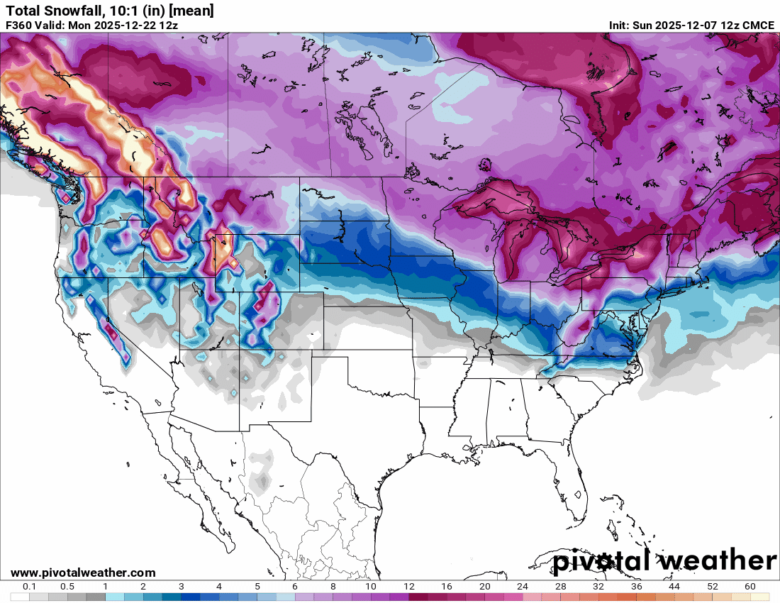
Since we’re getting close to the holidays, I’ll start giving you long-range model forecasts. Sometimes they don’t pan out exactly, so don’t get too bogged down in the weeds, just a trend is all we focus on past 7 days. You’ll notice in the temperature animation that all of the brutal cold air stays in Canada, but pieces break free and travel south. Every so often, some of that will sneak into Oklahoma for a day or two, but otherwise, we miss out on the brutal cold. Notice how temperatures across our region aren’t too bad up until Christmas Eve. Beyond that, who knows! Also, with this pattern, most of the snow stays across the northern half of the country as well. The 3 Ensemble model comparisons show Oklahoma not getting much action.
Our temperatures for the week are pretty decent until Friday night when the front arrives. Beyond that, we’ll warm back up heading into Christmas, which is just beyond my crystal ball. Stay tuned! -AT

Be sure to mention Aaron Tuttle when you call (405) 820-1193!