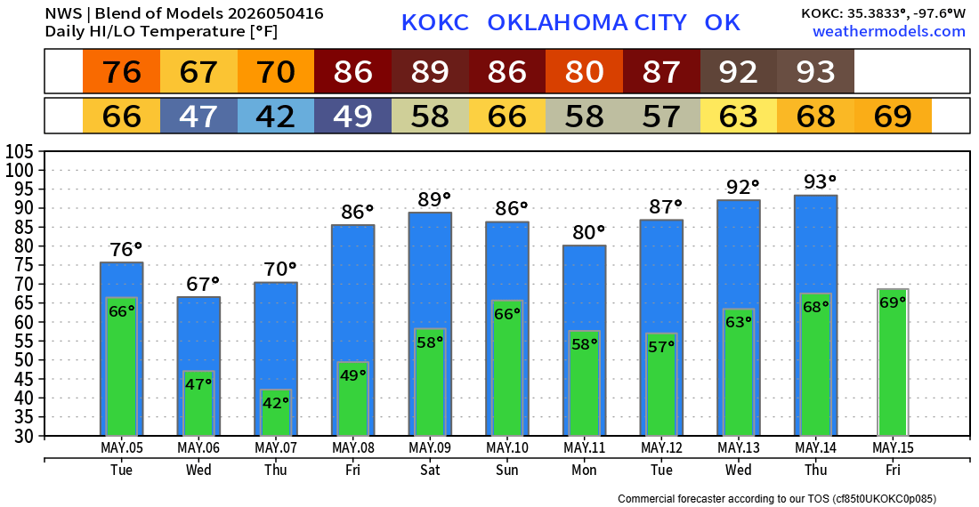
Few Storms, Big Cooldown, Then Heat
We’ll have a few storms across SW, SE, and NE Oklahoma to start the week, then widespread chilly weather, followed by dry heat, and then wrap it all up with a stormy Sunday.
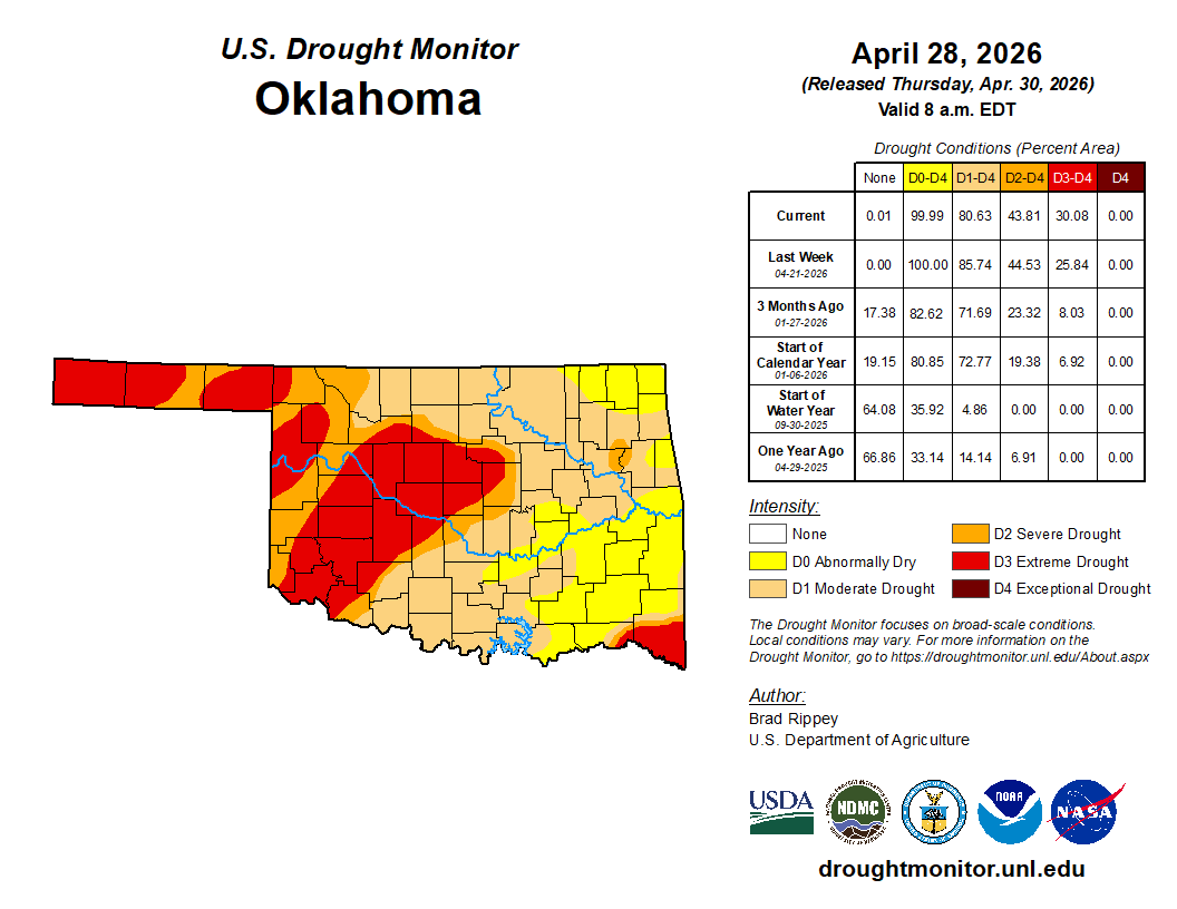
The cooler weather last week was a welcome change, although the rain I had hoped we would see for Thursday and Friday shifted mostly south into Texas. We do need the rain as the drought is hanging tough.

Ferguson Roof Systems is offering an AT's Weather special!
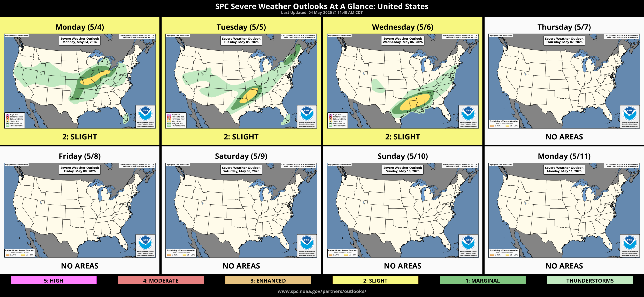
The Jetstream pattern shows a weak system moving by Tuesday, one passing south on Thursday, and then another on Sunday.
The SPC Outlook is mostly quiet for the stretch. The CAPE/Insability doesn’t stick around here long before being shoved back south. It will try to make a run into the state again on Sunday.

Be sure to mention Aaron Tuttle when you call (405) 820-1193!
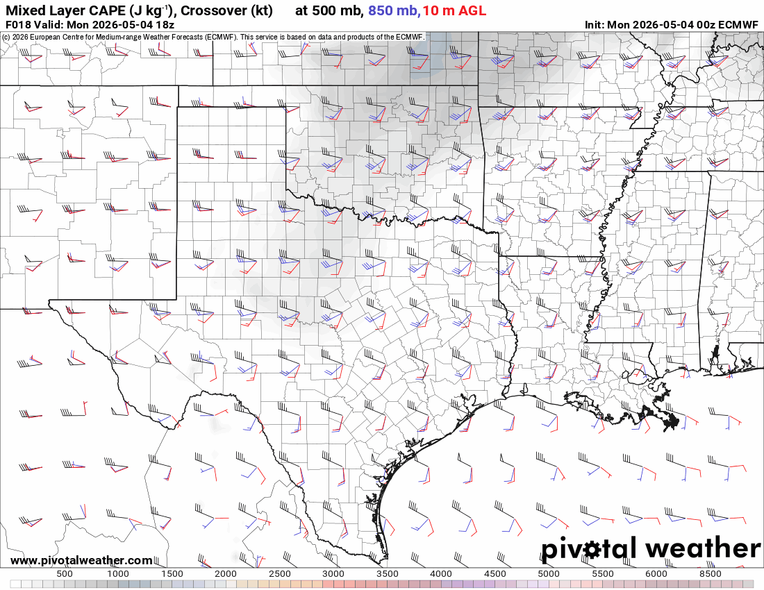
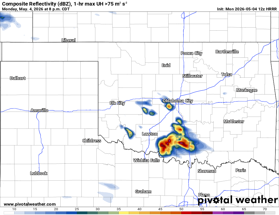
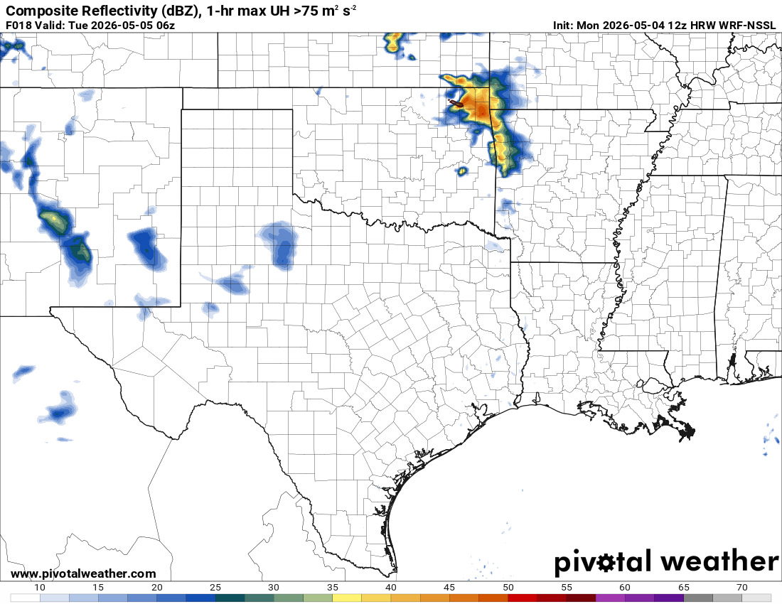
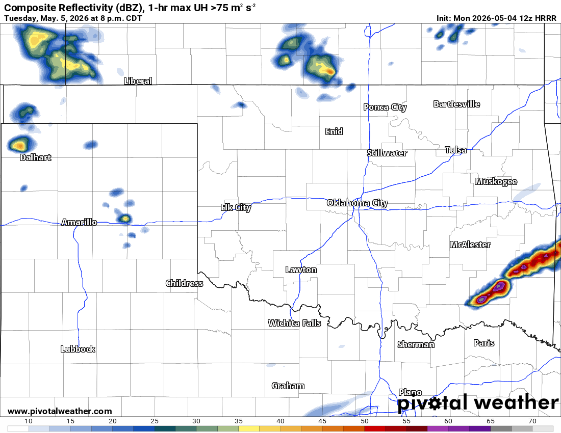
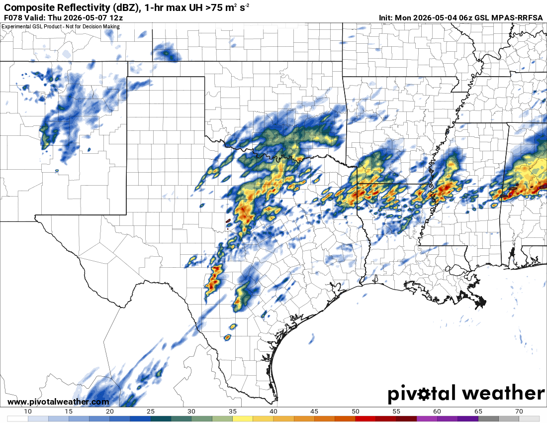
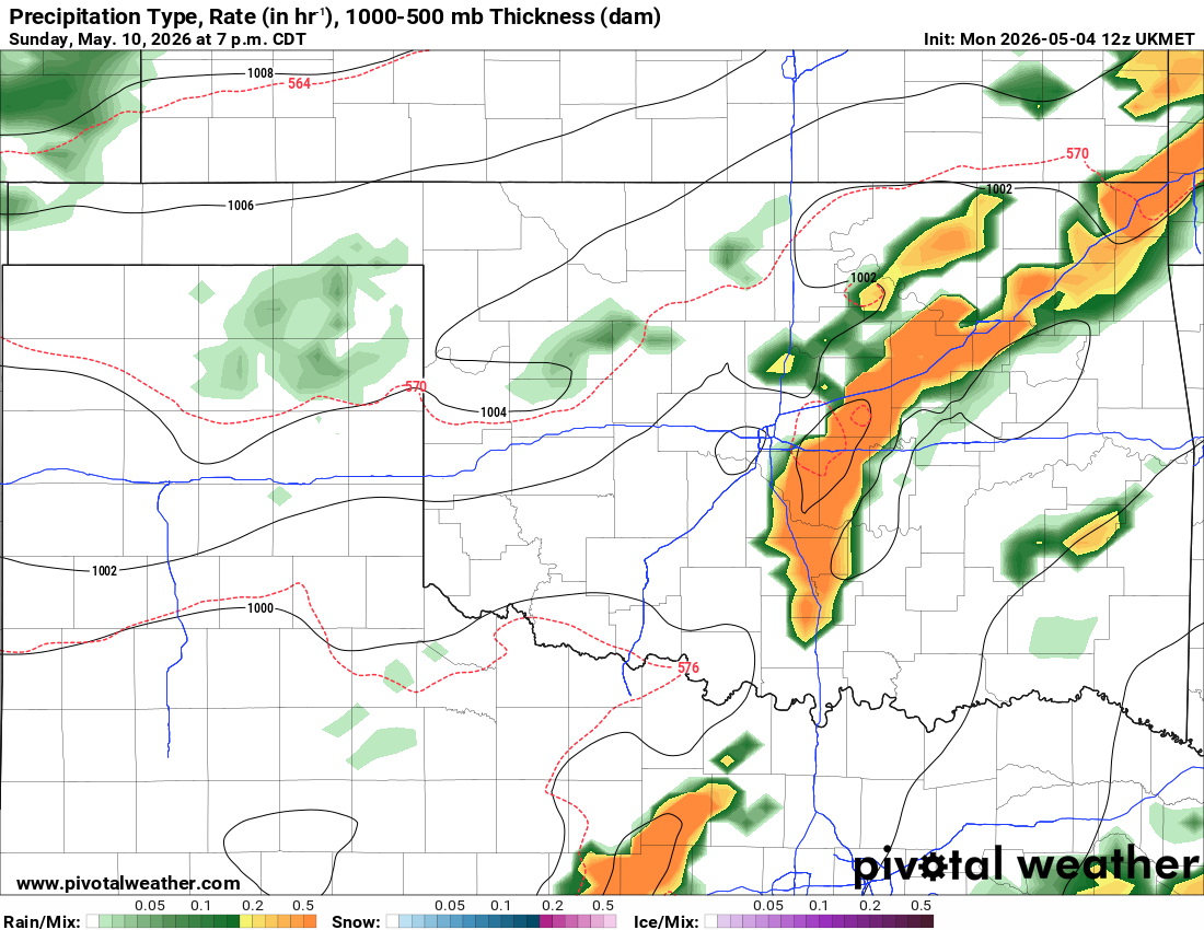
A dry line will work with limited moisture to kick off a few storms in SW OK, producing wind and hail for late this afternoon and evening. A strong cold front will move through tomorrow morning across the state. This should trigger a few severe storms in SE OK with wind and hail. More will develop deeper into Arkansas and may pose a tornado threat. Another dryline heats things up for Friday and Saturday. Then another cold front moves in on Sunday. Right now, those storms look to affect the eastern half of the state.
Temperatures are a little crazy mid-week! Don’t get used to them though!
Be sure to mention Aaron Tuttle when you call (405) 820-1193!