Could it be Our Last Week?
It’s been a long, hot, and in some cases, a very dry summer. But is all of that about to come to an end? September is our transition month. Let’s take a look.
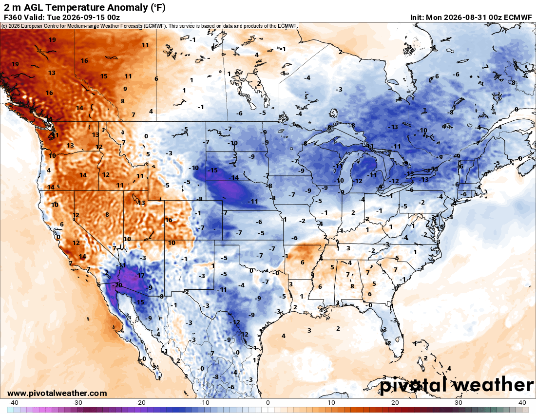
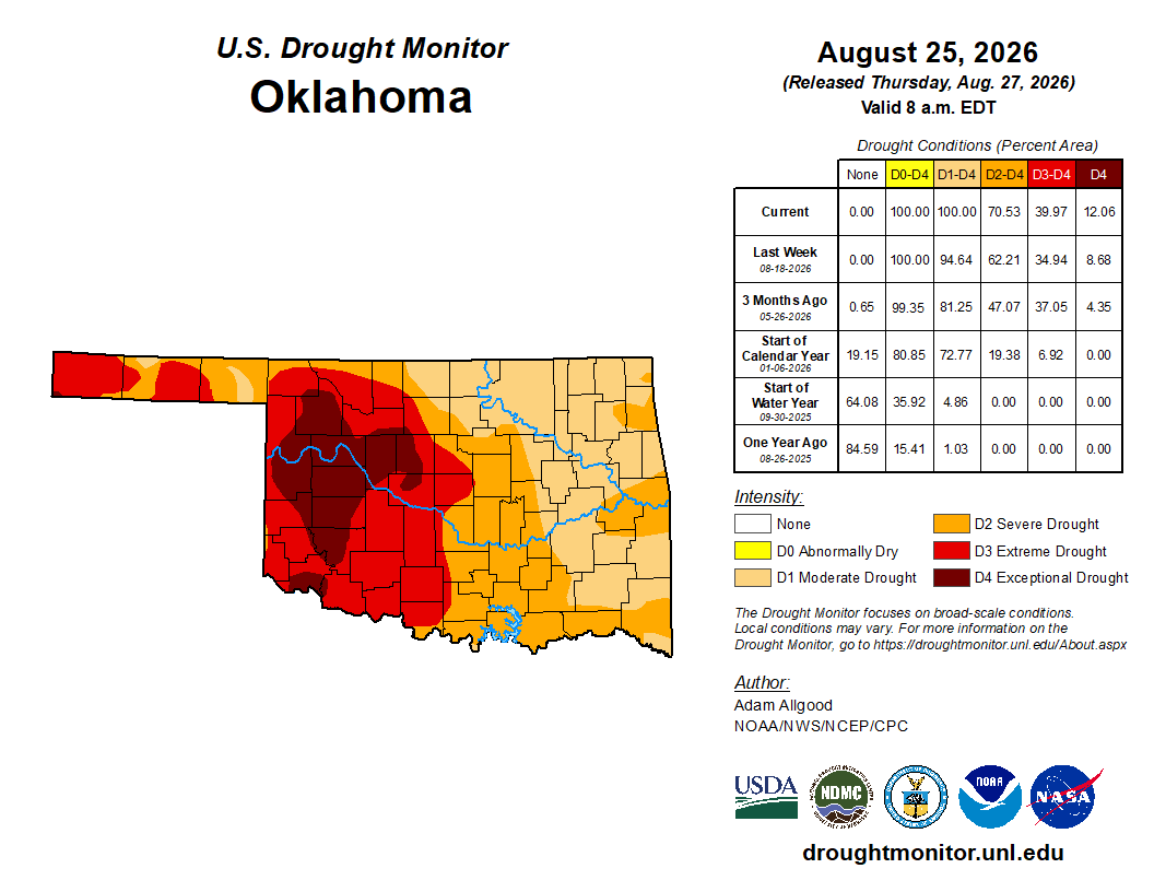
Fire danger always lurks around the corner this time of year until the Fall rains come or the humidity increases and the winds die off. Right now, we have the opposite, so be careful out there. Some have seen temperatures at or above 100 degrees for 58 days. Regarding rainfall, some have gone most of the summer without seeing a quarter of an inch. And even that is paltry when it’s this hot. All of that leads to extensive drought, and it is in the extreme to exceptional category for much of the West.
 Restoration and Disaster Cleanup Service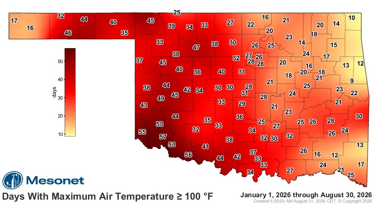
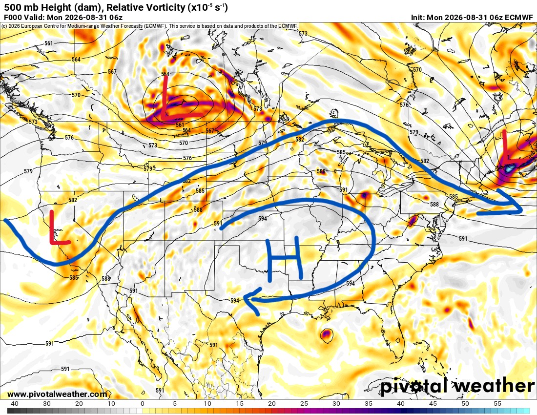
The upper-level jetstream pattern does not provide any relief this week. You’ll notice the upper ridge shifts from east of us to on top of us again. There is a weak tropical system that will move into Texas, providing some rain there, but with the upper ridge establishing itself as a block for Oklahoma, it doesn’t look like it will travel this far north by the end of the week.
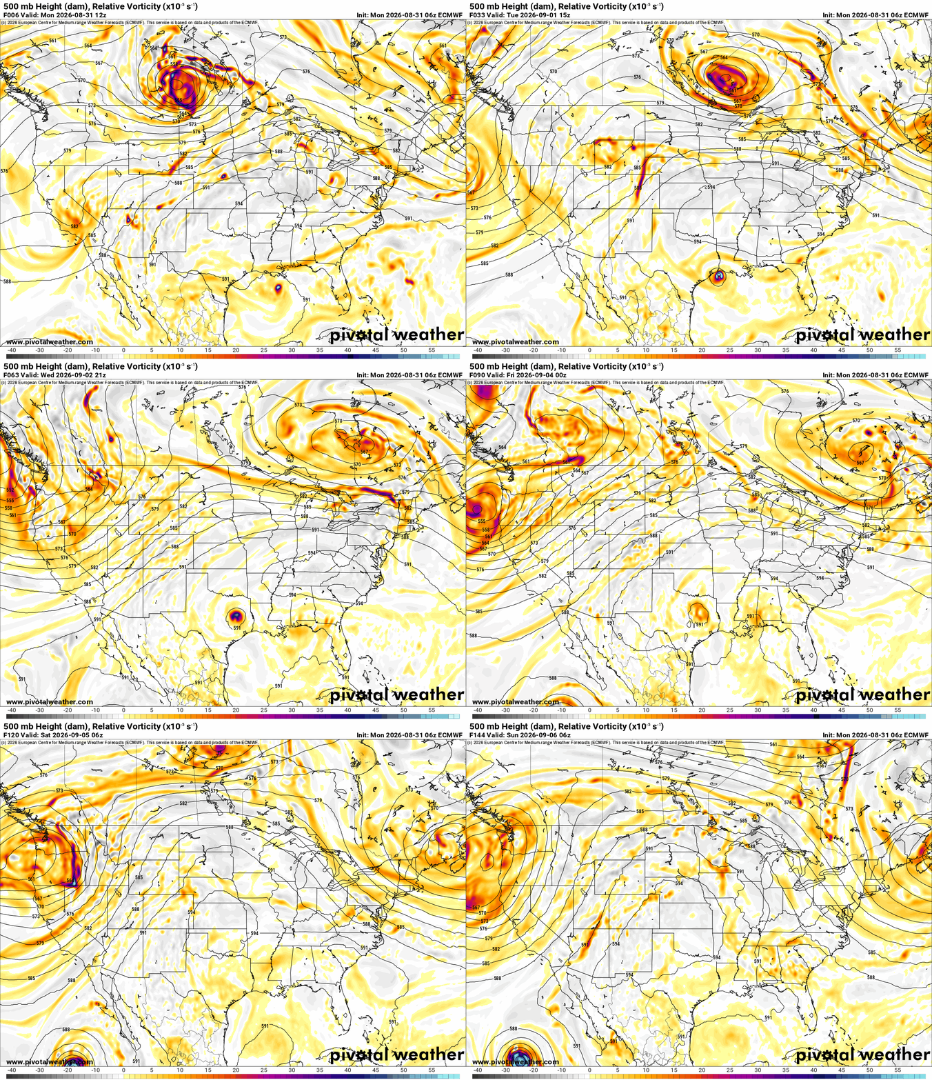
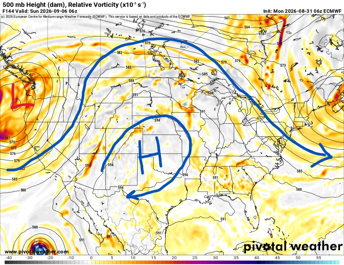
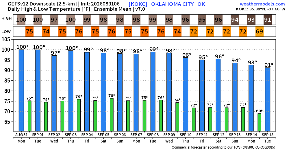
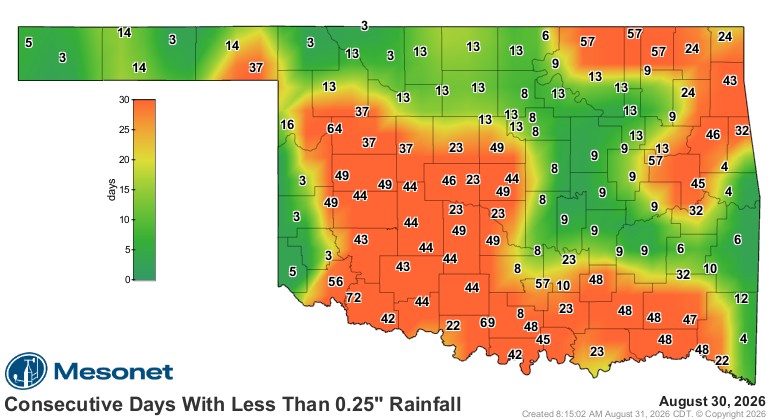
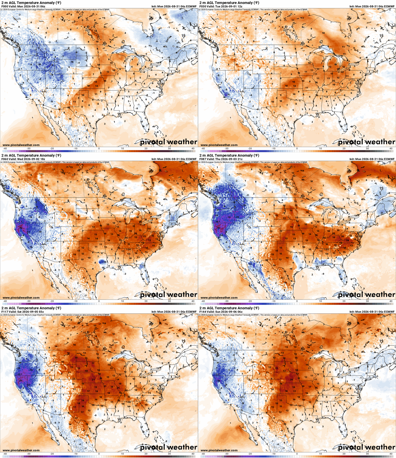
Temperatures with respect to normal will once again be far above. That means lots of 100-degree days ahead this week. The animation shows how much of the country is hot. That said, I gave you a sneak preview of hopium. The Euro model hints that the pattern may break by Sept 14th and bring in some much cooler air to the country as the ridge is replaced with a strong upper trough. Time will tell, but outside of this, we do typically start cooling down each and every week of September due to solar angle and seasonal change. There’s typically a 10-degree fall from Sept 1st to the 30th.
The temperature outlook for OKC is hot, as well as the rest of the state. I always encourage you to use my free weather app to get your backyard forecast. My live videos will return once we get past this hot, dry, and boring summer pattern.