A Welcomed Break in the Heat and More Rain Coming
The highlights for the week will be much cooler temperatures along with more opportunities for rainfall.
Last week we were able to squeeze in a few rain events across the state outside of the triple digit heat. This gave a few of us a brief break.
Be sure to mention Aaron Tuttle when you call (405) 820-1193!
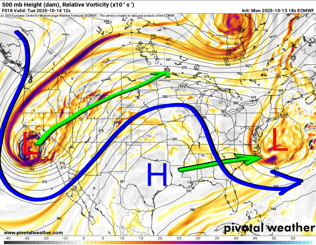
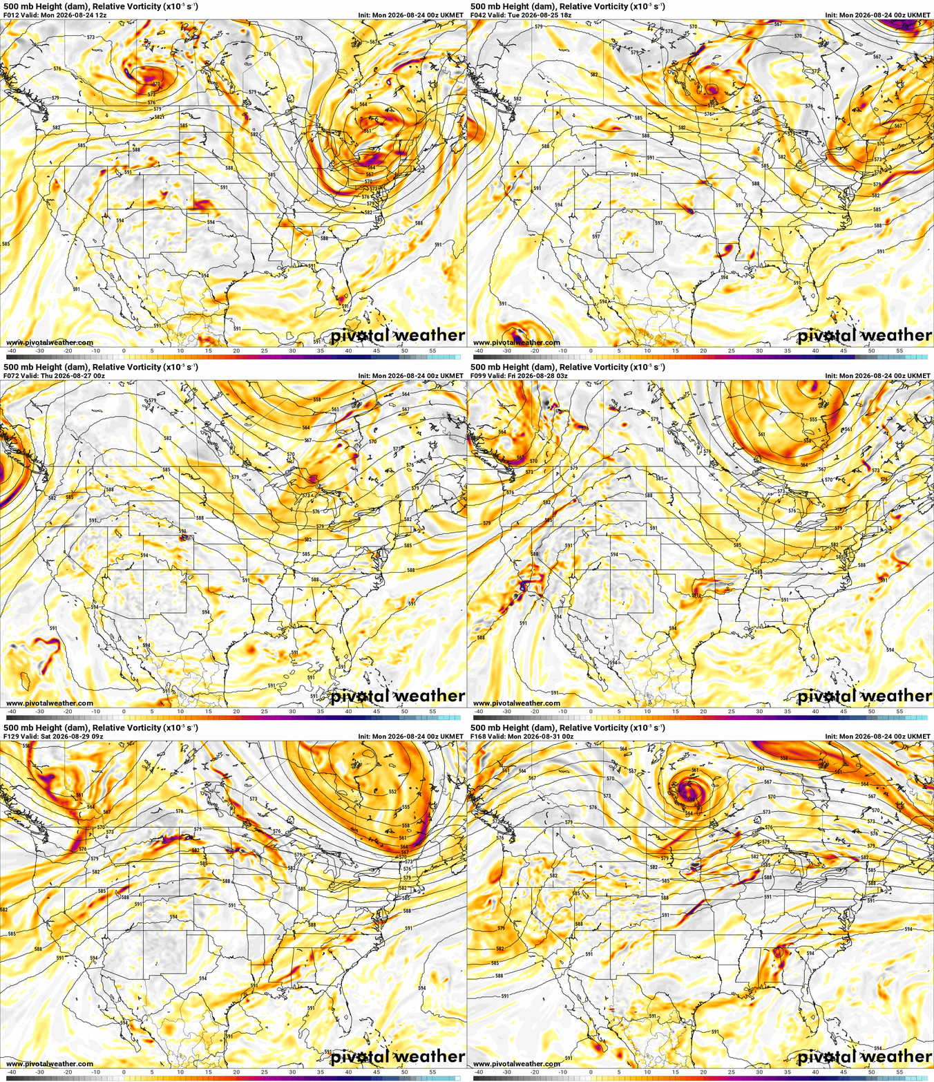
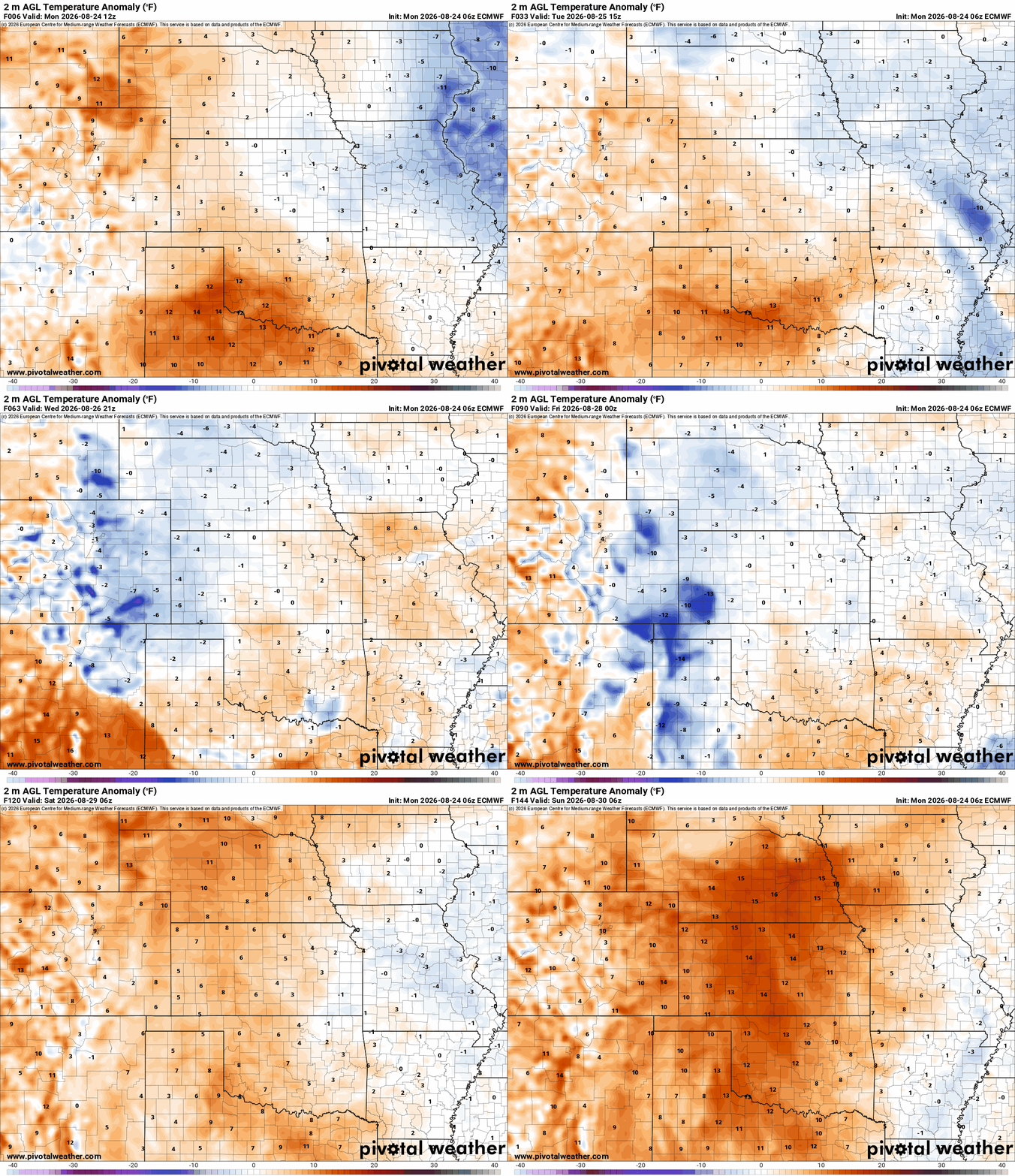
The Jetstream pattern shows the upper ridge that was centered across Colorado will shift southward closer to the Mexico boarder. That will allow temperatures too cool a bit and these upper disturbances to rotate through today through Thursday. Any of these can generate rainfall. The strongest signal will come Wednesday according to the short-term models. The temperatures above normal animation also reflects this slightly cooler trend until the weekend.
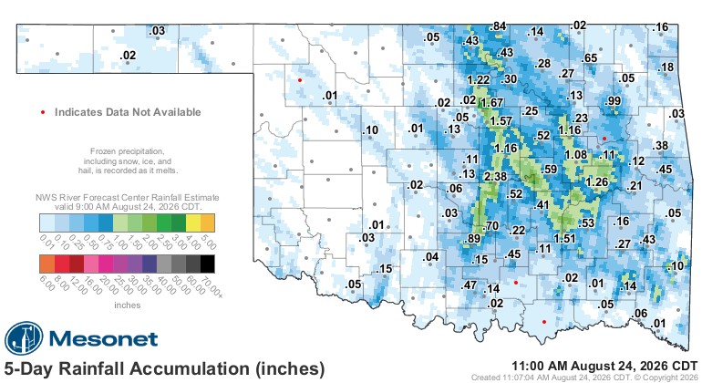
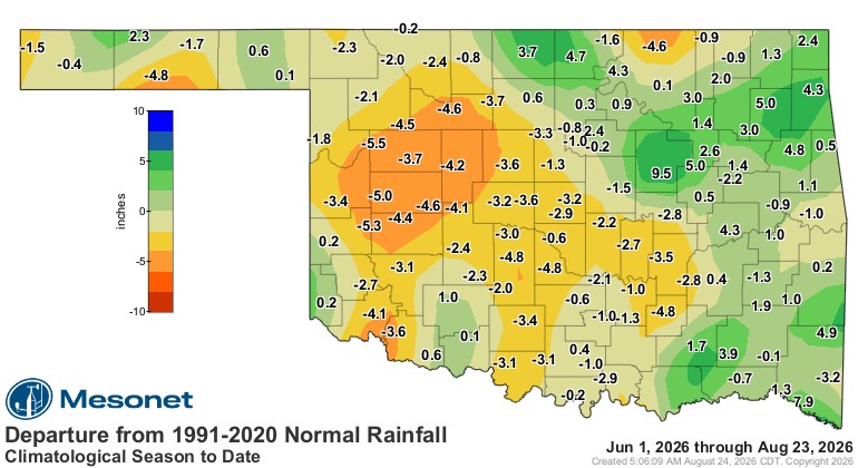
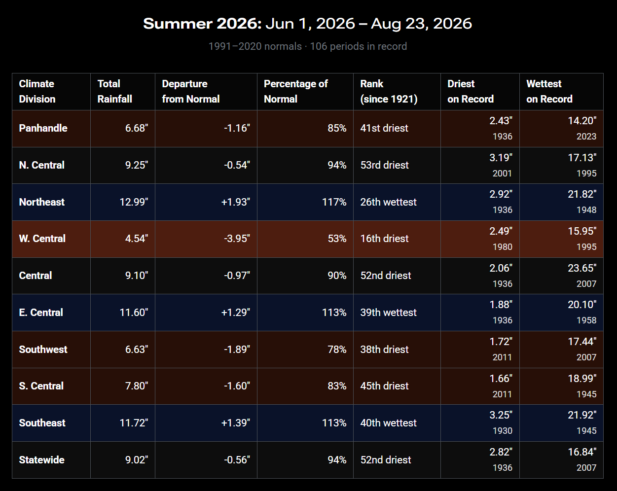
It’s been dry, but believe or not not record setting. Notice where different parts of the state are several inches below normal for our Summer while others are above normal.
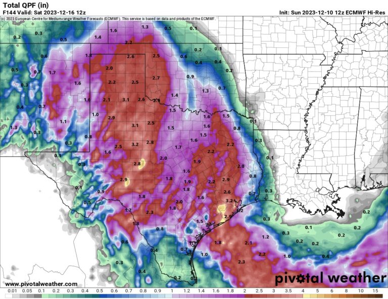
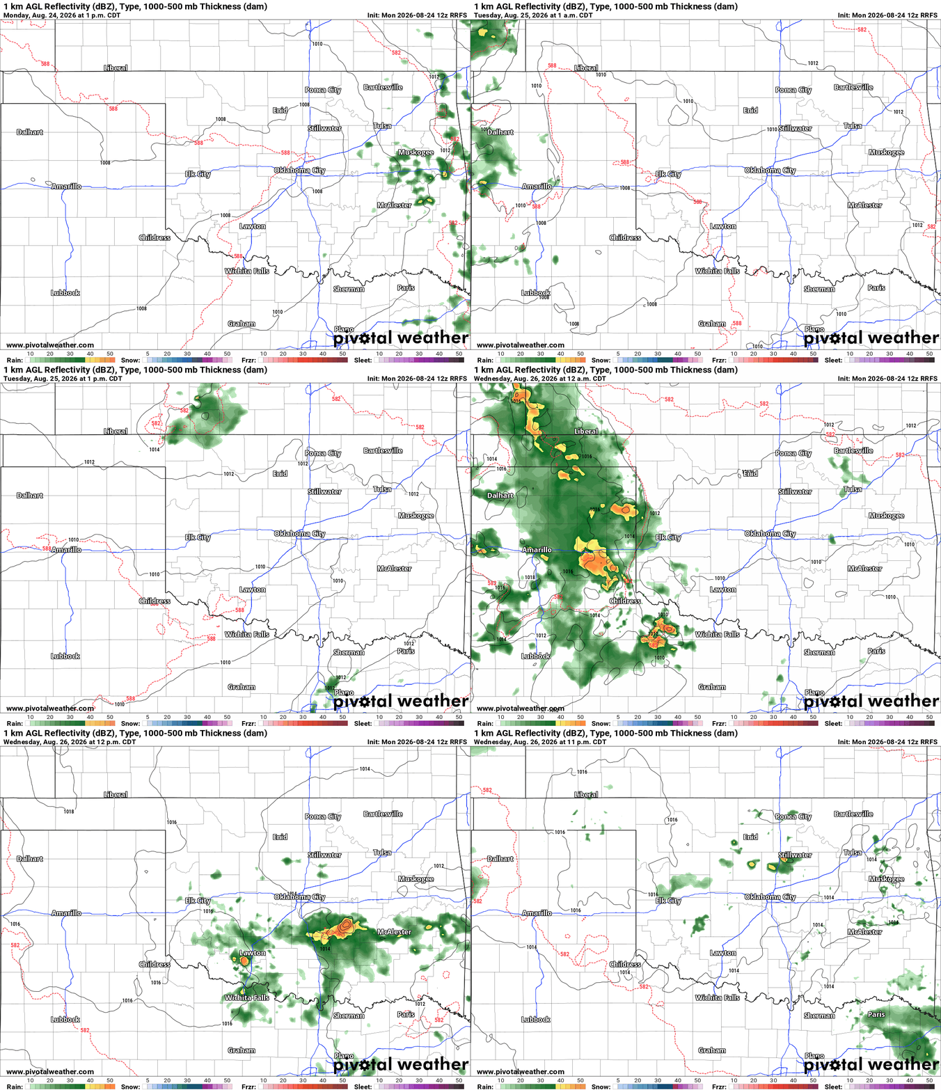
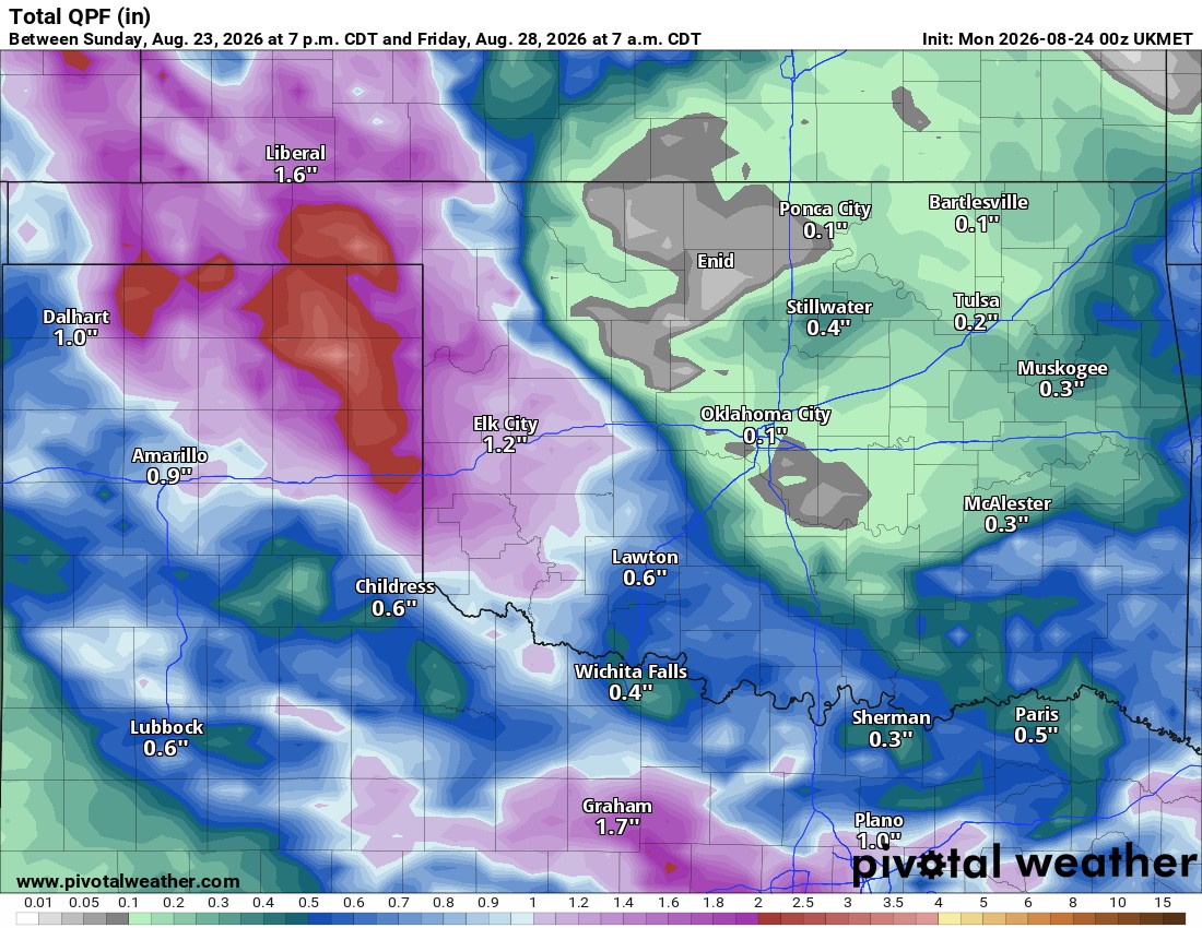
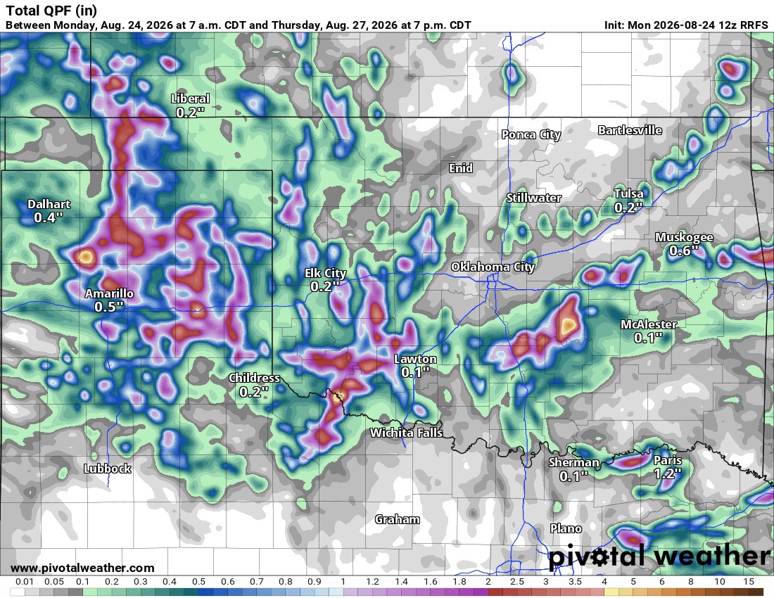
Regarding rainfall for the week. These passing upper level disturbances in the jetstream can trigger decent rain or barely any. It all depends on the strength. We have a decent one moving through the state today which already triggered morning showers across the E half of OK. Should be some isolated activity continue this afternoon and evening with the front. The next disturbance is a weak one for Tuesday afternoon. Spotty showers possible with that one. The one after is Wednesday during the day. That is a strong signal and our best for the week. The final one showing up in the data today is for Thursday afternoon. That one appears weak as well. The models don’t do well generating rainfall ouput in this type of pattern, so the maps below will be lackluster. The take home is the signal and that signal focuses on the W half of Oklahoma where it is deperately needed!
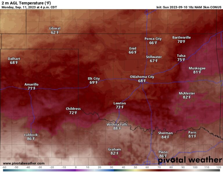
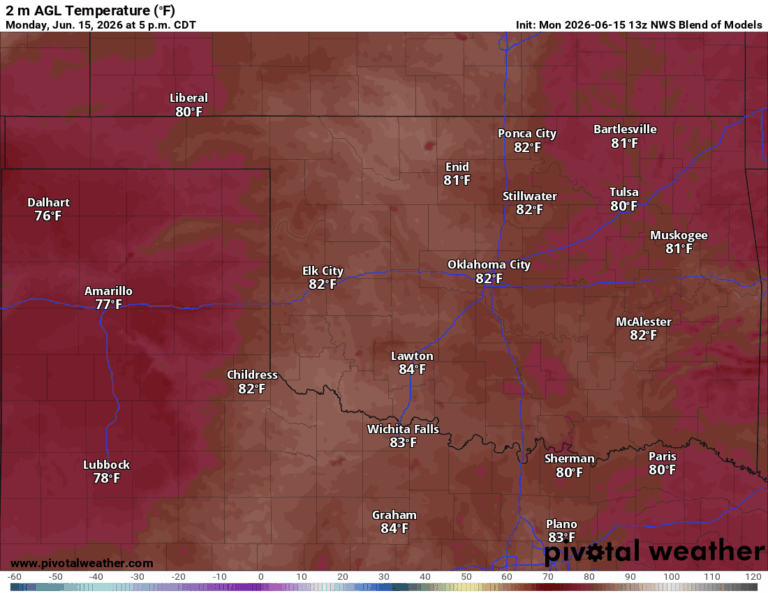
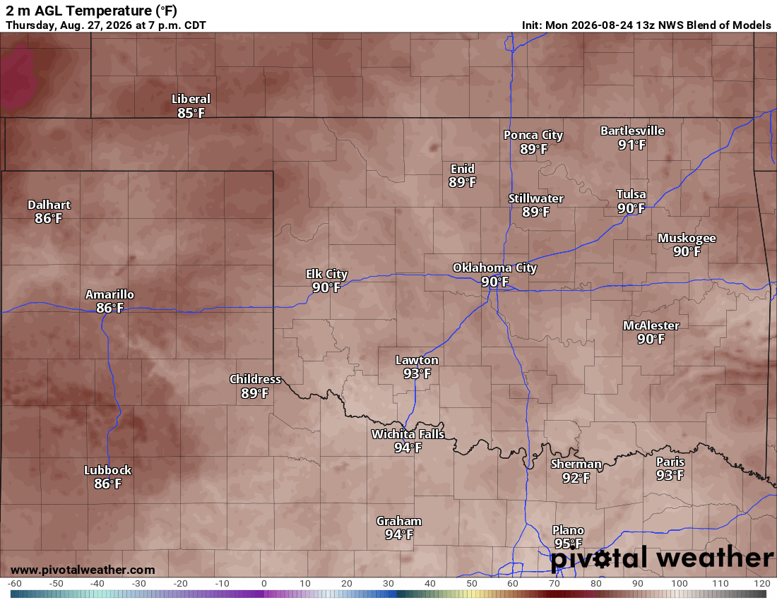
There is a weak cold front today setting up across the I-40 corridor that will move south into N Texas. This will also help to bring temperatures down for many and provide a mostly light north wind this week. Some models have us with highs in the 80s Wednesday and Thursday. I’m not quite ready to buy that extreme, but maybe we can do the low 90s. Either way, better than 110 degrees!
 Restoration and Disaster Cleanup Service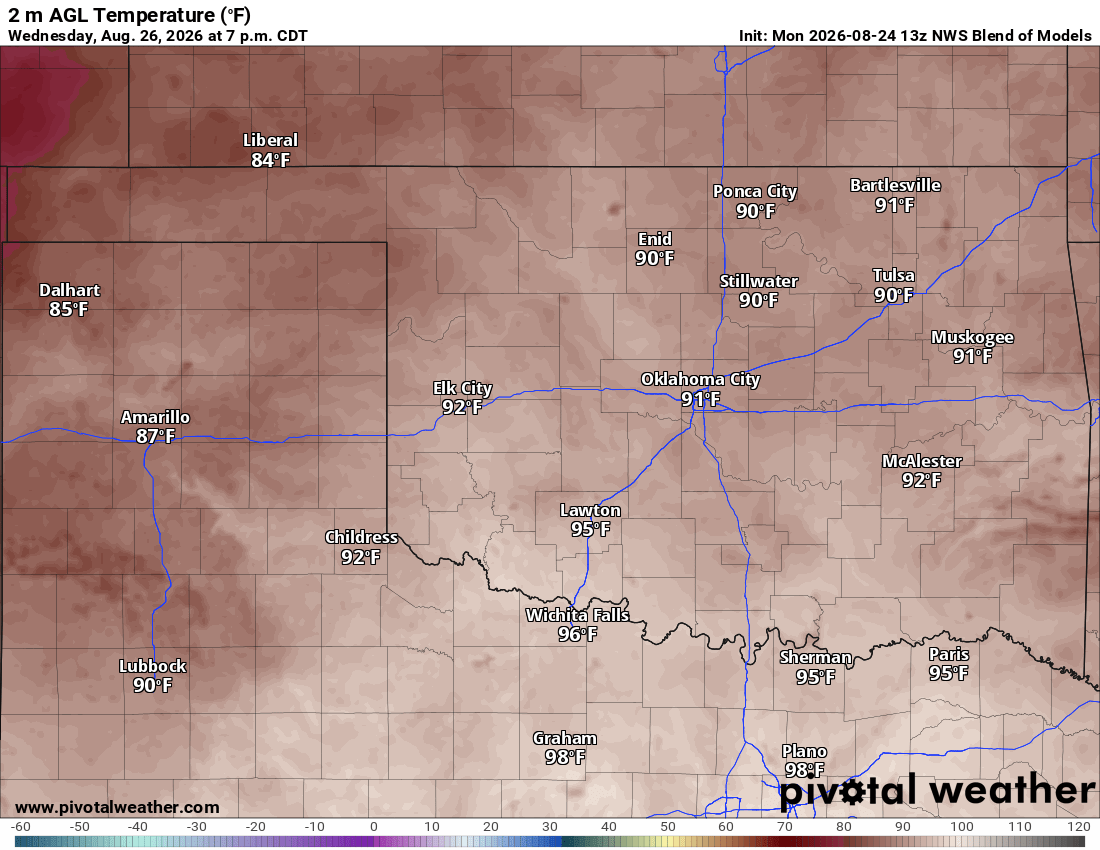
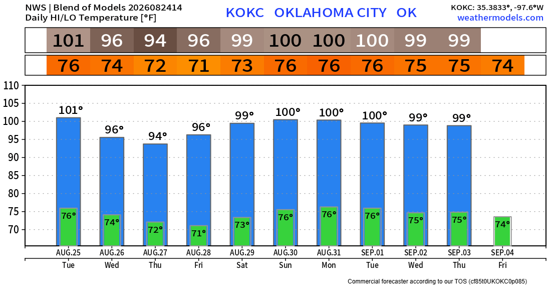
Long term outlook will keep the upper ridge shifting around us. So temperatures will climb back above 100 over the weekend into the first week of September. There are signs that a strong cold front will move in the second week, putting an end to our 100 degree weather. Let’s hope!
Here is the model blend temperature trend for OKC. Any of these numbers can change with rain and cloud cover. Fingers crossed we’ll see much cooler weather for Wed and Thu than shown here. -AT