Rain Returns but Fire Danger and Extreme Heat Continue
Last week was pure brutal heat and wildfires. This week, more of the same, but we’ll get an upfront break with some rain activity.
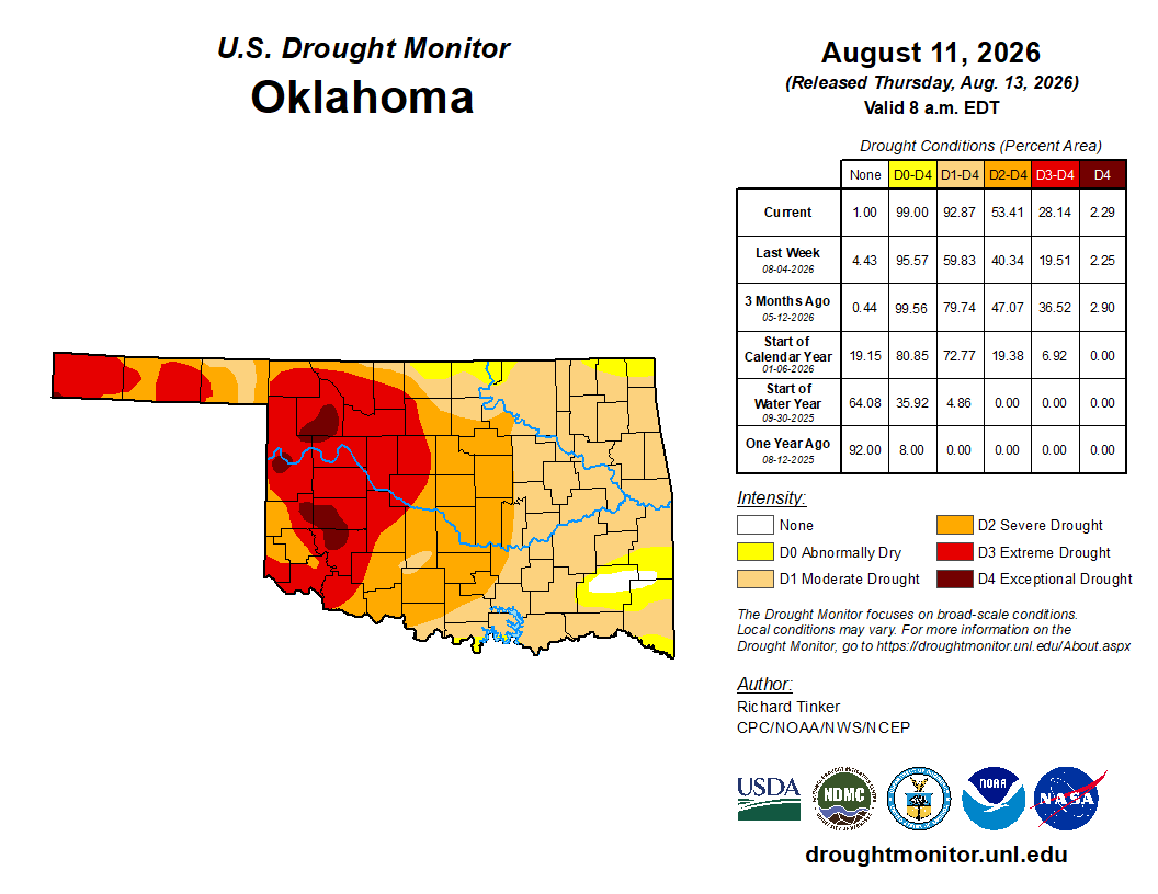
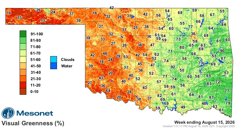
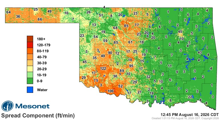
The drought continues to expand, and the visual greenness is showing less and less “green” across the western half of the state as the vegetation continues to dry out. Numerous fires developed last week, and although we’ll see some fires this week, the wind speeds will be lower, so that might help keep the numbers down a bit. If a fire does break out, the spread index shows how fast it can travel in feet per minute.

Ferguson Roof Systems is offering an AT's Weather special!
The Jetstream shows an upper disturbance moving through tomorrow and another weaker one around Thursday. The upper-level ridge will gradually transition back to Oklahoma, cranking up the heat for next weekend and beyond.
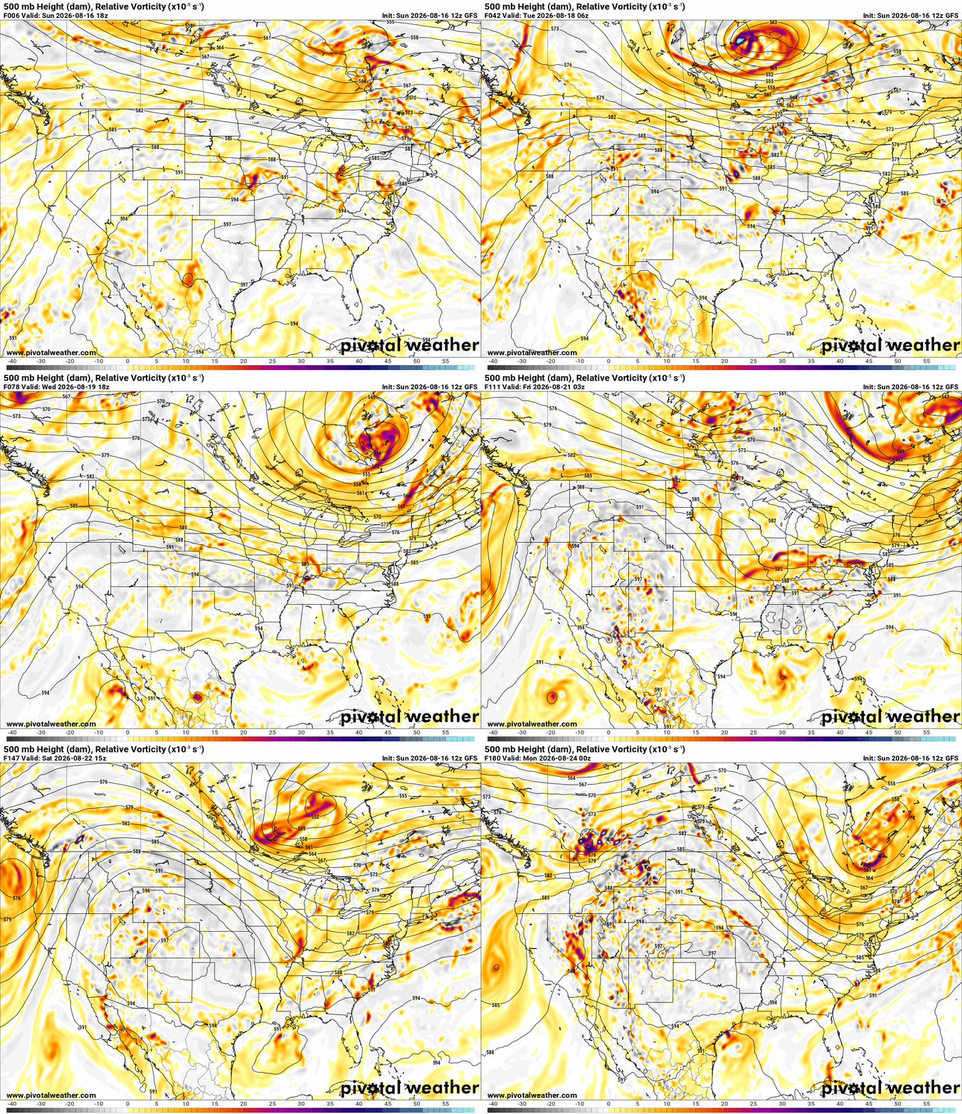
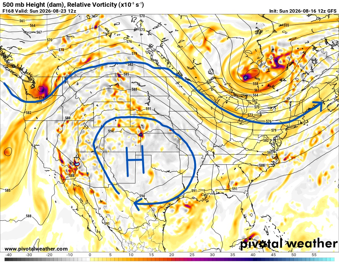
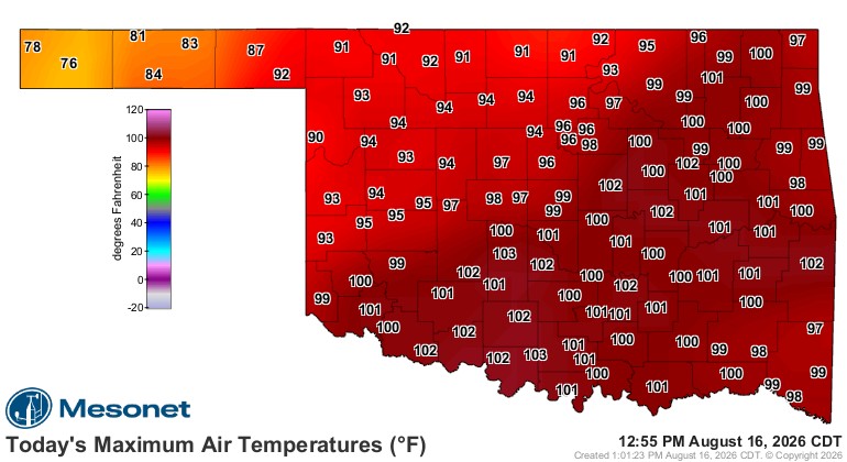
In addition to the help from the Jet, we do have a weak cold front today, which actually made a difference in temperatures on our Sunday. Another weak front will move in Wednesday night and Thursday, so that may knock temperatures down a few degrees as well.
Ferguson Roof Systems is offering an AT's Weather special!
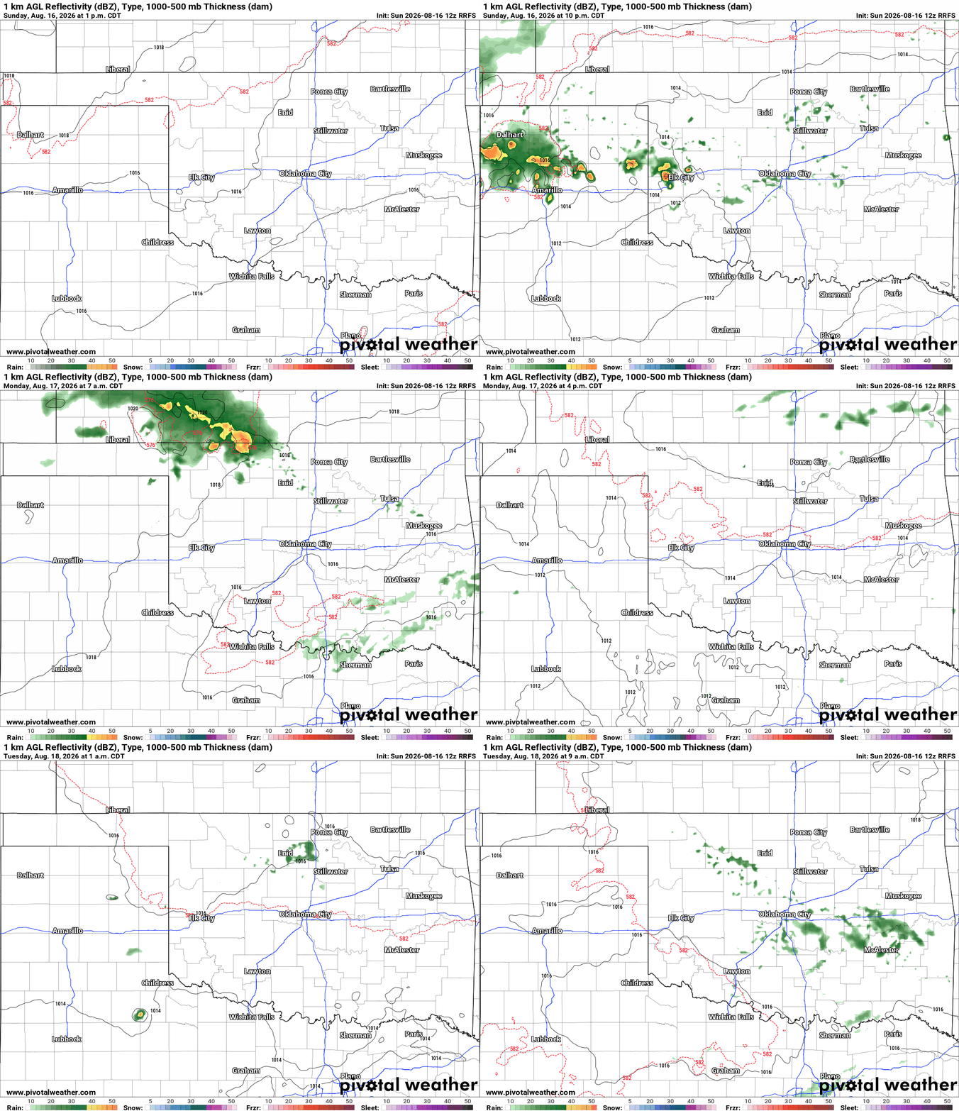
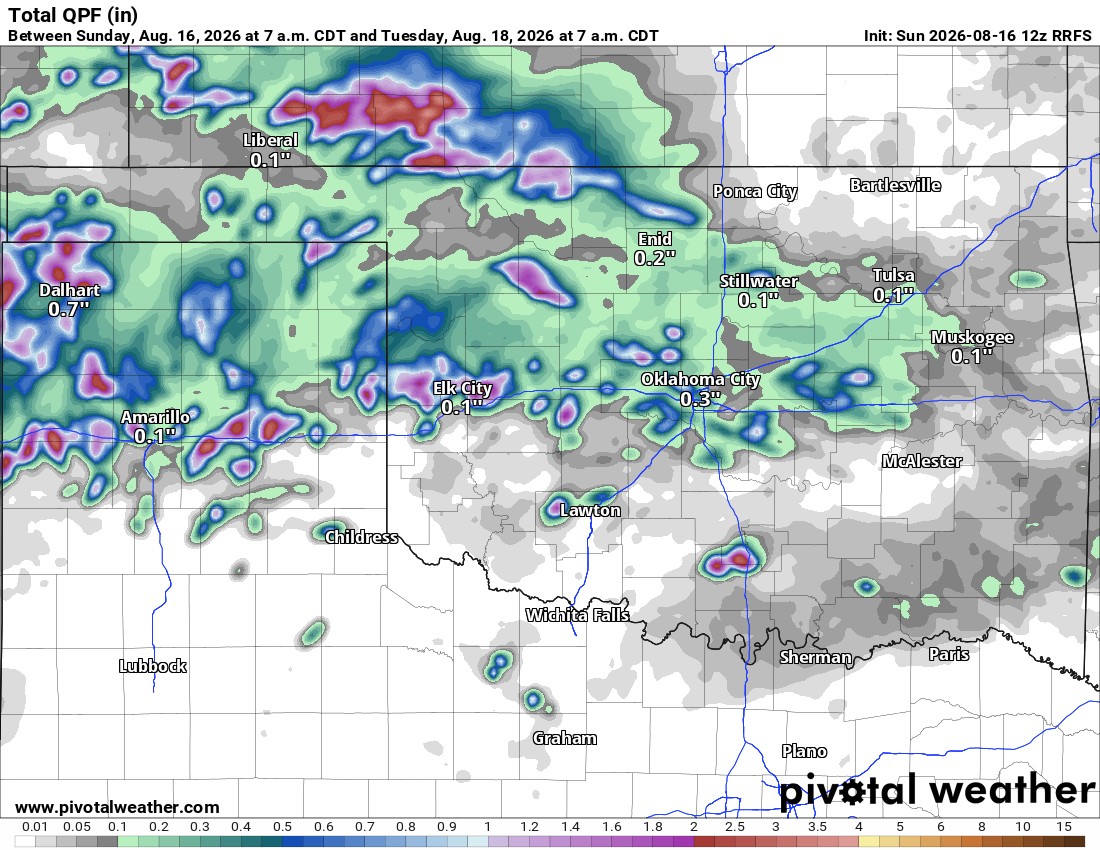
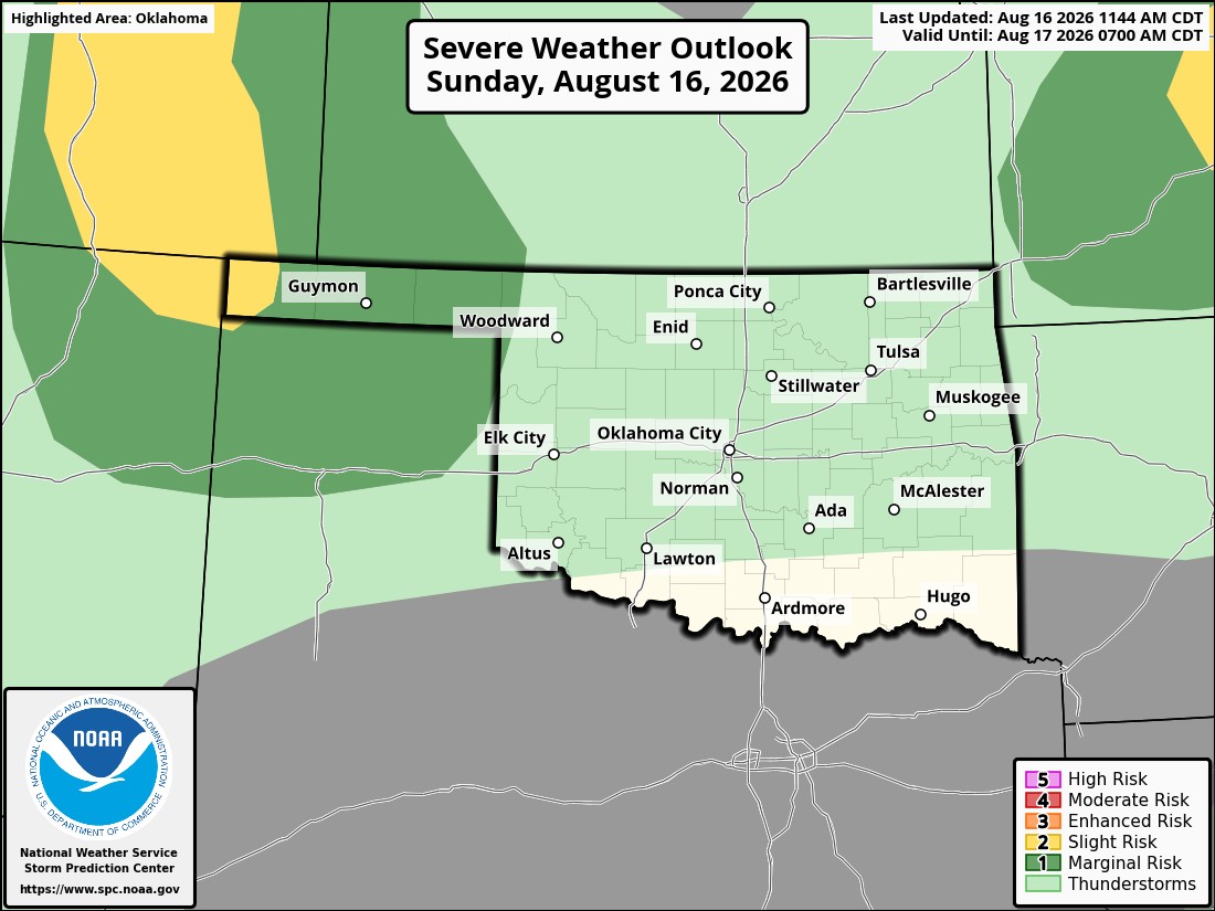
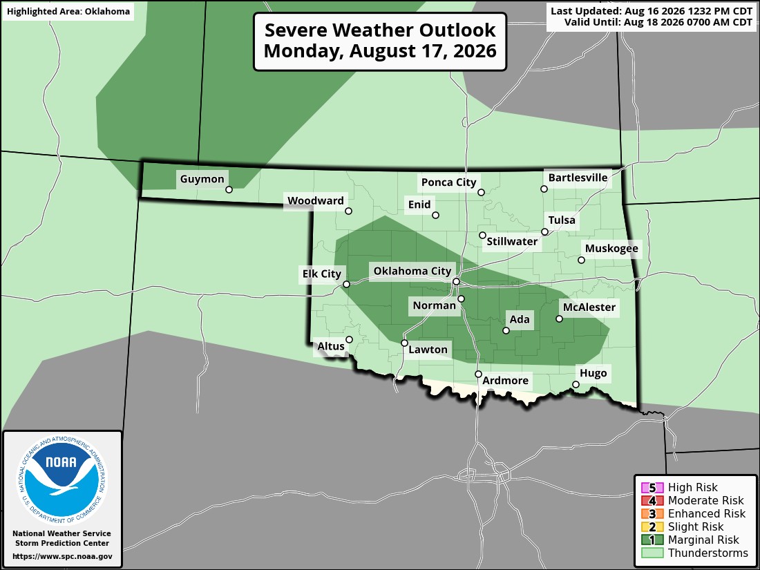
A few showers and storms will develop from this afternoon through Tuesday morning until that boundary washes out. Maybe Thursday will bring us something, but for now, models aren’t excited about it. The rain animation for now through Tuesday is shown below. Rainfall amounts might be decent for those lucky enough to get under a storm. However, any lightning may spark additional fires. Damaging winds would be the severe weather threat with any storm cell that collapses.
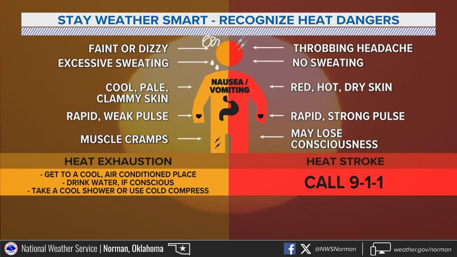
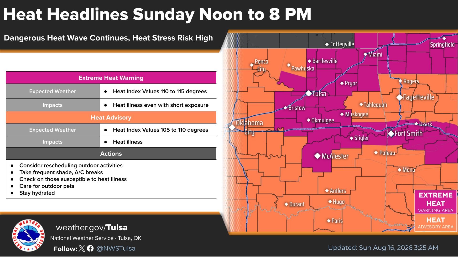
The heat will continue to be a problem. Make sure you take heat safety seriously if outdoors for any length of time. The long-term outlook will trap that above-normal heat across Oklahoma. The values are as much as 10 to 15 degrees above normal. We normally top out in the low to mid 90s across the state this time of year. So add 10 to 15 to that to get the values just about every day. The only thing that can break this streak are these weak cold fronts that sneak in from time to time under the flow aloft.
 Restoration and Disaster Cleanup Service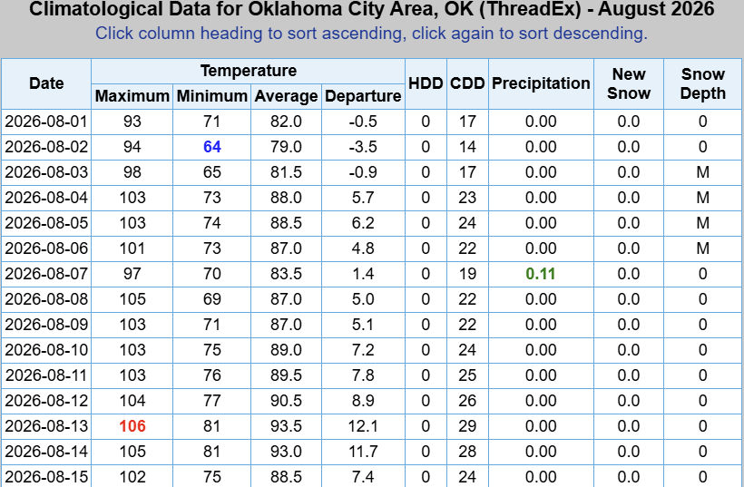
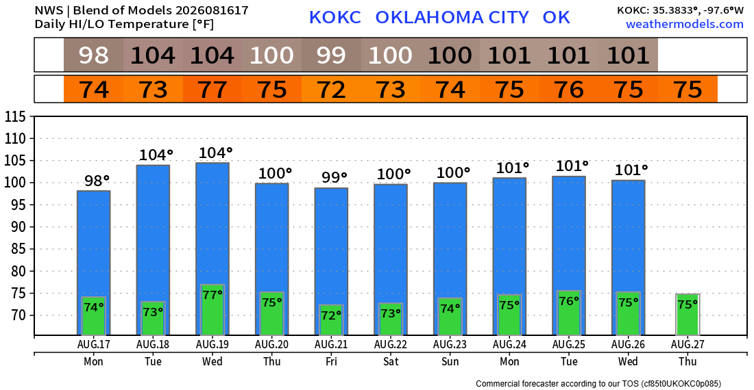
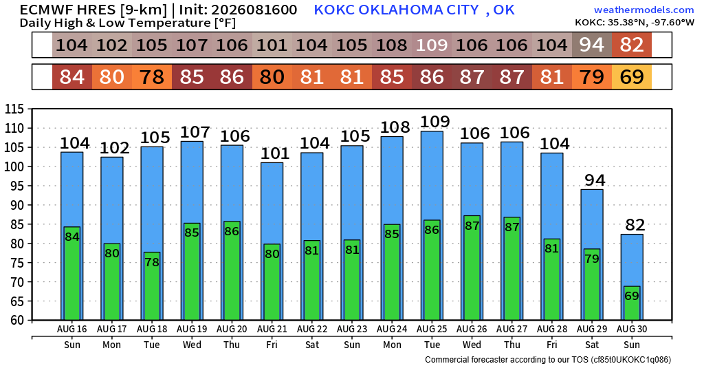
Here is the OKC temperature trend. Just like before, the first set of numbers this week is more accurate, with the extended more representative of much higher 100+ degree days.