Fire Danger and Extreme Heat Expand, and a Rare Astronomical Event
Our highlights for this week will be the expanding heat and fire danger, and on August 12th, quite an astronomical collaboration.
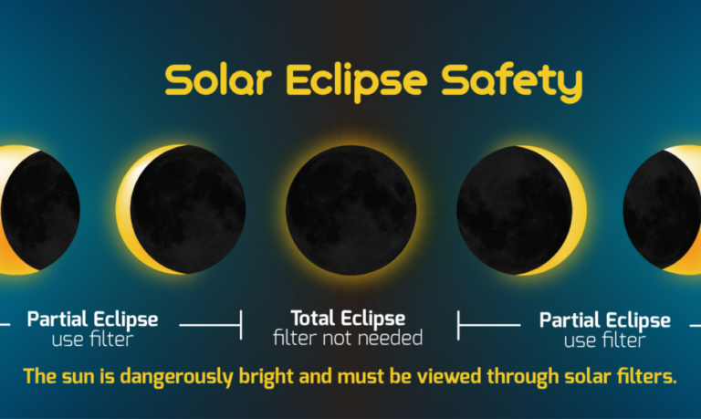
Before we get to the weather, let’s start with the fun news…the Astronomical Event! Several things will transpire on August 12th. In the early morning, there will be a planetary alignment of the following six planets: Mercury, Jupiter, Mars, Saturn, Uranus, and Neptune. Mars and Saturn are the easiest to see without optical aid. Mercury and Jupiter will be low in the dawn twilight, while Uranus and Neptune require binoculars or a telescope. During the day, a total solar eclipse will affect the Northern Hemisphere with a direct track across Greenland, Iceland, and Spain. After midnight, the Perseid meteor shower will illuminate the sky under a new moon, which will make it far easier to see outside of city lights. Now back to the weather…
 Restoration and Disaster Cleanup Service
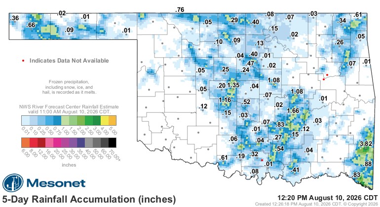
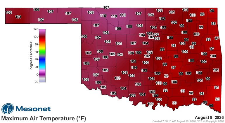
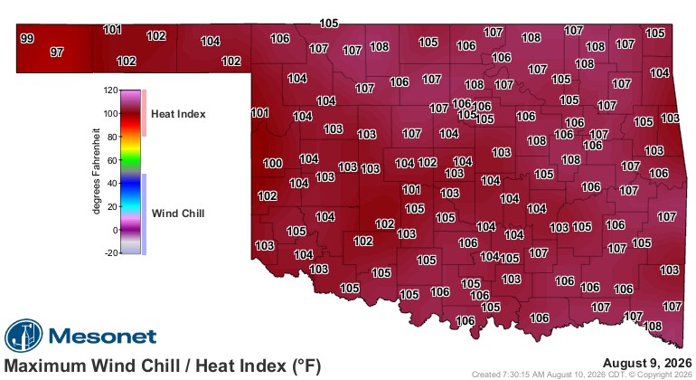
Last week, the rain skirted the northern counties until one event managed to build from leftover activity and work through the central part of the state. Outside of this blessing, it was mostly hot and dry. As we dry out our grounds in August, the temperatures are able to get hotter during these types of summer patterns. Yesterday will be a typical day on repeat, where temperatures are much hotter out west, but the humidity out east will make it feel just as hot.
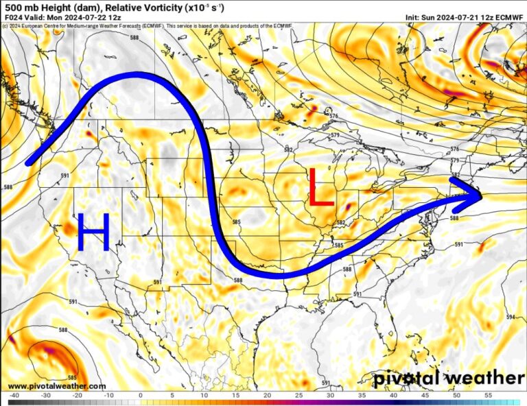
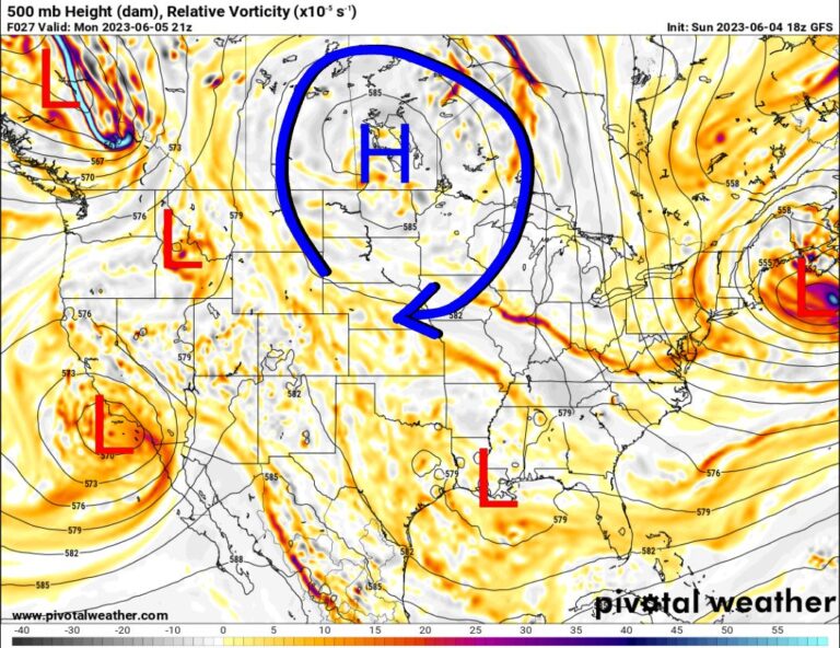
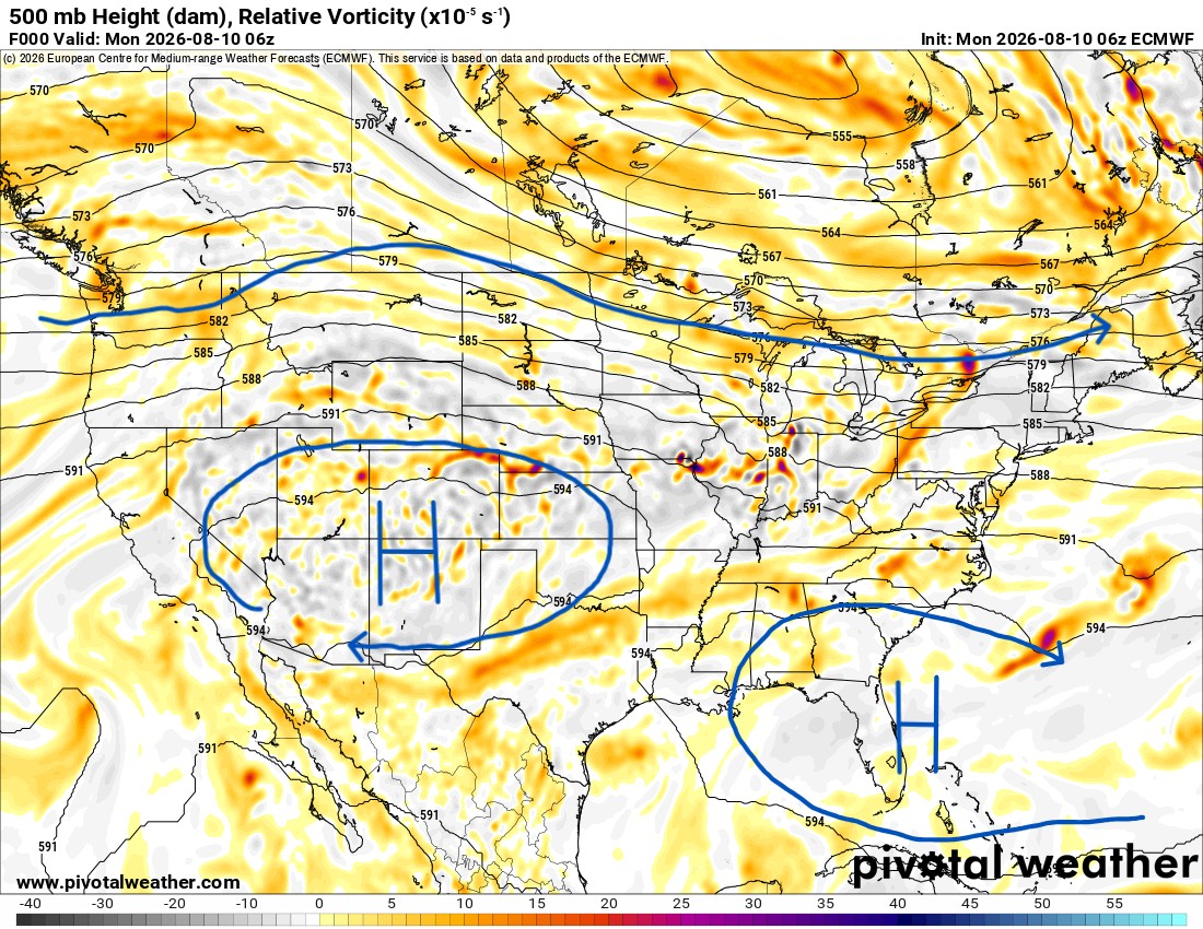
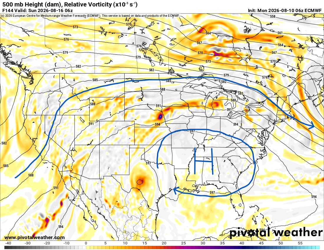
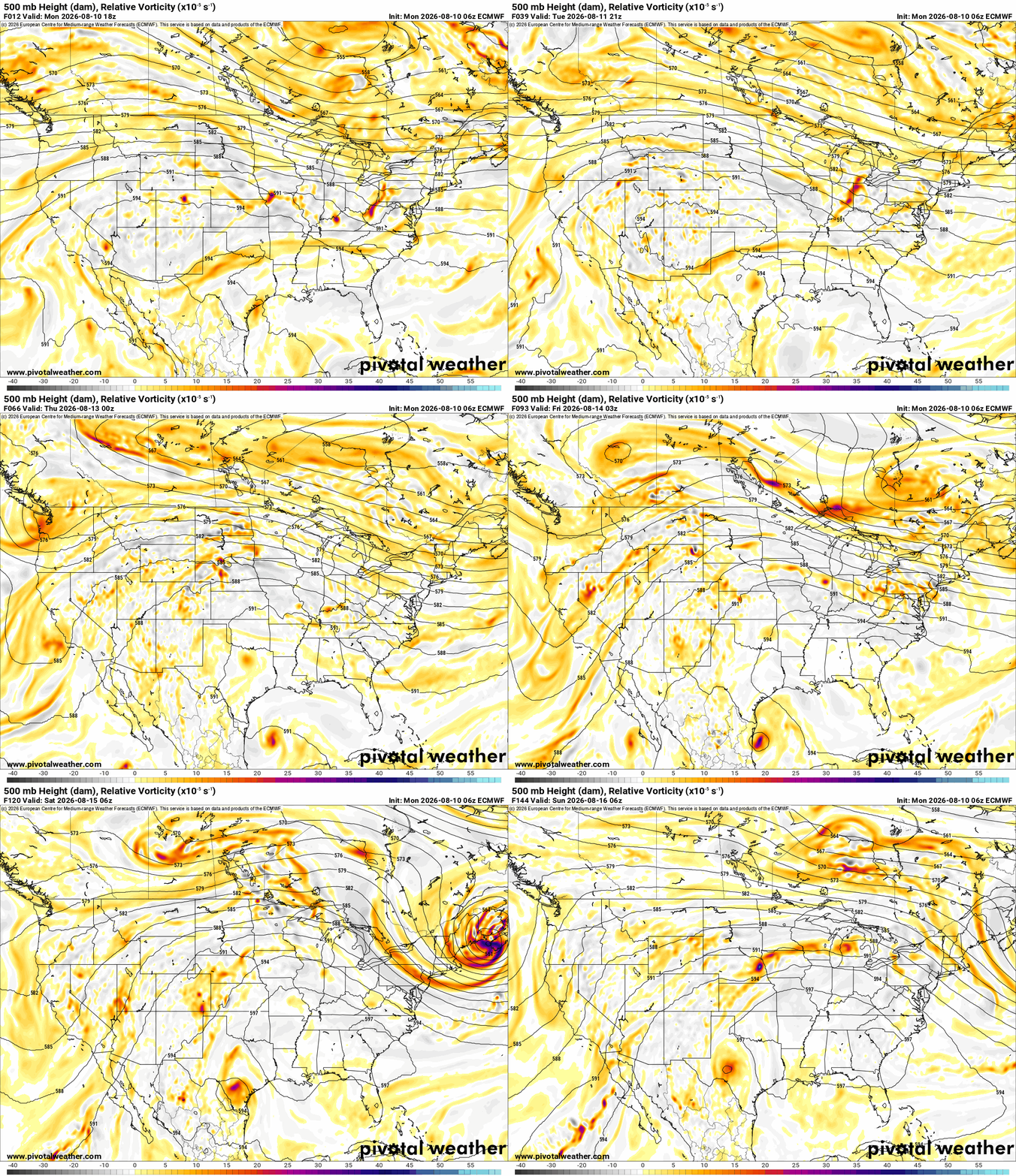
The Jetstream shows the upper ridge out west transitioning to an eastern ridge. We’re caught in between, and that doesn’t allow us to cool down. It’s a hot pattern, and the models are going crazy with the extended temperatures as a result. It also doesn’t show any significant rain signals for the body of the state.
Be sure to mention Aaron Tuttle when you call (405) 820-1193!
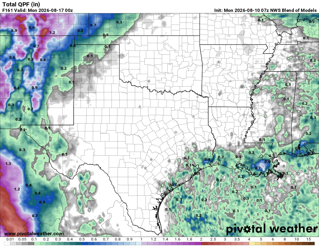
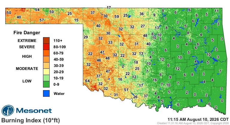
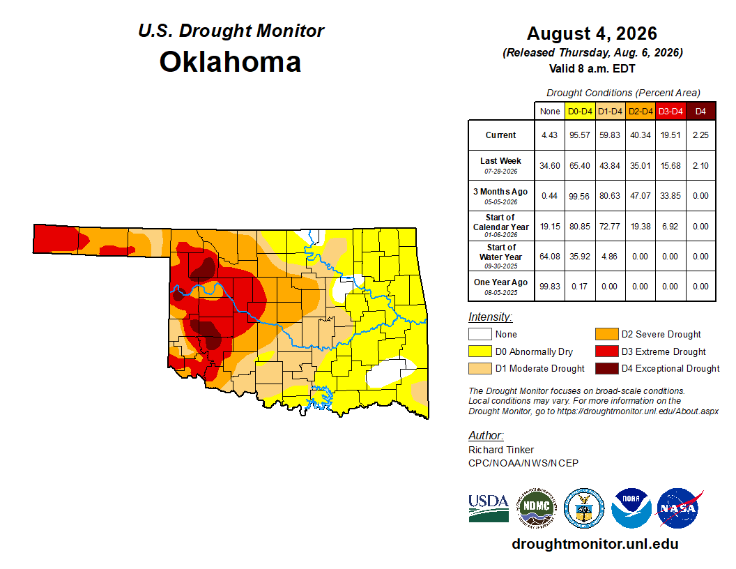
The drought update will come out tomorrow, but the last report already has it expanding. This will continue until August ends. With the vegetation and soils drying out, the fire danger will expand across western and central Oklahoma. The burning index map below integrates both the spread component (SC) and energy release component (ERC) with respect to fires. The higher the number, the harder they are to control. Anything above 80 is a very serious concern, and we’re starting to see more of those values on the map.
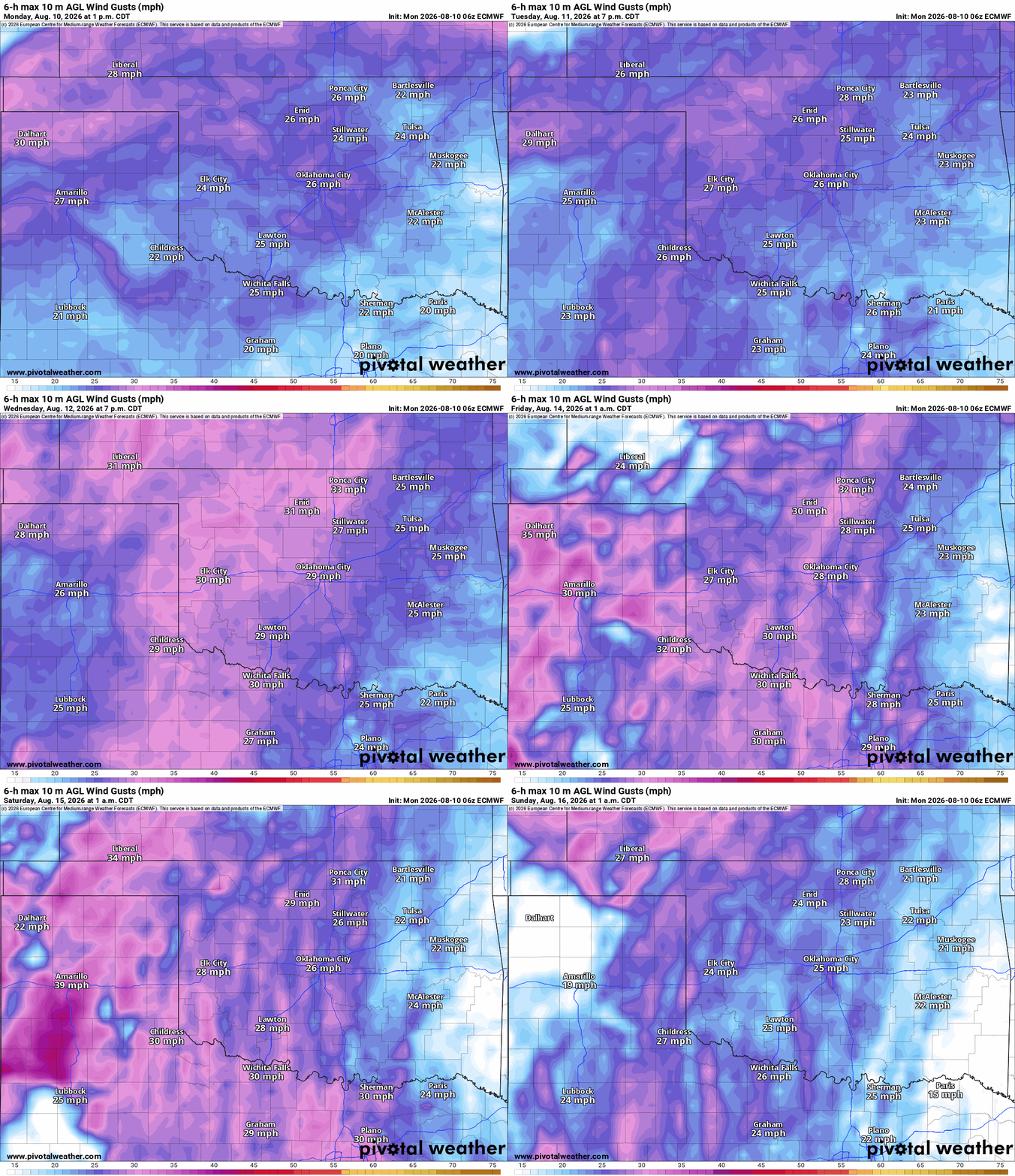
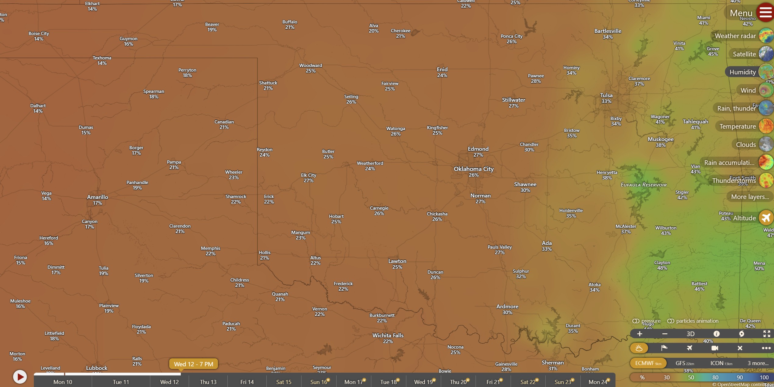
Two other components to track for wildfires are the wind speeds and humidity levels. The wind will be gusting out of the S and SW during the week, and humidity values will fall into the teens and 20s at times.
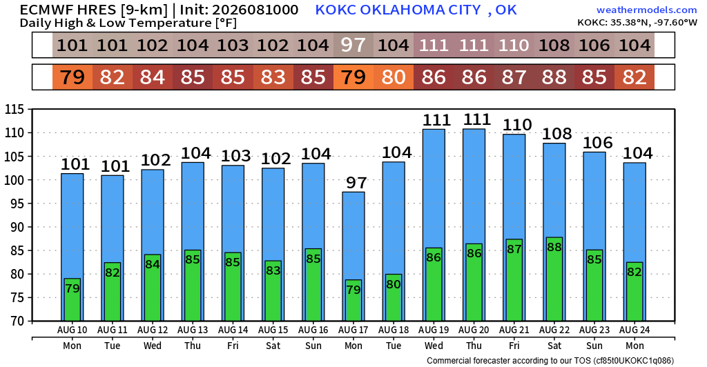
The temperature anomalies across Kansas and Oklahoma will be around 10 to 15 degrees above normal. So that easily places us well above 100 degrees day in and day out. Overnight lows not falling below 80 degrees is a problem for human comfort at night as well.
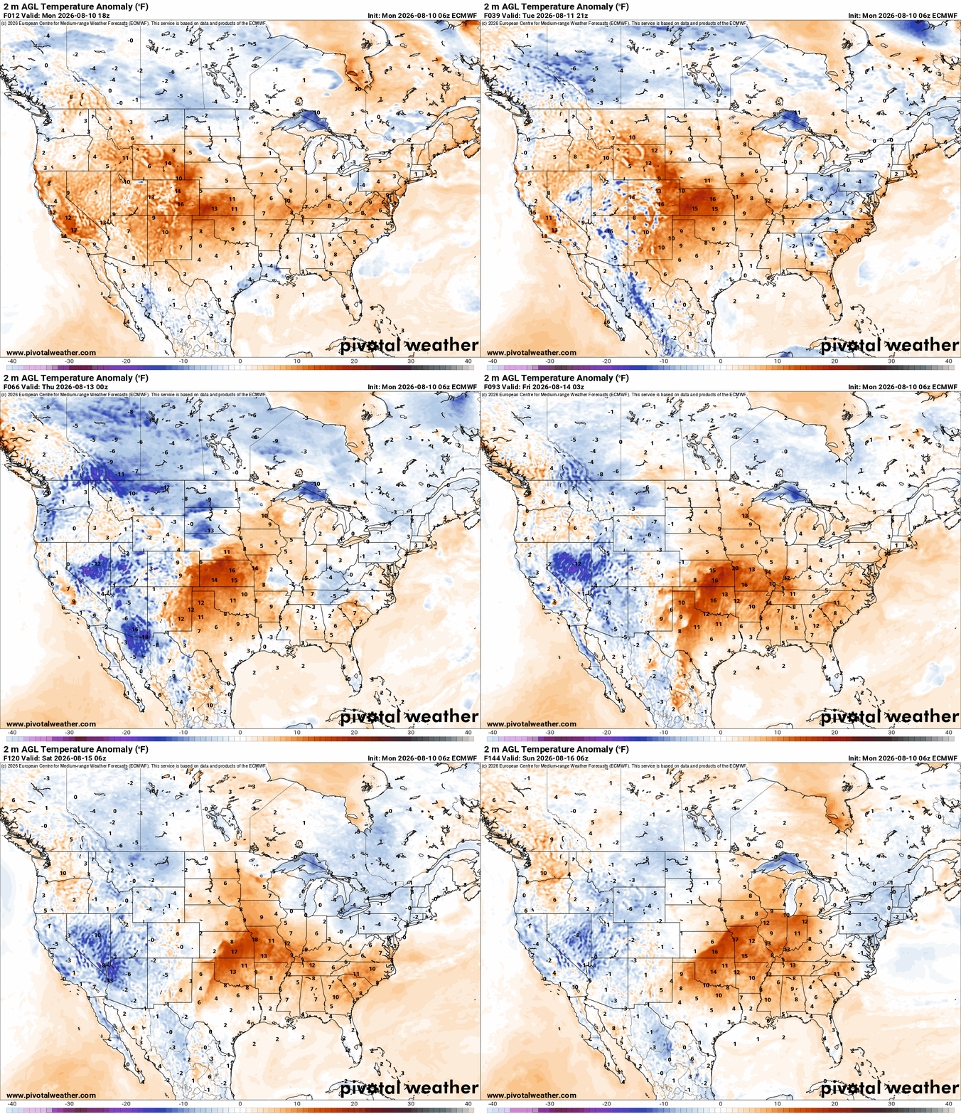
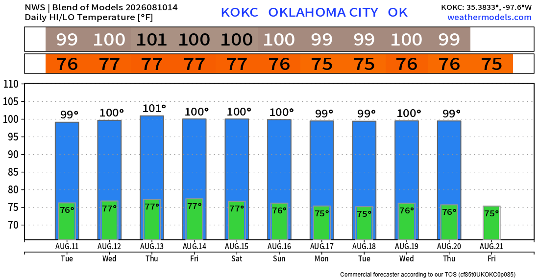
I normally show the model blend for the long-range temperature trend. I’ll do it again here, but I’m also showing the European outlook, which is far more believable in this pattern. Do what you can to stay cool and hydrated! -AT