Severe Storms and Best Solar Eclipse Viewing Weather
This blog entry will be packed full of helpful information as you plan your solar eclipse viewing and I’ll also discuss the severe weather and beneficial rainfall coming back into the forecast for the week.
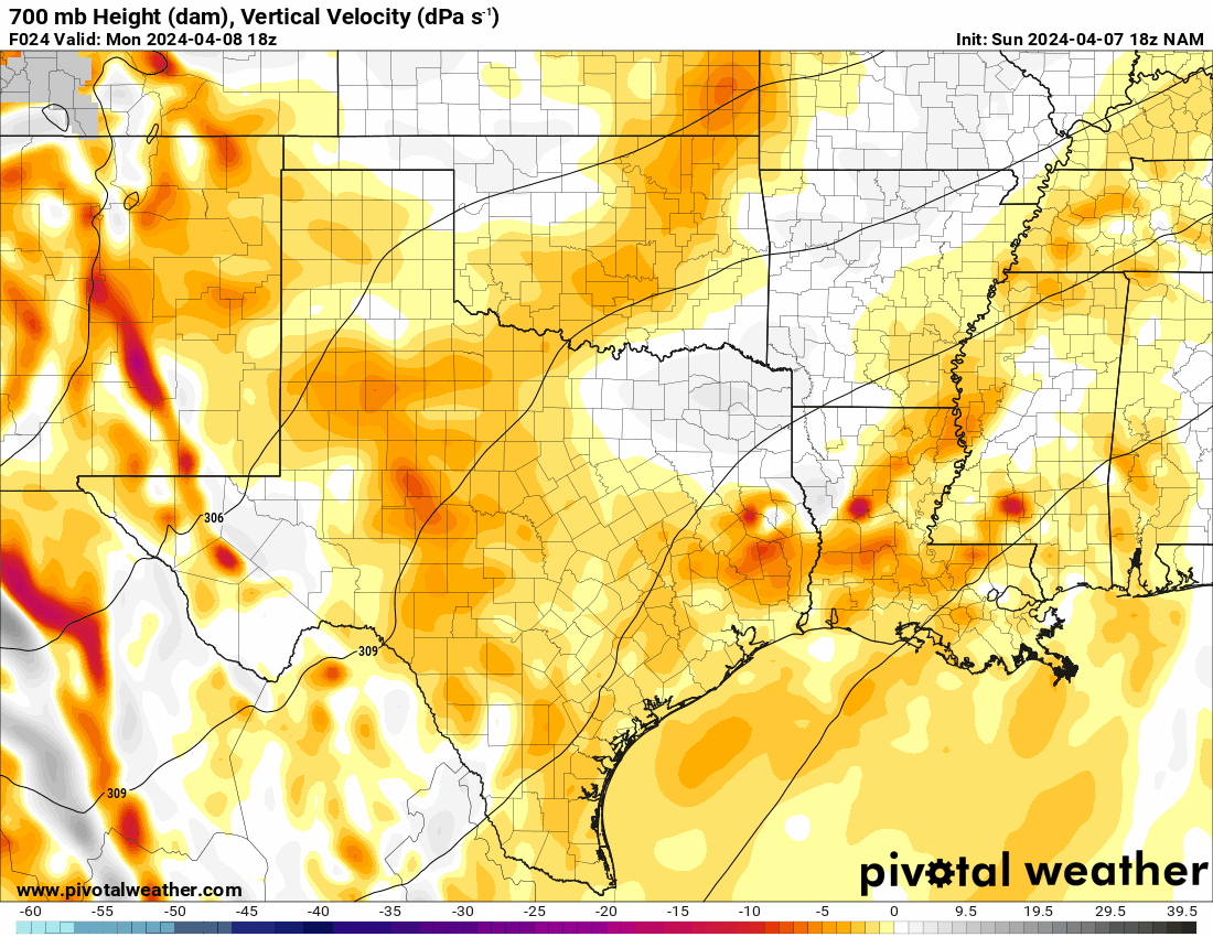
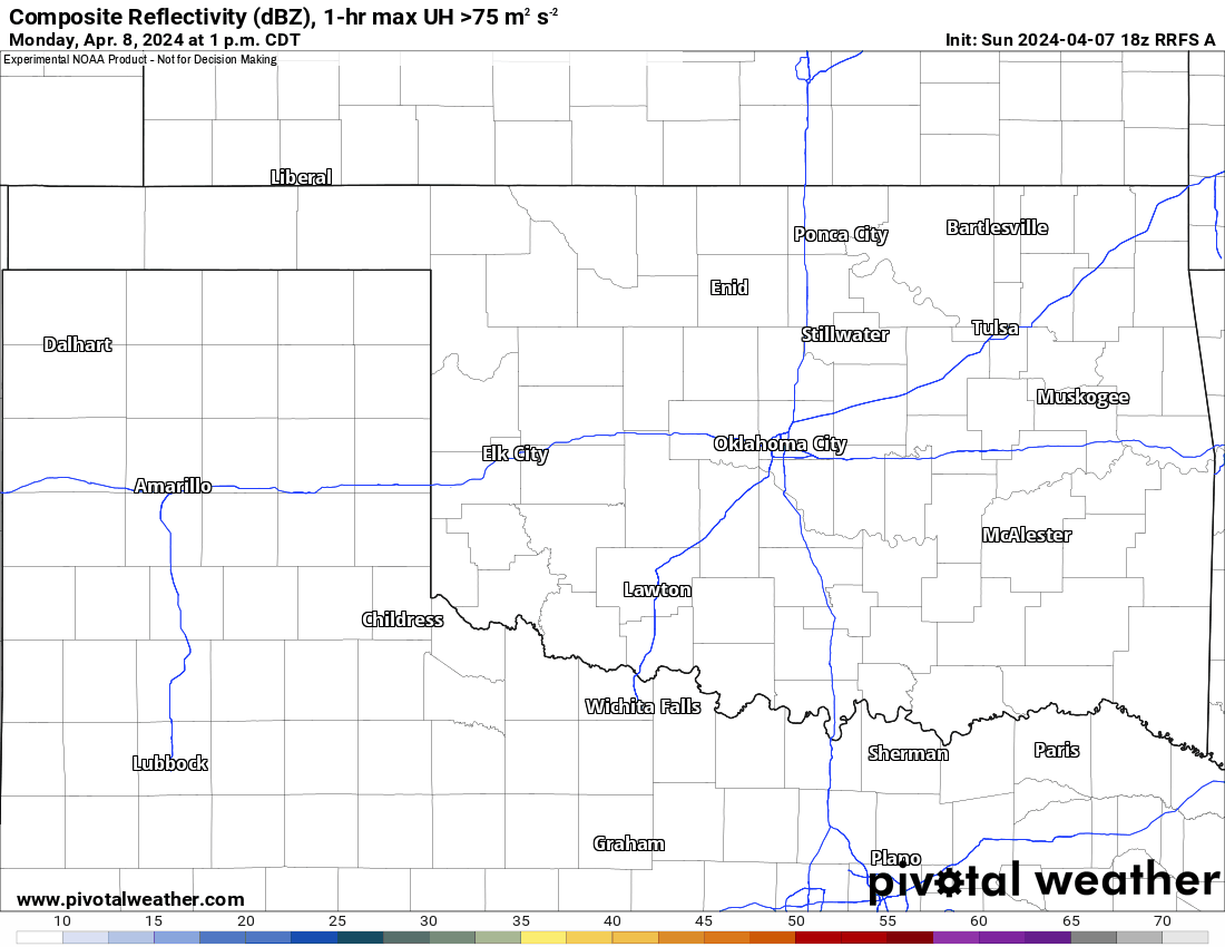
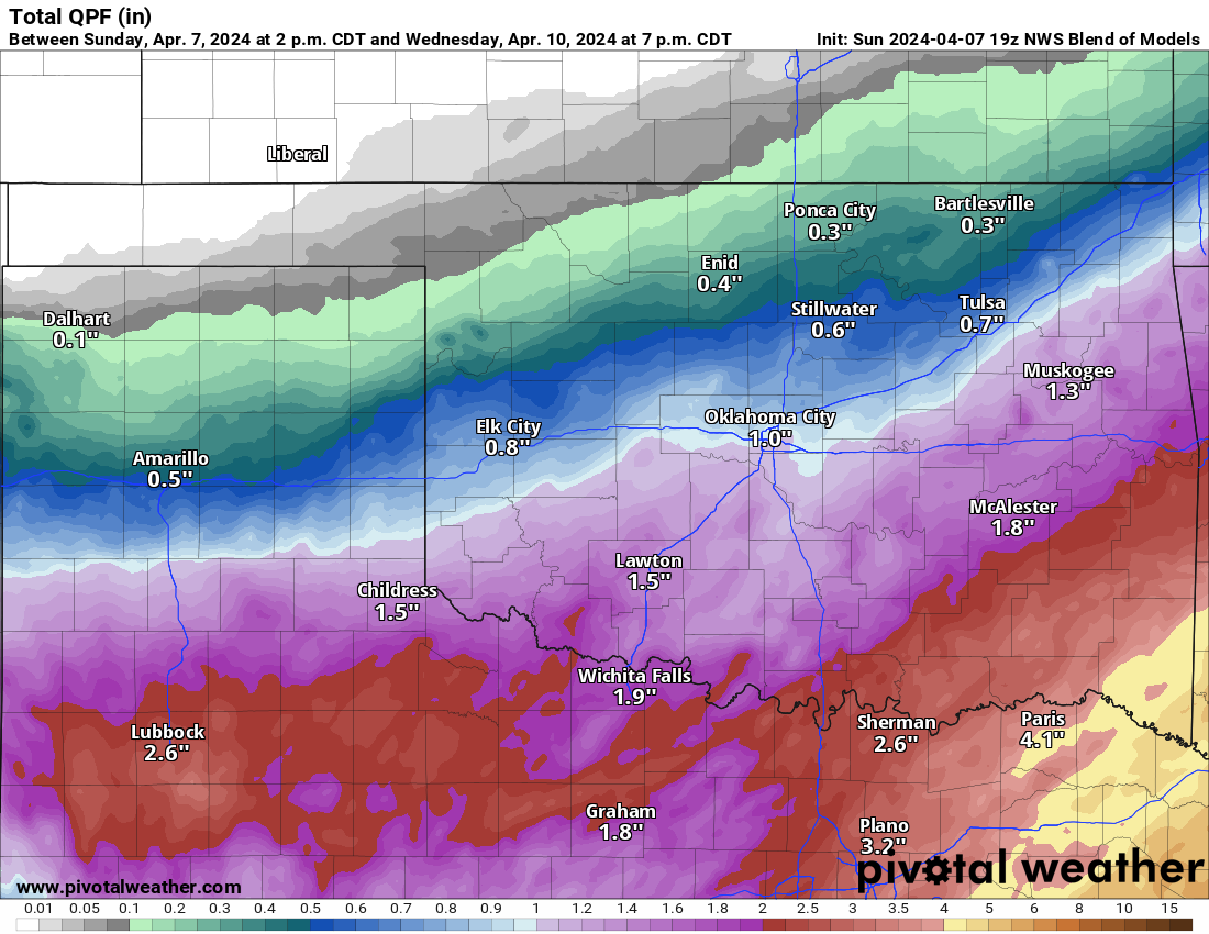
A strong upper-level storm system will move across the SW part of the country and into Texas Monday through Wednesday. Due to its slow movement, rainfall will persist during that time frame and some of it will reach Oklahoma. Wind shear and instability will improve enough to allow severe weather to occur across Texas and southern Oklahoma during this period as well. Watch the animation with the midlevel lift (red-purple/white blobs) rotating through. Those are your rainmakers.
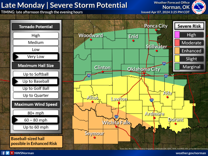
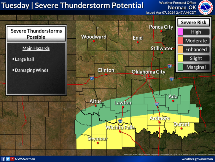
The radar animation shows a few helicity tracks, mostly across the Red River. This indicates hail and wind. There is a low threat of a tornado, but it’s mostly the former folks will deal with. There will also be some decent rainfall across Oklahoma. However, some flash flooding may occur across NE TX, and SW AR. The timing to kick start the event will be late Monday afternoon across NW TX and into S/SW Oklahoma as well as during the evening.
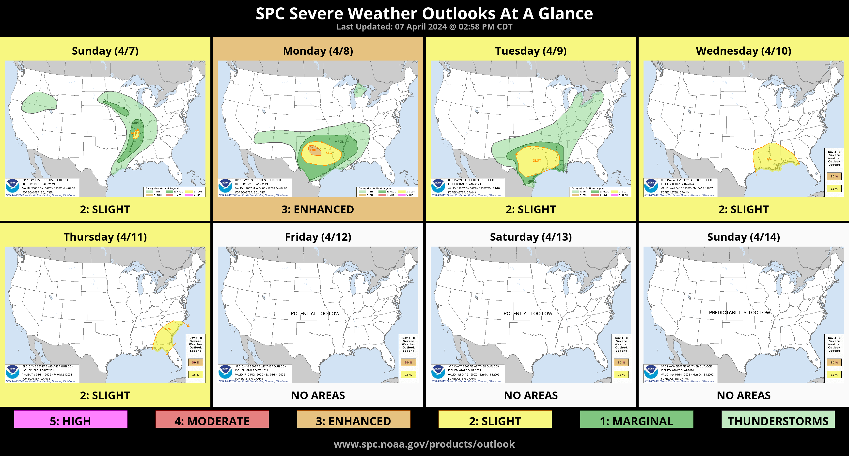
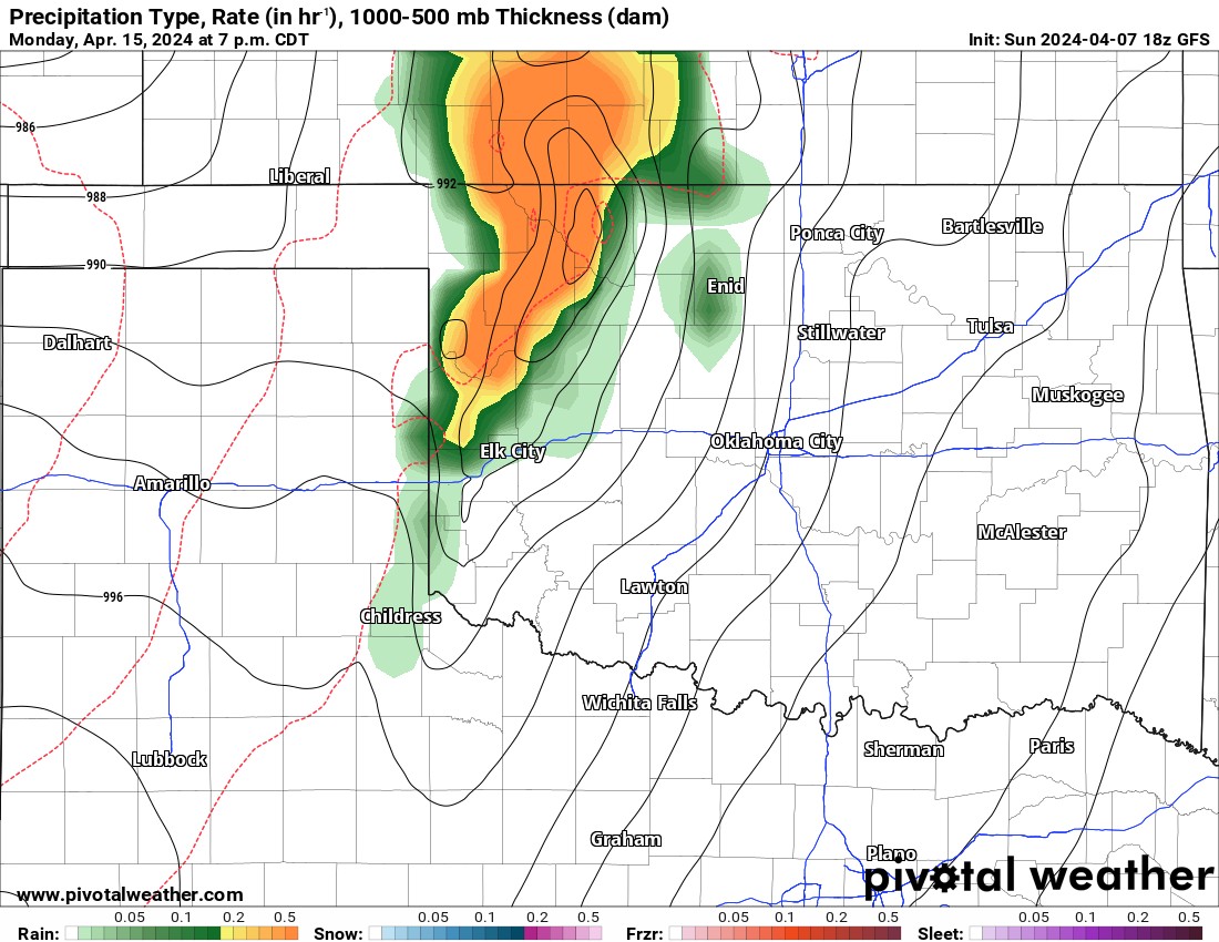
One last mention of severe weather. Another storm system will move towards Oklahoma by the following Monday which is beyond this week’s blog. As of now, models are not yet in agreement but there is some ensemble support of a significant severe weather episode across NW OK that evening. It will come down to exact track and timing. I’ll keep an eye on things during the week.
Now let’s get to the fun stuff, the Solar Eclipse! First I’ll provide the cloud forecast and the best viewing areas. Then I’ll post some excellent information from the National Weather Service.
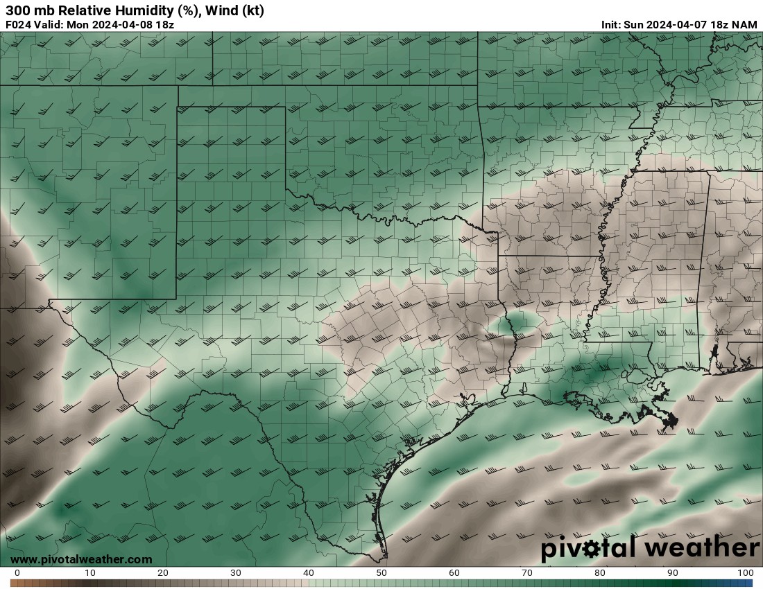
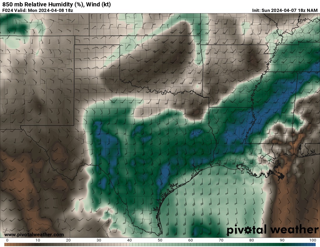
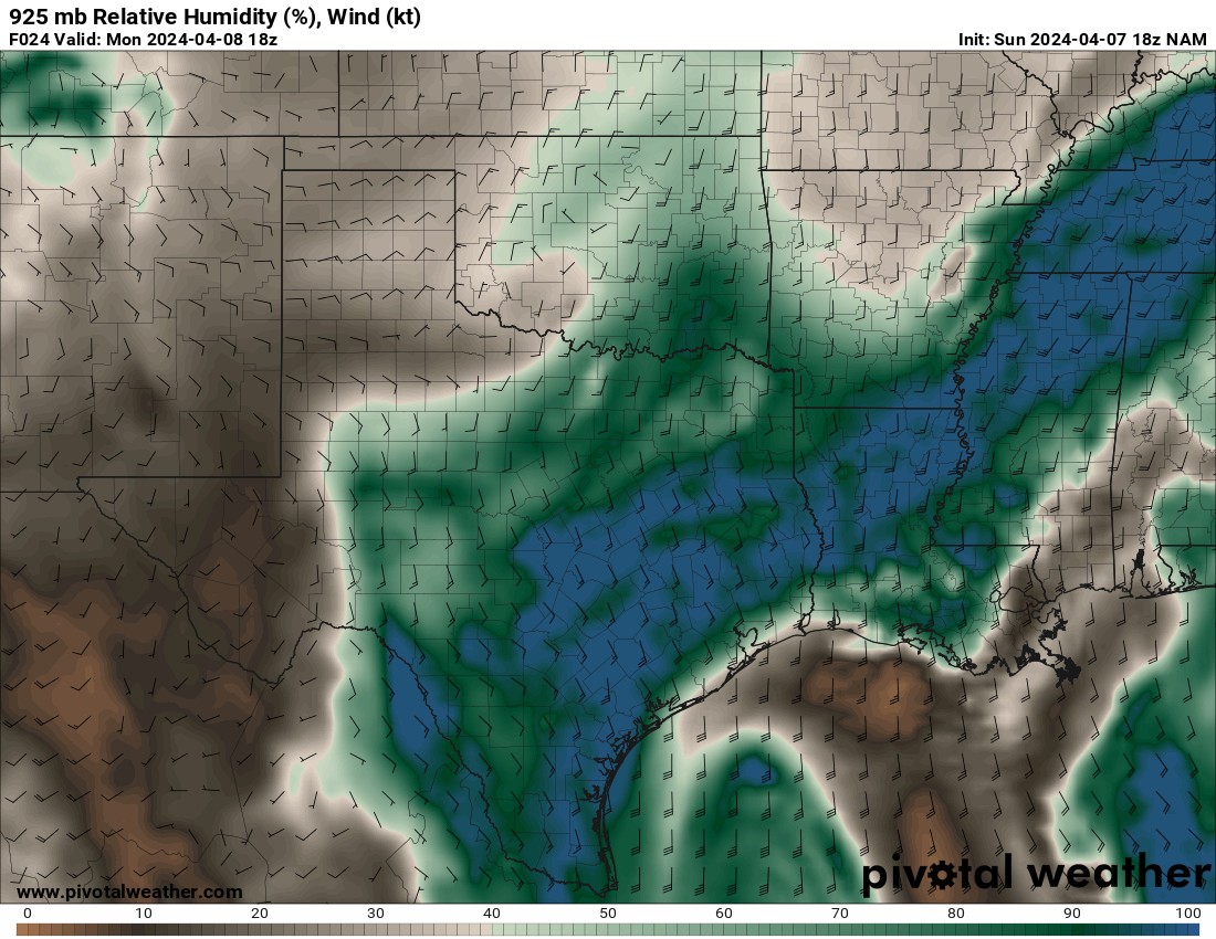
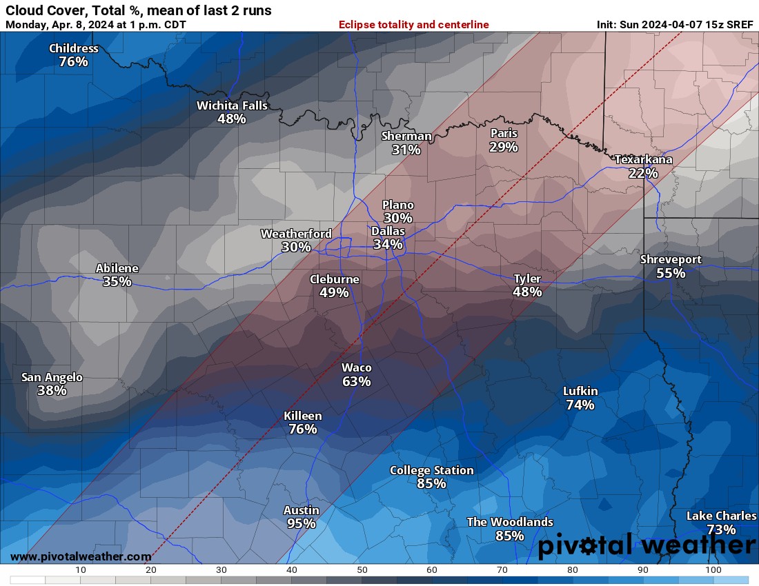
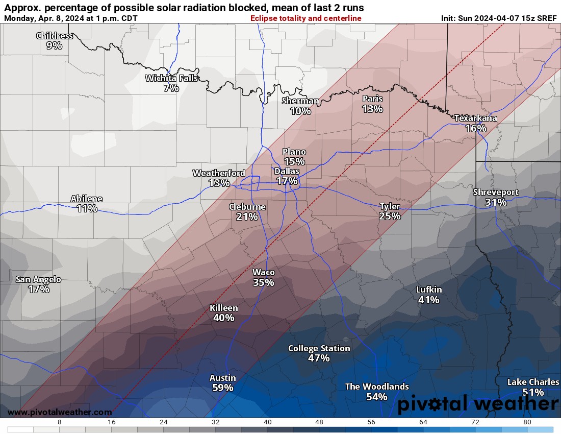
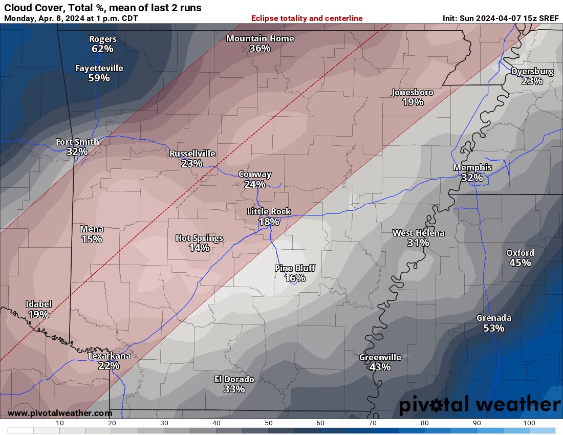
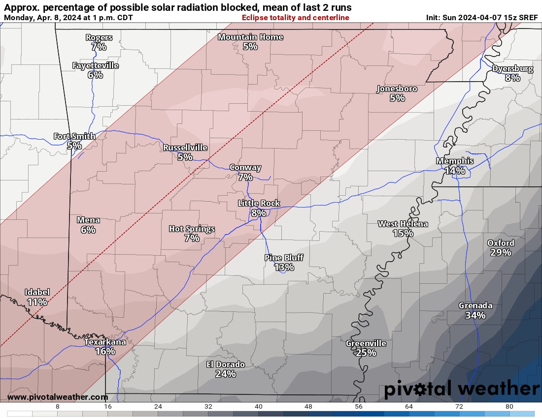
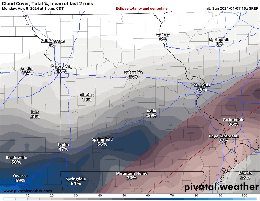
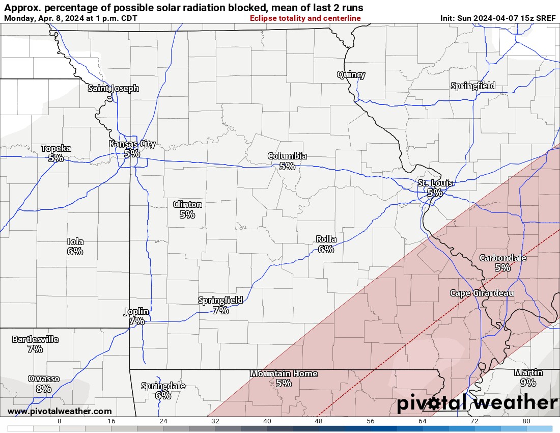
The good news is that models continue to dry things out in the various levels of the atmosphere for the event. As far as the direct track goes, there will be some high-level clouds across MO but otherwise great viewing there. For Arkansas and SE OK, very good conditions will be present as well. Some low clouds will be present from S/SE Texas up through the DFW area to NE TX. It appears that much of that low cloud deck will mix out on the northern fringe. So it looks better for DFW than from a few days ago. I’ve posted the flat maps below to show you where the humidity levels are and what percentage. The 300mb map is for the 30,000 ft level of cirrus clouds and the 850/925 for the low cumulus and stratus clouds. One of the nice things about a total solar eclipse is that it will help dissipate any cumulus cloud development immediately clearing those out. It might not help much for the stratus layer, however. Regardless, I plotted a red line from just southwest of DFW through SE OK and SE MO. From point A to B notice the very low level of humidity around N TX thinning out as you get midway to SE OK and dry through AR and MO. You’ll also see a little bit of high-level moisture there, but again not enough to block a great view in Missouri. So if you are traveling nearby, MO and AR look fantastic. SE OK looks very good as well. The wildcard will be N/NE TX, but looking better than it did before. Where you see the blue (100%) colors, that means total saturation of clouds in the lowest level blocking the viewing completely.
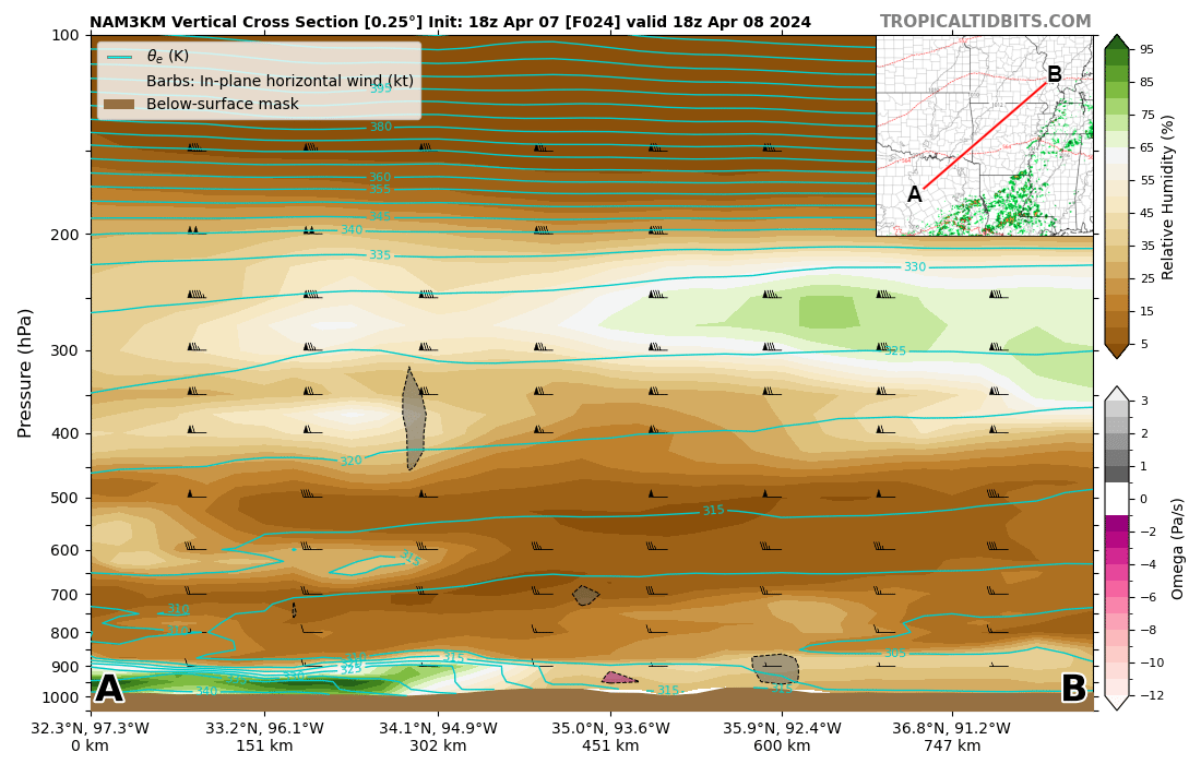
For a more simpler way to visualize the cloud cover areas and also how thick it will be to block out the sun, I’ve posted several maps below with the track.
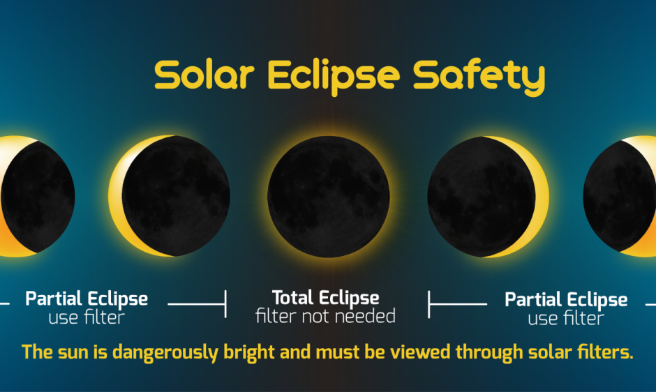
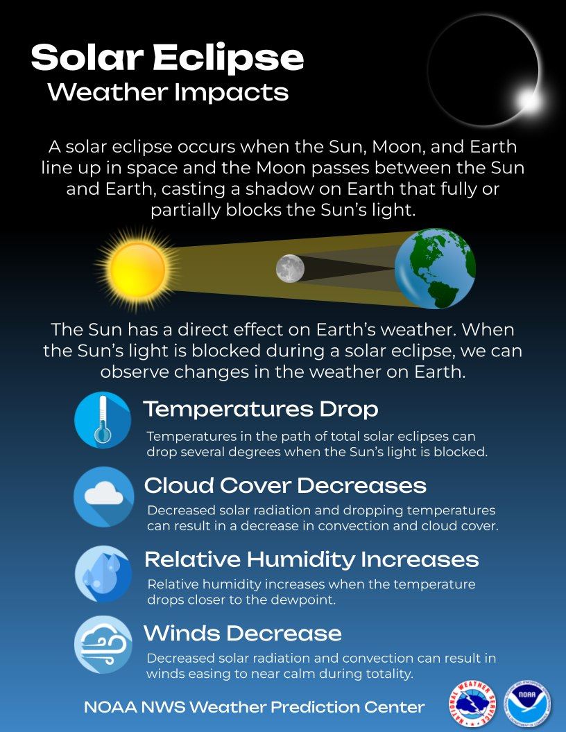
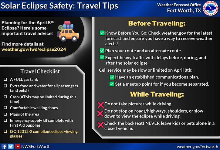
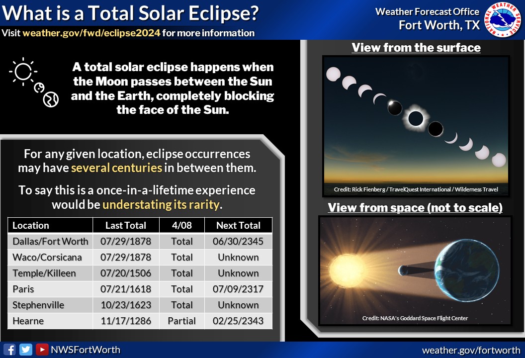
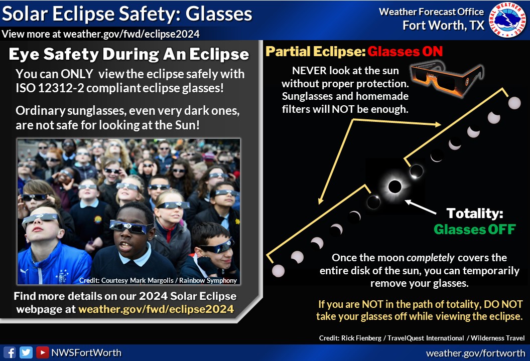
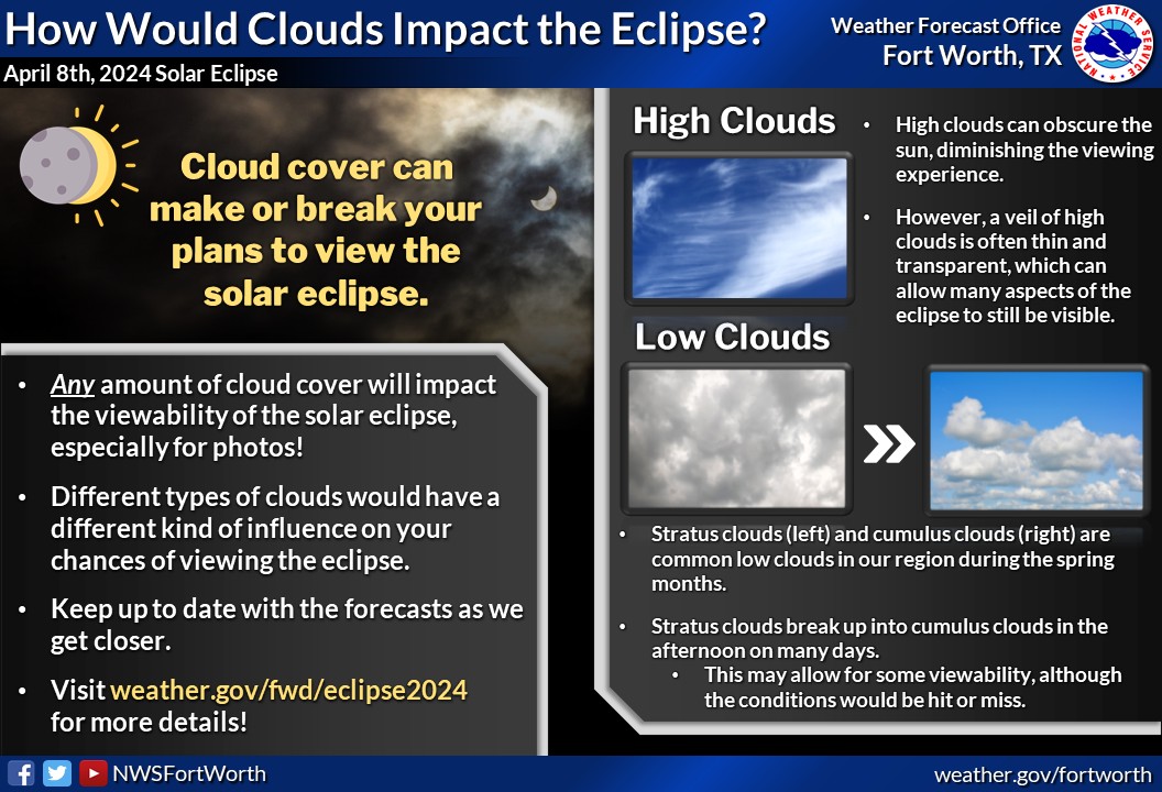
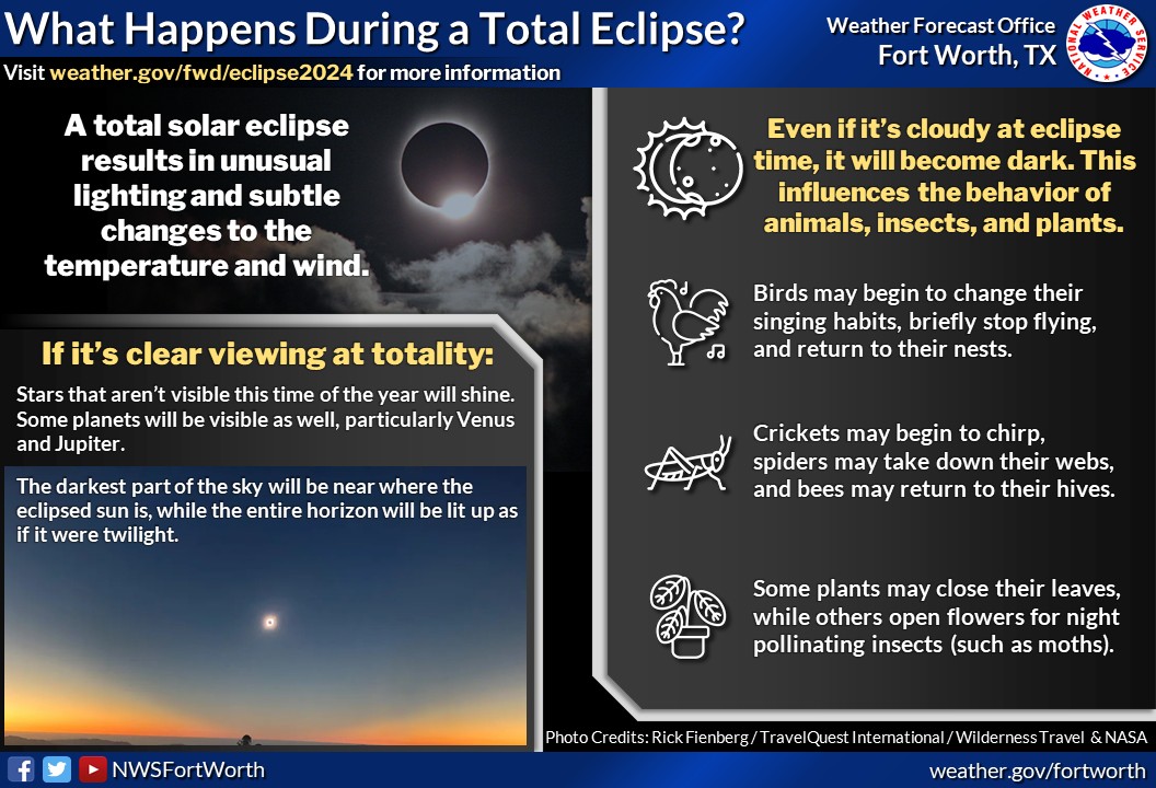
Regarding some of the cool information about an eclipse, I’ll share with you multiple graphics from the NWS in Ft. Worth.
I hope you have a safe and fun viewing of the eclipse Monday. If you’d like to get very details and specific weather data for the location you will be at, use these two websites and just tap the dots in Texas or click anywhere on the map for link #2. And if you would like to find the exact time for that location as well as what the sun will look like at that time, follow link #3!
Solar Eclipse Forecast Website Link 1
Solar Eclipse Forecast Website Link 2
Solar Eclipse Track and Time Website Link 3
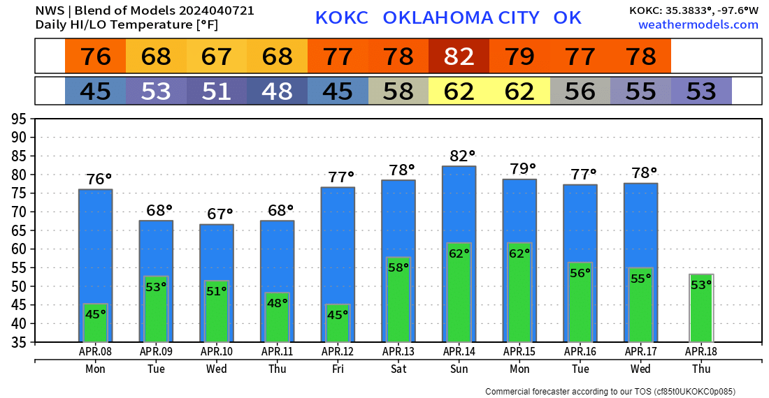
As far as temperatures go back across Oklahoma, another great week. Here is the trend for the OKC metro region. Enjoy! -AT