Mild with More Weekend Rain (and Snow?)
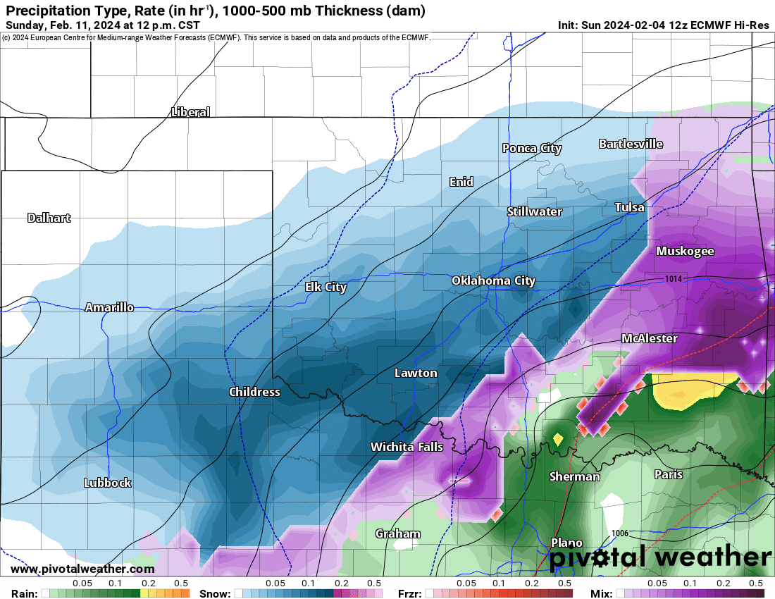
Although the timing was terrible, we ended up with some decent rainfall across Oklahoma again. As this system moves out mild sunny weather will return to kick-start the week. A pattern change will bring a weak system through late Wednesday night and Thursday morning. Finally, a strong system will affect the region late Saturday and Sunday.
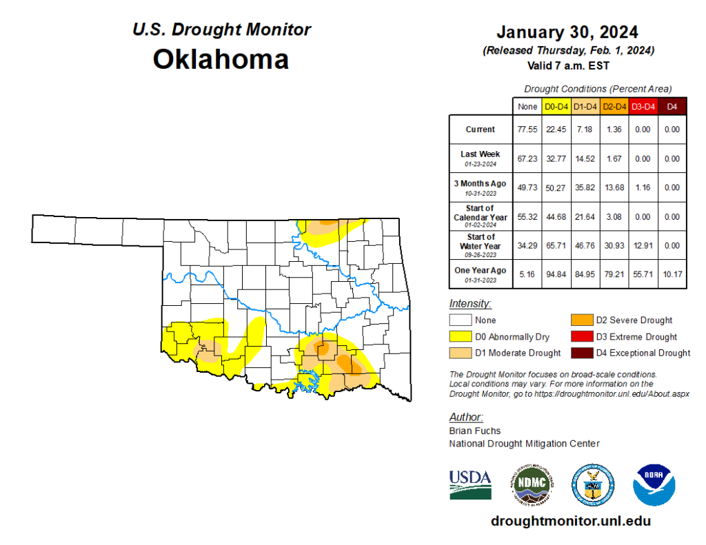
Rainfall amounts from Friday through Sunday helped to ease the drought once more which is great to see over our winter season. That said, the more moisture we have in the ground for early Spring, the better the localized dew points for severe storms. So there is a trade-off. More on that next month though.
Ferguson Roof Systems is offering an AT's Weather special, Call Today!
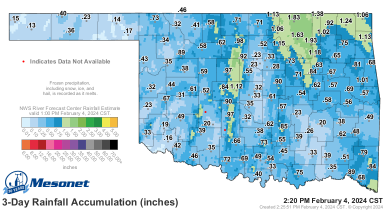
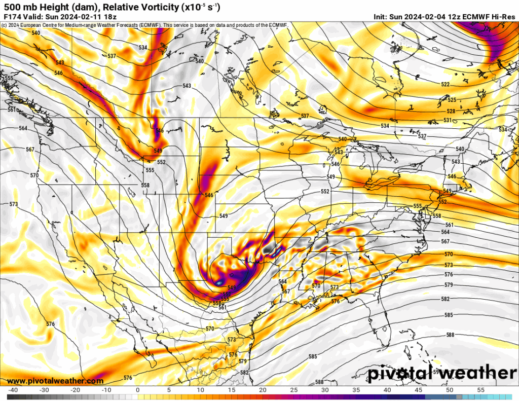
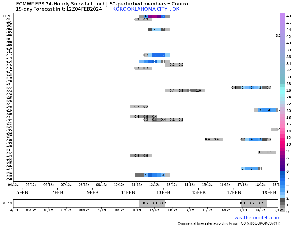
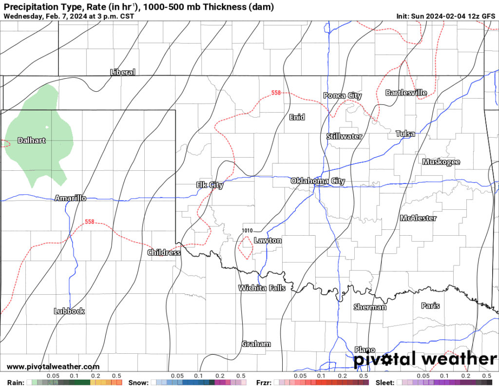
The storm system for the weekend is problematic. First of all, the Jestream pattern is chaotic starting later this week through the rest of the month. This means a lot of variability and uncertainty with little model agreement in the extended range period. Case in point: look at the 4 model output for Sunday’s storm system below. The European is the strongest and closest, while others vary in position and strength. Two of them would produce a little snow across KS and the OK panhandle region, one across most of Oklahoma, and the other just a cool rain. This is because the upper flow dictates the surface flow as well, and there’s not much cold air to work with. The European barely keeps us in the critical 32-36 degree surface temperature range to receive snow. I’ve shown the upper flow comparison below along with the European surface map for Sunday. Its snow trend is so new that I don’t buy it yet. Its ensemble data is not very confident either. While yes there is a signal, it’s weak. I would have to watch trends over the next couple of days to see if this solution is viable.
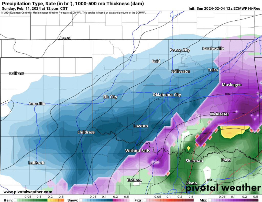
In the meantime, we should get at least a few light passing showers Wednesday night and early Thursday morning as a system kicks through west of us. Our atmosphere is pretty dry so much of the precipitation will evaporate before hitting the ground. This is a similar outcome that we saw last Thursday. So don’t expect much measurable rainfall out of it. However, come Saturday night as the cold front approaches we’ll begin to get the rain going again through Sunday. At this point, I like this model solution the best keeping any snowfall confined to the far NW corner of the state.
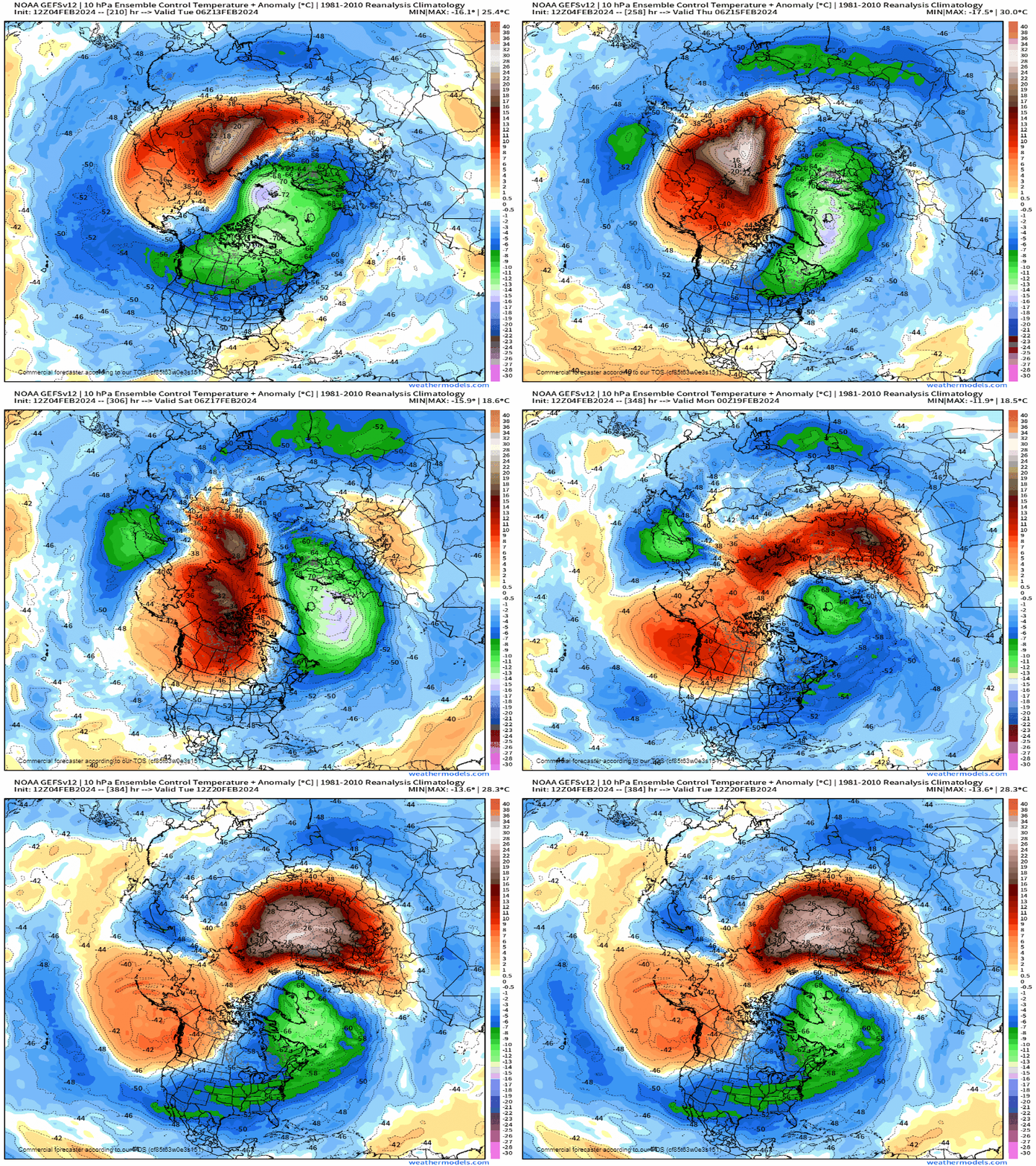
Once we get past our weekend, the pattern near the North Pole changes to that SSW event I spoke of in my last blog. While this event is unfolding as predicted, some changes will affect the overall outcome. Instead of an omega block forming to allow the brutally cold air to spill into the US, a double ridge will form in that region which traps some of the cold air and only allows small highs to come south a little at a time. This coupled with a very active Jetstream overhead may spell multiple opportunities for wintry precipitation through the 3rd and 4th week of February. So stay tuned!
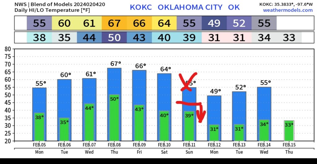
Temperatures over the next several days will be on the mild side for a bit. Expect a stronger cold front Saturday night, so temperatures Sunday will likely spend the day in the 30s and 40s across most of the state.
