Storms and Rumors of Tornadic Storms
You may not have seen them, but because I’m on so many social media platforms with a lot of weather content I have witnessed the ramping up of the gloom and doom forecasts from now through May. I made a few jokes about this on my accounts because we always have a higher number of severe storms this time of the year, it’s the peak of our storm season.
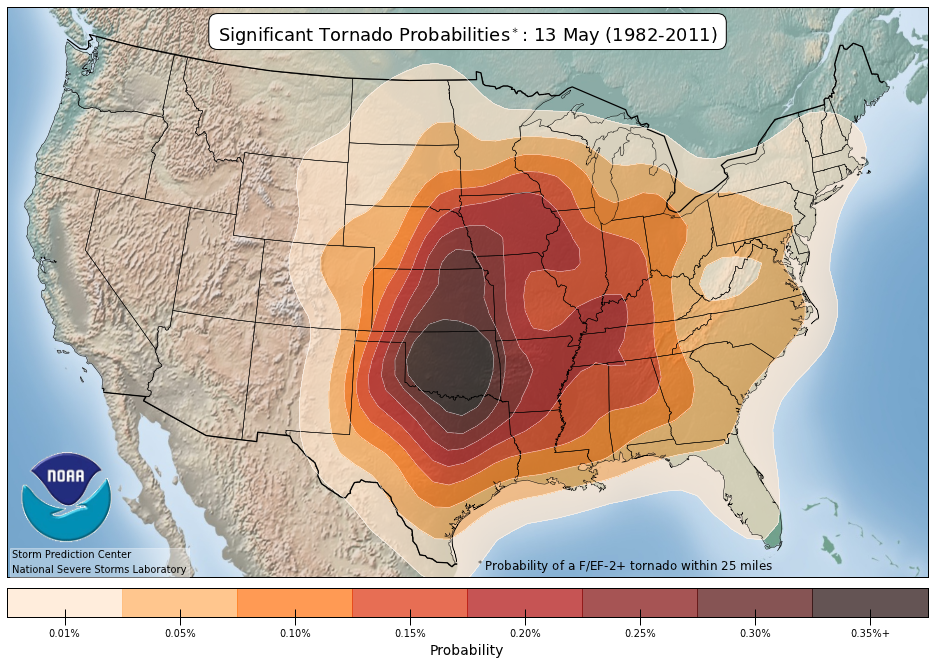
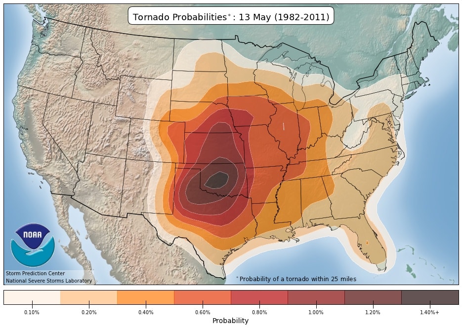
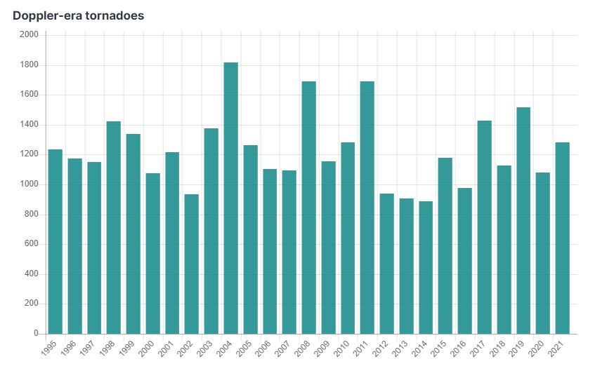
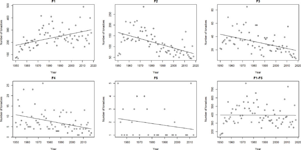
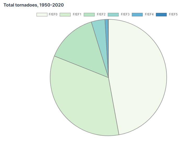
Take a look at the climatological average peak for Oklahoma. It occurs mid-May. This is where it shows a max of a 1.40% chance of seeing a tornado in the darker-shaded region. For strong tornadoes, EF2+, only a 0.35% chance. Yes, you read that correctly. Aren’t statistics and probabilities cool, really takes the sting out of emotional hyperbole. There’s another statistic that goes with our tornado season. The fact that EF0/1 tornadoes make up 80% of all tornadoes. I call those the baby tornadoes. EF2 is about 14% and EF3 4% with EF4/5 about 2% depending on how far back you want to go. Any well-built home in Oklahoma will still stand with an EF2/3 tornado. Those are great odds! Always get in the middle of the home, lowest floor, away from all outside walls and windows. As far as tornado frequency trends are concerned, overall they are down not up as the climate zealots would have you believe. We can detect EF0/1’s more now due to advancements in Doppler Radar technology which undetected these weak ones beforehand.

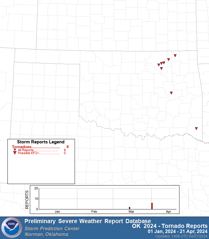
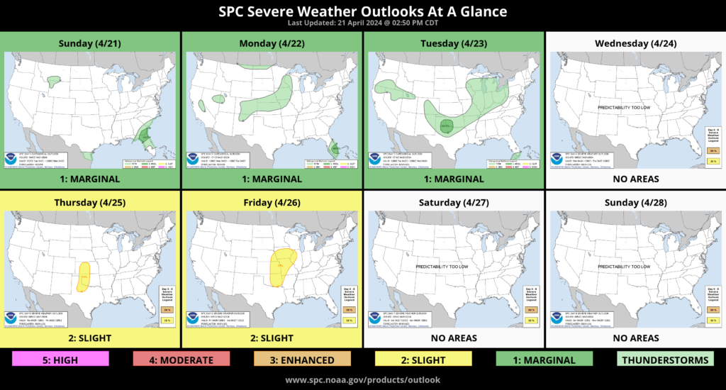
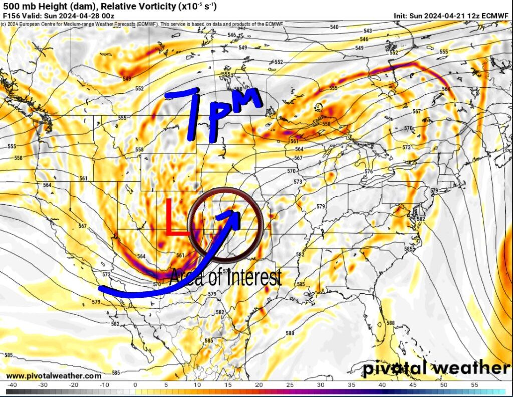
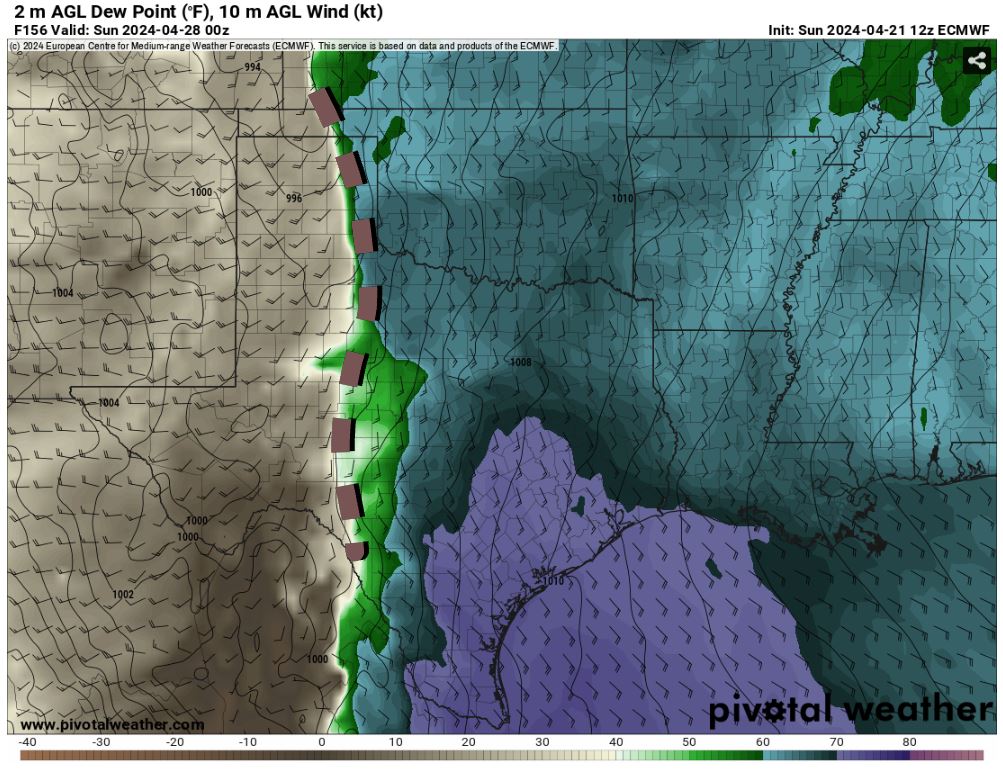
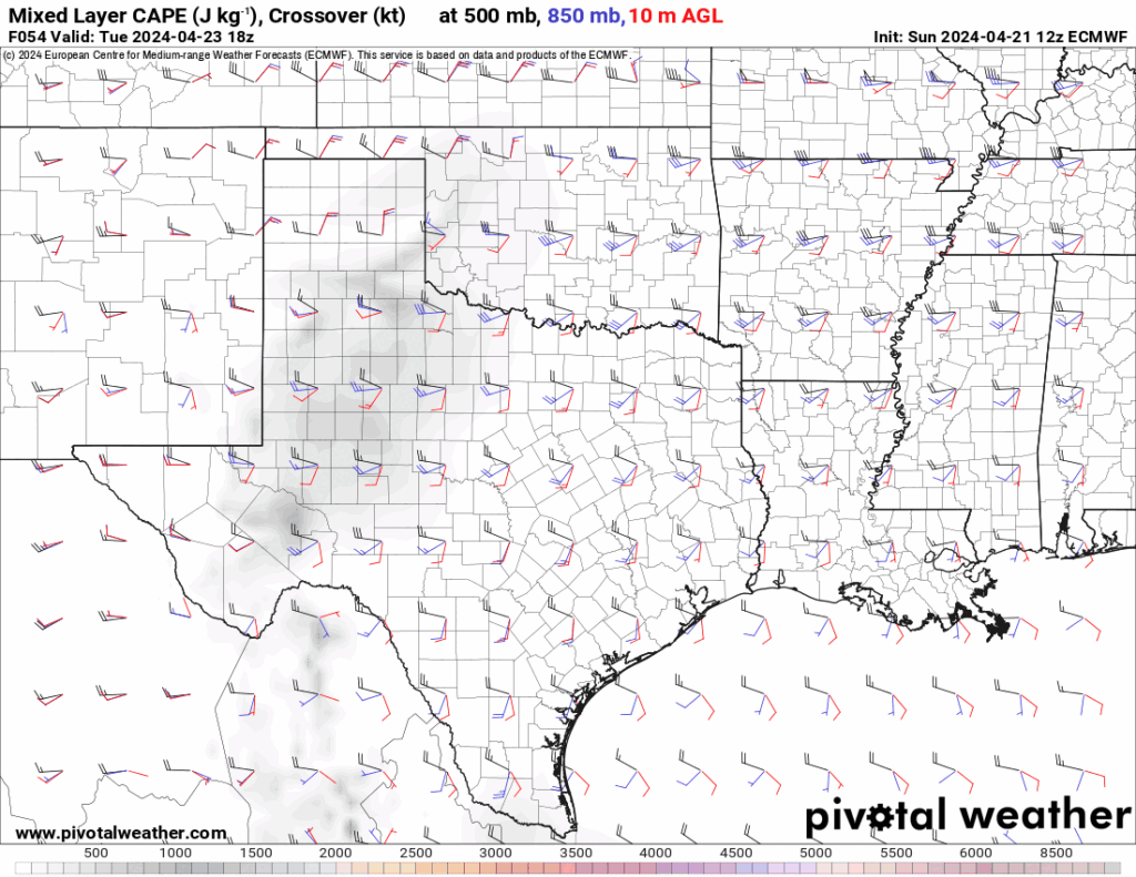
So with our reality check out of the way, let’s see what the pattern holds. There will be 2 strong upper-level storm systems. The first one comes out way too late, centered west of Colorado. This keeps the dryline too far west on Thursday so just some overnight storms with the CAP keeping them weaker. There’s not much upper support for Friday, but there will be a dryline nearby. The Saturday wave seems to be timed right and positioned well for severe weather in Oklahoma. I caution however, this is Sunday and that’s 6 days away. Nonetheless, dewpoints will increase and we’ll be under a SW flow aloft through the weekend. Most of the activity will be from the E 1/3 of Oklahoma Sunday. The CAPE/Shear animation shows how our atmosphere becomes unstable and supportive of severe storms. However, the CAP can always keep things under check and timing can be off, or wind fields not aligned. Regardless there should be at least some severe weather this week as we are in late April.
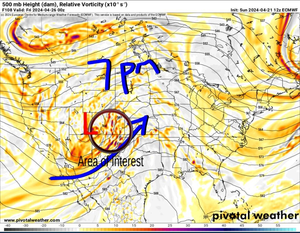
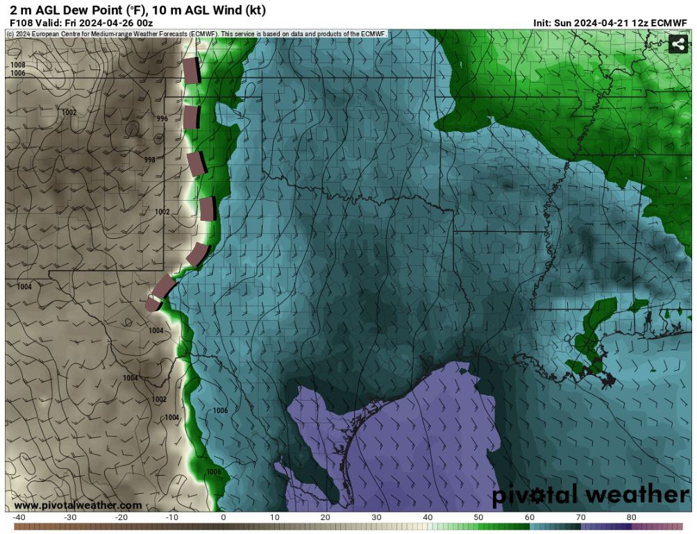
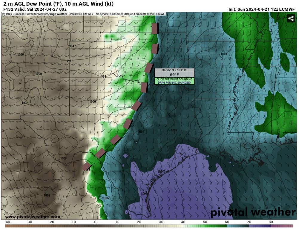
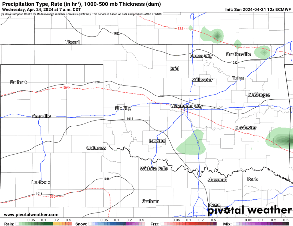
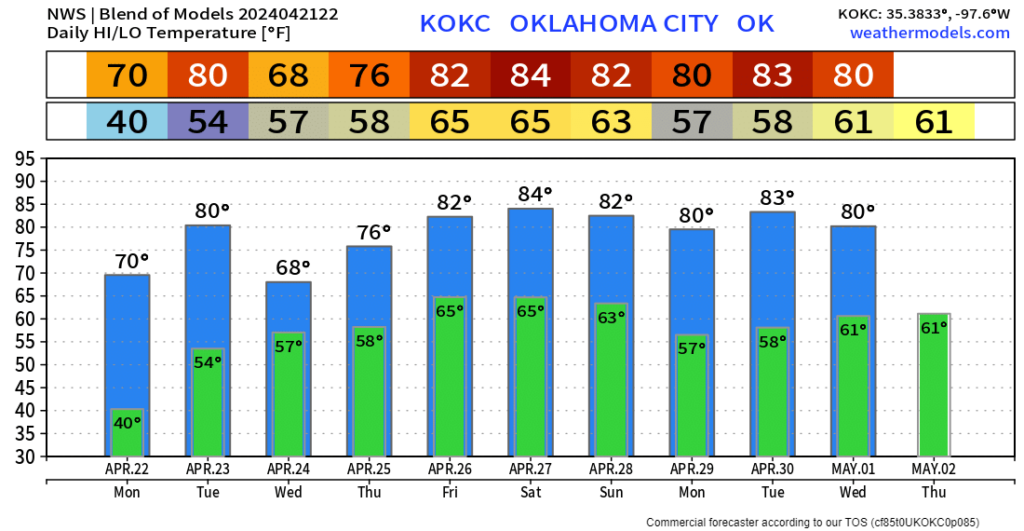
As far as temperatures go, looks fairly good this week for OKC. I’ll keep an eye on things and update you if tornadoes look likely. I use a 48-hour rule to retain accuracy. -AT
