Tornadoes, Fire Danger and Cooler Wet Weather
We’ll start off the work week with a few severe storms around the region. A high fire danger will sneak into NW OK and then a cold front will move in towards the end of the week kickstarting a few days of chilly rain.
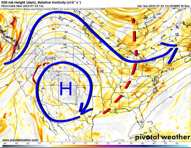
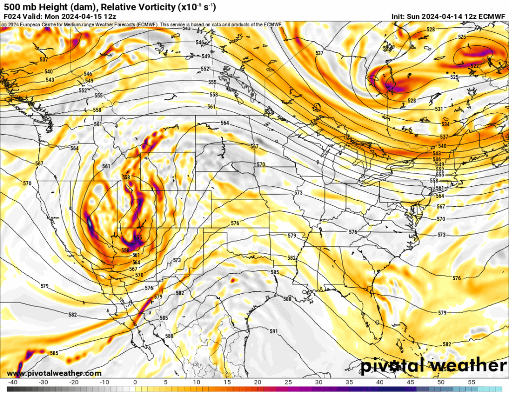
The jetstream shows a large storm system moving through Colorado Monday and through the Midwest Tuesday. This will spawn severe thunderstorms over parts of Nebraska, Kansas, Oklahoma, and Texas Monday and then the Midwest Tuesday with lingering severe weather opportunities across Arkansas, far southeast Oklahoma, and northeast Texas.
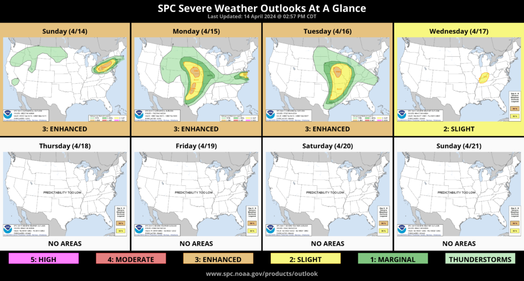
Let’s dive into the severe weather specifics. On Monday we’ll have a very strong CAP in place across Oklahoma. It will be a little weaker as you travel north. As a result, it will be next to impossible to get severe storms in Oklahoma in the late afternoon. Another reason for this is light showers and cloud cover that will transverse the state midday. This prevents us from heating up the atmosphere at the surface, which is what you need to weaken the CAP. In NW Texas, after that wave moves off, they will heat up just enough along the dryline to fire off a round of severe storms. These will be mostly hail/wind producers but will pose a low tornado threat as they travel E/NE. The severe parts of these storms should stay just south of the Red River. If they were to cross over, they’d run into a stabilized atmosphere and weaken dramatically. Other severe storms may develop across WC KS and travel eastward. Those would have a better chance of producing a tornado.
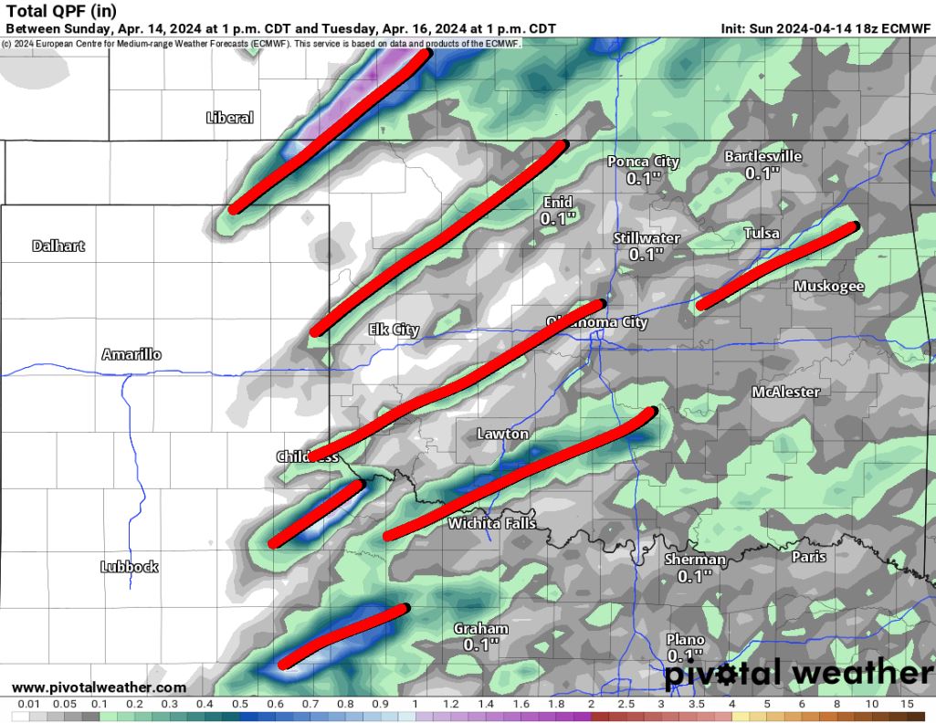
As day turns into night, the storm system will slowly advance east across Colorado and drag a Pacific cold front with it to merge with the dryline out in Western Oklahoma. Models indicate the CAP will erode just to the east of this slow-moving boundary. Oddly enough, almost all of our CAM models are storm-free, or have weaker storms that ride on top of the capping inversion. Considering how they remove the inversion and keep the shear strong, this is strange behavior and will be used as a learning experience after the event by the community as a model weakness to make note of. There is only one model out of ten that has any supercells overnight. The problem with this one is that it’s always producing erroneous supercells. So it’s hard to trust the output. Perhaps the strangest turn of events is that the morning European was in agreement that storms would not develop overnight. However, its midday run decided to break out supercells overnight as indicated by the total rainfall product. These paths indicate that type of storm. Now the European is not a severe weather storm model nor has the resolution to decipher if a storm is capable of producing a tornado, large hail, or damaging wind. That said, the signal is concerning. The reason why is that IF and that’s a big IF, supercell storms could develop overnight, they would be capable of producing tornadoes. The instability and shear will linger overnight. The probability is low but not zero. Perhaps the evening runs will shed more light on the situation or even Monday morning’s computer runs. So be sure to check in Monday at noon for my lunchtime live to discuss the latest. I’ve posted a few different model solutions below when it comes to the forecasted radar reflectivity and the helicity tracks. The helicity tracks indicate supercell behavior with the three threats mentioned above.
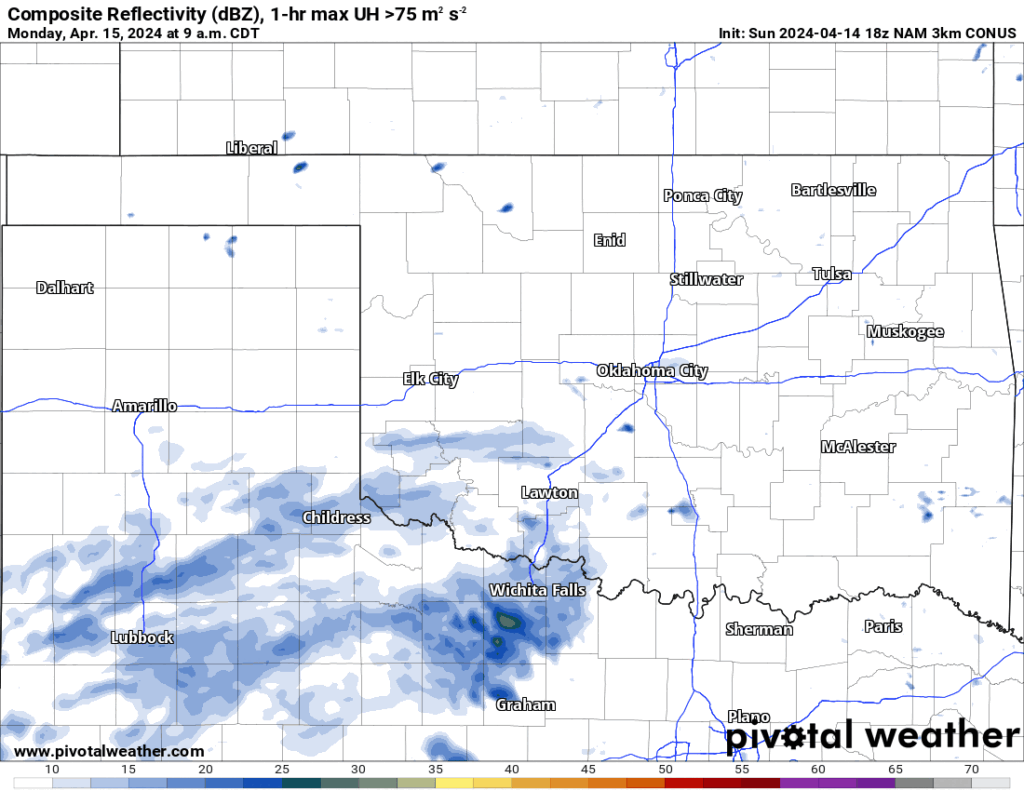
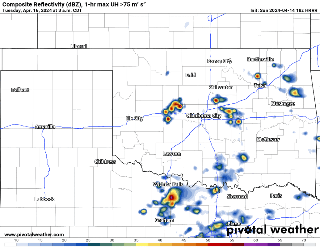
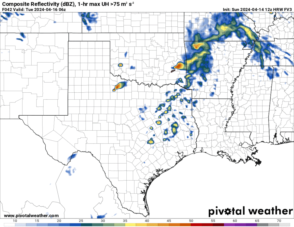
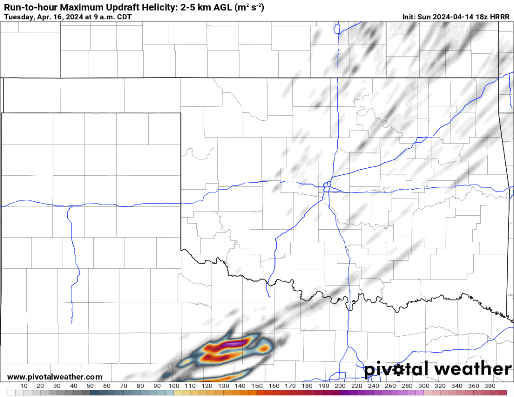
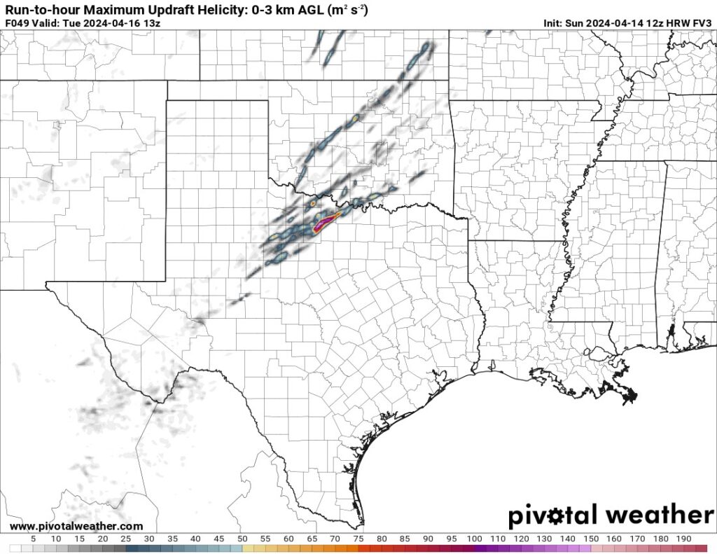

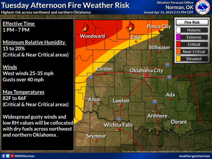
Regardless of the storm outcome Monday night, the system will advance east providing another threat of storms for AR, SE OK, and NE TX. While this is occurring a strong dry wind will aid in a fire danger across NW OK.
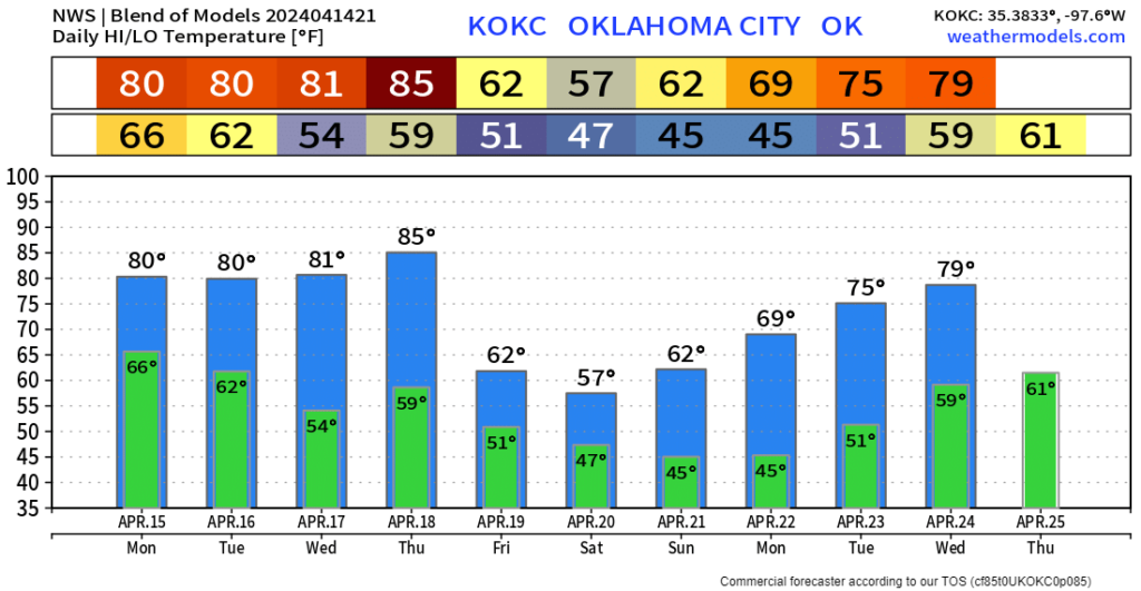
Long range, another cold front arrives late Thursday. It will likely trigger a few weak storms and then provide a lingering boundary for additional showers and storms off and on through Saturday evening. Rainfall amounts look decent during this timeframe.
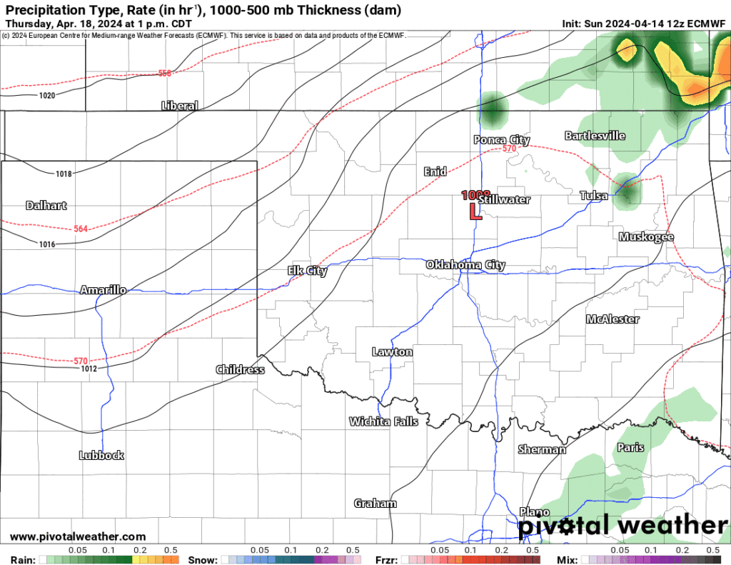
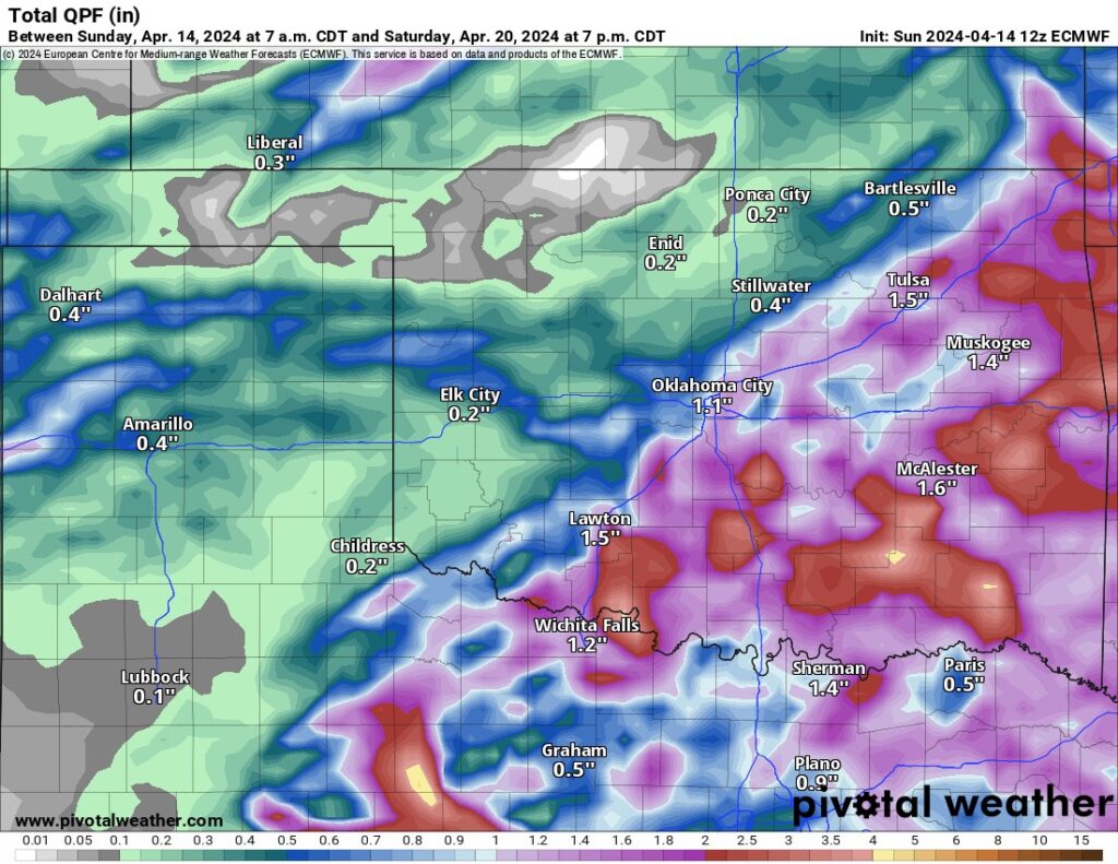
With the weather change at the end of the week, expect temperatures to get a little chilly again. Hope you enjoyed the hot day on our Sunday! One final reminder, download my free weather app, ATsWeatherToGo. It will predict tornadoes ahead of time to give you an early warning to prepare. Also, use your NOAA Weather Radios at night. Finally, have a game plan with the family should you incur a nighttime tornado. There are a lot of things you’ll have to do quickly coming out of a groggy sleep stage. Stay safe! -AT
