Three Winter Storms and an Arctic Outbreak This Week

What a change! We went from a mild and quiet start to our Winter in December to several winter storms and a prolonged period of arctic air.
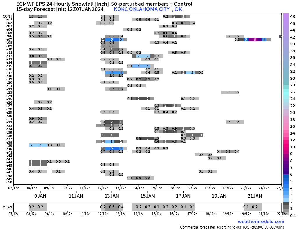
There’s so much to unpack but I’ll make it as brief as possible. I always like to start with the Jetstream as it shows us the storm systems that will affect Oklahoma. If you watch the animated map below, notice the bright red blobs that move through the country. Our first is Monday/Tuesday. Our second is Friday. Our third according to the Euro is the following Monday/Tuesday but other models like this coming Sunday. The European ensembles also indicate the snow probability in the first two columns and the 3rd is scattered between Sunday-Tuesday as it is unsure of how quickly that last storm comes in.
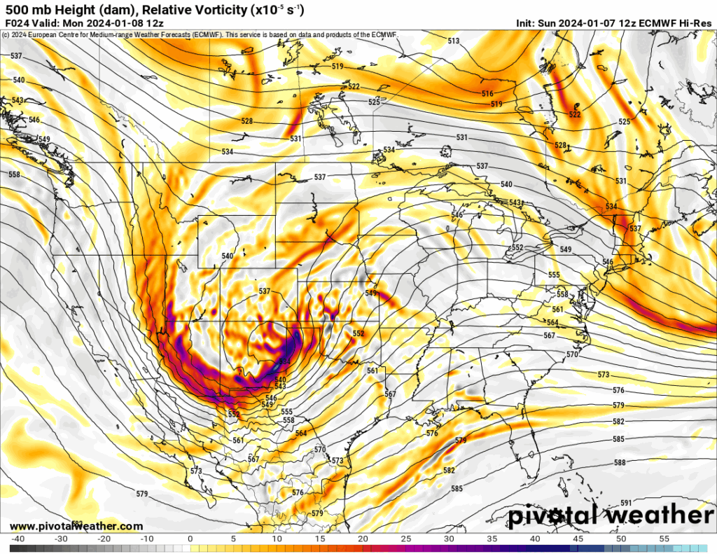
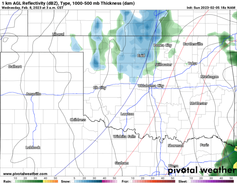
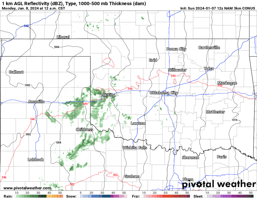
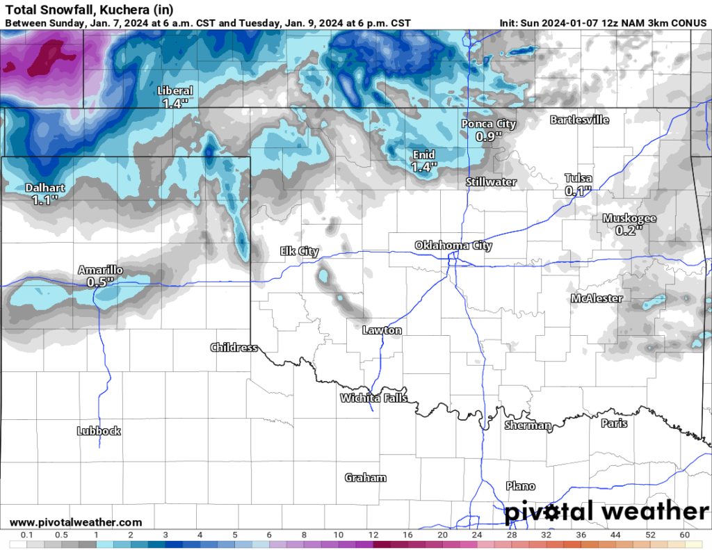
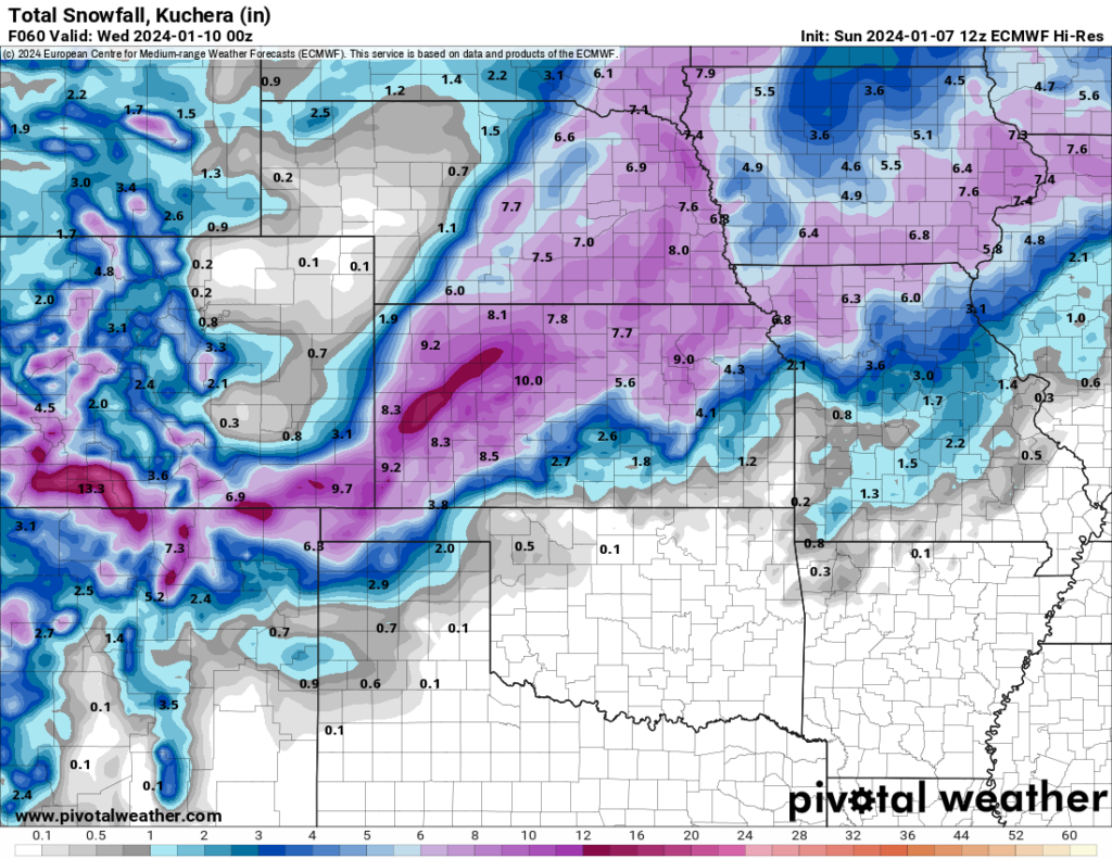
Our first system takes too much of a jog to the north and brings in not only warm air but also drier air aloft which keeps most of the snow out of the state. Once again the far northern counties will have the best potential for accumulating snow, albeit not significant while Kansas will see widespread 5-10″. The other big story will be the wind gusts over 50 mph at times across the Southern Plains late Monday and Tuesday. That will place wind chill values in the teens and single digits for many by Tuesday morning. Travel impacts with the first system will be relegated to blowing snow and reduced visibility. With that much snow falling up north, roadways will become snow-covered at times. Be sure to use my free weather app, ATsWeatherToGo, or my website here as both have the road conditions for surrounding states.
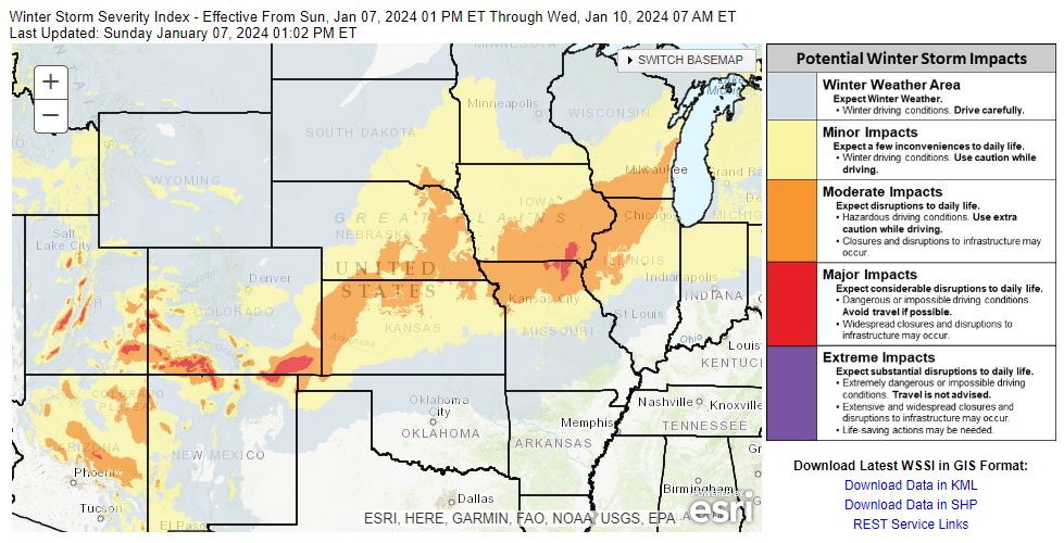
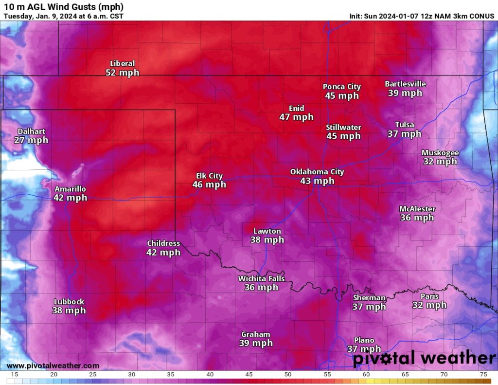
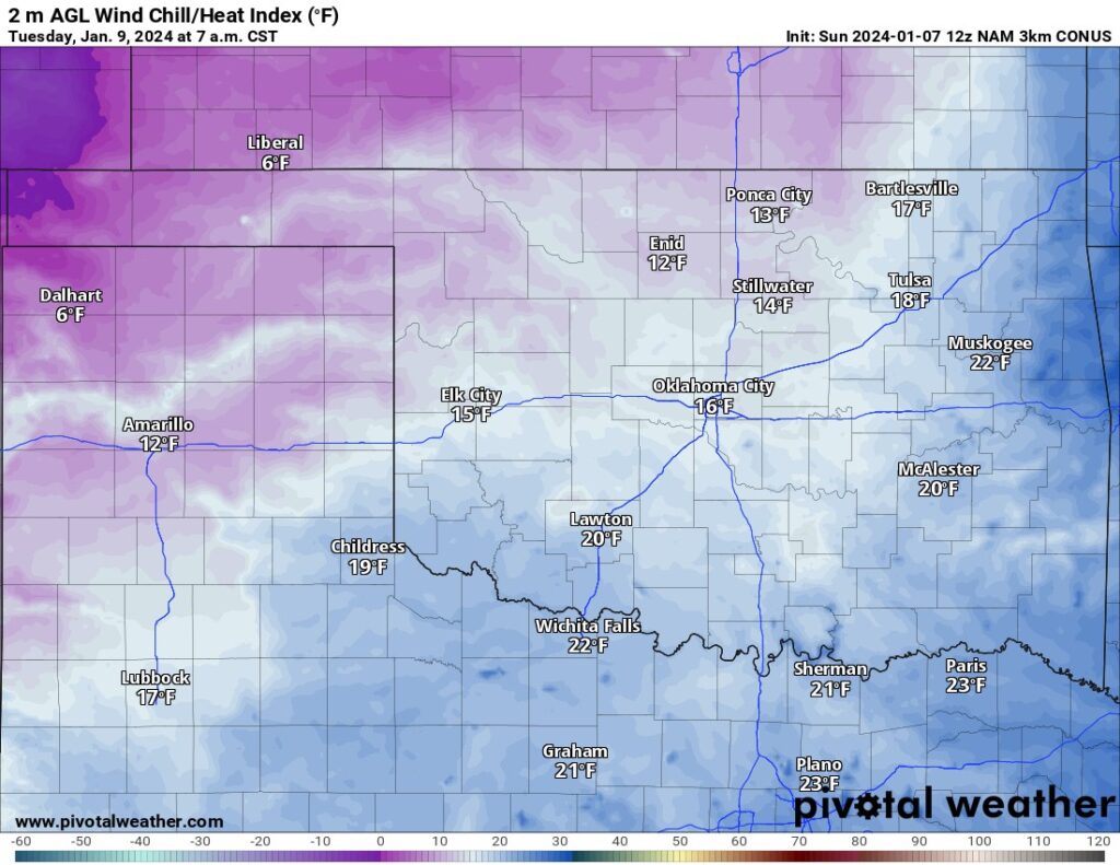
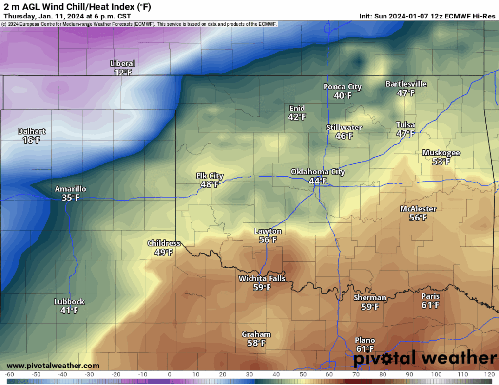
Our next cold front will move in Thursday evening and snow will develop by Friday morning with our next system. There should be a light wintry mix across parts of eastern Oklahoma. It’s too early to get into snowfall totals with any accuracy. As of today, there is a wide range of solutions with most of them focused on the northern half of Oklahoma and some amounts exceed 10″. For now, I will show you a conservative model blend that captures the final two systems. It also indicates we may be dealing with some ice (freezing rain) for SE OK, especially with the last system. Again that storm may start developing as early as Sunday and continue into the following Monday. So we will watch both of these outputs carefully in the coming days. Wind chills during this extended stretch into and beyond the weekend will be eye-opening.
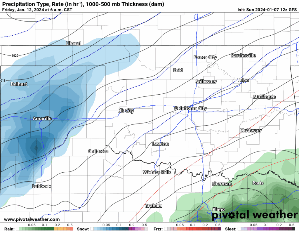
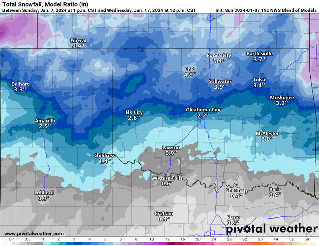
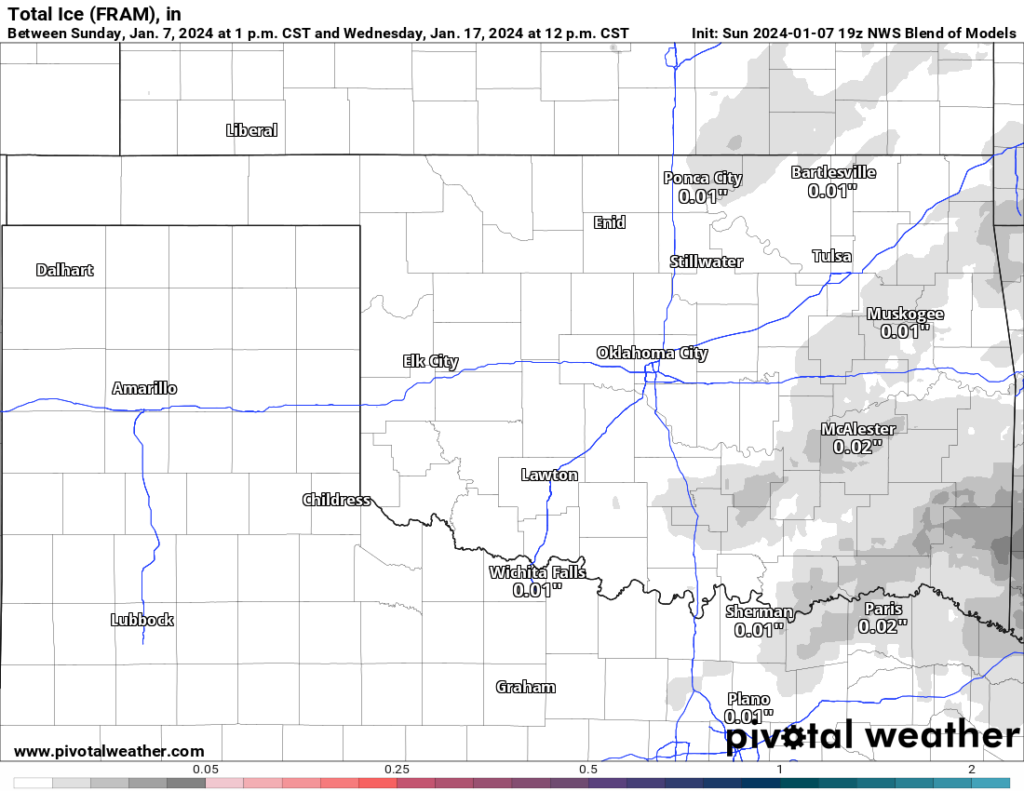
During the next ten days, there is going to be a lot of snow dumped across the country. This is a significant pattern change with very cold air and strong upper storm systems, so a great combination for winter from the West Coast to the East Coast. Take a look at the snowfall map overall. Impressive amounts!
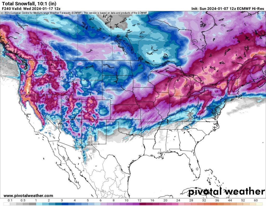
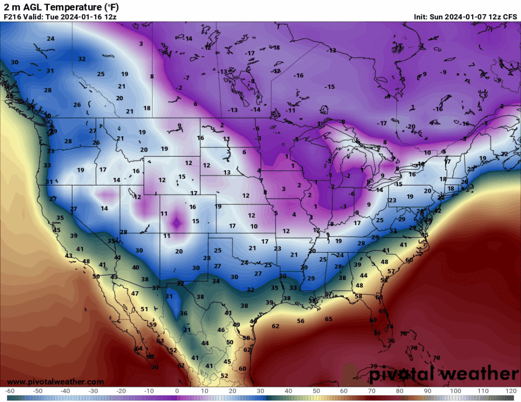
As far as how cold could it get with this pattern change, depends on what model you believe. I’ll show you 5 outputs for the same day, next Tuesday morning the 16th at 7am. All are cold, and one is below zero cold! Brrr!!!
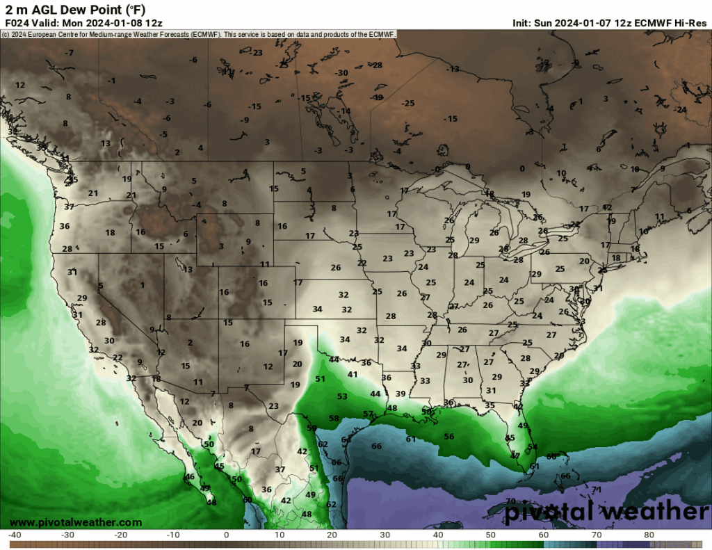
I’m going to teach you a little secret when it comes to predicting true arctic airmass arrivals. Tracking temperature maps can be difficult at times because the air may be warmer in certain areas than others depending on the time of day, sunshine, clouds, or precipitation. However, there is one indicator that can stay mostly independent of that, the dewpoint. Arctic airmasses are very dense and dry containing dewpoints oftentimes well below zero. So in the map below, watch the animation and notice the dark brown waves moving through from Canada and the US. You can time the arrival of the cold air that accompanies it. Watch the initial surge enter the northwestern US from Canada on the 10th. Track these surges as they move south and east. Oklahoma gets hit will multiple reinforcements as we round out the week through the 17th. As long as these keep coming in, that cold air is here to stay!
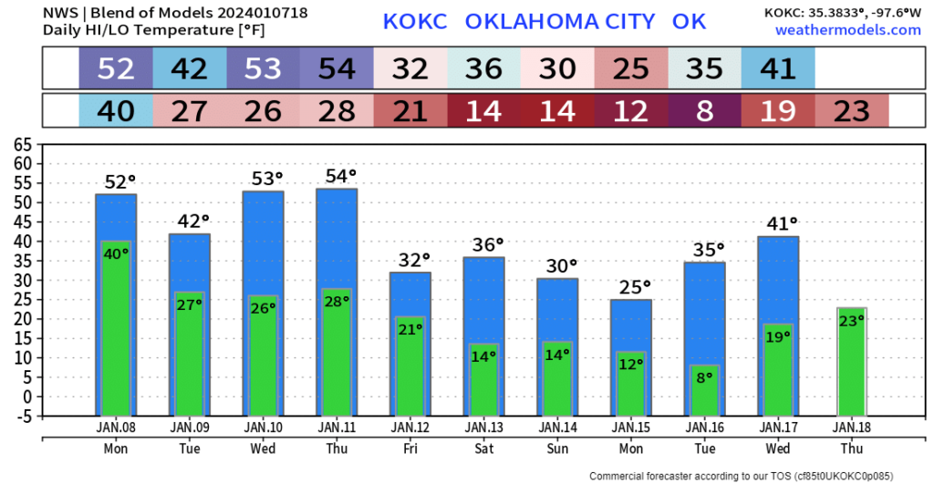
As far as temperatures go during this timeframe, the first few days of the week will be standard stuff. Models are notoriously problematic on arctic air. So in this extended outlook for OKC, expect a lot of changes to the last few days. Always bet on colder numbers rather than warmer ones.
A final note about the extended cold snap. Make sure you have protected your outdoor pipes and faucets. Open your indoor cabinets for the outside walls that have a water source once temperatures get down to 17 degrees. Below that number, water lines can break after 24 hours. Another helpful tip is to make sure your heater is working properly. Reach out to All Comfort Specialist Heating and Air and tell them I sent you to get that furnace tuned up. My second cautionary point is to be prepared for power outages this time of year, which of course will lead right into tornado season. Give Nathan Snyder Electric a call and tell him I sent you to discuss what a home generator can do for you. A lot of people dread driving on the roads in the winter ice and snow and I don’t blame you. If you need additional auto insurance or want a better rate than you are currently paying, use the team I do and call 405 Insurance Advisors. Jason and Alea are good people! The last thing I want to mention is that I always get asked about traveling during these events and what to expect on the roads. Although we in the weather community can always provide you with our best guess, the perfect way is to monitor them before you head out. I have all of the road conditions plotted for the surrounding states that you can access in the data menu above. You can also get a direct link on my free weather app, ATsWeatherToGo. You can download it on the Apple and Google app stores. So be safe out there this winter season and be sure to tune into my live broadcasts. If you would like to get notified when I go live and your social media platforms don’t always tell you, my newly created broadcast channel is used for that purpose. Join here: Facebook Broadcast Channel. If you are new to the site, welcome! As most of you know, I post a new blog every Sunday afternoon for the week ahead. For any updates in between, be sure to check my social media accounts and be sure to interact with me live! Stay safe! -AT


