Storm System Brings Rain and Snow This Week
I’ve been out of pocket due to three consecutive trips and thankfully the weather was mostly quiet during that stretch. As I return to the saddle this week, I see a strong storm system that will bring a lot of rain and snow to parts of Oklahoma and Texas.
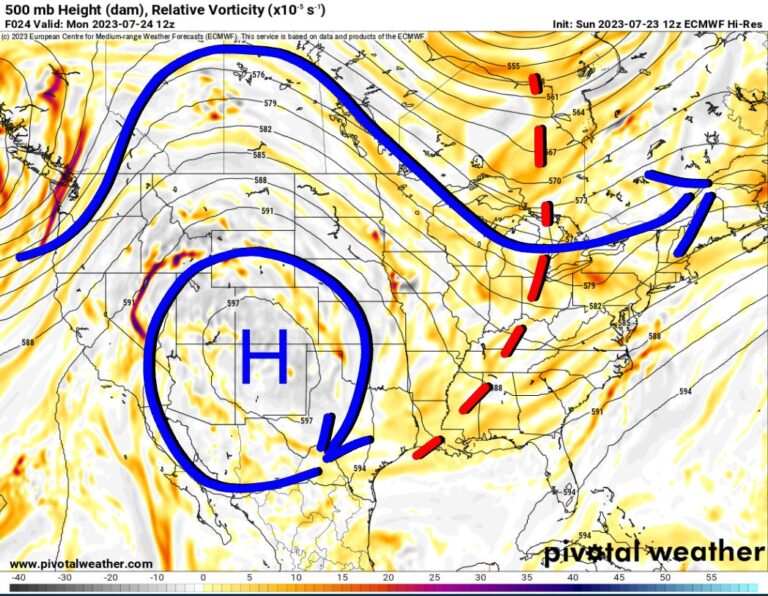
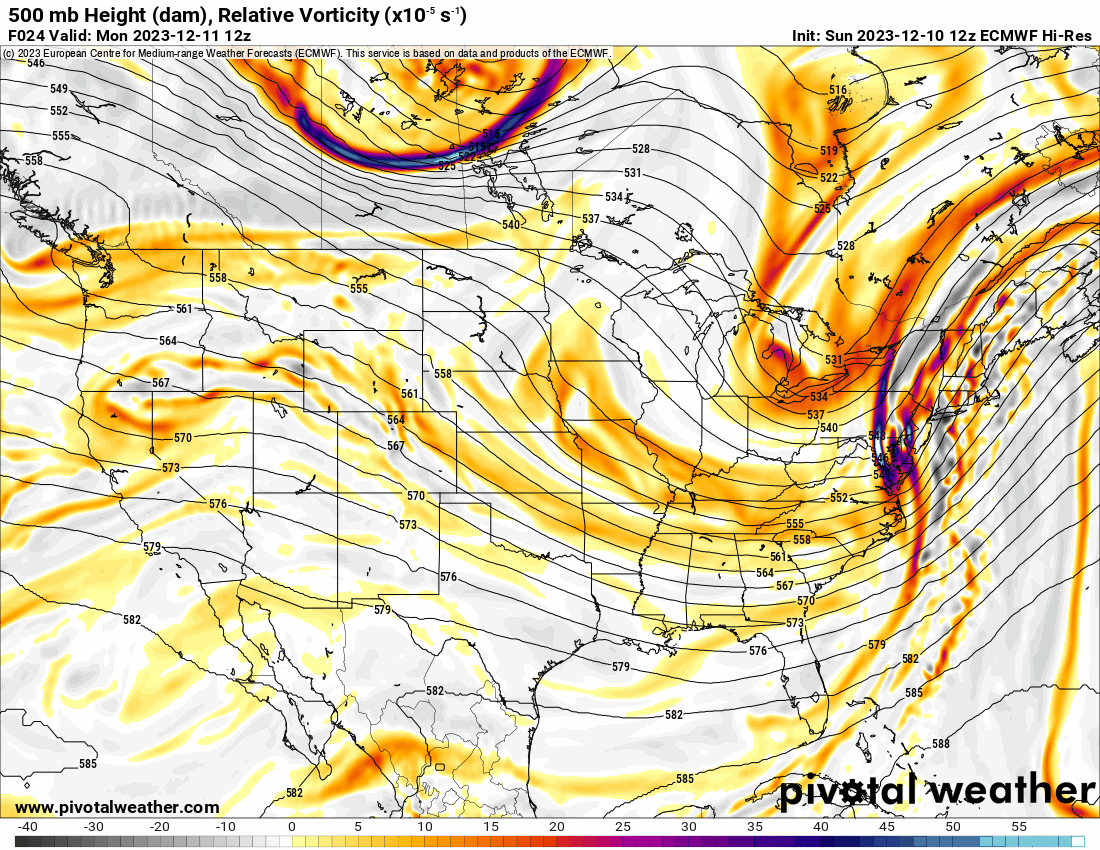
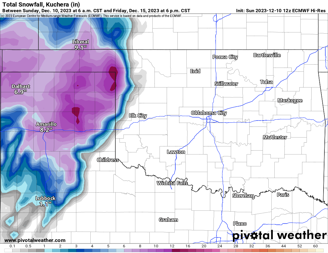
The system will dive down across the southern Rockies as a cut-off low to the Texas Panhandle. Models slowly drift the low east and south. If the models are wrong and the upper low moves due east across Oklahoma, then more of that wet snow may travel eastward into C OK by Friday night and Saturday assuming there is enough cold air left over.

Buy or Sell today with Results That Move You!
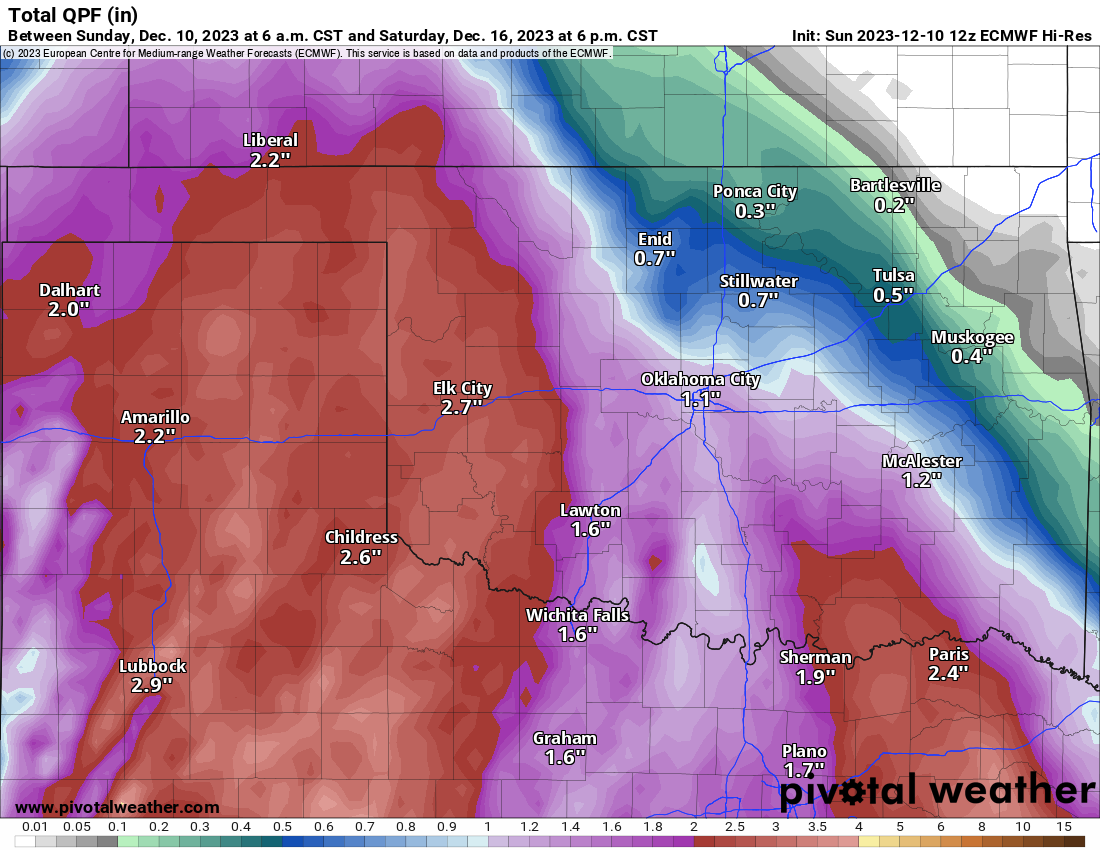
The Jetstream animation below shows the upper low moving into the region. The European model is the slowest with the system and keeps a slightly more northern track. This will provide plenty of lift in the atmosphere to produce a lot of rainfall, which is something we don’t always see in the winter season.
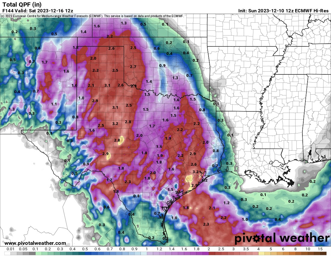
The precipitation starts late Tuesday night across SW OK and continues off/on through Saturday. Most of the rain will fall across the western half of the state during this time, but it will be cloudy most of this week as a result. The blue area is snowfall, and the green color is for rainfall. Temperatures are expected to remain above freezing across most of Oklahoma during the event with the exception of the far western counties where accumulating snow should occur. A lot of the cold air will erode and the system will produce its own cold air aloft, so the critical 30-34 degree temperature spread will be very important for those who get the wet snowfall. Since models crank up the water content in the atmosphere, amounts could be quite high. As always, wait until about 48 hours out from the first flake of snow to get a more accurate prediction in the model data.

Ferguson Roof Systems is offering an AT's Weather special!
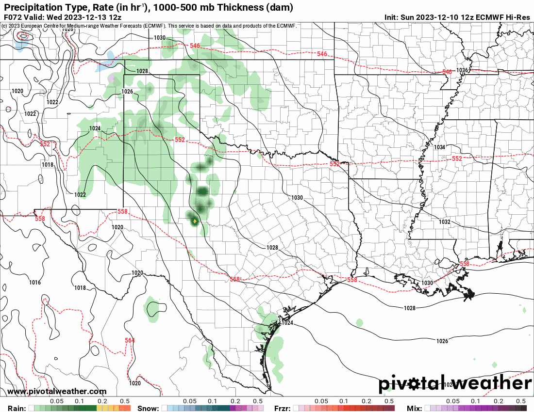
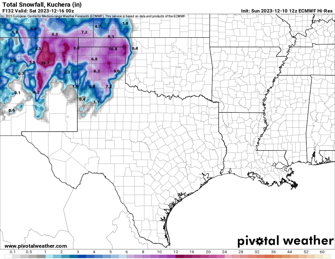
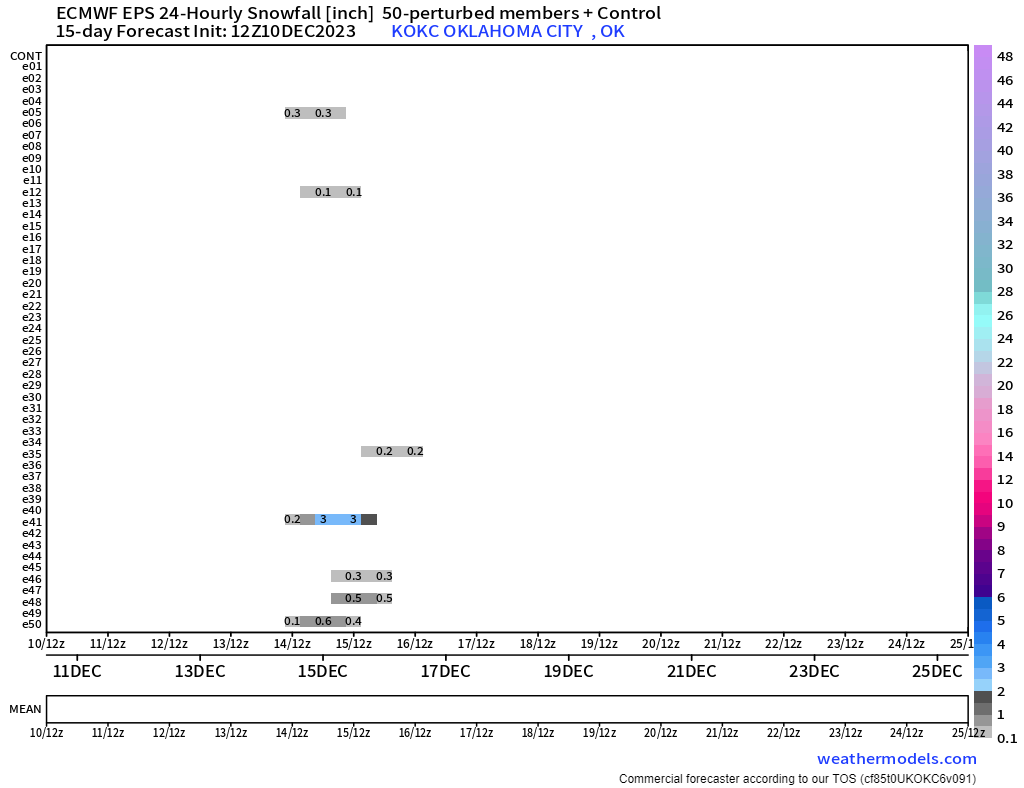
The rain and snow amounts are always dependent on the amount of cold air. A little warmer and the snow amounts drop off, and rain goes up, and vice versa if colder. As of now, the European keeps the measurable snow out west. I’ll watch throughout the week to see if there is more cold air to work with and a better storm track. The ensemble output for snow does have a few weak signals for the OKC metro indicating that maybe we could get a slight change in the outcome later.
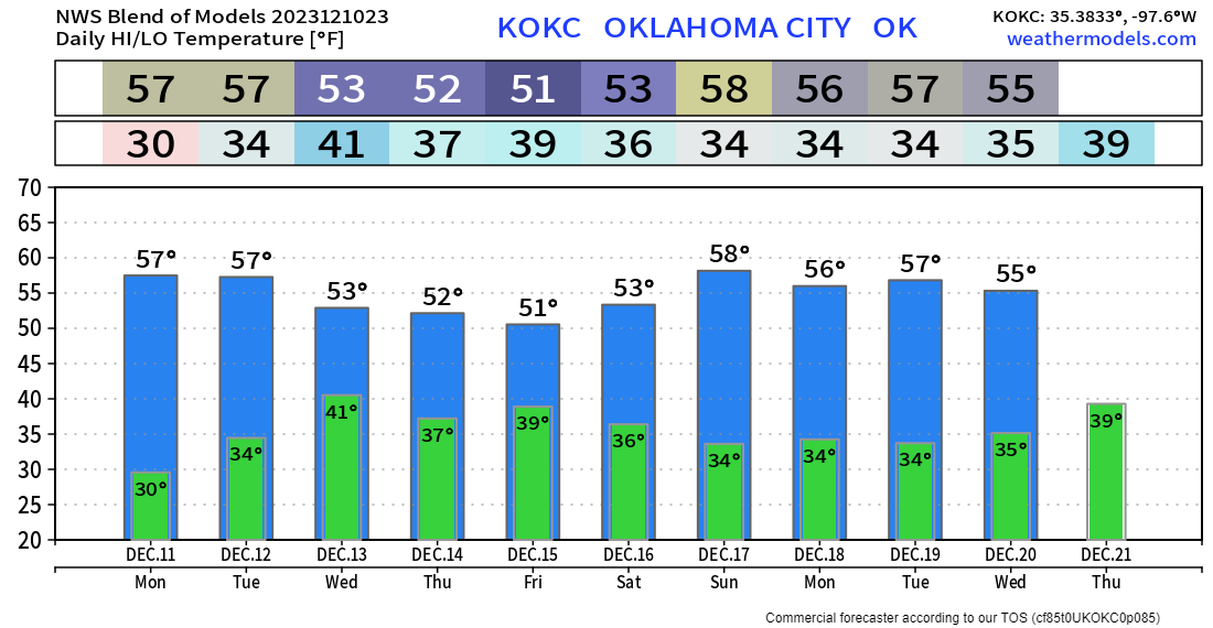
Temperatures this week will be more representative of December in Oklahoma. Coat and jackets are in order! -AT