Thanksgiving Week Brings Snow to Oklahoma
Well, we’ve been talking about it for a couple of weeks and it’s here! Thanksgiving will bring more than turkey to your plate this week. It appears we’ll also get a taste of snow! Now before you run off and buy all the milk and bread, let’s dive into the data to see if it’s worth panicking over.
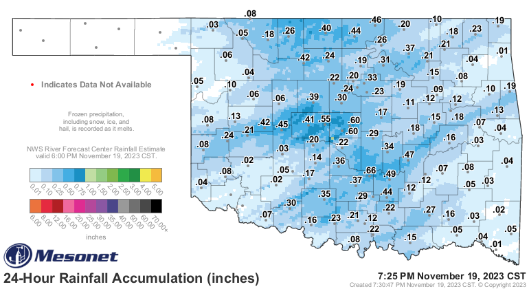
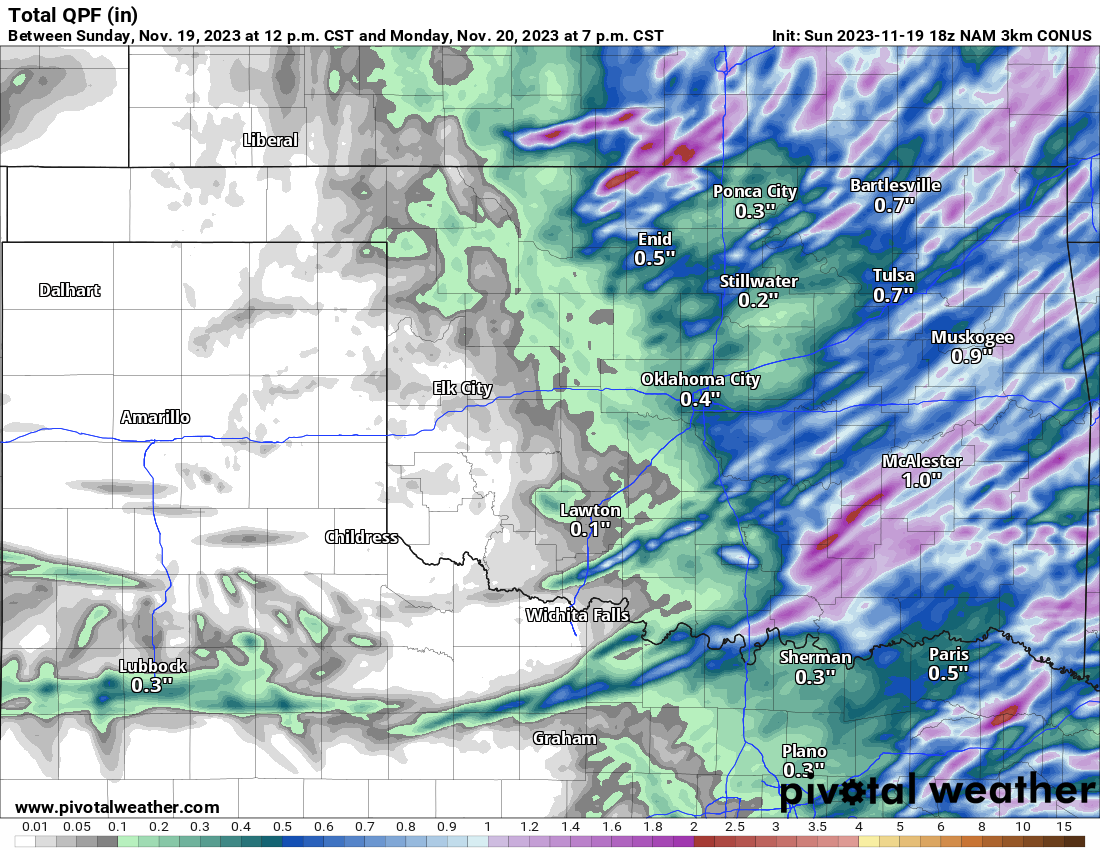
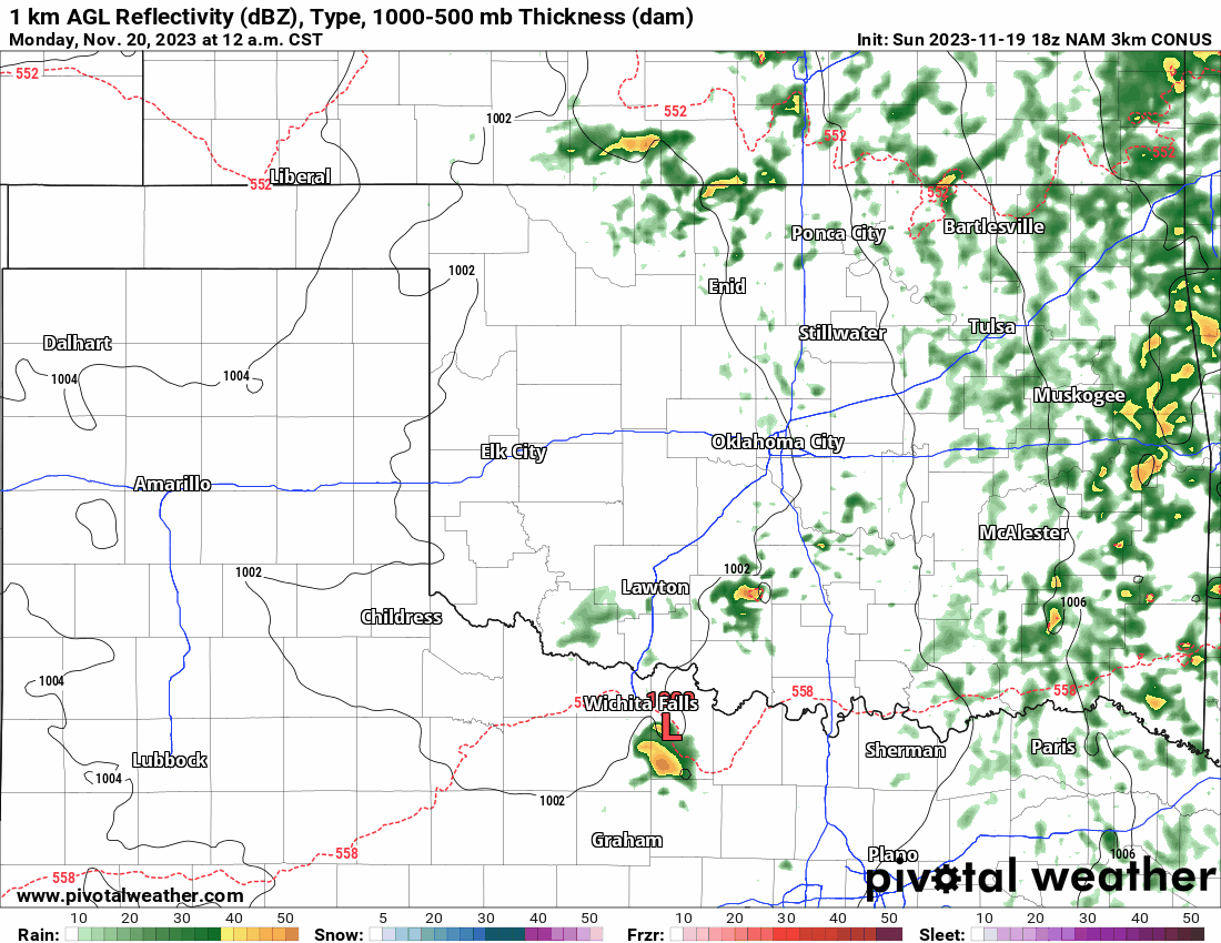
First things first, we saw some good rain on our Sunday, and more is to come through Monday afternoon before the system moves out. The mesonet shows how much we’ve received so far, and the computer model output states we have a little more to go. You’ll notice in the animation that the coverage is not widespread or constant. Just hit-and-miss scattered showers throughout the day.

Buy or Sell today with Results That Move You!
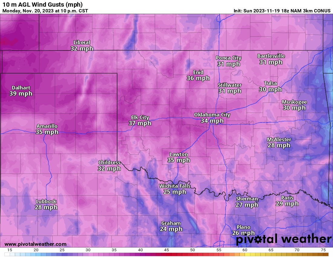
On Monday our first cold front will move through the state, triggering the rainfall, but also peaking those wind gusts to over 30 mph during the day and into Tuesday morning.
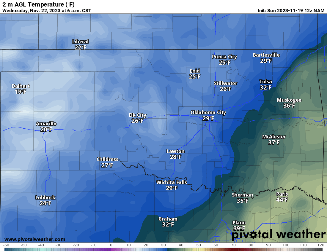
Our coldest morning of the work week will be Wednesday morning as temperatures drop into the 20s and 30s with much drier air in place.

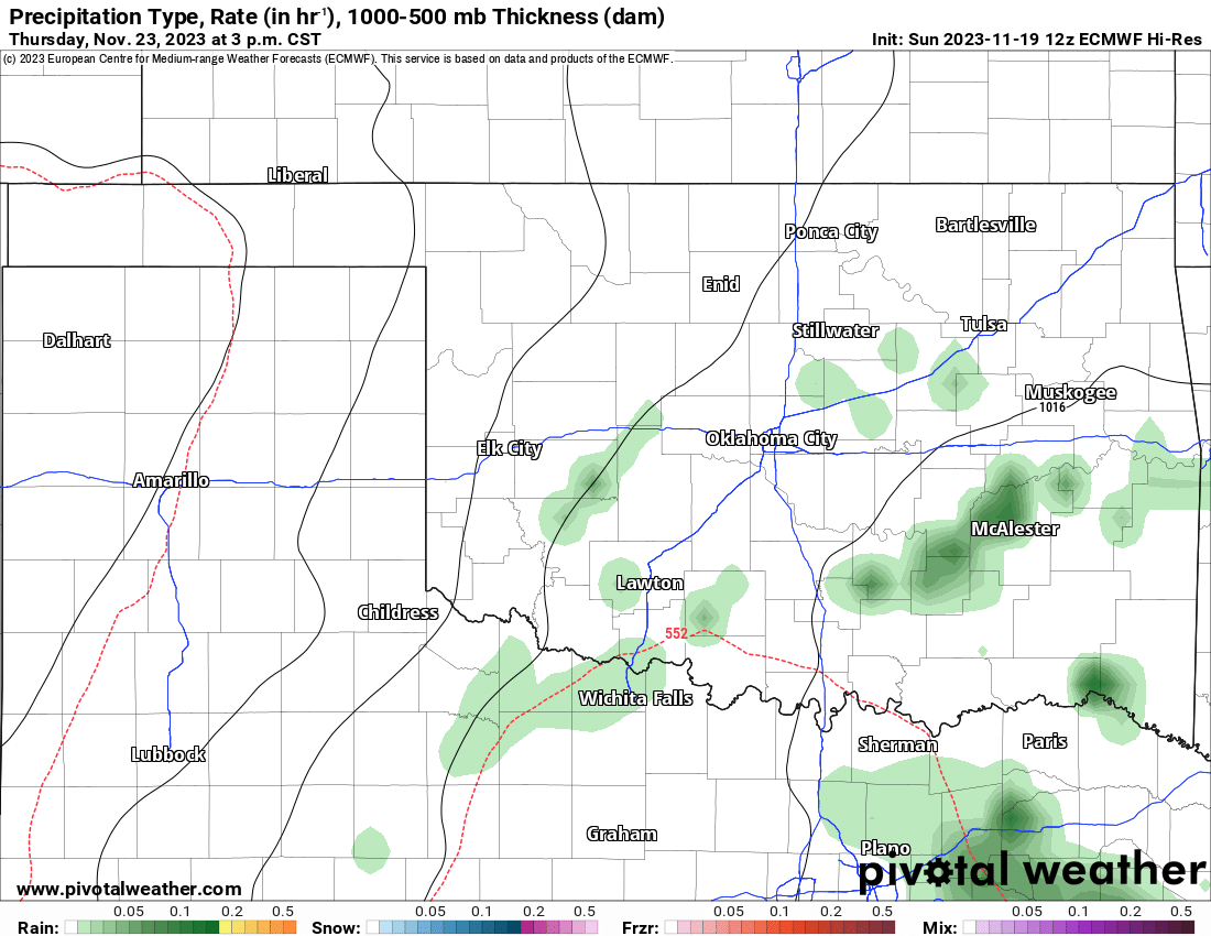
An upper storm system will move across Texas on Thanksgiving Day bringing rainfall down south. The northern fringe will clip Oklahoma however, keeping the clouds around and temperatures cool for the afternoon. Looks like we will see a few spotty light showers across C/S/E OK. Not the best weather, but could be worse!
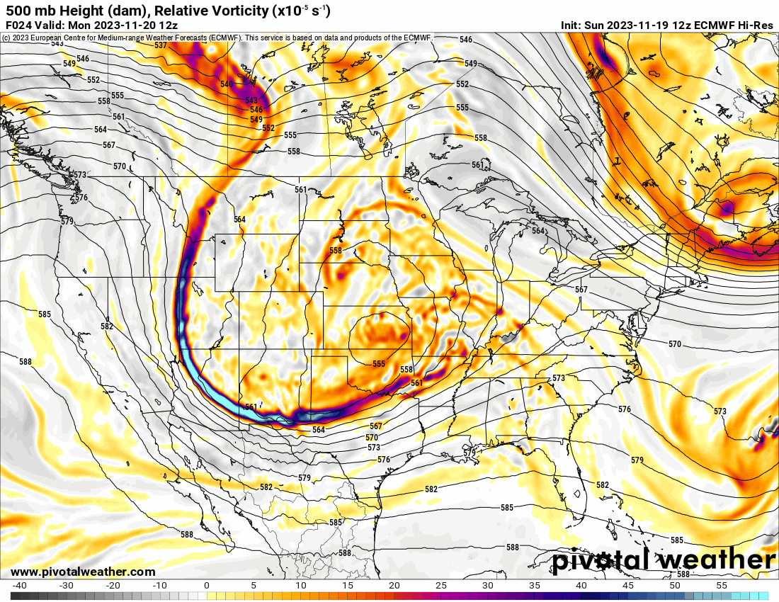
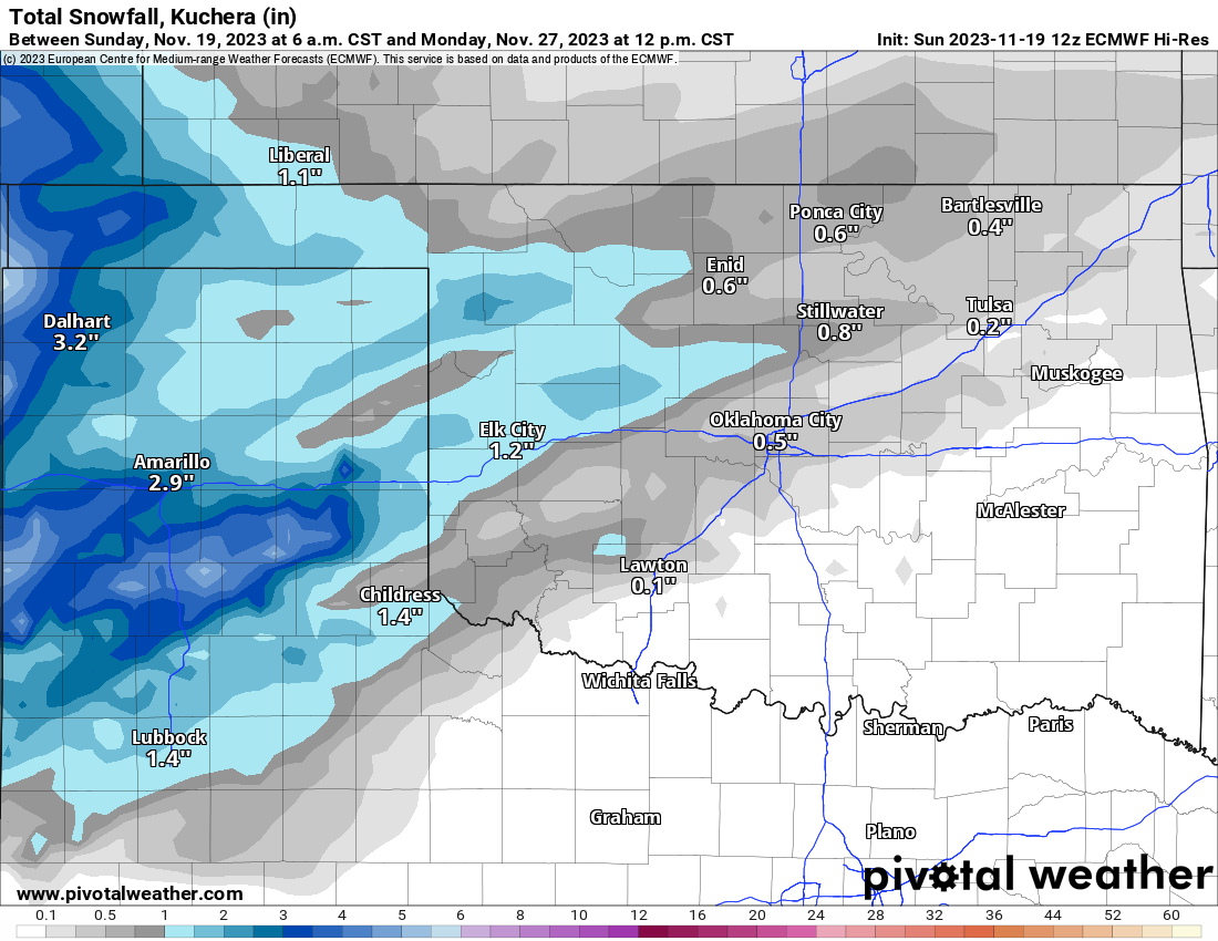
Now let’s shift focus and talk about that 4-letter word some of you dread this time of year while others celebrate! As discussed before, the Jetstream will become quite active and chaotic this week. Unfortunately, that means the quality of weather forecasts suffers a bit until things settle down. This happens every year at about this time. When we reach mid-December the pattern settles down and forecasts become more more accurate again in the long-term window. The main issue is the timing and exact track of these areas of vorticity in the atmosphere as indicated in the animation below. The brighter red colors indicate the most lift and centers of the upper disturbances. Four of our global models all handle these systems differently. This creates havoc in forecasting the 5-10 day period. For this forecast, I will lean on the European. It is the most consistent with the least swings. That doesn’t mean it will verify completely, but at this early stage in the game, I have to hang my hat on what I believe has the most legitimate outcome.

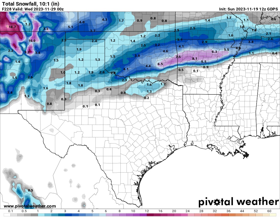
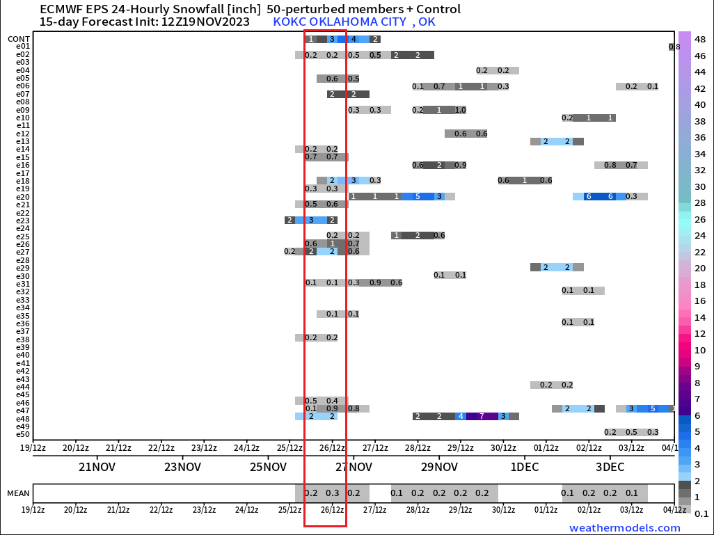
So what does the European model tell us? First off the ensemble members continue to increase in number to 19/50, which is more supportive of snowfall for Oklahoma. The amounts have also increased from a dusting to something a little more measurable. I highlighted this timeframe with the red box in the image below. Keep in mind this is just for OKC. If I were to pick a spot in W or NW OK, there would be more and higher amounts. But this tells me all I need to know for the pattern outcome. Also notice additional noise for the other days in November and into the first week of December.
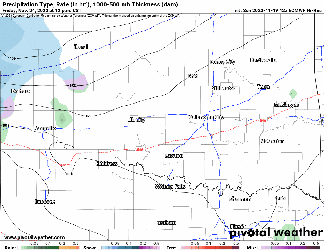
Now let’s take a look at the projected radar animation. Blue is snow, green is rain. You will notice that most of the snow is out west as temperatures will be more supportive of measurable snow. As you get into C/E OK, surface temperatures aren’t quite as cold during the period. If this were to change, then the snow would increase in these areas on the output. Notice how as more precipitation moves through into the following week, we replace the blue with green as the cold air erodes. I’ll show you an output from the Canadian model that is bullish on much colder air and for it to stick around longer, leading to a lot more snow for Oklahoma around Monday and Tuesday. For the record, I don’t buy into that solution at this time.
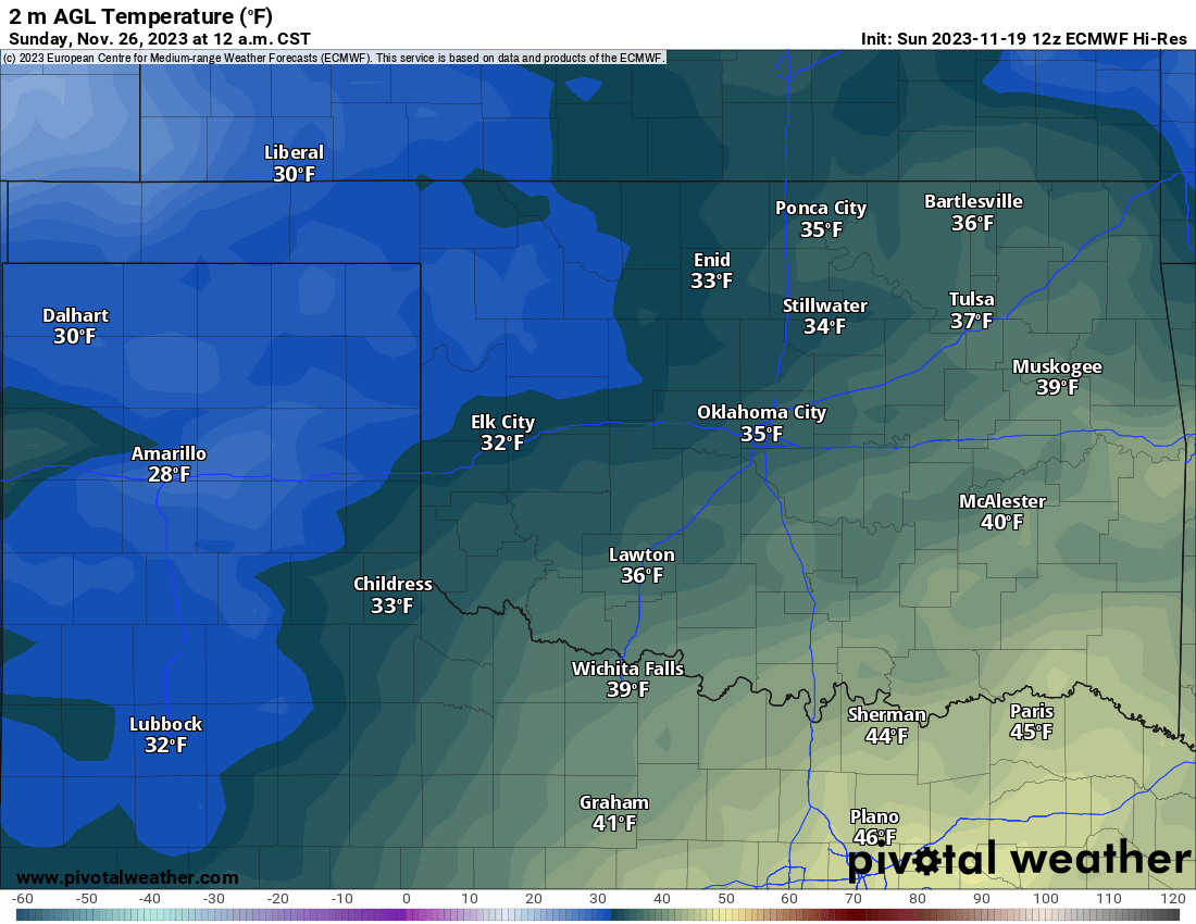
As you know, our ground temperatures are very warm and as the model alludes to, the surface temperatures are barely going to be cold enough for accumulating snowfall. All this means is that we shouldn’t have any travel issues and it will melt about as fast as it falls. Ah, the typical Oklahoma snowfall!
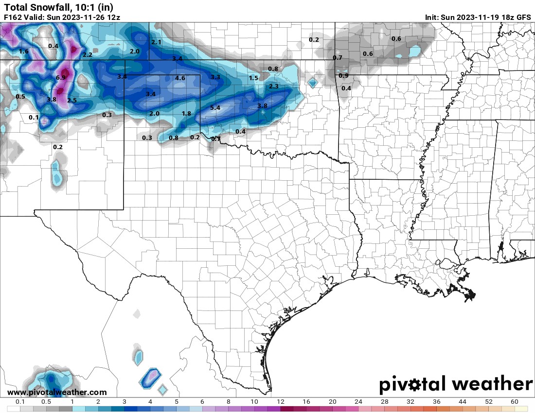
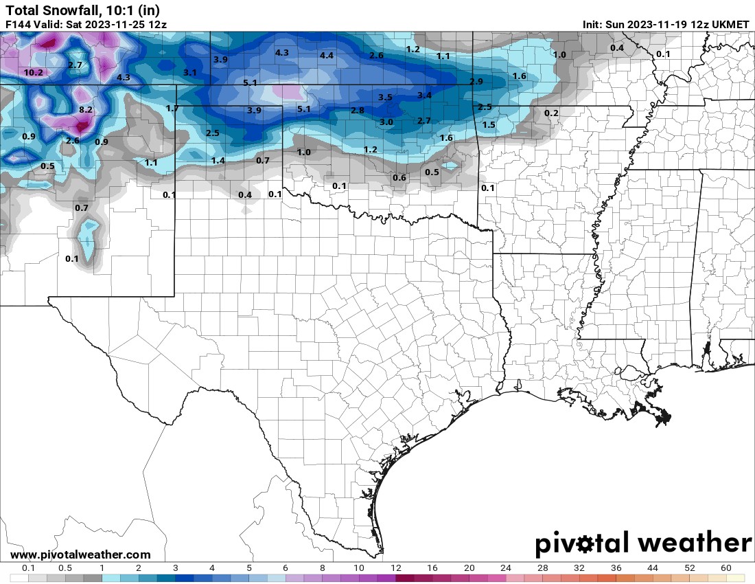
Just to show you the chaos in the model data. The following outputs are from different models and different timeframes. The first is the GFS (American) that says we’ll get our snow on Saturday. The second is the UKMET (United Kingdom model) and it says we’ll get our snow Friday night. Both of those have much higher amounts. The third output is from the Canadian, which says nary a flake over the weekend, but a dumpage of snow Monday and Tuesday.
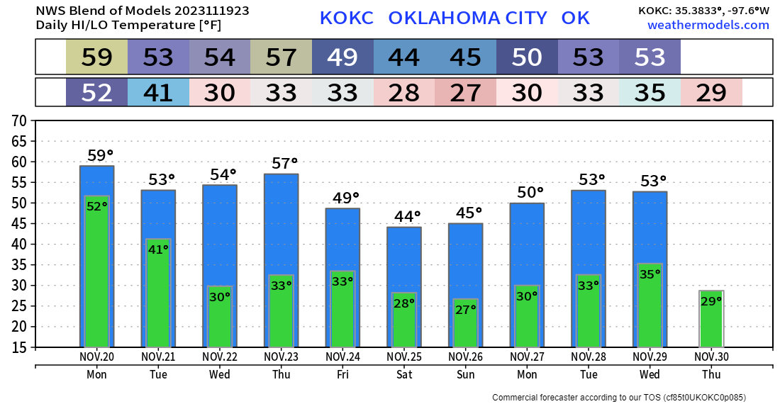
Remember, snow forecast amounts are like tornado forecasts. Only pay attention starting about 48 hours out from the event. Snow is a very difficult thing to predict in amount and location. Like you, I’ll be busy over the Thanksgiving week, but I’ll try to update you on my social media accounts when I can. In the meantime, here is the temperature outlook for OKC. Yours will vary a bit, so use my free weather app, ATsWeatherToGo, to keep track of the weather in your backyard, or if you hit the road for the holidays, it has you covered across the entire US. Jodi, me, little Larry and Penelope wish you a warm and happy Thanksgiving! -AT