Fall Has Arrived Plus Your Winter Forecast
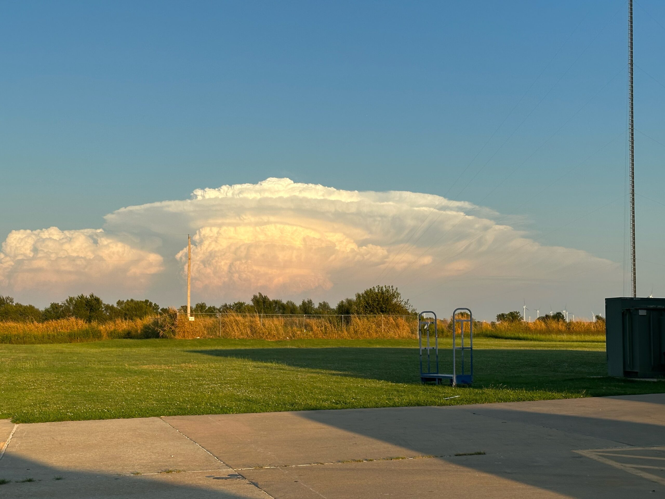
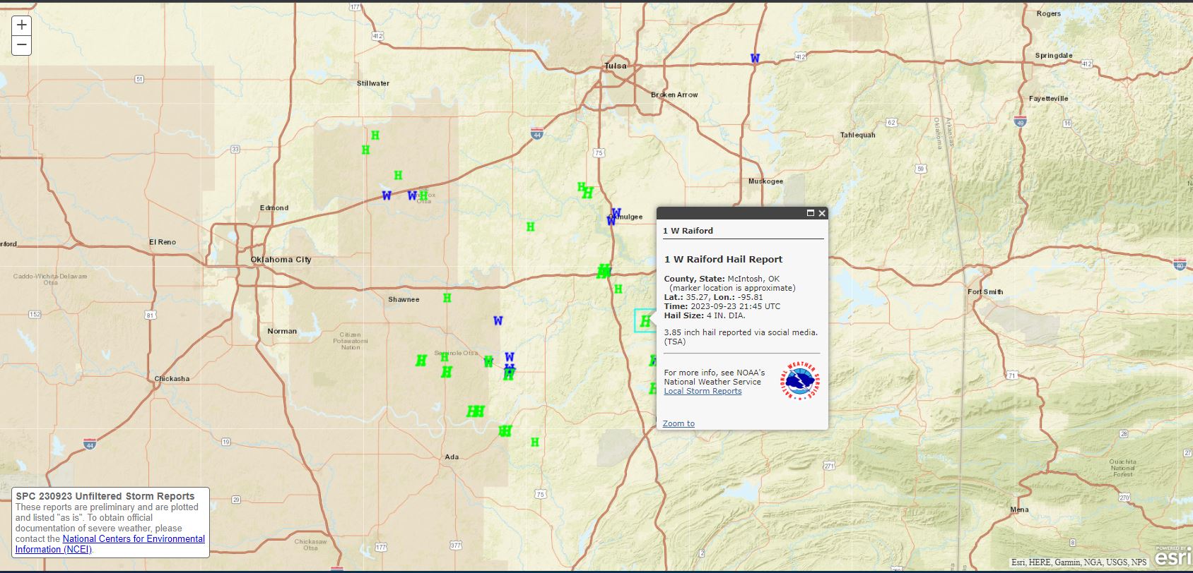
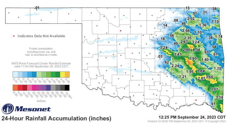
It wouldn’t be Fall if we didn’t usher in a little bit of severe weather. Severe hail and windmakers moved through the eastern half of Oklahoma on Saturday. Wind in excess of 75 mph and hail up to 4″ in diameter were reported.
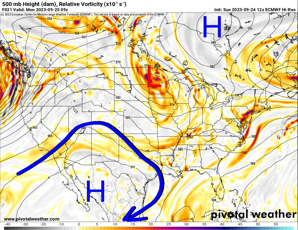
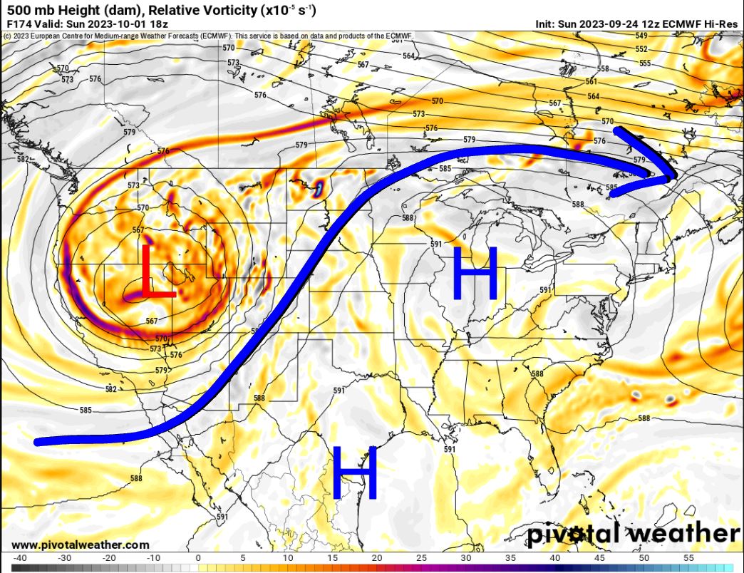
The first full week of Fall won’t be as exciting, however. Take a look at the Jetstream pattern. Notice the upper ridge down to our southwest. This places us in a NW flow aloft, which is usually a good thing as disturbances can ride down this flow and bring us rain. Unfortunately, as you’ll notice in the animation, the lack of red, or in other words, the lack of upper lift moving through. That means this will be a predominately dry flow this week. As we move into the weekend, a SW flow will develop with that big upper low out west. It all depends on how that thing kicks out, but we might get some action out of it the following week.

Ferguson Roof Systems is offering an AT's Weather special!
Even if we could get an upper perturbation to move through, take a look at the CAPE/Shear for the week. There just isn’t significant instability to work with. Without adequate moisture, it’s just hard to get rain around here, much less severe storms.
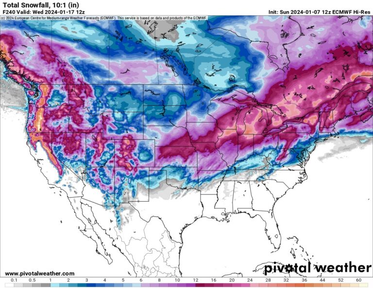
What we will see this week across the country is a bit of a warmup. Notice how temperatures are above normal this week and into next. In the final frames, you will notice a big cool push coming out of Canada. This will likely be our first really good Fall cold front. More on that later!

So about that Winter Forecast! If you watched my live the other day you’ve already heard it. It’s 100% accurate just about every year. Beats all other forecasts you’ll come across. It goes a little something like this: We’ll see a few days with rain and many dry days. There will be some mild days and very cold days. We’ll also see a little bit of snow and ice. I give this forecast every year, and I haven’t been wrong yet! =)
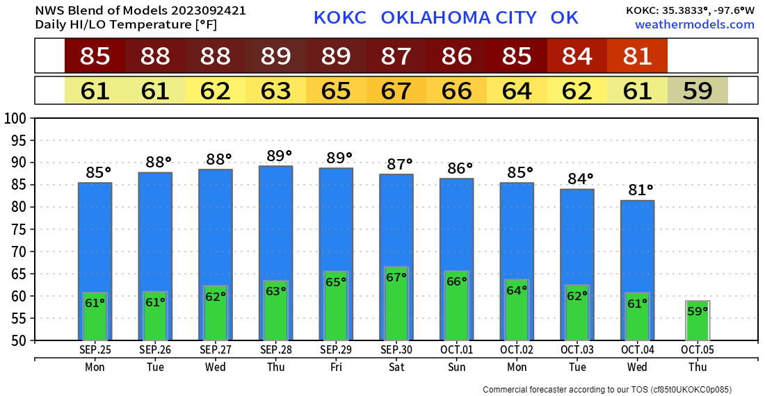
Here’s your OKC extended forecast for the week. Enjoy! -AT