Cool and Wet To Start, Pay Later with Heat
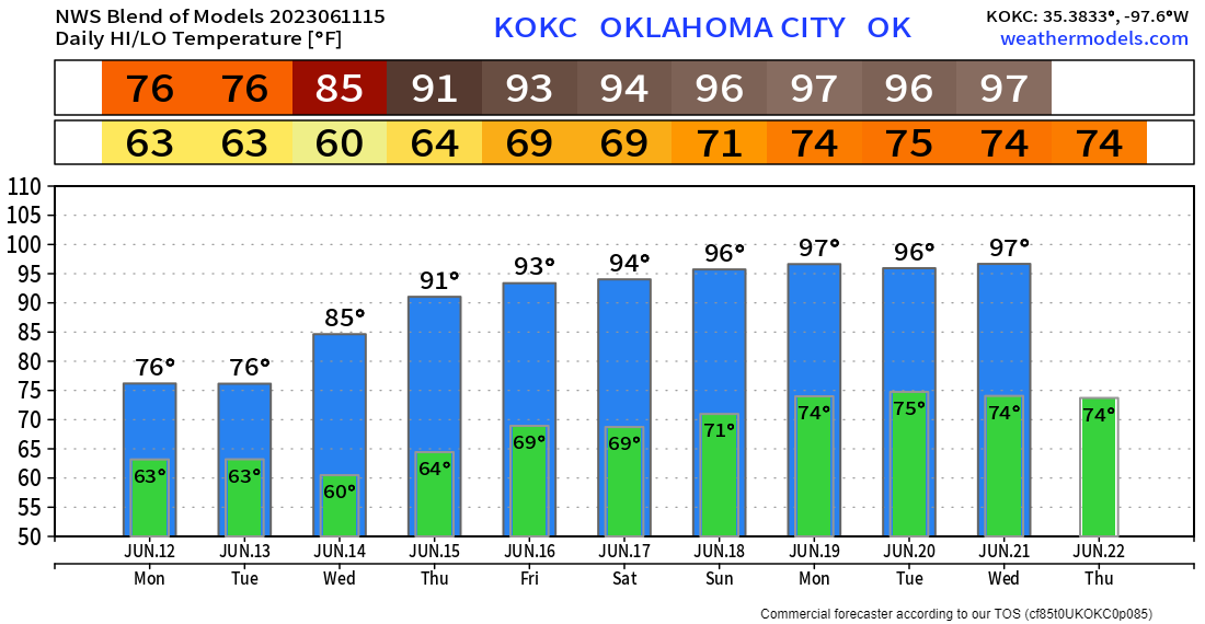
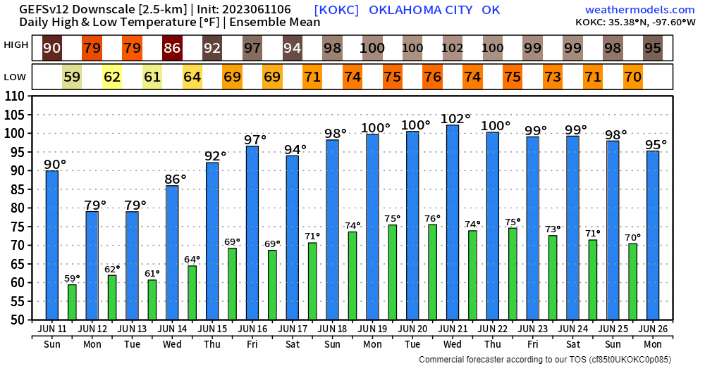
Alright alright alright! Now we’re talking! We get a couple of days of cooler and wet weather to start the week before things heat up to typical June fashion. By the weekend we’ll be back to those mid-90s across Oklahoma.
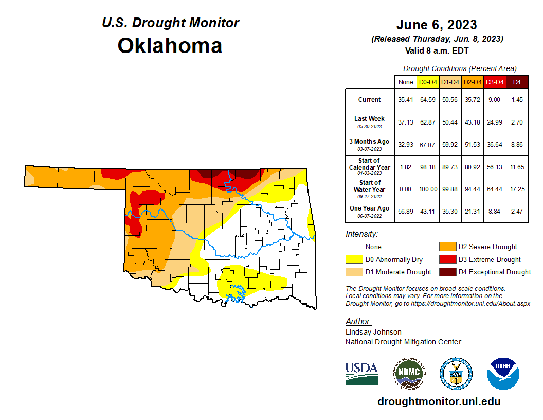
With all of the recent rains, we continue to chip away at the western Oklahoma drought. Notice though that northern parts of the state could use some relief. Don’t worry, that area should get rain this week.

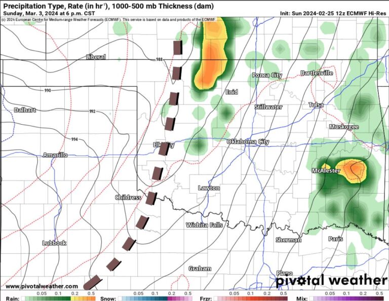
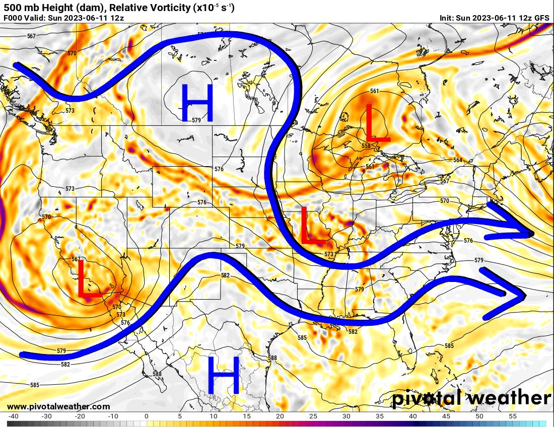
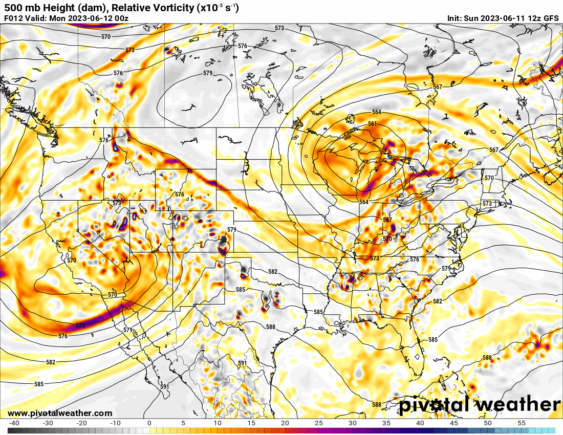
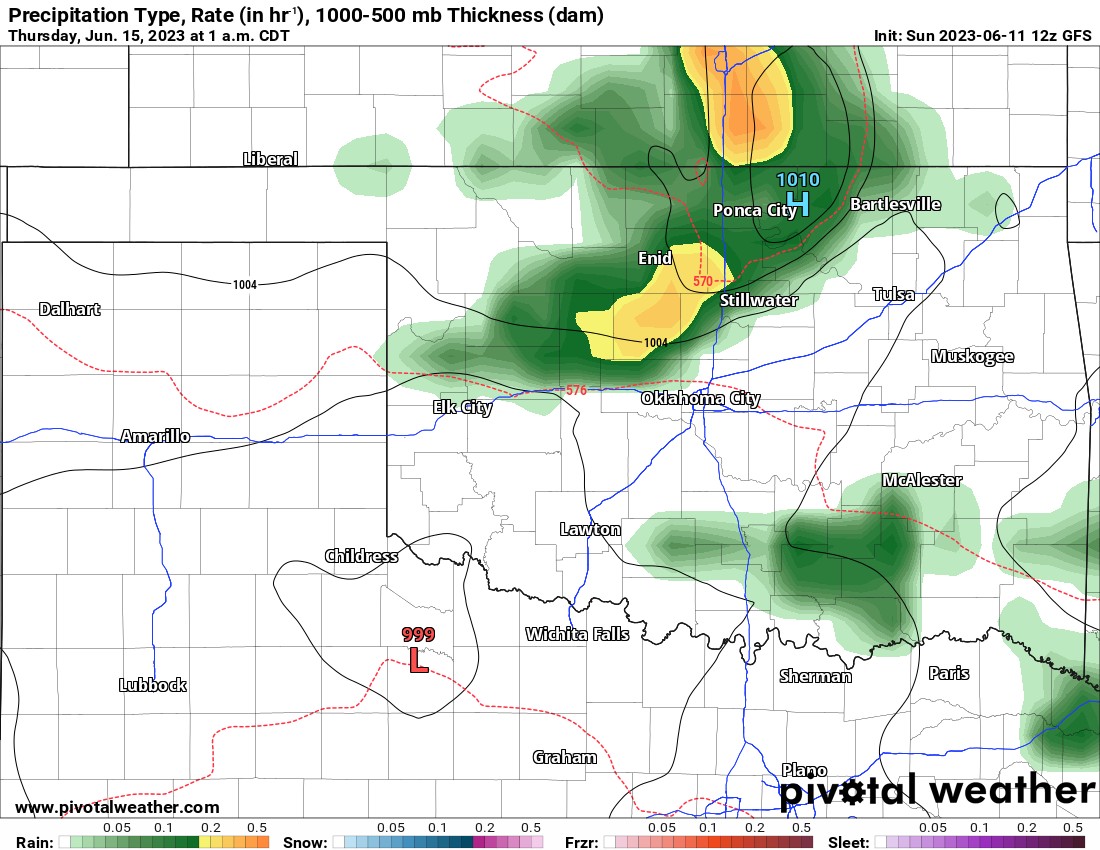
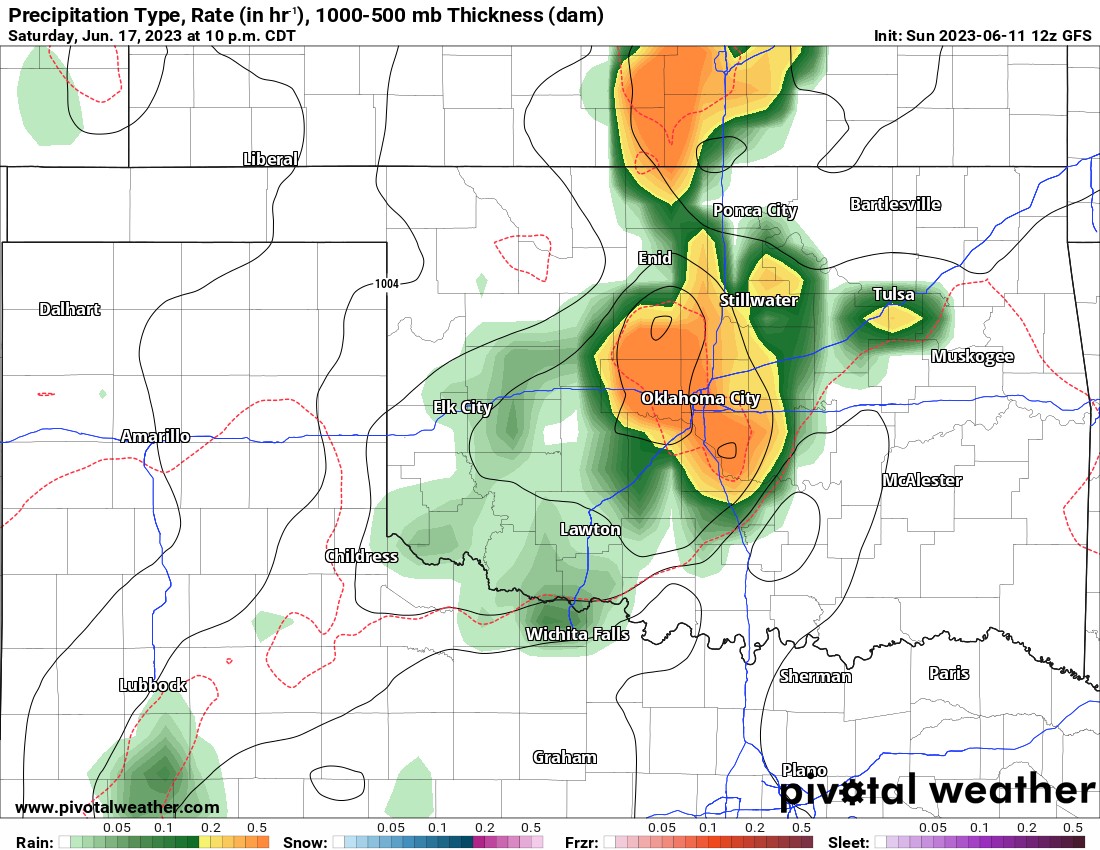
Take a look at the jetstream. The blocking upper high across C Canada is breaking down finally. This allows a new high to build across Mexico and into Texas. During this transition, it allows the upper energy and lift to move through Oklahoma giving us a few rounds of rain. All of those little bright yellow and red colors on the map translate into cloud and rain generation.
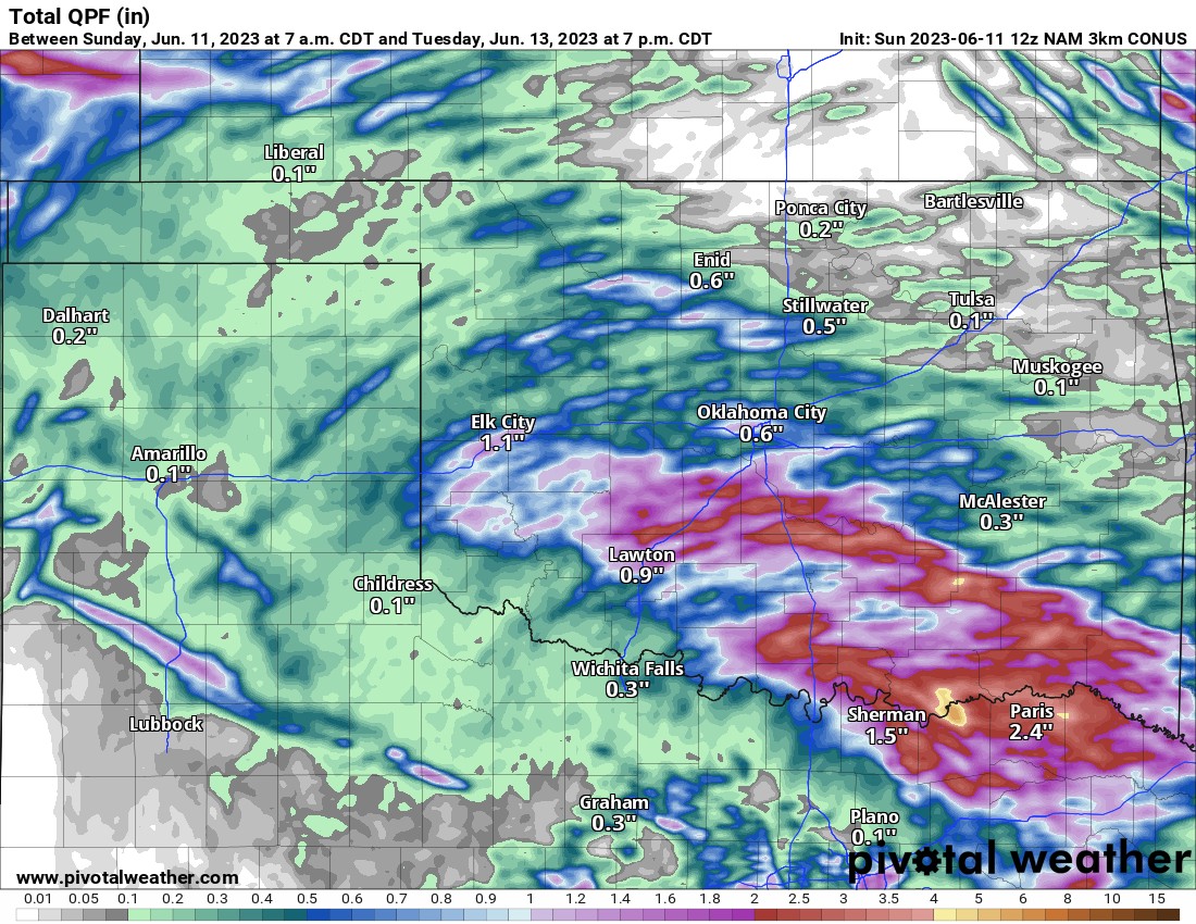
Watch the expected rainfall animation through late Tuesday. A few rounds will move through. After that another round early Thursday morning and possibly again late Saturday, although most of the Father’s Day weekend looks dry. By the way, some of those storms Monday and Tuesday could contain pockets of damaging wind and hail.
Ferguson Roof Systems is offering an AT's Weather special, Call Today!
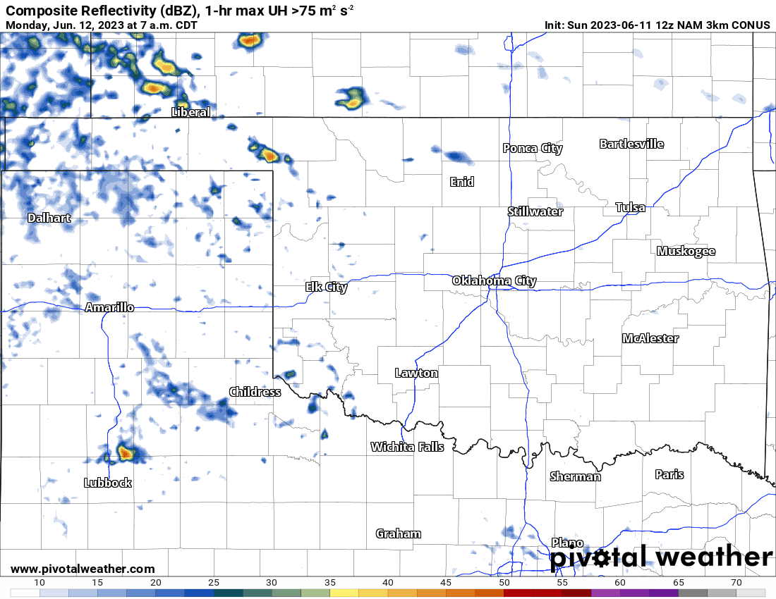
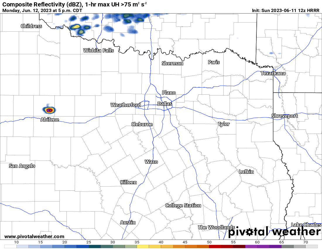
I also wanted to briefly mention N TX. The DFW area should see a cluster of severe storms producing very large hail, damaging wind, and a couple of tornadoes Monday afternoon and evening.
Temperatures over the coming days will go from nice to hot. Long-term outlook is hinting that it just might stay that way for the remainder of June with mid to upper 90s across the state and not as much rain.

Ferguson Roof Systems is offering an AT's Weather special!