100 Degree Heat Expands and July 4th Preview
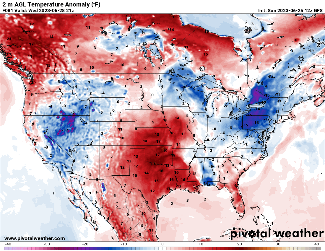
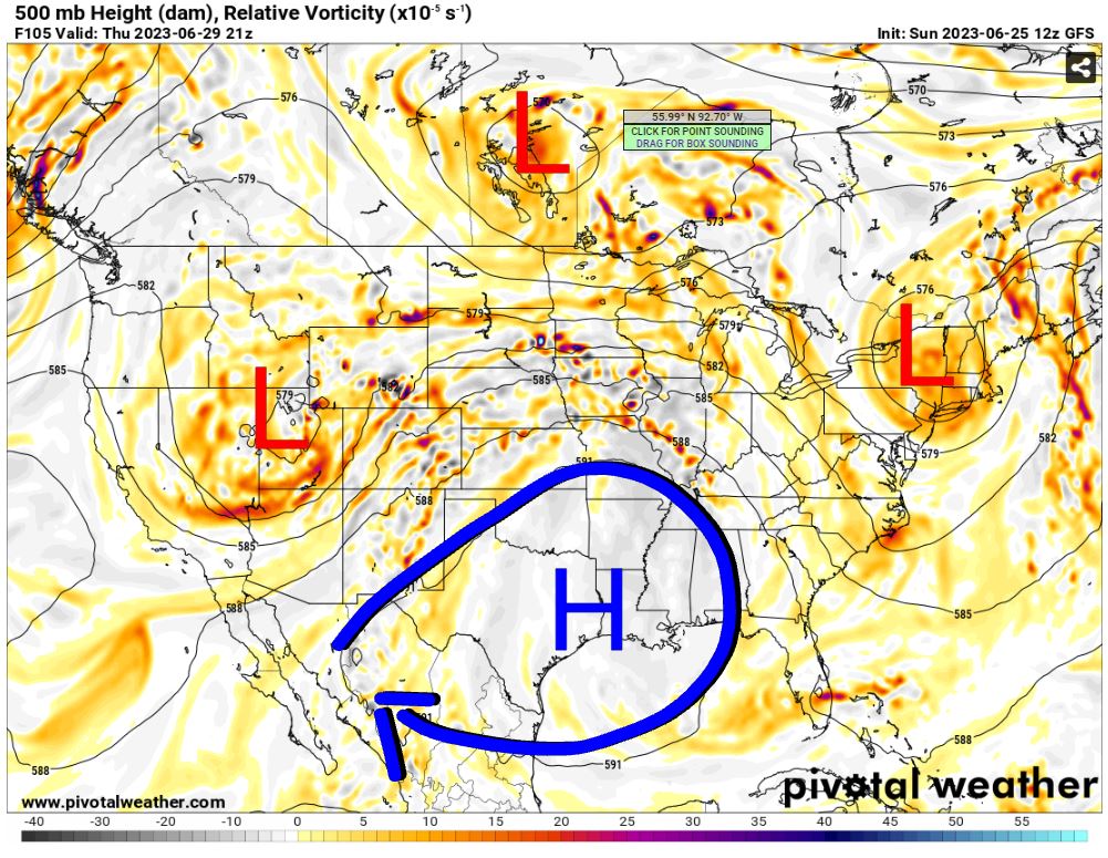
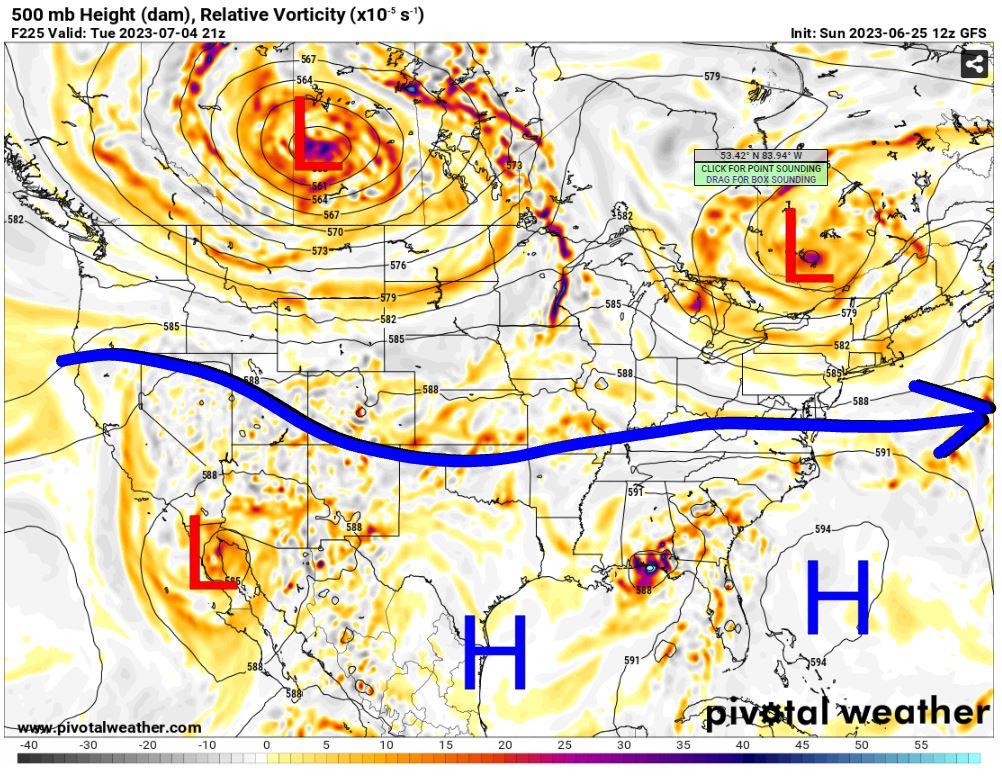
The last week of June is going to make us pay for the reasonable temperatures and repeated rainfall we’ve received over the course of the month. An upper-level ridge will grow across Texas and nudge into Oklahoma. This will shift the storm track to the north and bring in hot air off the Mexican plateau. Thankfully the pattern is short-lived as July 1st will bring back a cooler and wetter pattern.
The Jetstream shows us the ridge down south moving from west to east across Texas by midweek. This gives us potentially two storm days (Mon/Tue) across the I-40 corridor before it shifts into KS for Wednesday through Friday. As the high re-centers across SE TX, this allows a SW flow to bring in that ridiculous heat into the western half of Oklahoma. We do have recent rainfall and vegetation to help offset this in the form of evapotranspiration. This will usually save us here in C OK from getting to 100 degrees when the models call for it. This Wednesday and Thursday, they are calling for it!


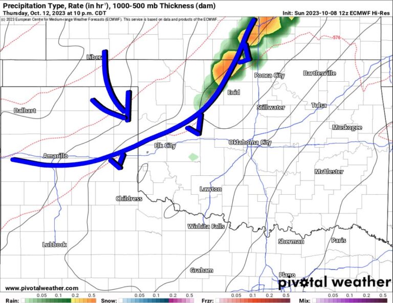
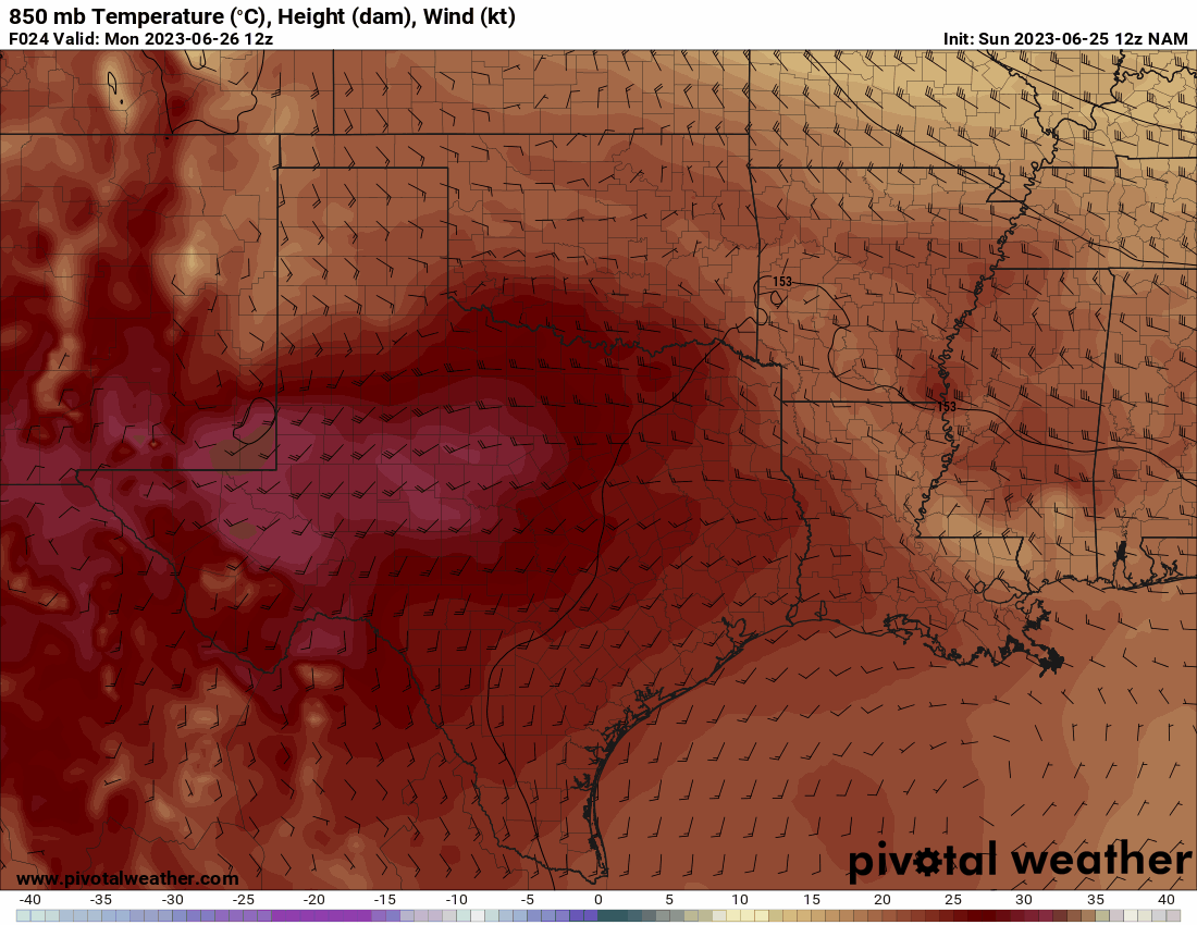
Notice the deep red/brown/white colors expanding from Mexico on the map below at the 850 mb layer. This animation shows how the hot air arrives this week.
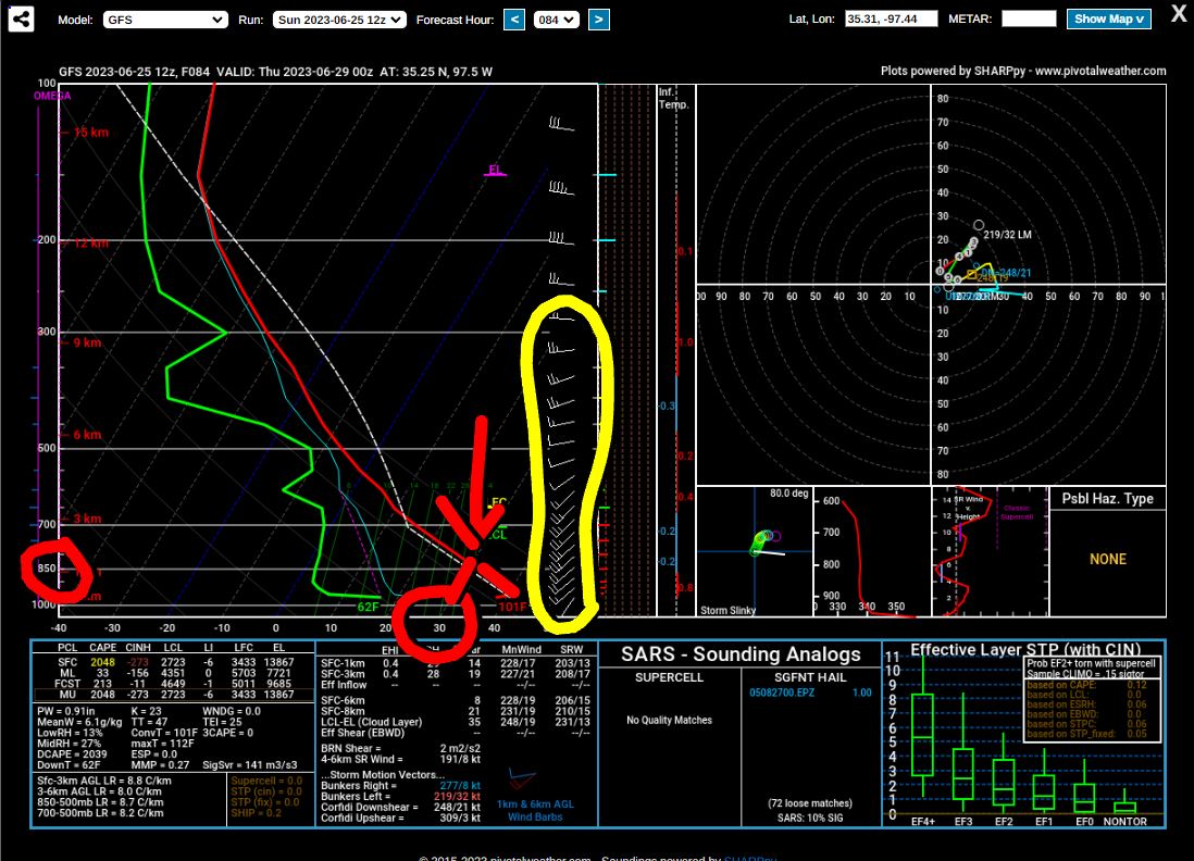
That air is also very dry. Take a look at the forecast sounding for C OK Wednesday afternoon. See how far apart the red (temperature) and green (dewpoint) lines are. That indicates very dry air. A few other things show up worth noting. The shear (wind) in the atmosphere is from the SW at all levels. That’s a drying and warming wind profile. The temperature at 850 mb is at 30 degrees Celcius. When you bring that down dry adiabatically (follow the red line on the right slant) to the surface, that typically corresponds to a temperature of 100 degrees. So our official high in OKC will depend upon two factors. Do we get to exactly 30 degrees at 850, or is it 29? Secondly, how much evapotranspiration will occur? Both of these can save us from 100 and we’ll top out at 98 or 99 degrees. Regardless, it’s going to feel hot and humid all week with heat index values around 100-110 degrees statewide!

Be sure to mention Aaron Tuttle when you call (405) 820-1193!
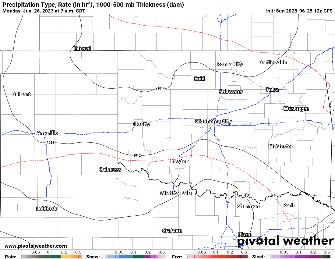
Regarding rainfall, we have a chance to see storms roll off the Texas panhandle and hold together overnight Monday and Tuesday for a bit as they travel east. On Wednesday an upper disturbance rotating across the top end of the high in the “ring of fire” region, will bring storms to Kansas and far northern tier counties of OK. After that, we’ll wait until the weekend before the pattern changes enough to allow a few storms to move through the state. There are more weak storm signals heading into the 4th of July. So you may have to deal with a few storms around the state that day, but at least temperatures won’t be hot as a firecracker (100+).
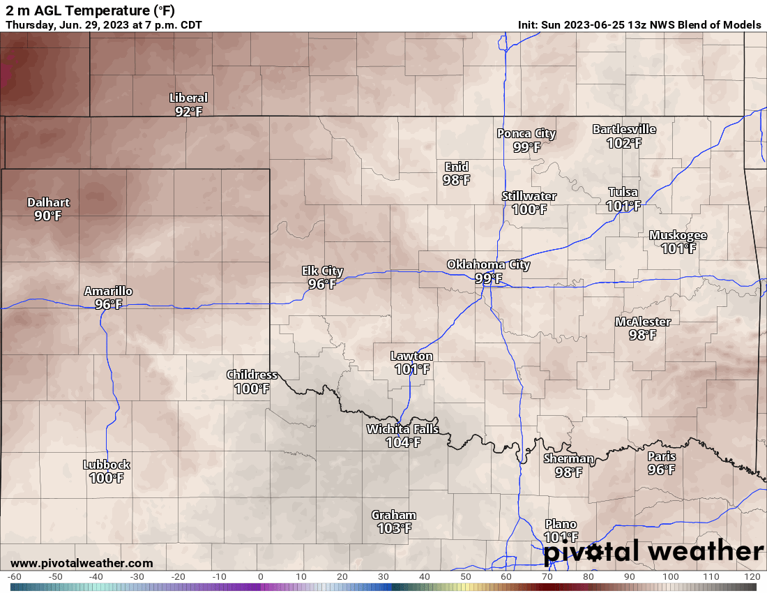
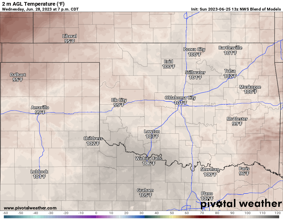
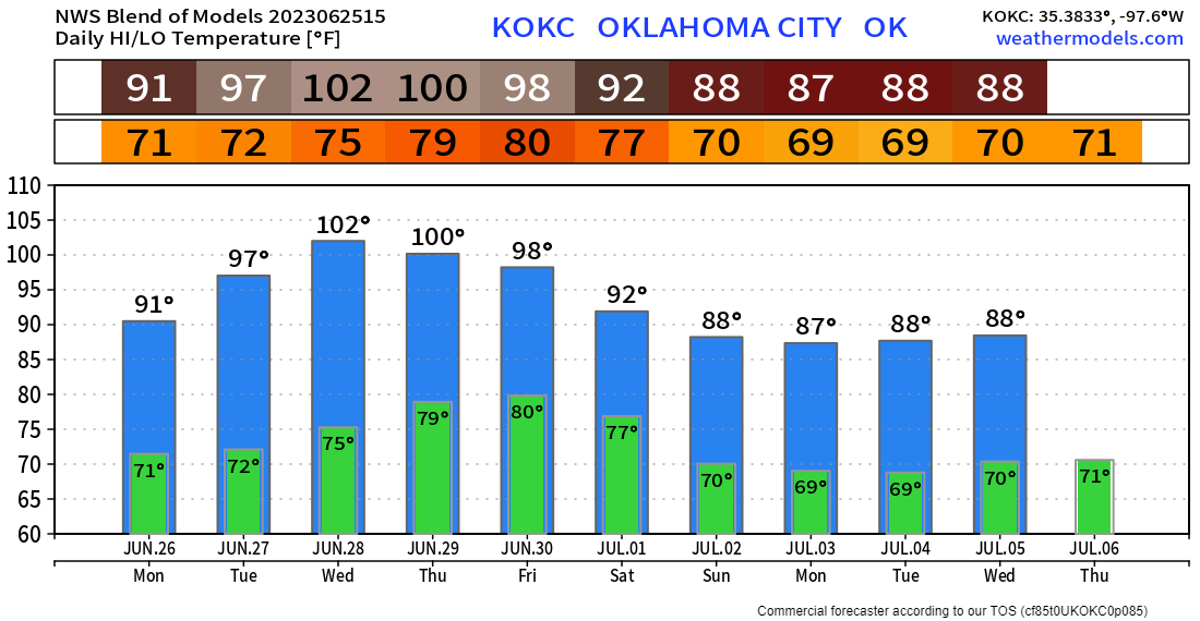
Temperatures here in OKC will heat up with the rest of the state. The model blend is calling for 102 Wednesday and 100 Thursday. I’m going to go out on a limb and say we cap at 99 each day. We’ll see! Stay cool out there! -AT

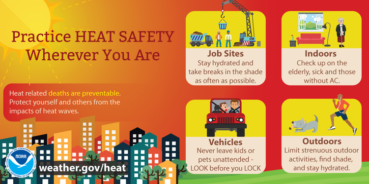
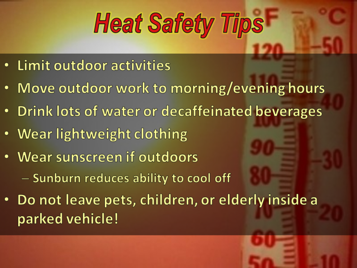
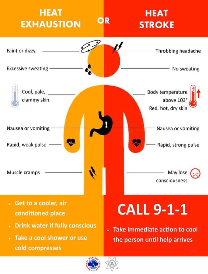
Summer heat tips below: