Warmup Then Weekend Chill
We’ll be in a transition week as the Jetstream rearranges for the Fall pattern. By Thursday evening another cold front will move into the state triggering shower and storm activity along with a chill into the weekend.
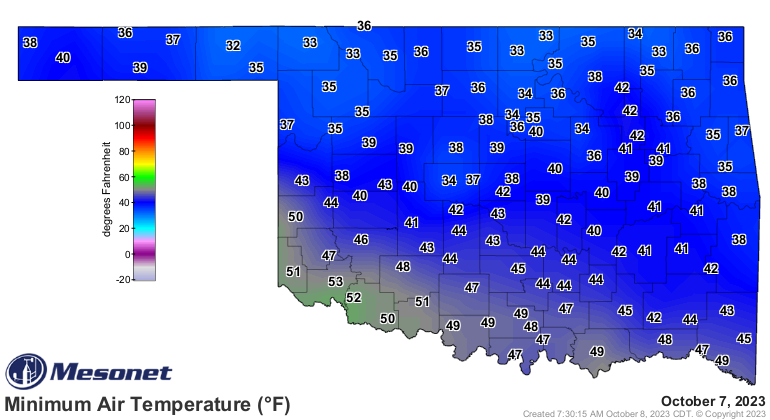
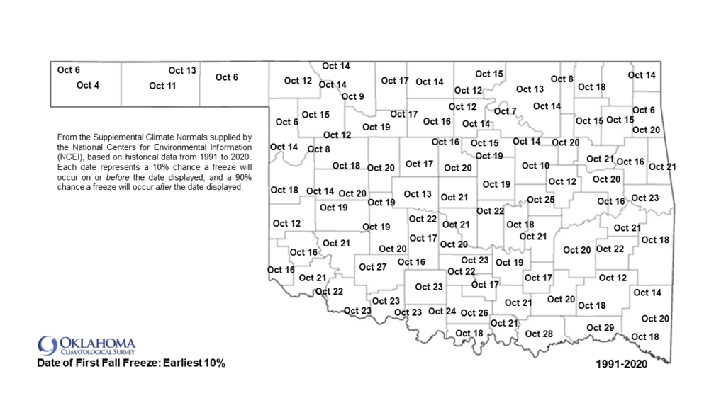
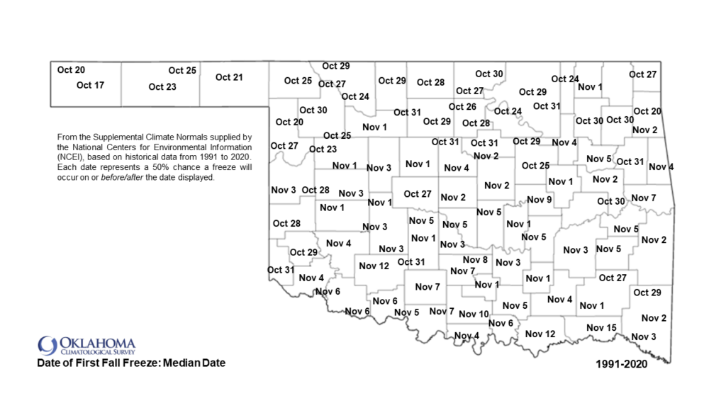
Speaking of the weekend, over our past weekend, temperatures really bottomed out! We saw lots of 30s across the area Saturday morning. Beaver actually hit the freezing mark for the first time. Check out the rest of the state and notice the dates on the first freeze of the season and the average date of the first freeze. As you can tell, October is a big month for Oklahoma with significant changes!
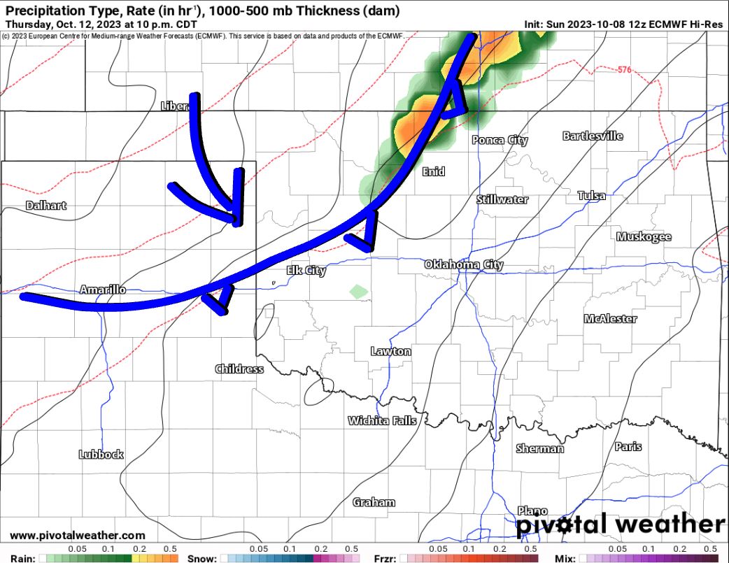
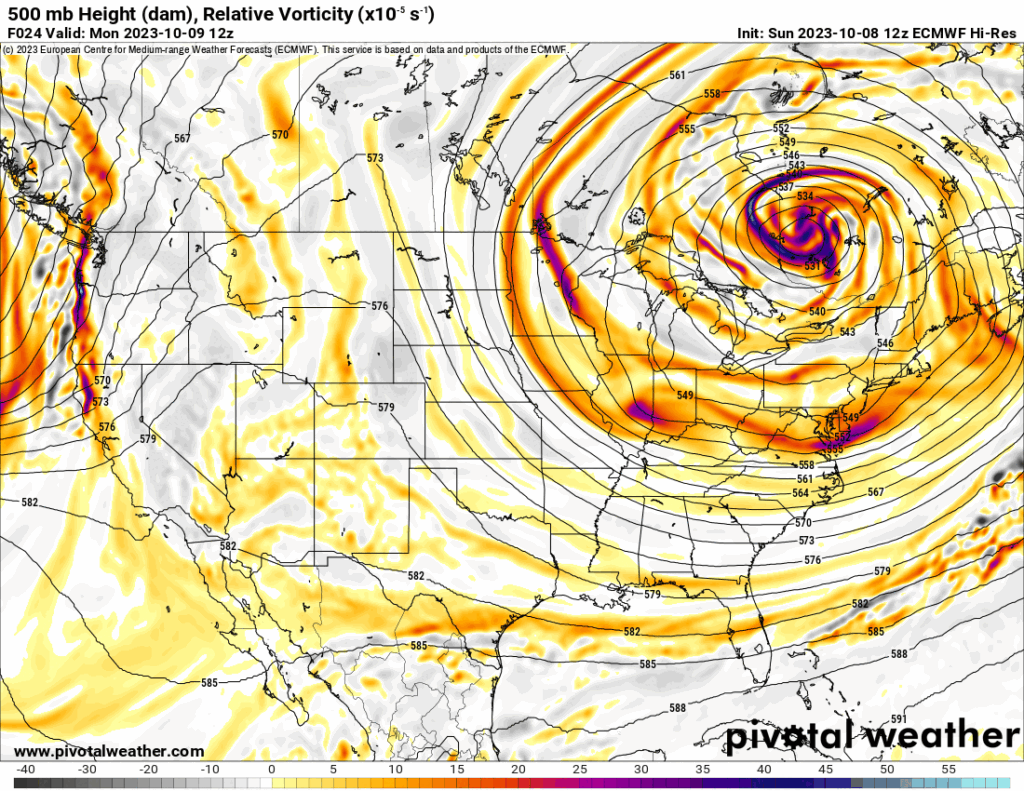
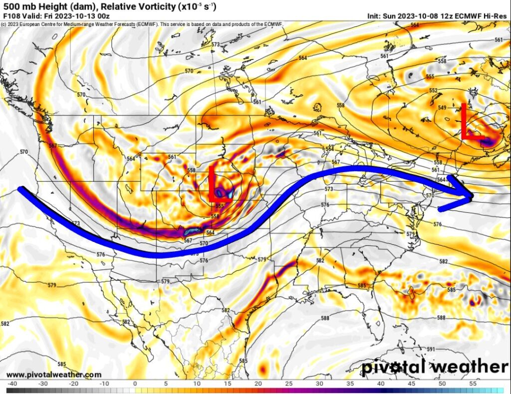
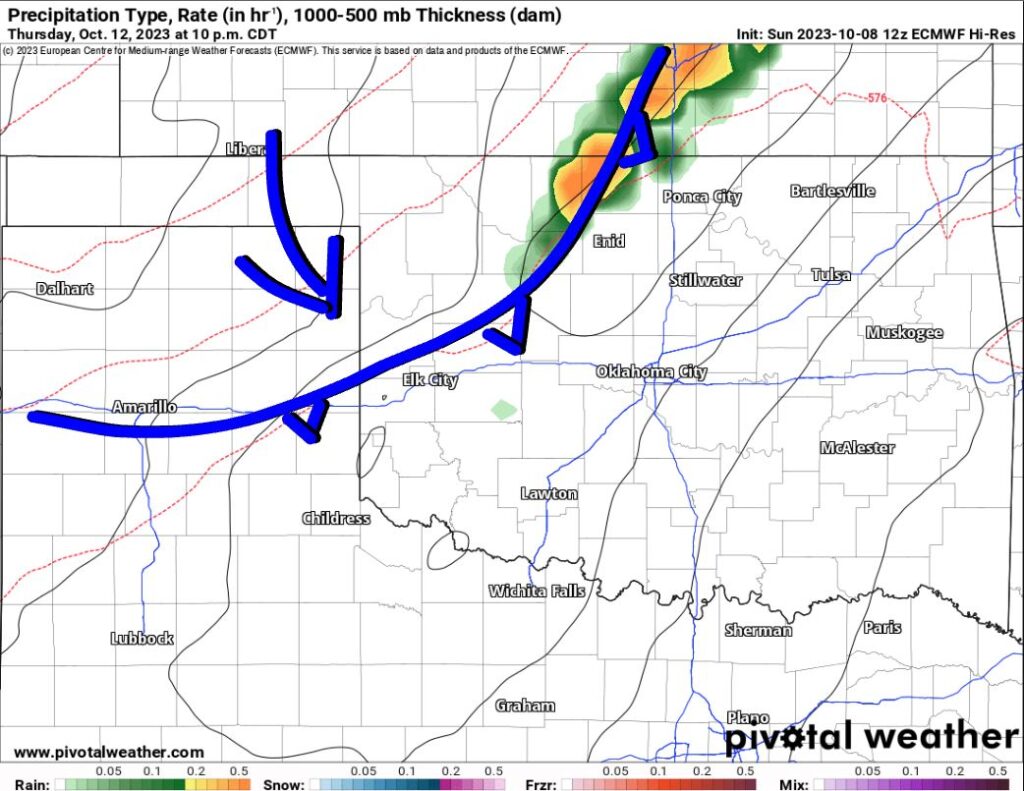
If you play the animation below, you’ll see the setup for our next storm system as an upper-low positions itself in SW Nebraska late Thursday. Unfortunately, most of the lift/instability will be in those red-colored areas north of Oklahoma. There’s still some hope it dives a little more south. If it were to do so, the outcome would be better coverage of showers and storms. As it is now, a strong cold front will at least trigger some activity along it Thursday night as it moves from N to S across Oklahoma. The map shows the front entering the state around 10 pm.
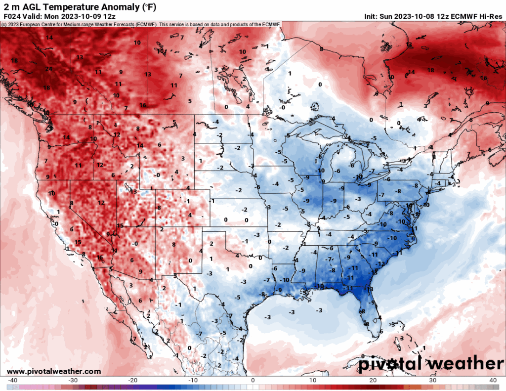
Notice how temperatures in advance of the front are a few degrees above normal for most of the country. The big blue area of below-normal temperatures returns by the weekend.
Ferguson Roof Systems is offering an AT's Weather special, Call Today!
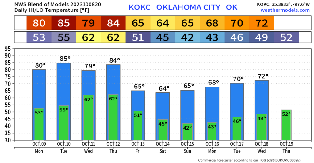
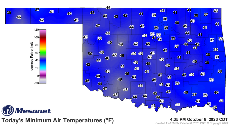
Here is a look at the OKC temperature trend. Enjoy the week! -AT
