Pipe Bursting Temps Continue and Possible Ice Storm Sunday

It was a record-cold weekend across parts of Oklahoma as pipe-bursting temperatures settled into the region. Temperatures will be slow to moderate this week with another intrusion coming. If that last wave doesn’t modify in time, we will be dealing with ice on Sunday. More on that in a moment.
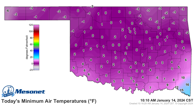
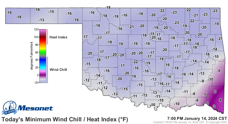
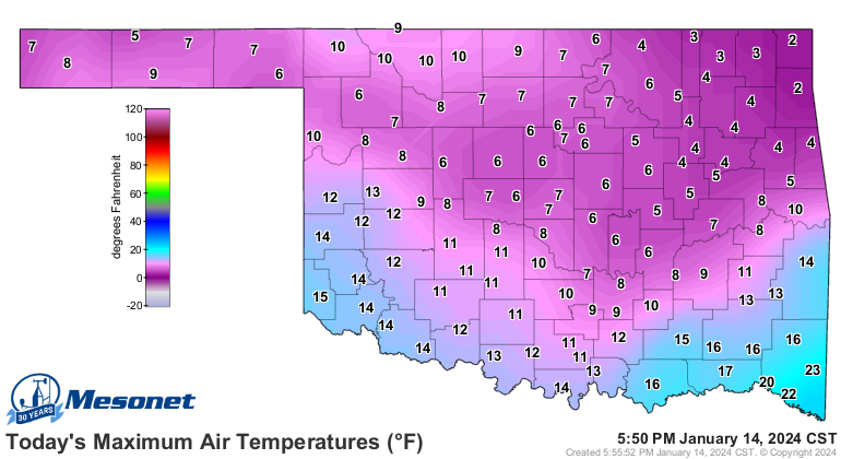
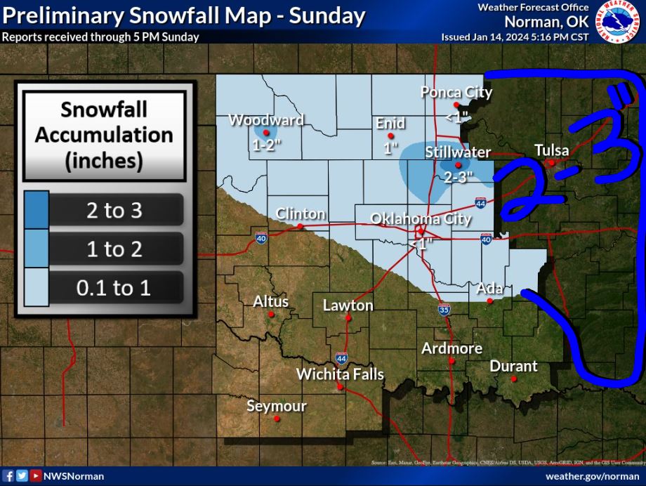
Low and High temperatures on Sunday were brutal along with the wind chill temperature. Any time you dip below zero at night and hold into the single digits during the day, you know it’s cold! The snow that fell varied in coverage with E OK getting the heavier totals between 2-3″ in some areas.
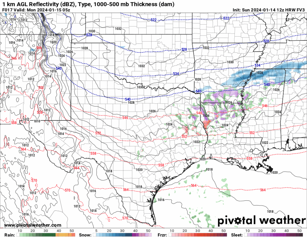
Another upper disturbance will zip through tonight producing a light dusting of snow with a final round late Monday but only a few clouds or flurries with that one. The animation below shows the snow for Oklahoma and the wintry mix for Texas including sleet and light freezing rain.
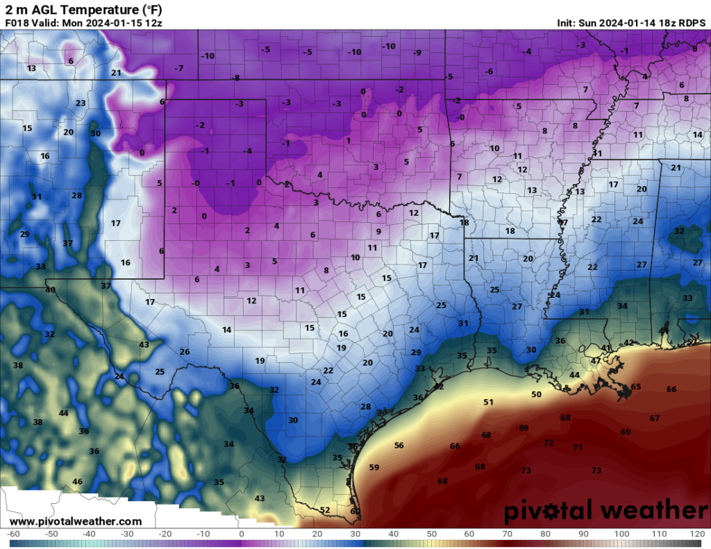
Because the clouds are hanging around and winds aren’t dying down completely, we won’t bottom out to the dewpoint temperature overnight Sunday or Monday. Regardless, it will still be bitter cold on both Monday and Tuesday morning. If skies clear and winds drop off for Tuesday morning, then those forecasted lows will be closer to the dewpoint values as shown.
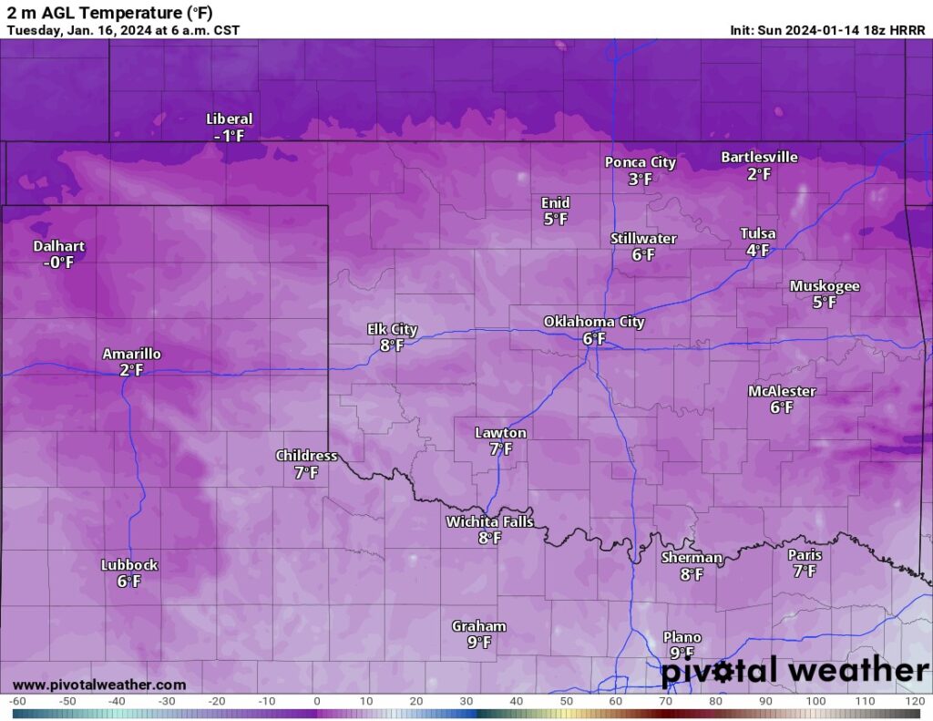
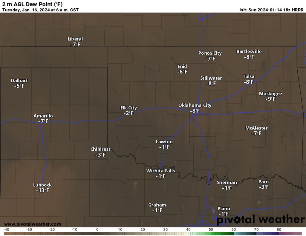
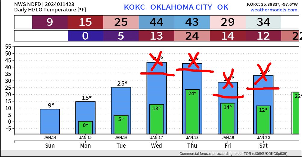
Often times the models are too quick to warm us up. The arctic air is difficult to erode and mix out. So always hold off on the big warmup that’s advertised. Usually, that trick will hold for the questionable day but the day after it will soar. This time around we have another cold front coming in to prevent that big thaw. So while we may briefly hit 32 degrees in OKC Wednesday, a cold front that night will prevent a thaw for Thursday. Then another arctic blast arrives knocking us back into the lower 20s during the day Friday.
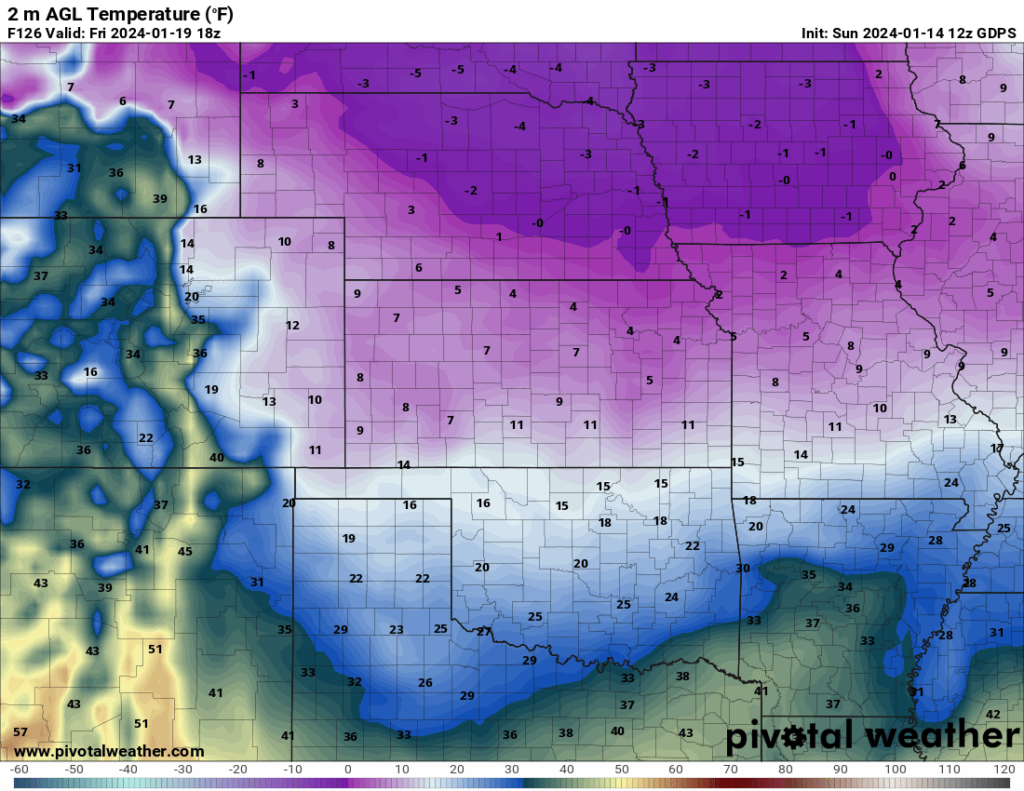
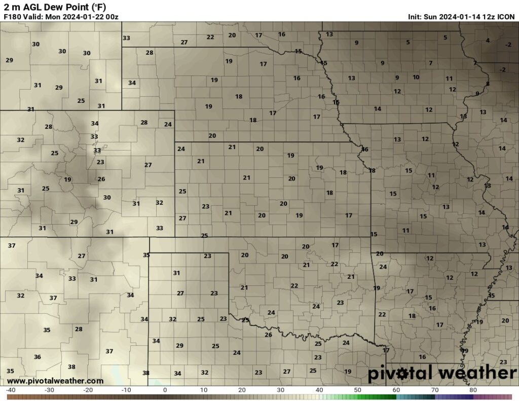
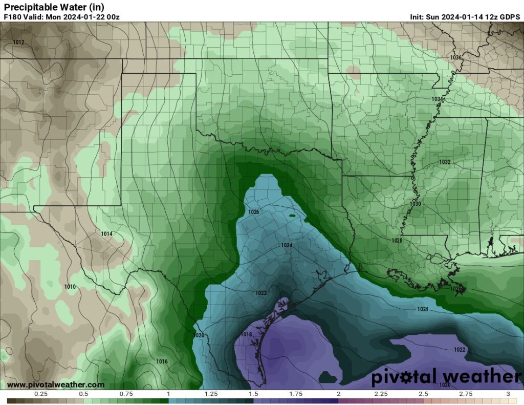
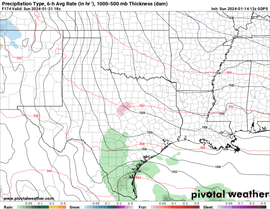
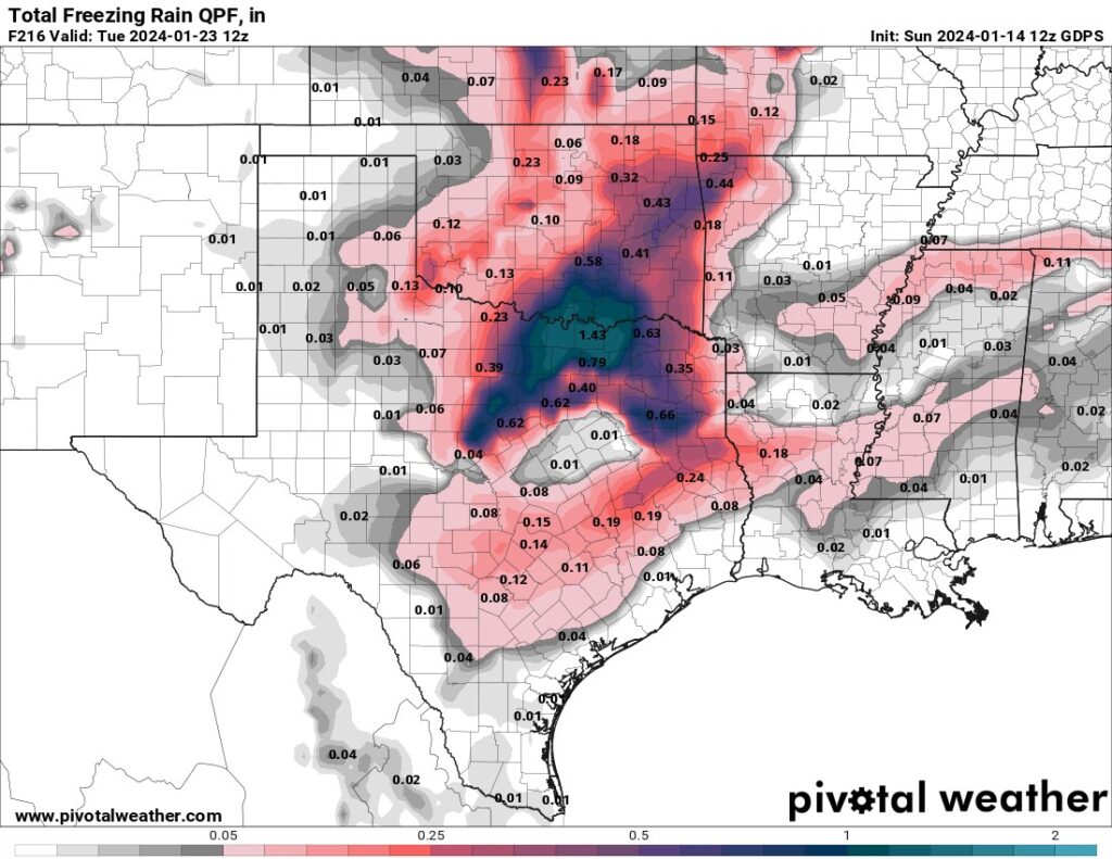
The arctic air will be slow to modify over the upcoming weekend. Sunday low-level moisture will stream northward from the Gulf of Mexico increasing cloud cover and preventing a warmup. As the precipitable water increases, light rain and drizzle will form. The problem with this is that temperatures won’t recover enough to get us above freezing. With temperatures expected to be in the upper 20s and dewpoints in the low 20s, that means wet-bulb temperatures will be in the mid-20s which is not good. This would allow a significant ice storm to develop across OK and parts of N TX until temperatures finally moderate with warm air advection over time. It’s hard to say this far out what the exact temperatures will be and how long they may stay below freezing. The best outcome would be ice at the beginning of the event but getting so much precipitation that it warms the arctic airmass from above and the ice melts say by Monday morning for example. I’ll have to watch for this setup over the coming days.
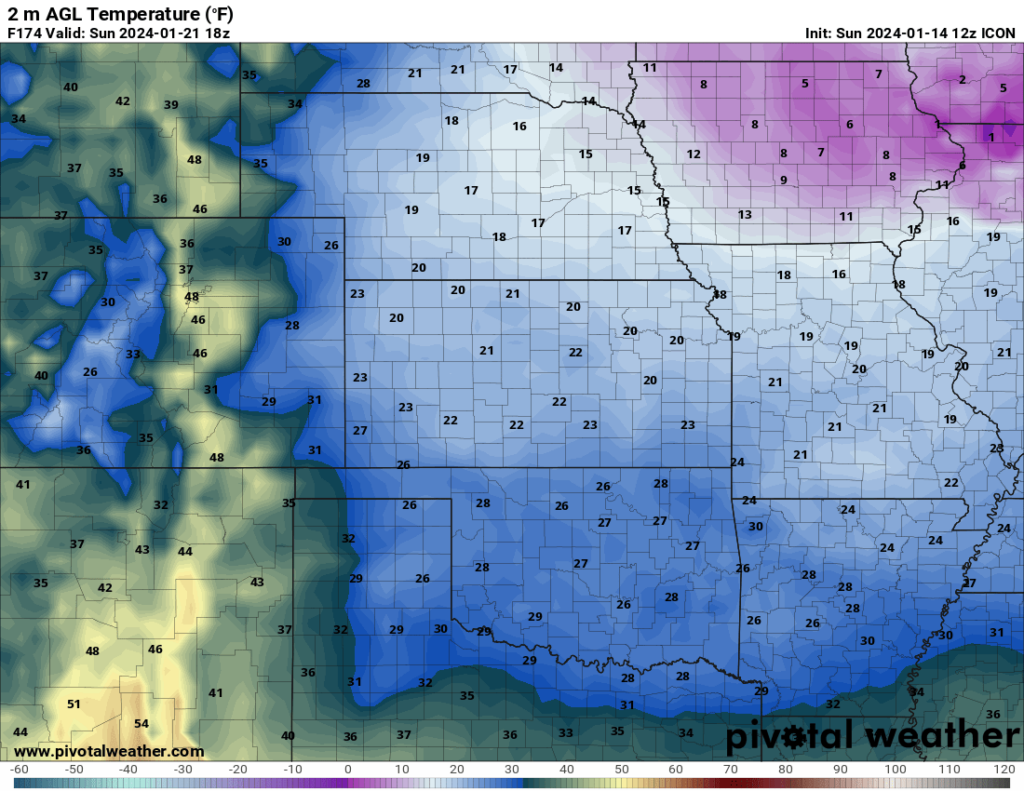
If you are in a situation where your pipes have frozen, it may be until Wednesday or Thursday before they thaw. Those are the only two days this week where temperatures have a least a chance to get into the 30s and above freezing. I reduced the numbers on the 7 day according to my rule of thumb and the secondary cold front for Thursday. We’ll probably top out near the red lines. Stay warm out there! -AT
