Mild Start, Freezing Drizzle, Possible Snow, and Feb Cold
I was really hoping for an uneventful week with mild temperatures and lots of sun! It will start that way but we’ll have a few bumps along the way. I also looked at the long-range forecast to see if Old Man Winter will make a return with a vengeance.
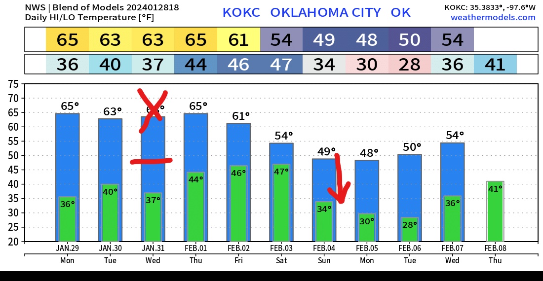
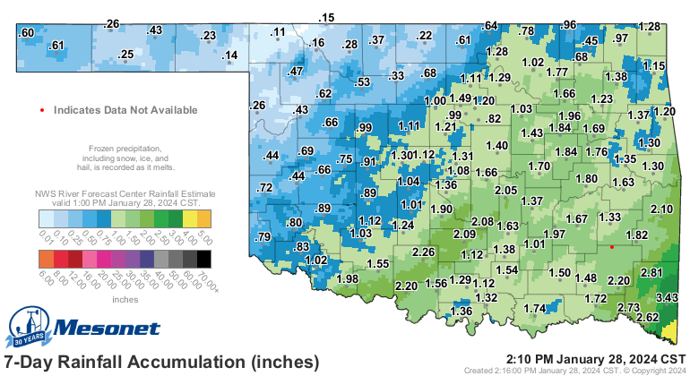
Let’s start with good news, which is we received some much-needed rainfall over the past week and that lots of 60s will return across the state Monday through Wednesday. The temperature maps below show the fly in the ointment between Tuesday afternoon and Wednesday however.

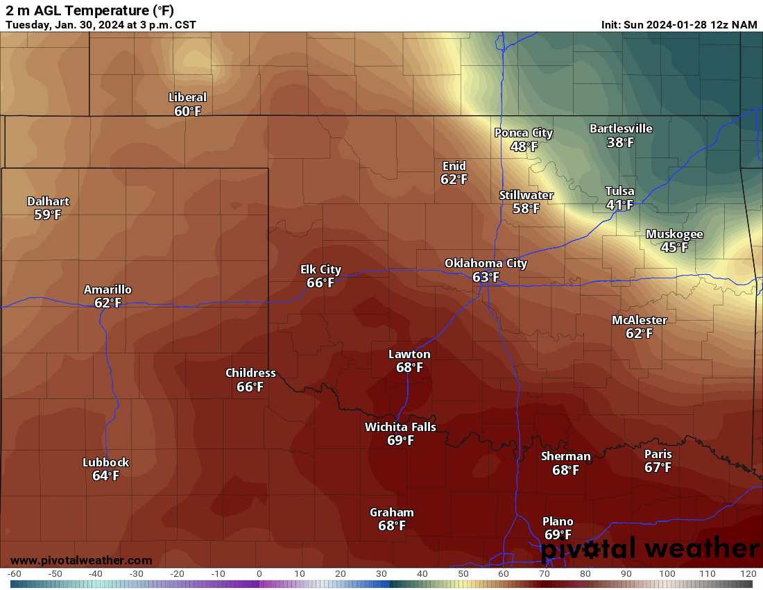
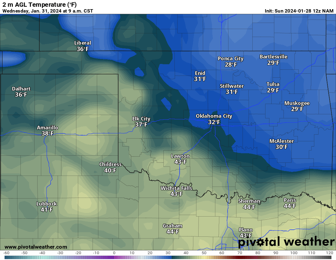
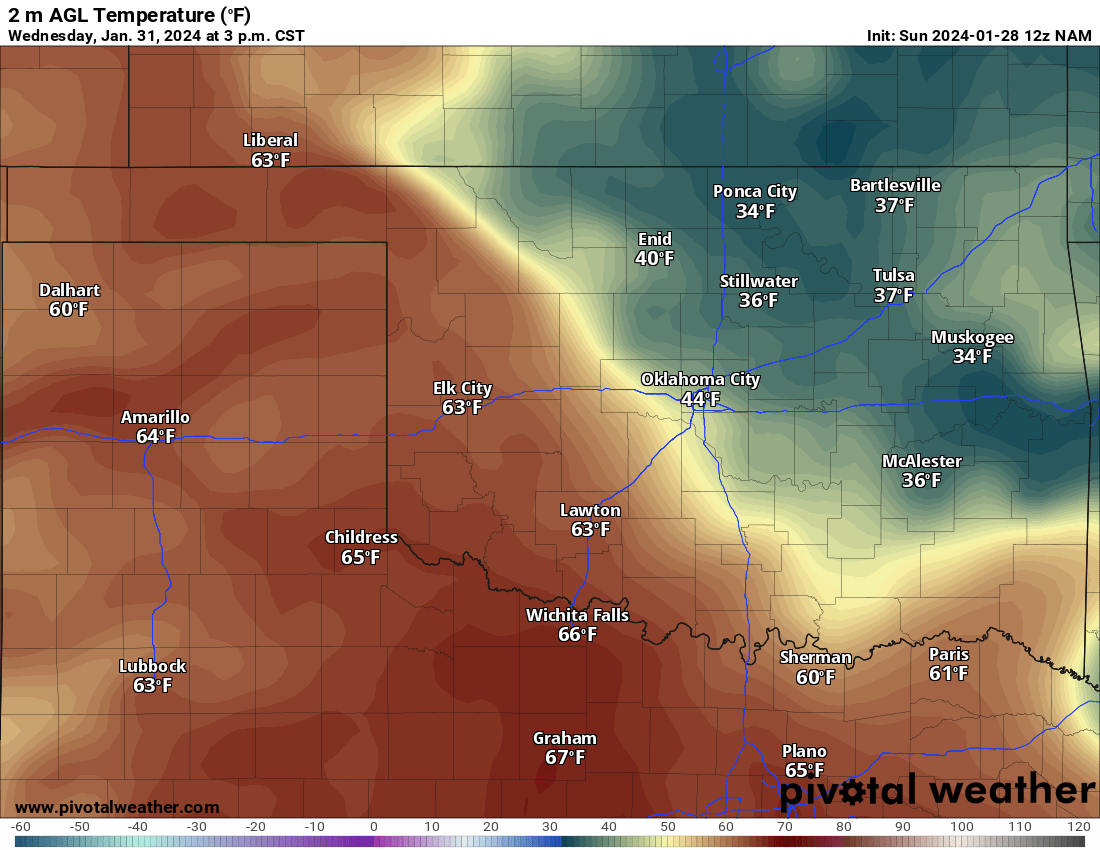
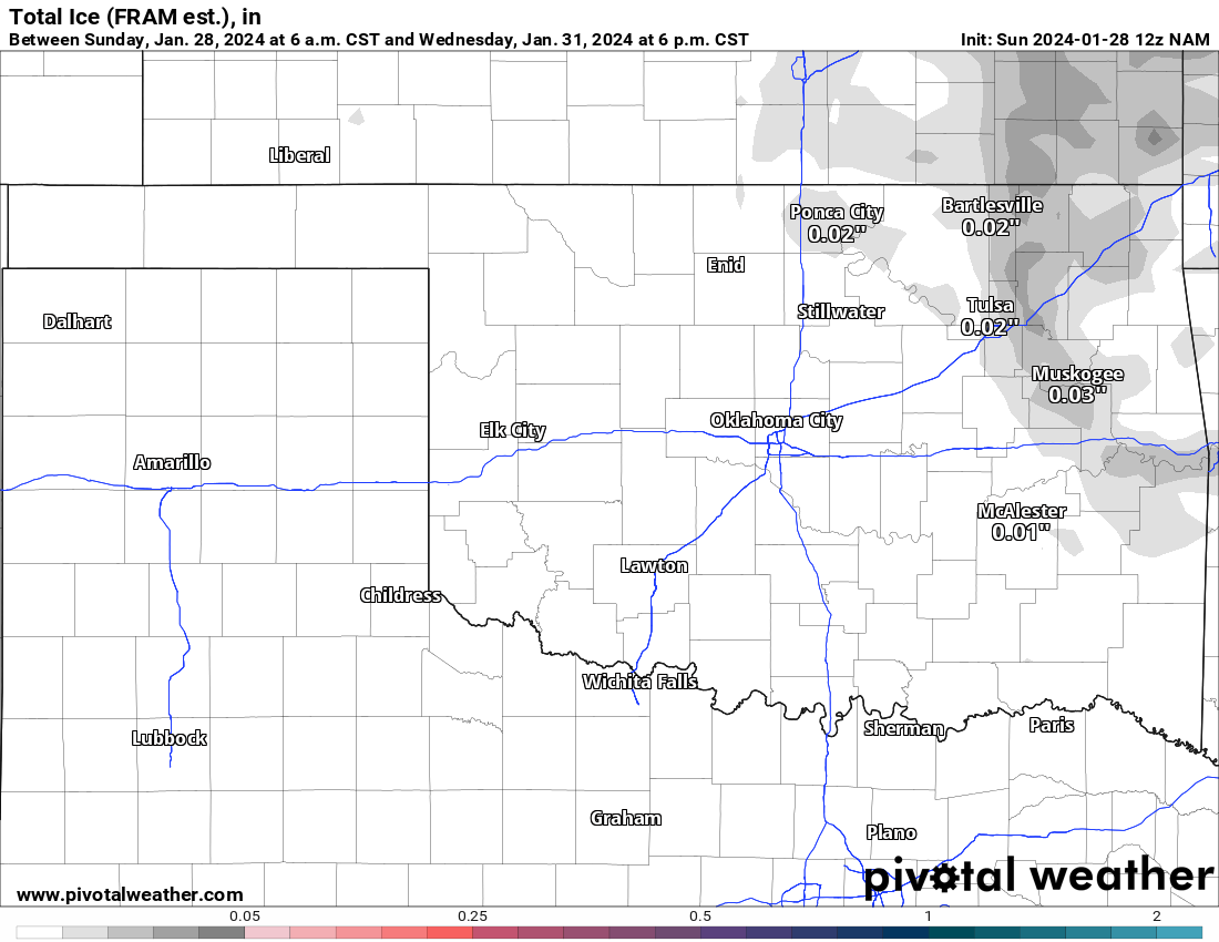
The first thing that most weather forecasters will miss is the freezing drizzle event Tuesday night and Wednesday morning across the NE 1/3 of the state. As of the time of this blog, the NWS forecast is calling for clear skies. I tracked a weak and shallow arctic airmass quickly dropping south out of Canada and into the Midwest Tuesday. This backdoors into Oklahoma dropping temperatures down to just below freezing overnight. I’m favoring the NAM model for this outcome as it’s one of the few to detect such an airmass that is only 50-75 mb in depth. Clouds will accompany the front as well, which is why those temperatures don’t recover much in the afternoon. So bottom line, be very careful if you are traveling after midnight Tuesday into early Wednesday morning in that blue area. This does include the OKC and Tulsa metro at this time, which means rush hour traffic in both cities could be on an ice skating rink. If the NAM model is too aggressive here, then there’s nothing to worry about, but now you know what is a possibility.
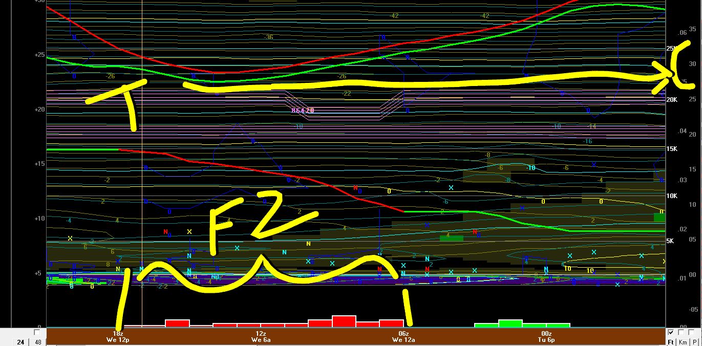
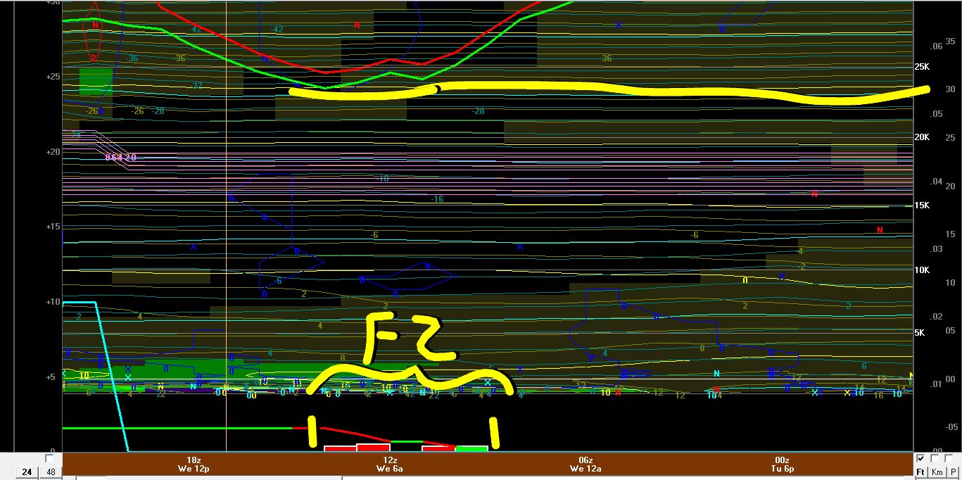
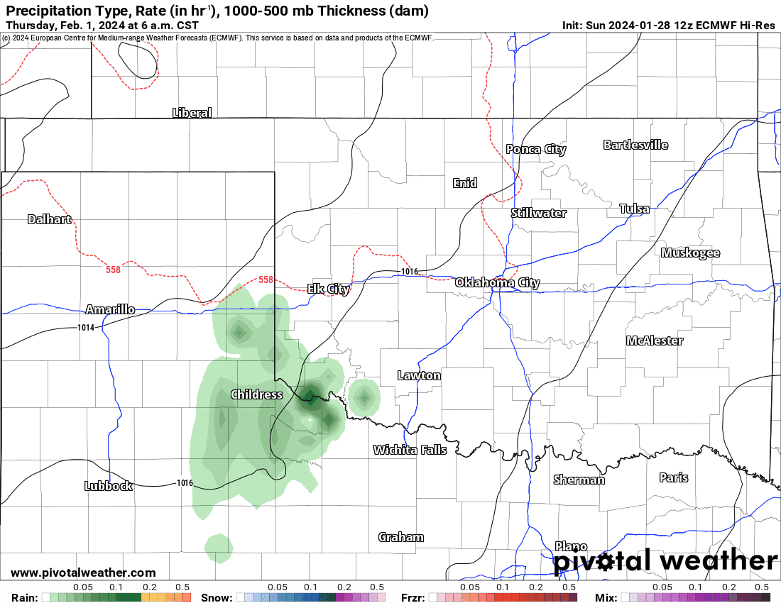
We can look at the vertical cross-section across both cities below. Notice the red bars, that represent accumulating freezing drizzle. The window for Tulsa is from midnight to 11am while for OKC it is from 4am to 9am. The yellow line at the top highlights how the temperature (red) and dewpoint (green) drop below freezing during the time windows (temp scale on far right). It only takes 1/100th to cause problems and if crews don’t treat the bridges and overpasses beforehand, you can end up with a black ice nightmare. As of now, the model indicates measurable ice accumulation across NE OK.

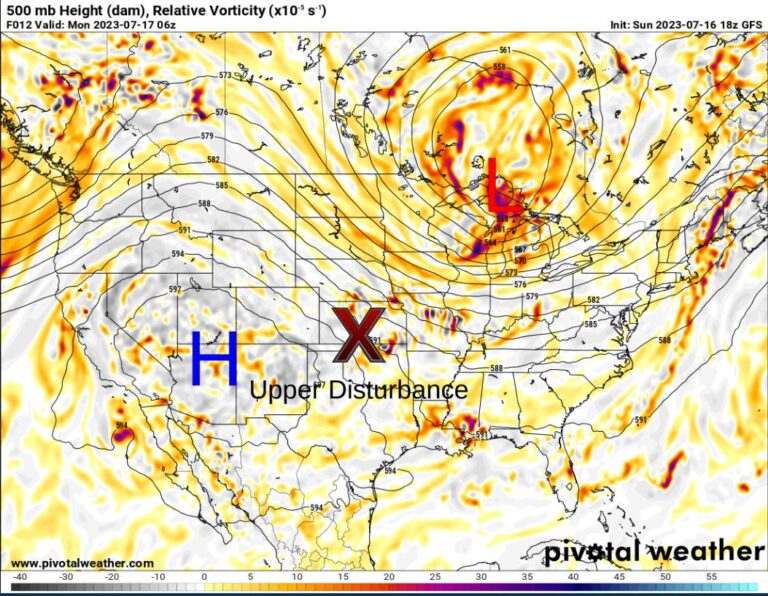
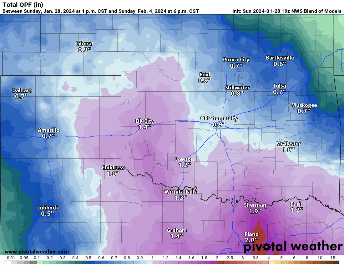
After this event, the focus is on the upper storm system approaching from the SW. Take a look at the snapshot of the Jetstream below. It shows the upper low affecting our region by the weekend. It also shows a ridge across Canada which will drive in another weak arctic surface high into the Midwest with it backdooring into Oklahoma again for Sunday. The lift in the atmosphere will get the rain going in two stages. The first is with a little light rain scattered across the state on Thursday. The next round starts Friday afternoon and continues through Sunday. See the animation below. Estimated rainfall totals look decent as well.
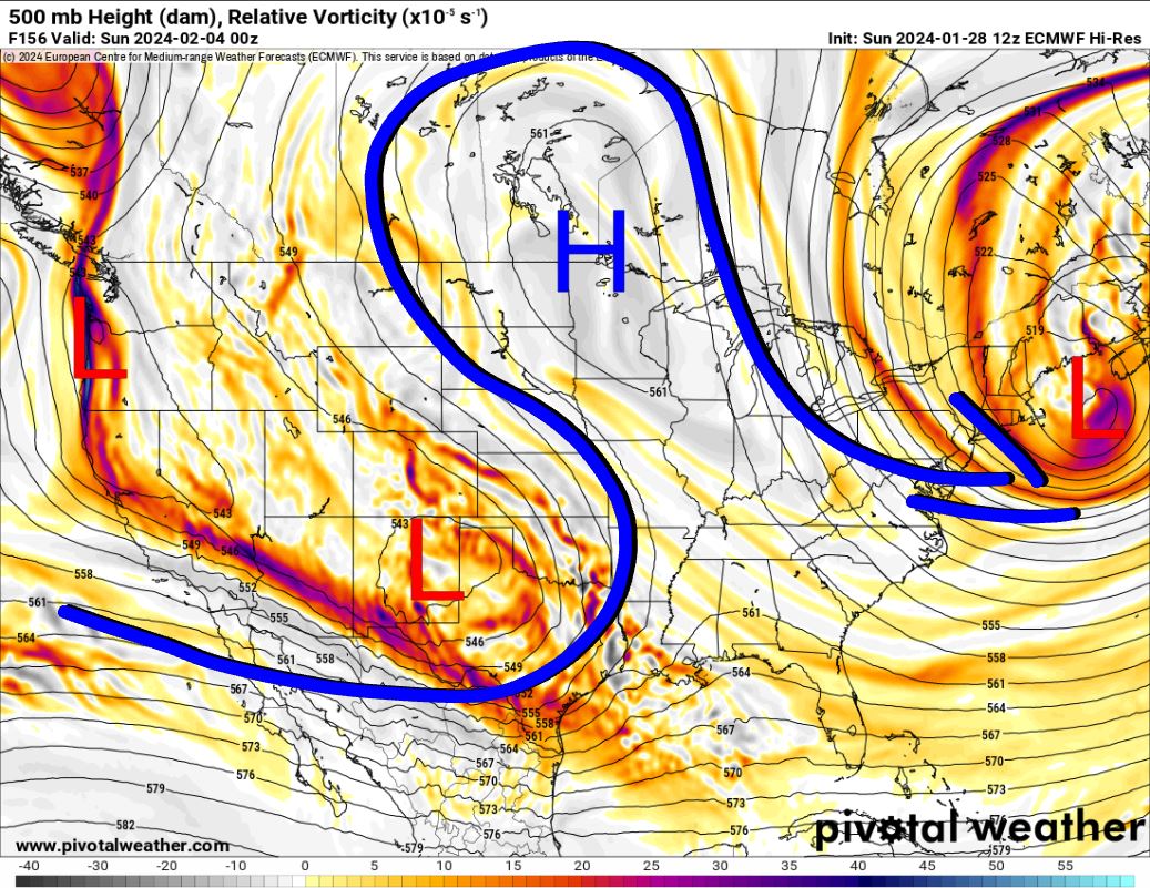
Now the question is what happens on Sunday. Only the German Icon model thinks that the source region of the arctic air may be cold enough for snow here by late afternoon. Other models lose the surface high which I think is a mistake. So my bet is on a colder airmass. Secondly, some of the models bring the upper storm too far south into Texas which robs Oklahoma of precipitation on Sunday. I’m betting against this too and keeping it on a more northward track. So due to the above, my forecast today would be for a mix of rain and snow next Sunday afternoon as the system starts to pull away. Amounts would probably be light, but we can look at that later, should this outcome develop.

Buy or Sell today with Results That Move You!
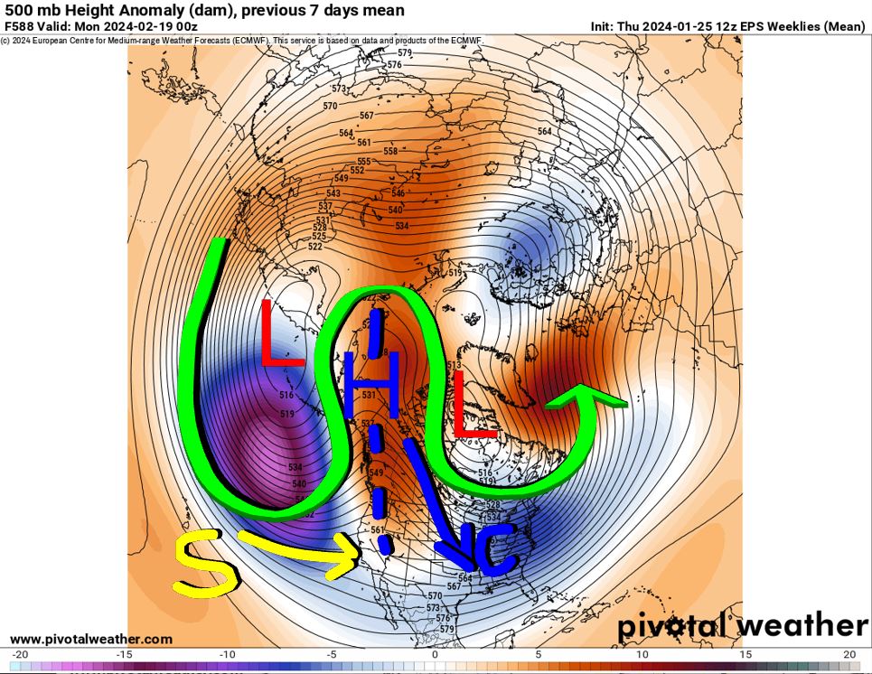
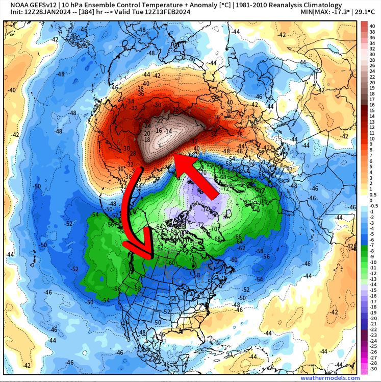
So are frigid winter temperatures returning? I took a look at the long-range forecast and noticed that we will have an Omega-blocking pattern developing by mid-February with the high building up near the N Pole and a trough on either side. This allows cold air to spill southward back into the US and the position of the ridge axis should allow a direct shot or two into Oklahoma. At the same time, we do have well below normal heights at the base of the upper low to the west. This could translate into storm systems riding under the ridge, indicated by the yellow line, and into our region. In addition to this, we might have another Sudden Stratospheric Warming Event where you see that large red blob that will rotate in our direction before collapsing. It’s very far out and the model stops on the last image shown below. This would cause the temperatures to be even colder if it were to happen. So the bottom line is to expect a colder 2nd half to February with opportunities for more winter precipitation.
Finally, we get to your temperatures over the next several days. The trend is an overall warmer one compared to the past 2 weeks, but not without nuances. OKC is shown below. You can always get your town’s forecast with my free weather app, ATsWeatherToGo, found on the Apple and Google App Stores. You can also use this website as well. Stay tuned! -AT