Severe Storms Then Chilly and Wet
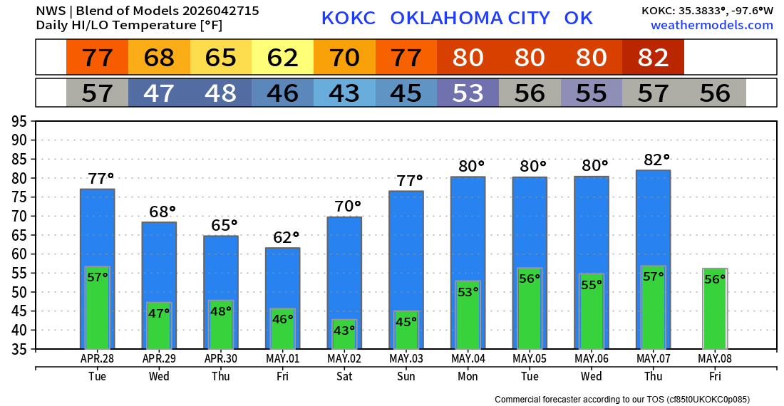
We have an interesting week ahead. Severe weather will be pushed off to the east, and then an upper low will move slowly across the area, bringing much cooler air and beneficial rain. A great weekend will follow.
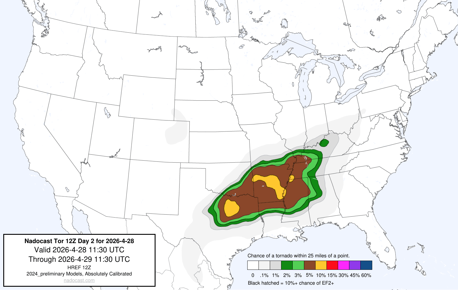
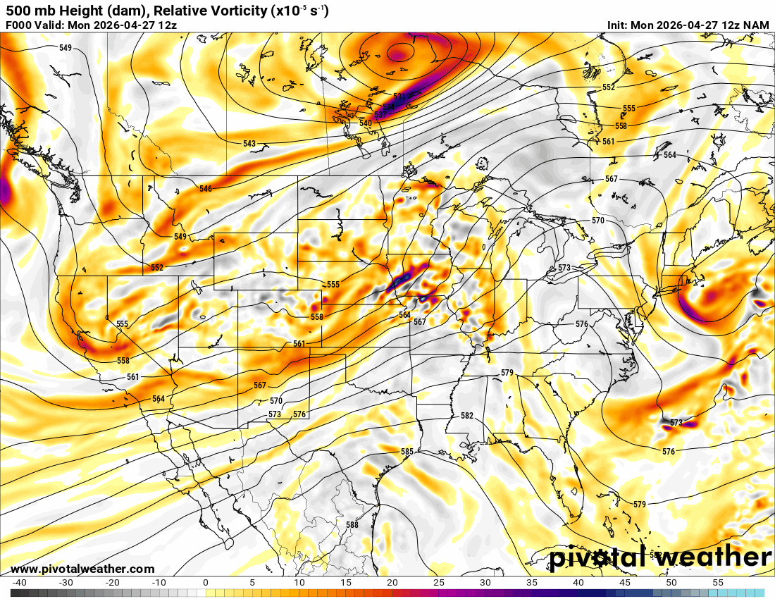
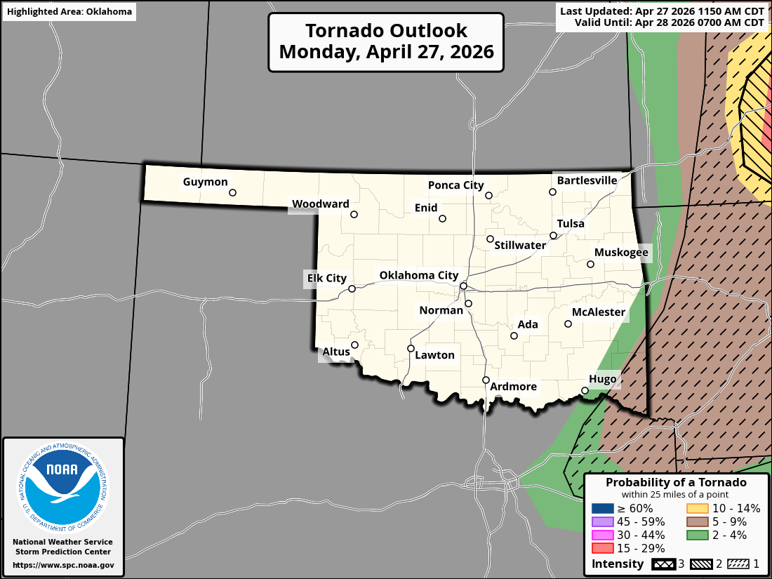
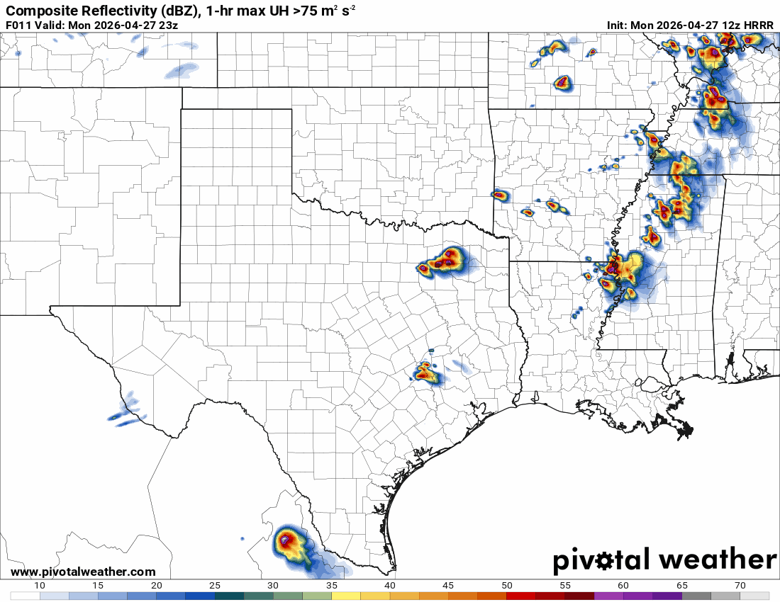
A few tornadoes occurred last week, and we’ll likely have a couple more across SE OK if not today, then tomorrow. The Jetstream animation shows we have disturbances moving through before the main upper low moves in on Thursday. The dryline will form across E OK, which places the severe threat across SE OK, N TX, and AR both days.

Ferguson Roof Systems is offering an AT's Weather special!
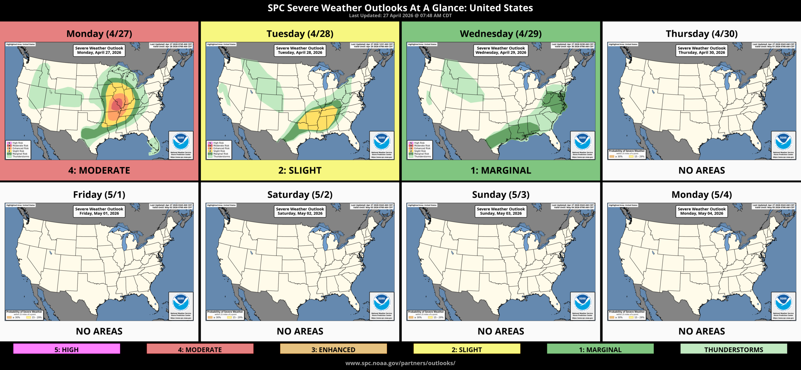
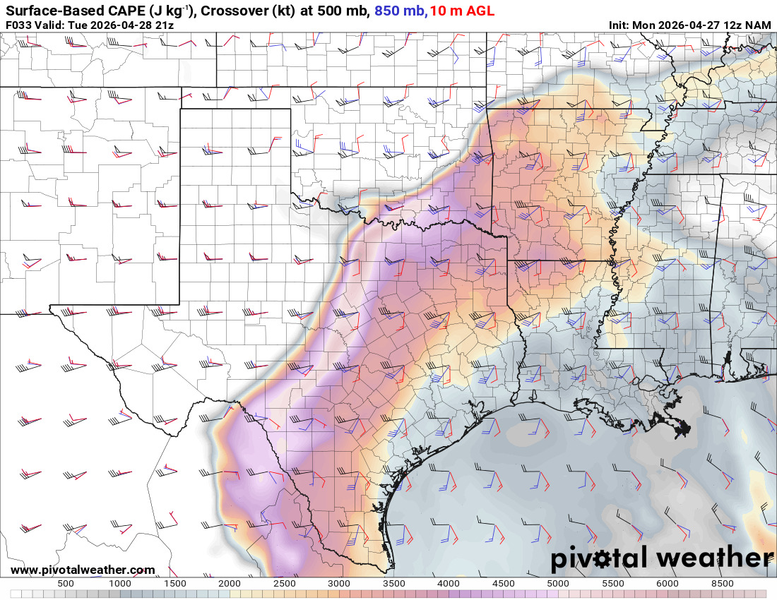
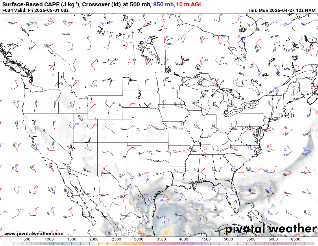
After the round of storms moves through, the instability gets shoved deep into Texas. This allows the upper low to come across late week without severe storms. That’s very unusual for the 1st of May.
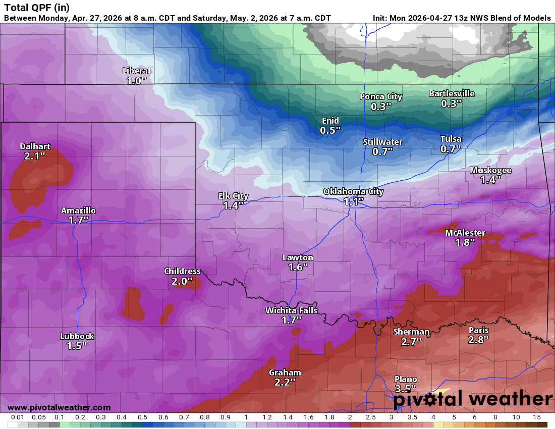
The upper low could drift a little more south, and if it does, the following rainfall totals will have to be adjusted southward as well.
Ferguson Roof Systems is offering an AT's Weather special!
Temperatures are going to be chilly for a bit, but no threat of a frost or freeze across the state at this time.