New Year’s Forecast and More Snow On the Way
Last week I talked about a SSW (Sudden Stratospheric Warming) event. This brings true winter to the US and will start the 2nd week of January and persist through mid-February. It often accompanies the new term thrown around for clicks, the polar vortex. With the cold air and storm systems to work with, we should have a little fun around Oklahoma.
Here’s the discussion from my Facebook post about the SSW:

Ferguson Roof Systems is offering an AT's Weather special!
The models continue to advertise a split in the Polar Vortex. There is still a discrepancy if the feature will set up across the W US/CA or the usual Great Lakes region. Regardless, during the transition, true arctic air will invade North America. As of today, it appears the 2nd week of January through the following 30 days will be bitterly cold for the US overall.
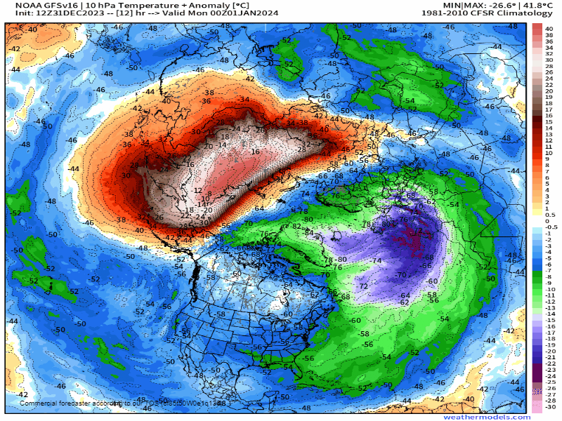
The tipoff for this event is the SSW (Sudden Stratospheric Warming) at 10hPa (see animation). Note the large red area of above-normal temperatures around 16+ miles up into the atmosphere. As it grows and expands it shifts south into the US. Now at the end of this animation, the temperatures modify. That would limit the amount of cold we receive on the extended days. However, more rounds can come after that if the pattern holds.

Be sure to mention Aaron Tuttle when you call (405) 820-1193!
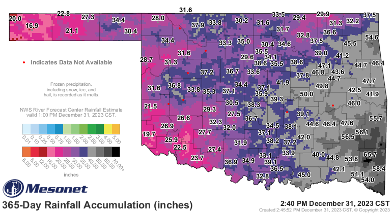
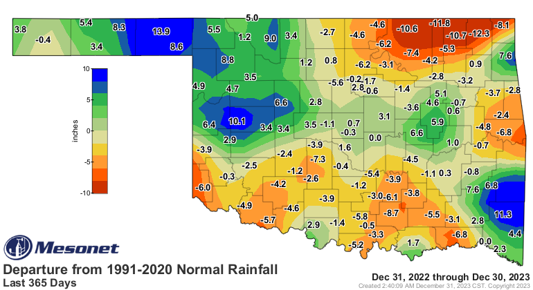
Before we get into the active Jetstream and cold pattern for January, let’s quickly recap how our year’s precipitation went. It’s important we end each year close to our normal amounts so our water table stays full and our drought is kept at bay. Some parts of the state got well more than they bargained for, ironically in areas that typically don’t get enough. the NE was the hardest hit with nearly a foot under.
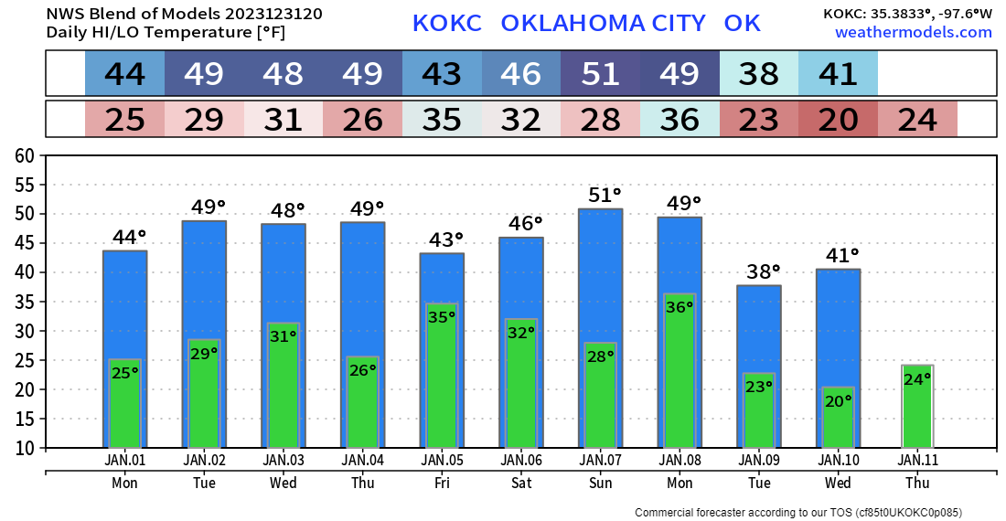
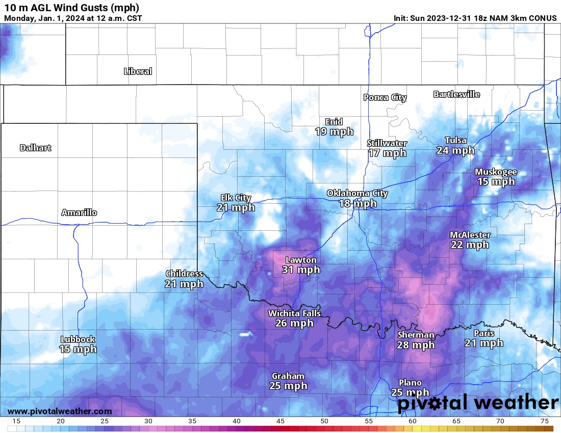
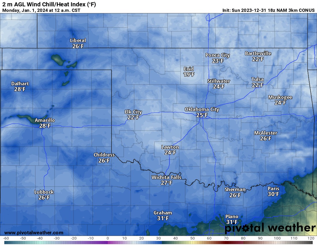
So what does 2024 have in store? We’ll start at midnight for your New Year resolution celebrations. It’s going to be cold, so bundle up! North winds will die off across the north, but still gusty down south. Wind chill values will be in the 20s many areas. Skies will be partly cloudy.
 Restoration and Disaster Cleanup Service
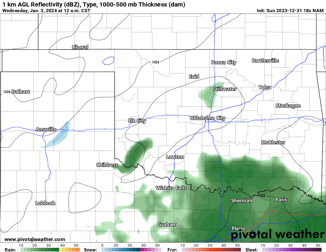
Our first weak storm system will move through late Tuesday. Expect scattered light showers as it moves through. We may see a few wet snowflakes mixed in, but don’t expect anything significant.
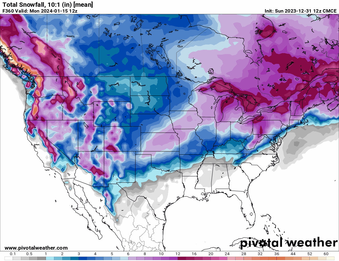
The next system after that will have a little more cold air to work with and a stronger storm core with a more favorable track across Oklahoma. This means we might have some decent snowfall with this system. Models as usually can’t predict the amount, but it does provide confidence that snow will fall in the area and accumulate. It may be one of those deals where Kansas gets dumped on and Oklahoma gets just a taste. Stay tuned this week for updates!
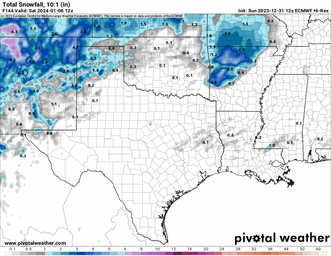
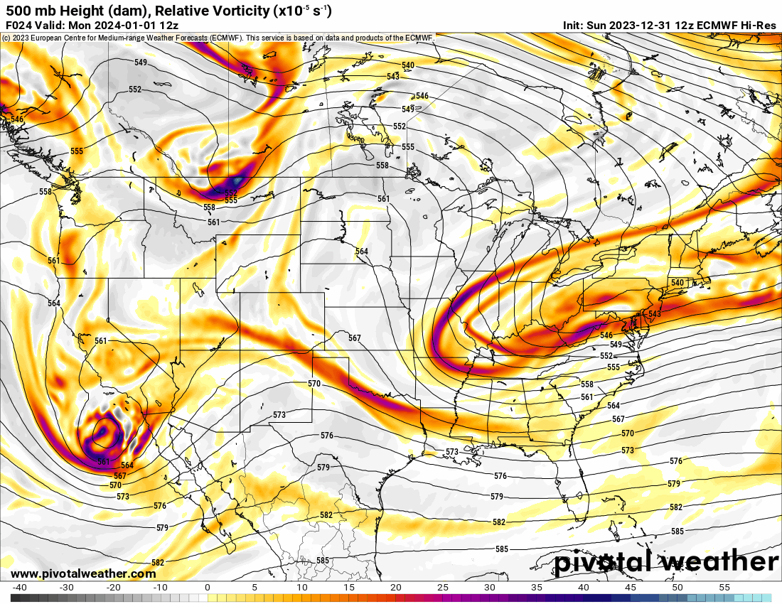
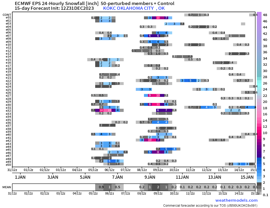
Let’s take a quick look at the Jetstream pattern before we talk about more snow. Count the number of waves that move through (large red globs). Each of these provide lift and if enough cold air in place, winter precipitation. So we’ve got some action headed our way and with the aforementioned SSW should have cold air to work with on some of these. Below the Jetstream animation, you’ll see the European Ensemble plot which indicates several of its members think it will snow here in OKC Friday and the following Monday with more signals after that. The global ensemble models all indicate measurable snow in Oklahoma over the next two weeks.
Temperatures leading up to this unsettled period will be about normal. On the last two days of this model blend, expect changes, and odds are much colder. Stay tuned! -AT