Weather Highlight – A lot of Rain Coming

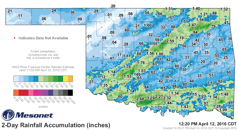
We just finished up a nice rain event, see the map below for final totals. Now attention focuses on what’s next.
So we have two upper level storms systems to move through the state/region. The first will be on Wednesday, and the second will be this weekend.
Wednesday’s storm is small and weak but enough to generate about a quarter to half inch of rain as it moves through C/SC OK. Should start clearing the state by Wednesday evening.
The second storm system is very large/broad. This allows copious amounts of gulf moisture to stream in from the south and with a more linear wind profile in the atmosphere, more of that heavy tropical rain. This also helps to limit the severe weather a bit. I’m sure we’ll still get some, but the big story may end up being the flash flooding aspect.
We’re pretty far out on timing, but as of today, heavy rain will occur across the TX/OK panhandle Friday and that shifts E slowly for Saturday. Models differ but consensus will likely be dry in OKC Saturday morning, then rain developing around lunch time and getting heavy by evening. Heavy rain will occur Saturday night and parts of our Sunday before slowly moving east. Still some lingering showers through Monday.
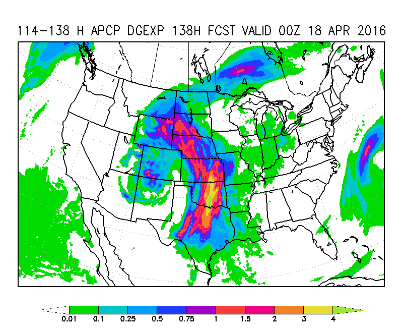
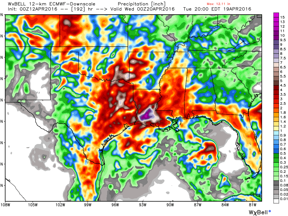
You can get an idea on rainfall amounts that the computer models are indicating below, several inches. Just look at these as an overall trend as they will fluctuate over any particular area.
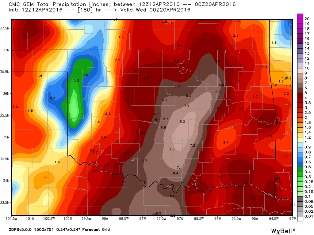
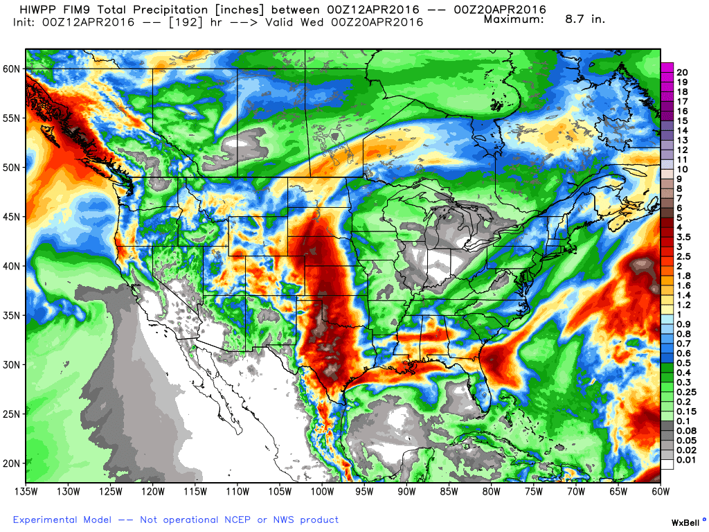

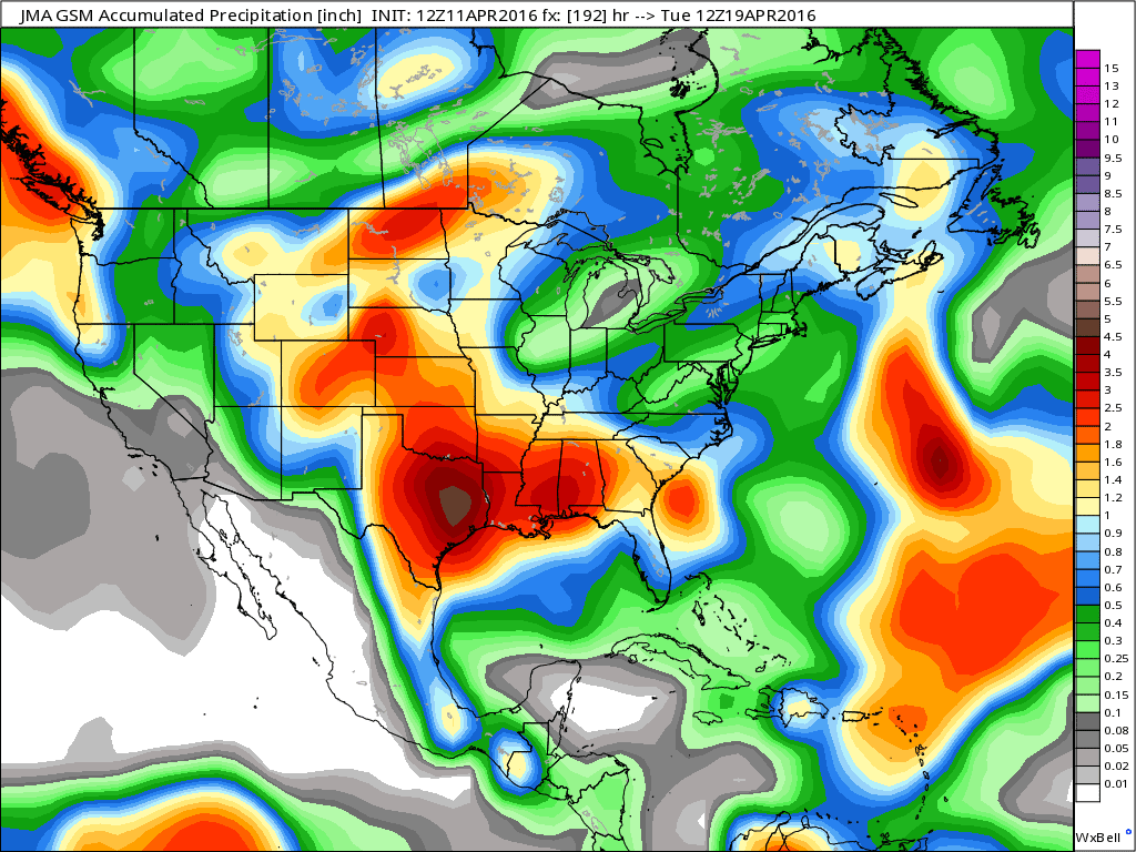
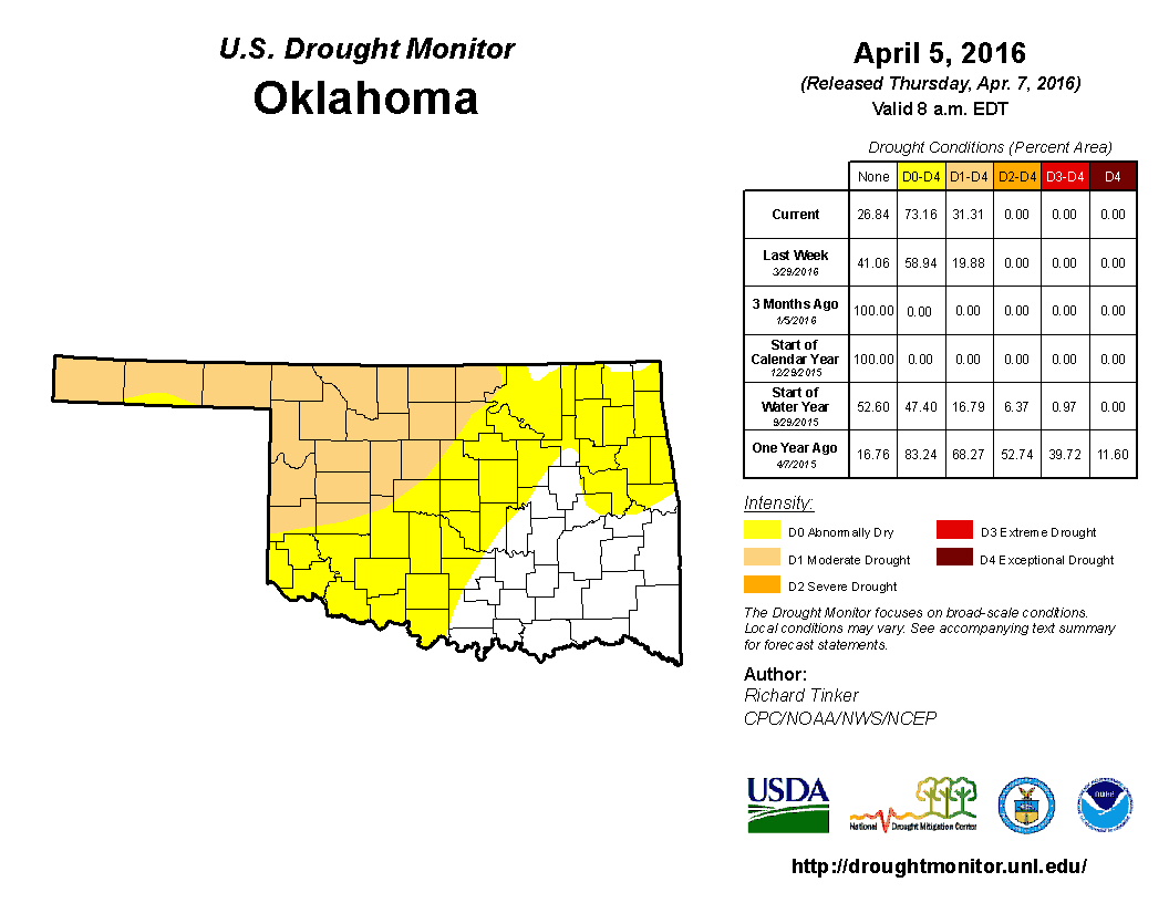
The good news is this will help keep the drought at bay as it was creeping in these past few months.