Weekend Outlook

Another cold front is heading this way and it has more bark than bite.
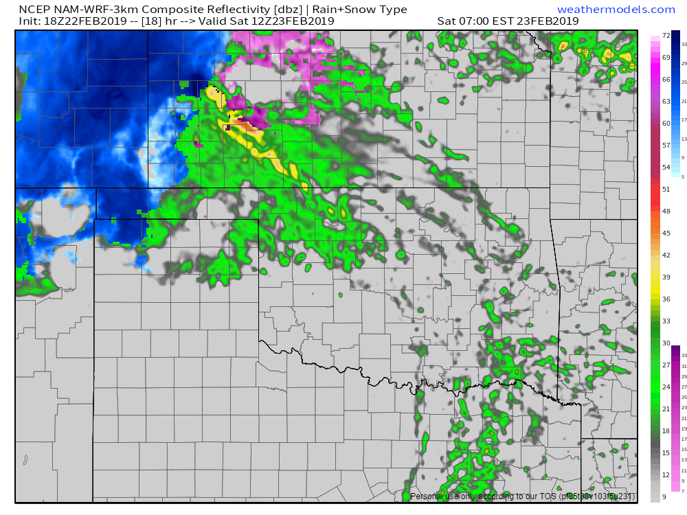
For Friday night through Saturday morning expect light showers to move across the state.
Ferguson Roof Systems is offering an AT's Weather special, Call Today!
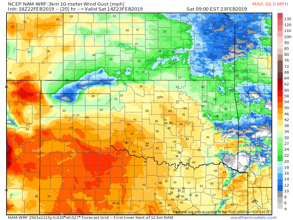
The bigger story will be the strong southwest winds gusting up to 50 mph initially before they die down to 30 mph by afternoon and switch directions to the NW.
[su_spacer][ad id=”1787″]
Ferguson Roof Systems is offering an AT's Weather special, Call Today!
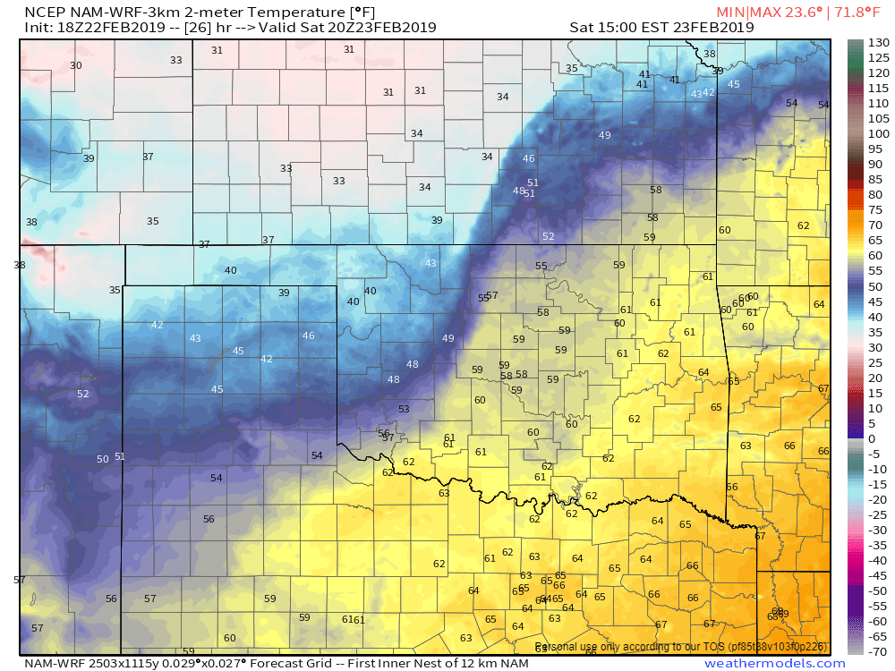
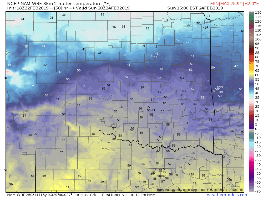
Temperatures out ahead of the front will warm up a bit Saturday afternoon. By Sunday morning they will cool back into the 20s and 30s but will be pretty nice under sunshine and light winds by afternoon.

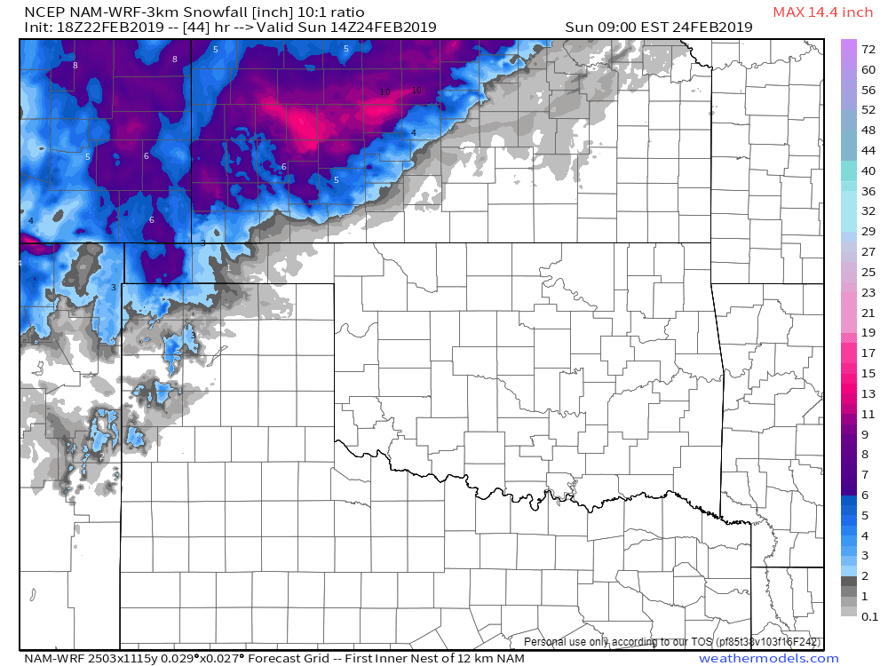
There will be a little snow with this system as well in the panhandle and in Kansas.

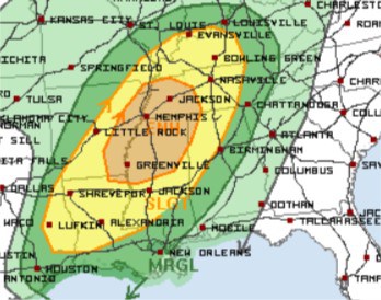
One final note is the severe weather expected out east Saturday afternoon/evening. If you have a loved one or family member that lives in the area indicated below, tell them to use my free weather app, ATsWeatherToGo, to get up to 15 minutes of early tornado detection. You just might save their life in doing so! -AT
[su_spacer][ad id=”1787″]