Monday Tornado Outbreak Across Kansas and Oklahoma
So are we getting tornadic storms Monday? The short answer is yes. For once the atmosphere is actually loaded with all of the ingredients this time around that the prior systems did not contain. Oklahoma and Kansas will have robust shear, enormous instability, a surface trigger, and proper placement of the upper jetstream. All of these ingredients will boost the strength of storms and allow many of them to produce very large hail, damaging winds, and strong long-track tornadoes. But what about the CAP? Yes, we will have one and once again models diverge on how to handle it.
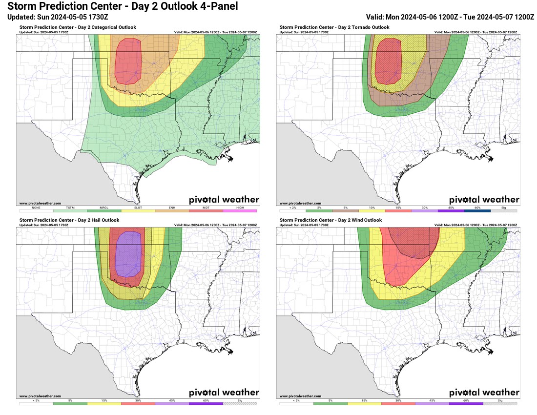
First, let’s set up the event with what we know. For one the Storm Prediction Center has us in a Moderate Risk for severe storms. Could they upgrade to High? If they did, it would likely happen either in their morning or noon update after they ingest the balloon data to estimate cap strength.

Be sure to mention Aaron Tuttle when you call (405) 820-1193!
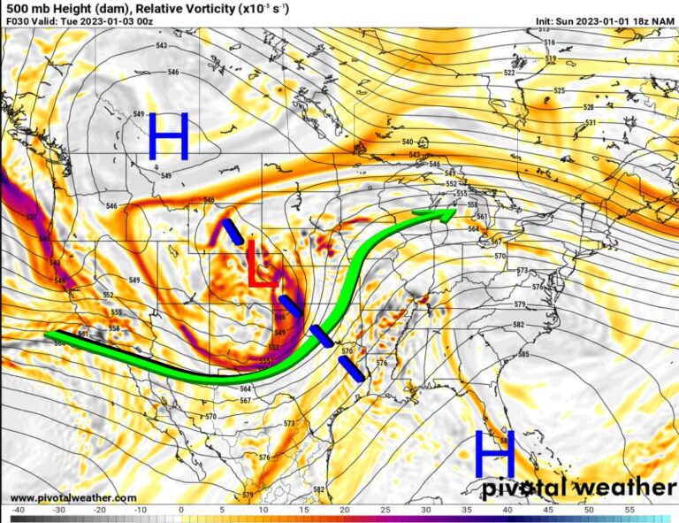
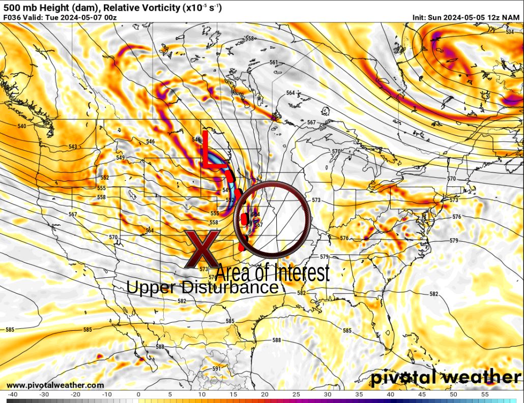
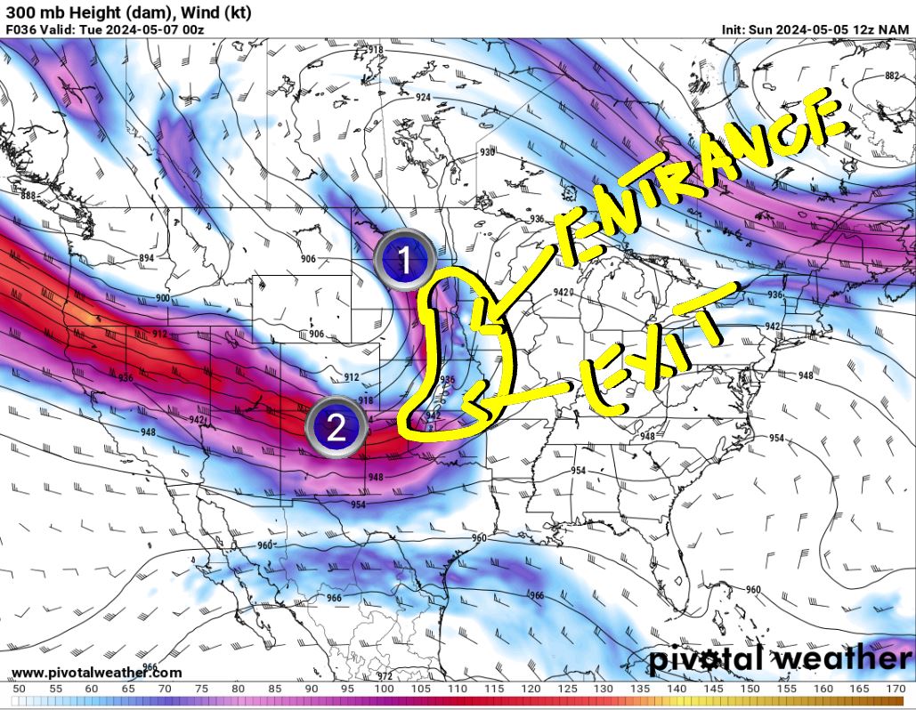
The 500mb upper low is far removed from Oklahoma, but a long trough axis extends SSE from it, creating lift in the atmosphere. This focuses most of the storm activity along and closer to the upper low. Farther south, we fight a capping inversion. However, there is an upper disturbance that will also aid in lift rounding out the bottom of the trough Monday evening/overnight keeping a storm threat going. The other major influence we have is two jet streaks moving overhead. The two circled areas indicate the entrance and exit region of each. This is where explosive storm development occurs. Other levels of the atmosphere not shown here show plenty of speed and directional shear in the lower levels.
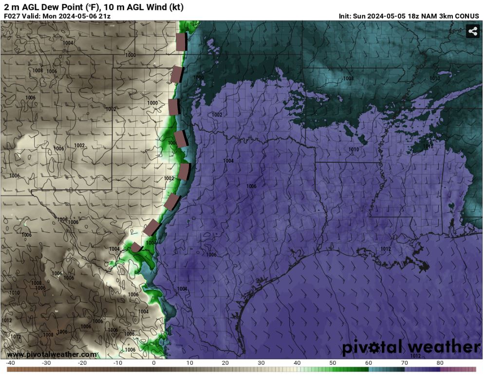
At the surface, we have our dryline forming along the Texas state line, and east of that we have plenty of shear and instability for storms to work with as dewpoints return to the upper 60s and low 70s.
Be sure to mention Aaron Tuttle when you call (405) 820-1193!

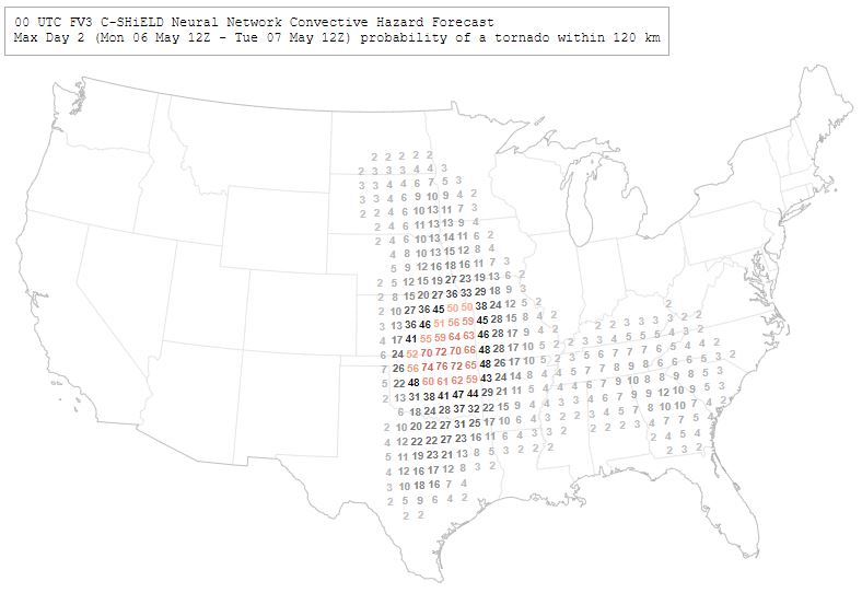
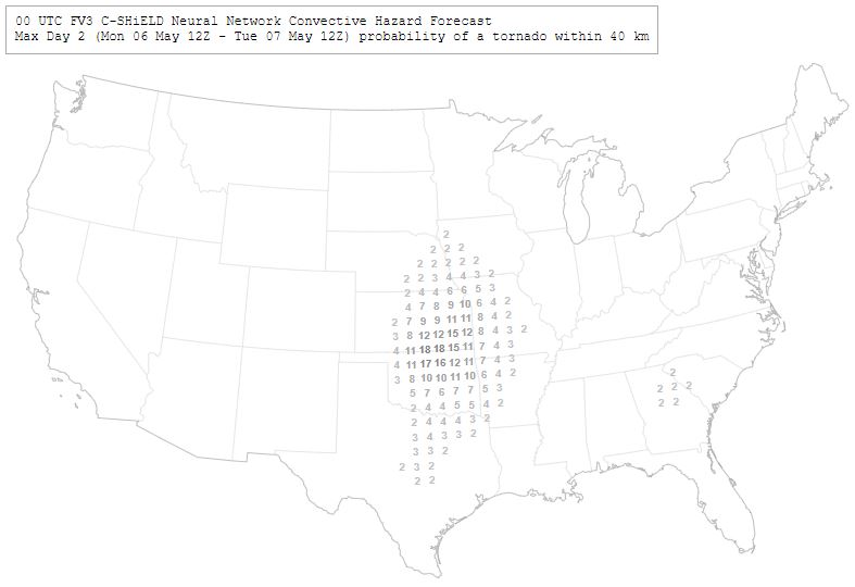
We have a few experimental models that have been in development over the past couple of years. One is based on a new dynamic core FV3 and the other based on our best short-term model HRRR. Both are running with a machine learning language model (AI) to plot probabilities of severe weather. The FV3 is shown with the probability of seeing a tornado using 120km (75 miles) and 40 km (25 miles). Notice how a tornado drops from a 76% probability within 75 miles in N OK, to only a 17% probability within 25 miles. What this tells you in general is that tornadoes are very small and as you shrink your area of interest, the probability of getting a tornado at one particular point gets lower. The take-home is the general area in which the model thinks there is a higher probability. Also note that this model tends to overestimate supercell development, so probabilities are a little high-biased as a result.
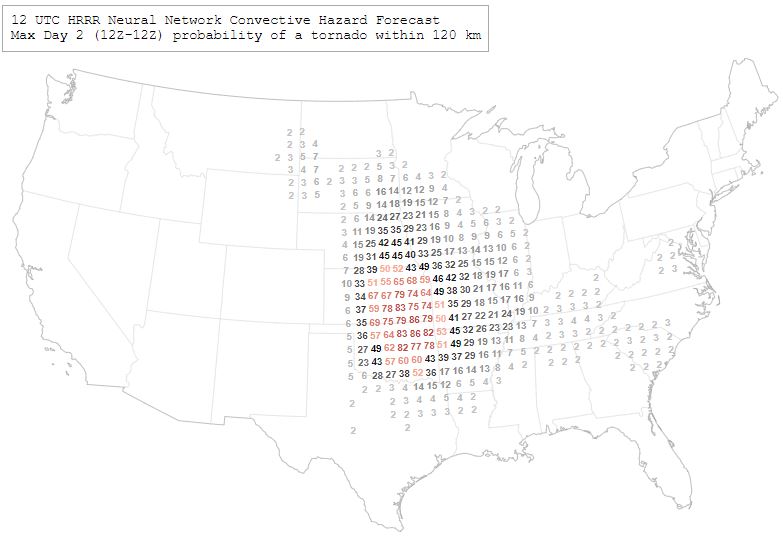
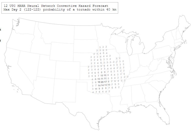
The HRRR model indicates a similar distribution but keeps those numbers out of Texas and focuses on the northern half of OK. The first map is any severe weather report, hail, wind, or tornado. The next two are tornadoes only. The point here is to see how much more likely it is to get hail and wind in any of these storms versus getting a tornado. Tornadoes are low-probability entities.
Be sure to mention Aaron Tuttle when you call (405) 820-1193!

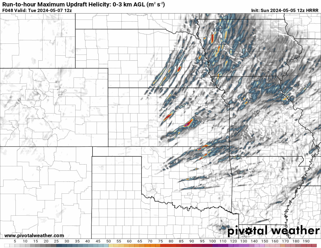
Our various convective models have a wide range of outcomes for Oklahoma. Some keep things north of I-40. Others have storms lined up N/S, and others have just SW OK moving only through far southern OK. What these signals tell us is that the CAP is a problem and each model tries to deal with it depending on which physics scheme it’s made with and how it resolves low-level temperatures and moisture distribution. I can tell you that the CAP is not uniform, it’s transient, and a very close call of breaking even in the dry model output. Look at a few of the outcomes below.
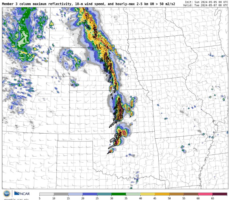
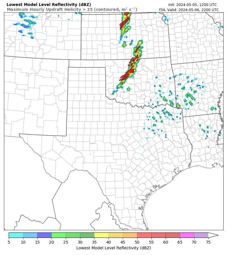
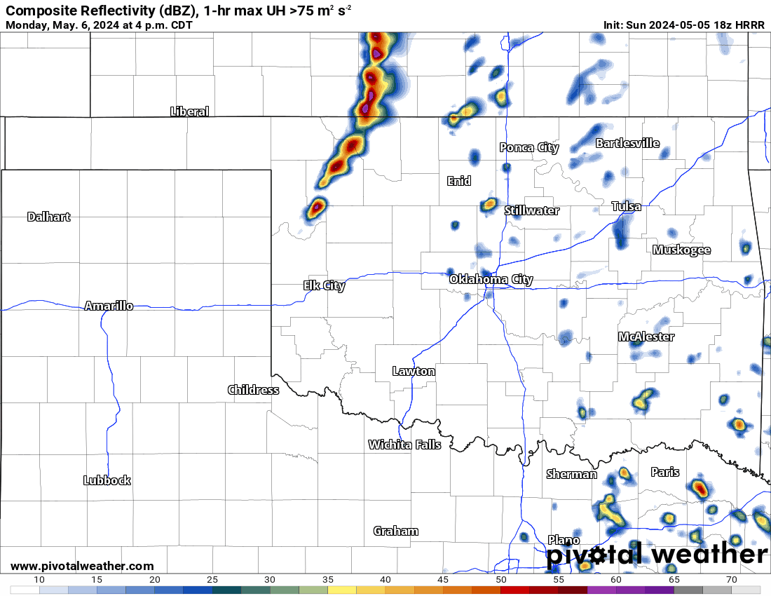

I could show you many more which splits the difference of the above but the take home in all of them are their helicity tracks. These indicate where supercells drop large hail, damaging wind, and tornadoes. Notice how many there are and the various positions. So the bottom line is regardless of how the models break out the storms, once they do, the environment supports all of the hazards. By the way, where you see the long narrow bright colored ones, those are the signals for long-track tornadoes.
We’ve discussed how the atmosphere will be conducive this time around for multiple tornadic storms and those that can produce long-lived, long-track tornadoes. Hail sizes can climb up to grapefruit size and wind in excess of 80 mph. We also have the unfortunate situation of an evening event which means tornadoes after dark. So as of now, this is my best guess as to how things will go. The CAP will break along the dryline in a few areas from NW to SW OK by 3pm. Those storms will travel E/NE at 50 mph at times. Inititially they will be high-based, meaning mostly wind/hail threat. As any storm moves into C OK after 5pm and especially any around at 7pm, the low-level jet will intensify shear. Any storm rooted in the boundary layer environment where the CAP is weak can produce strong long-track tornadoes. Unfortunately, this does include the greater OKC metro. By 8 pm most of these storms will travel east of I-35 for the remainder of the evening and will continue with all hazards up through midnight.
After we get through Monday’s event, things will be fairly quiet. A few weak storms will clip the NE quadrant of the state Wednesday and then again Saturday night and Sunday night across far W/SW OK. Rainfall amounts look decent across the state. The model will not pick up those isolated flash flooding amounts up to 3″ or more that can occur during severe weather.


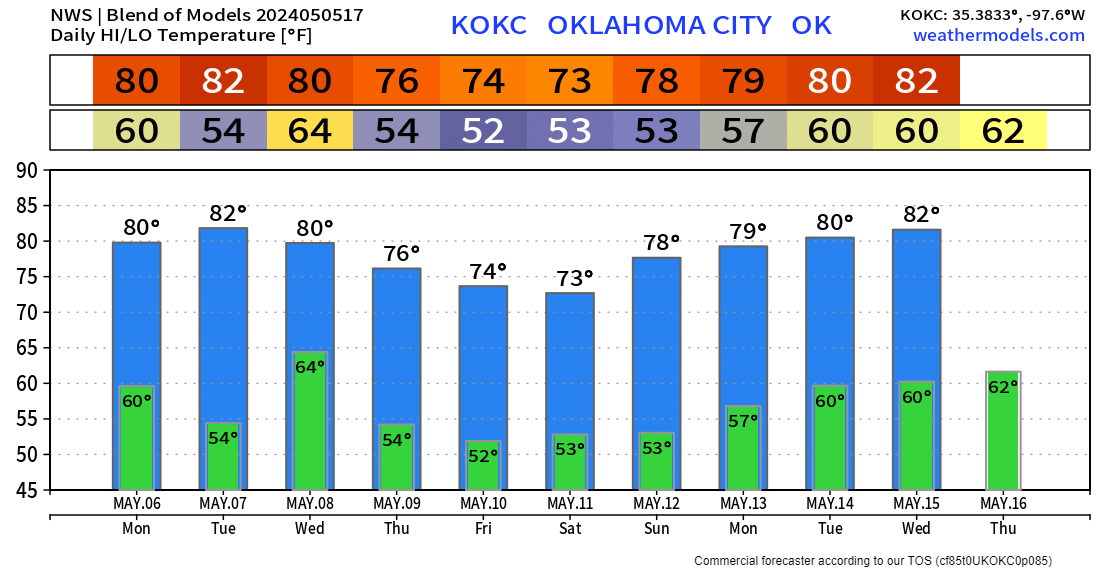
Temperatures will be very nice for most of this week. Make sure you download my free weather app, ATsWeatherToGo, now from the Apple and Google app stores. It predicts tornadoes before a warning is actually issued. This gives you more time to prepare. I will go live around 9:30 pm Sunday night and around Noon Monday for a storm update. Then I’ll cover tornadic storms live on all of my social media channels late Monday. Stay safe and share this with a loved one! -AT