Nice Weather Then Some Storms Return
Overall, it’s going to be a great week. Temperatures are pleasant, and the humidity will be lower. We do have a few opportunities for storms again as a couple of cold fronts affect the area.
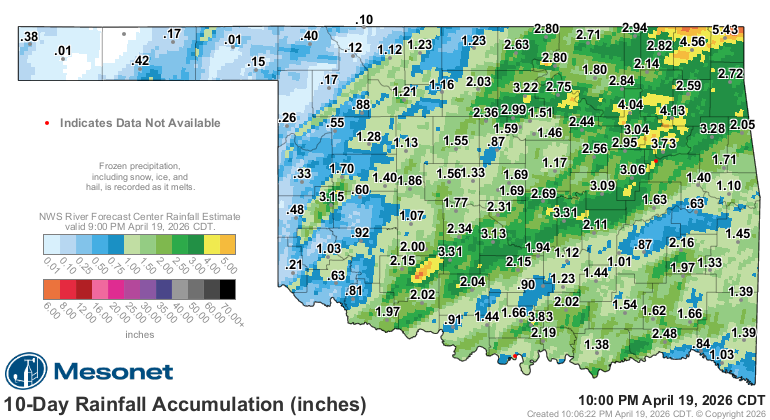
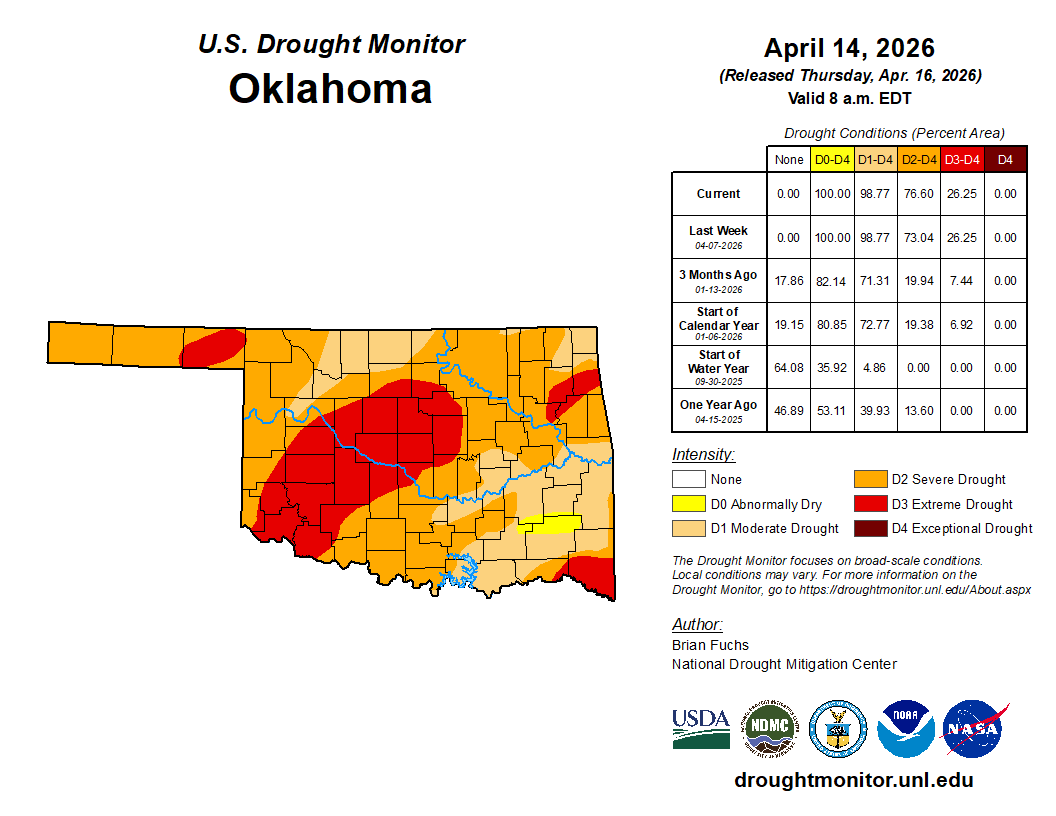
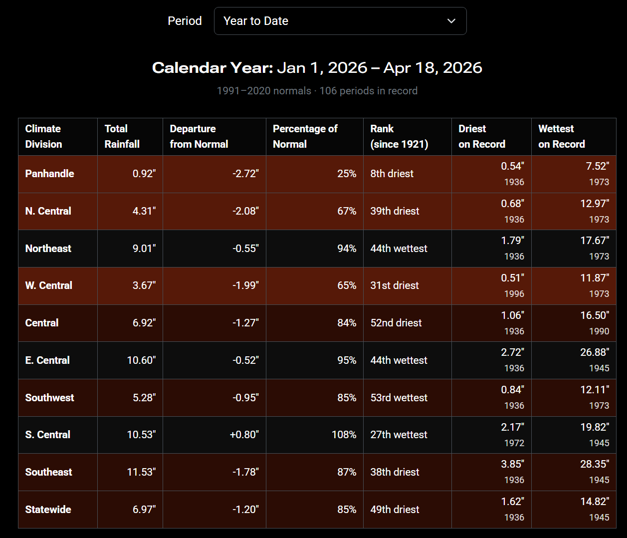
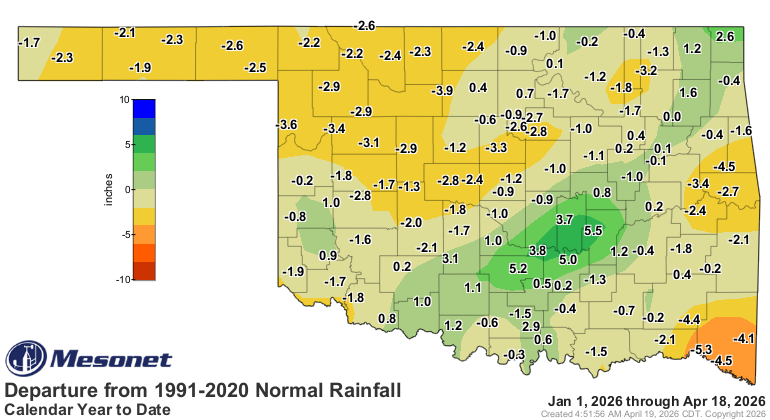
Last week we received some much-needed rainfall. It did come with a couple of tornadoes and a lot of wind and hail reports. The drought monitor will take this into account during its next update. It’s a lagging indicator. You can see how far below normal parts of the state are regarding rainfall for the year.

Be sure to mention Aaron Tuttle when you call (405) 820-1193!
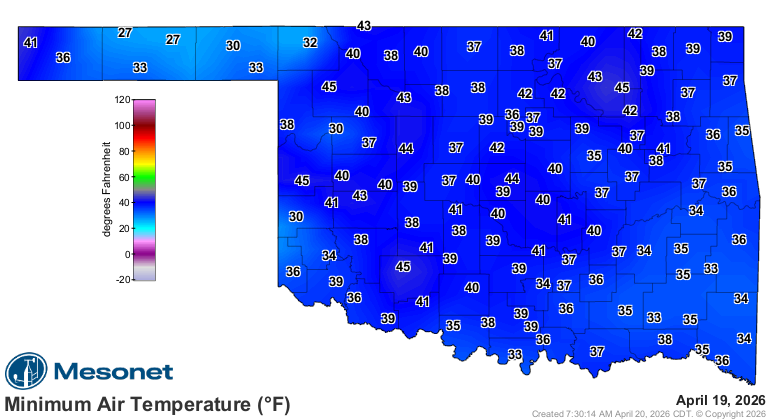
We also had our mid-April cold shot, which gave some of us a light freeze or frost to deal with on Sunday morning.
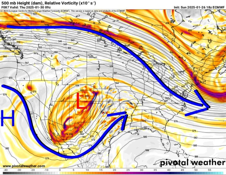
The Jetstream shows a weak system moving across S OK / N TX on Tuesday, a large system moving through the Northern Plains with a trailing end across Oklahoma on Thursday, and one more big system to come through late Sunday.
 Restoration and Disaster Cleanup Service
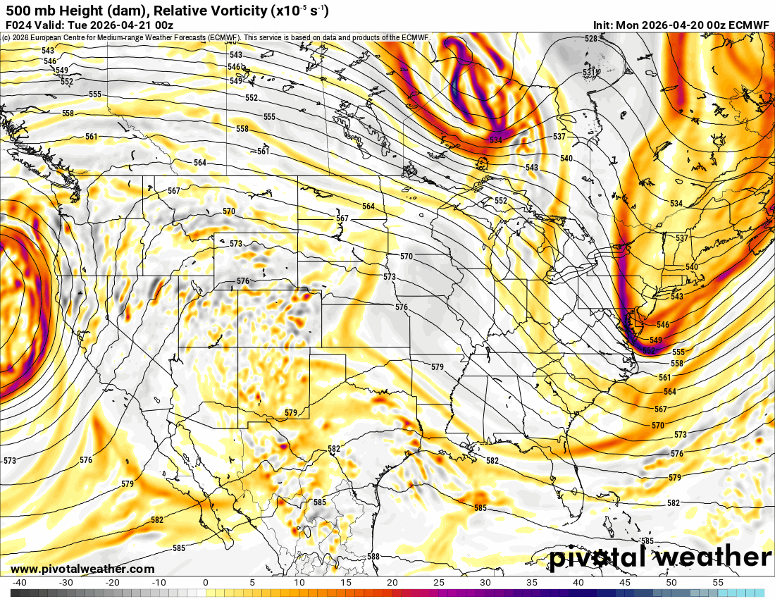
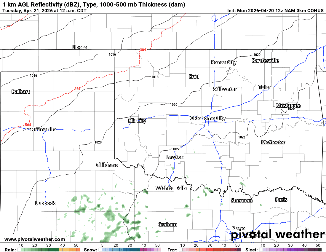
The system on Tuesday is very weak and will keep most of the rain south of I-40. Light rain will develop very early Tuesday morning and wrap up Wednesday morning.
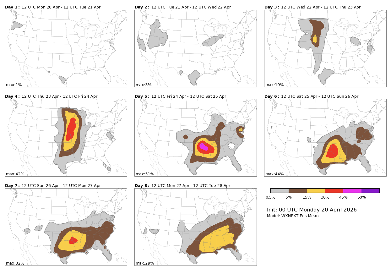
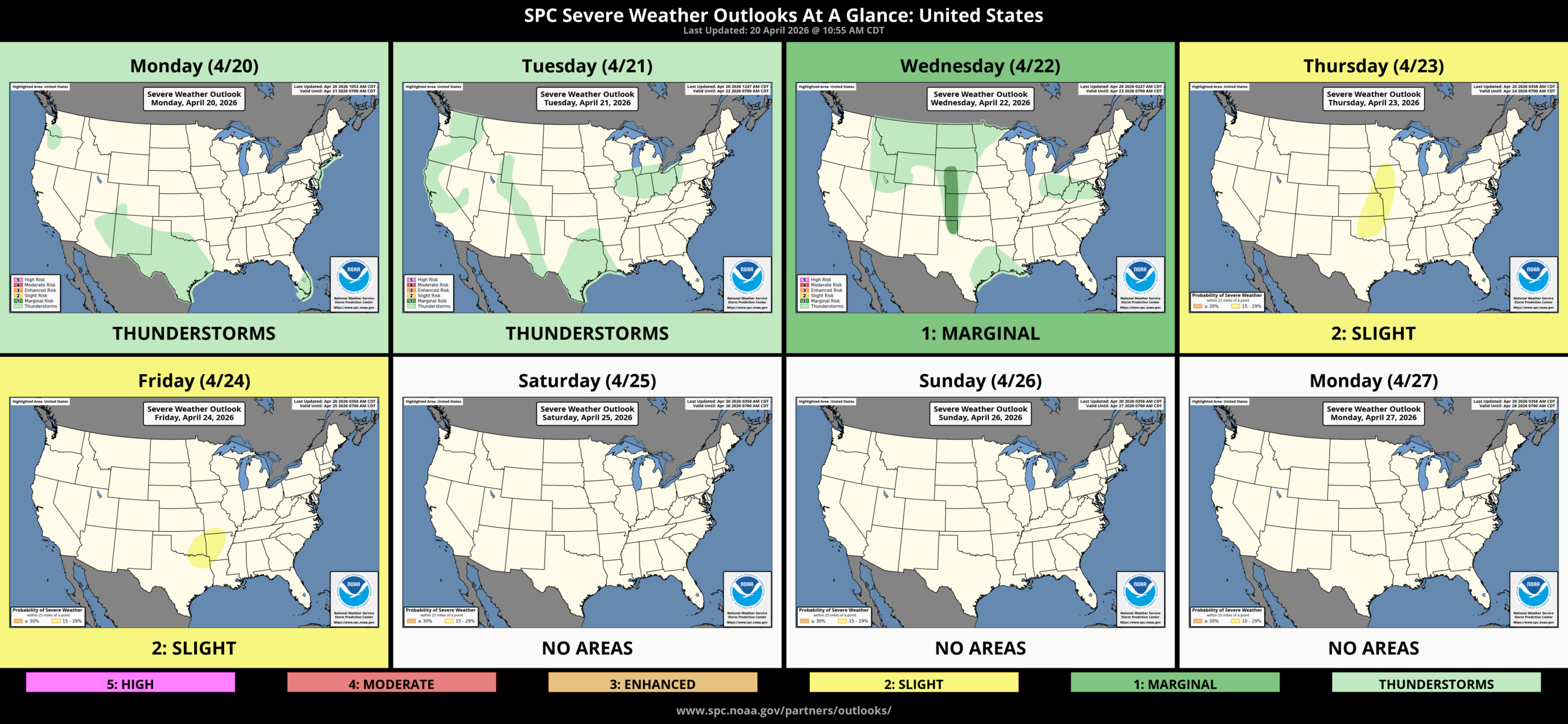
The front and dryline will be in play on Thursday afternoon/overnight. But so will the CAP. We might only get storms on Thursday night with the frontal passage. Depending on how fast things move, there may be some residual activity on Friday across E OK and Arkansas for storms. In theory, the front clears the state for Friday/Saturday, and the instability returns for storms on Sunday. This extended outlook is very messy with model solutions all over the place. Some keep it stormy all weekend, while others keep it dry. I’ll have to update you during the week for the details. Regardless, it will not be a washout; there will be plenty of dry hours during the period.
The AI models that didn’t do so well give it another go this time around. The SPC posted its outlook as well.
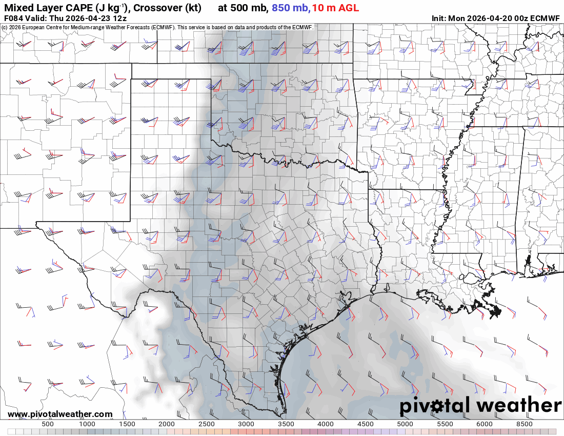
The CAPE/Shear is pushed away from Oklahoma in the European data. As long as that’s south, we’ll have great weather!
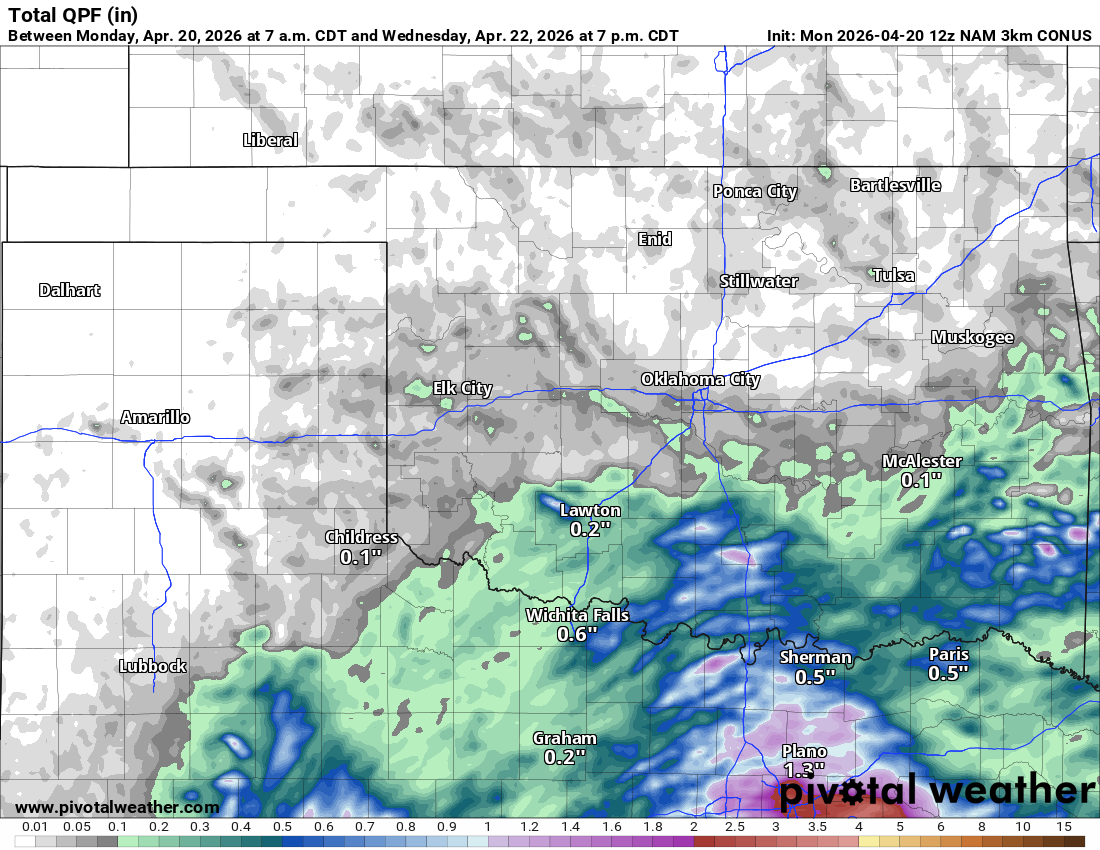
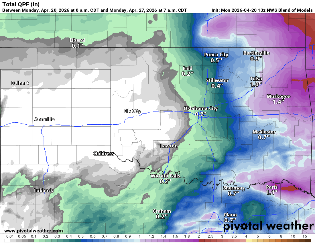
Because of the nature of the dryline and CAP that can prevent storms from forming, the extended rainfall potential is quite low in the output. This focuses most of the accumulation across the eastern half of the state. If, for some reason, the cold front stalls or washes out on Friday, we could get more coverage across the state both Friday and Saturday. In that case, expect better rain than this and, unfortunately, a lot more humidity.
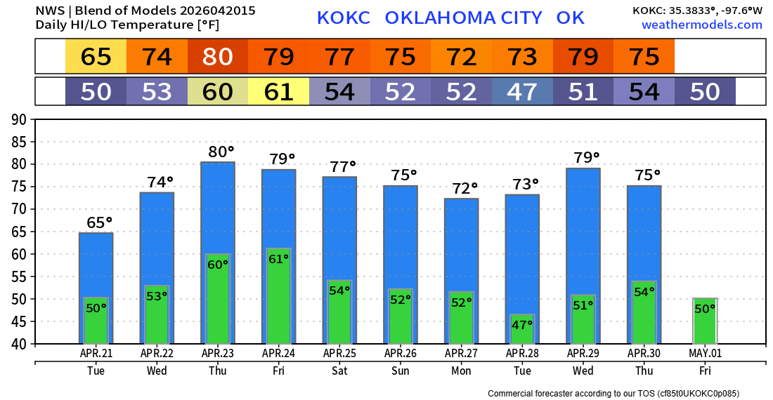
Temperatures are very nice this week. The humidity will return for Thursday and Sunday for sure. Wind gusts will remain over 30 mph during the week.