Winter Returns and Quiets Severe Storm Season

A little fog, drizzle and sprinkles will kick start our week on Monday. Otherwise, two cold fronts will move through. The first somewhat mild, the second means business.
The first front arrives Wednesday without much fanfare. Temperatures prior to that will be very pleasant compared to the last couple of days. Be sure to use my free weather app, ATsWeatherToGo, to get the daily details.
Ferguson Roof Systems is offering an AT's Weather special, Call Today!
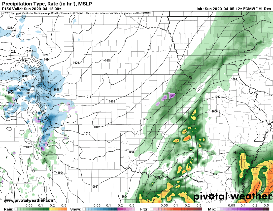
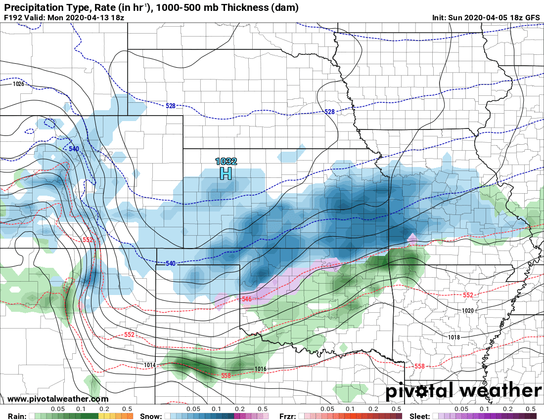
Then all eyes turn to Saturday with the passage of the next winter cold front. Other models delay the front by a day or two, but I’ll side with the European model this go around for timing. Should see at least a few showers and storms with the front.
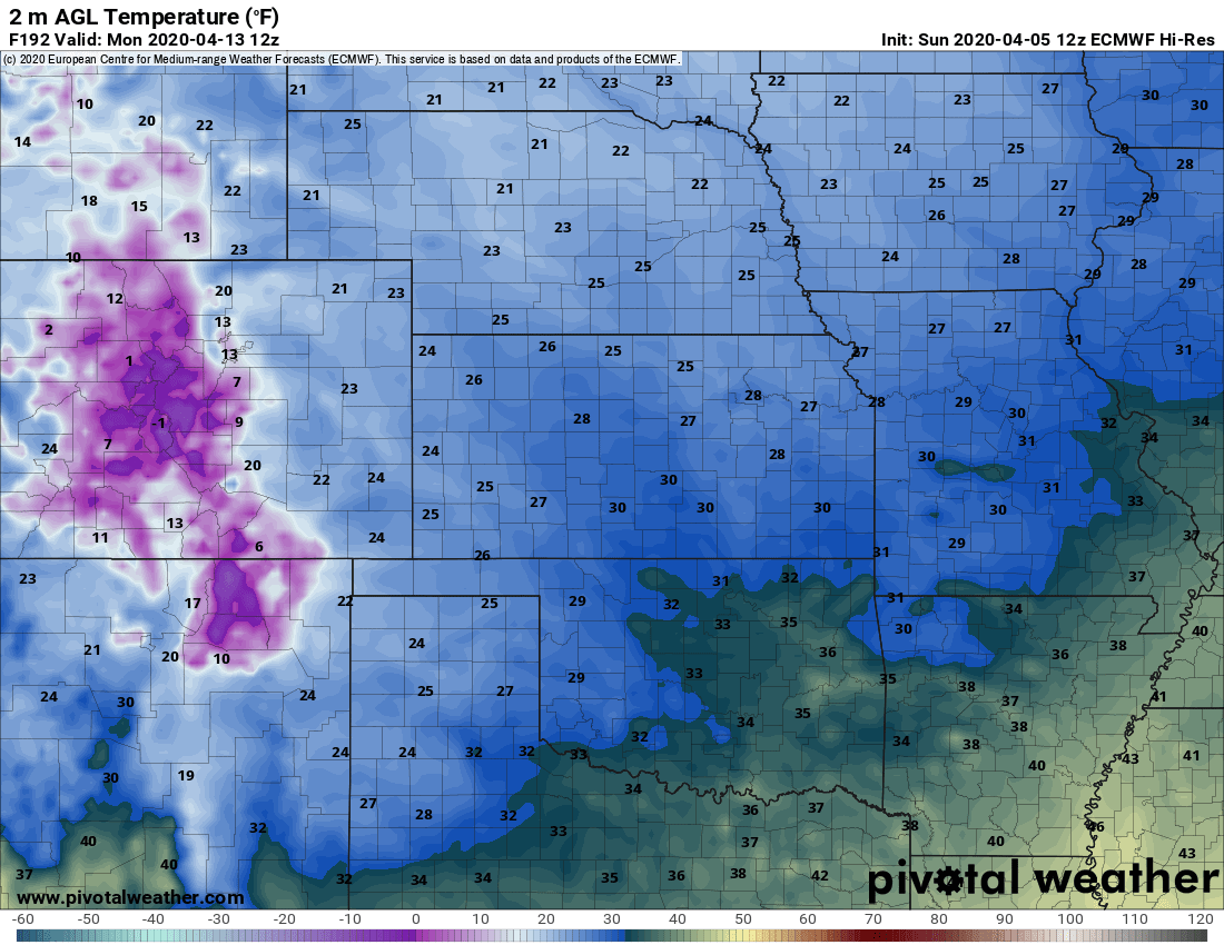
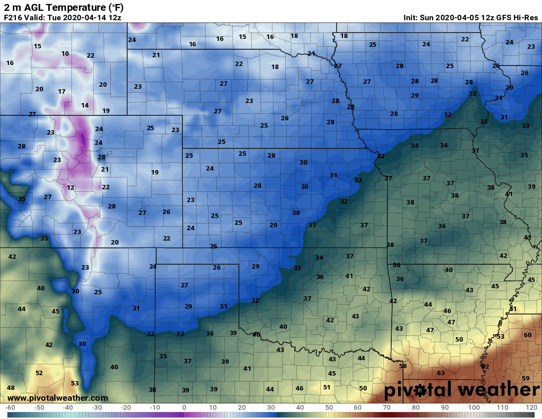
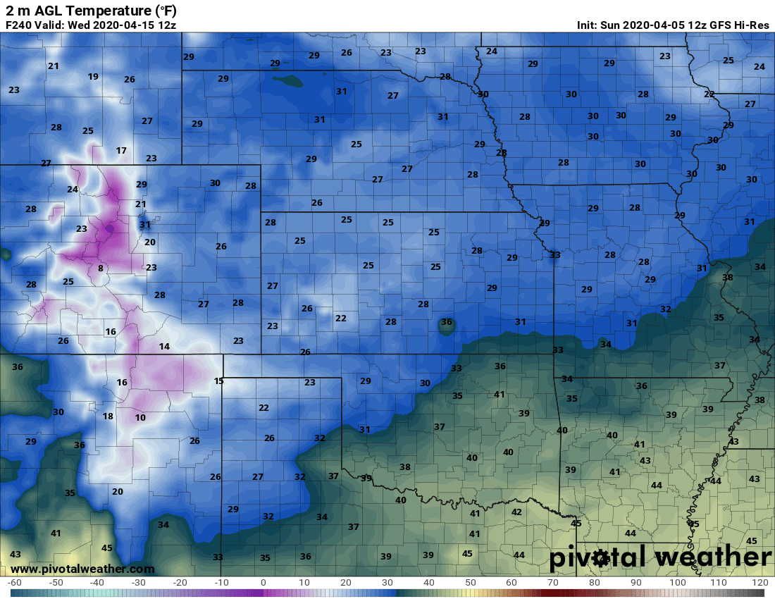
Temperatures will take a nose dive by Monday, Tuesday, and Wednesday morning. Model output varies, but the general idea is that another frost or freeze is likely for many across Oklahoma. The American model is even suggesting we’ll see snow back across Oklahoma on Monday. I’m not ready to buy into that at this point however.

Buy or Sell today with Results That Move You!
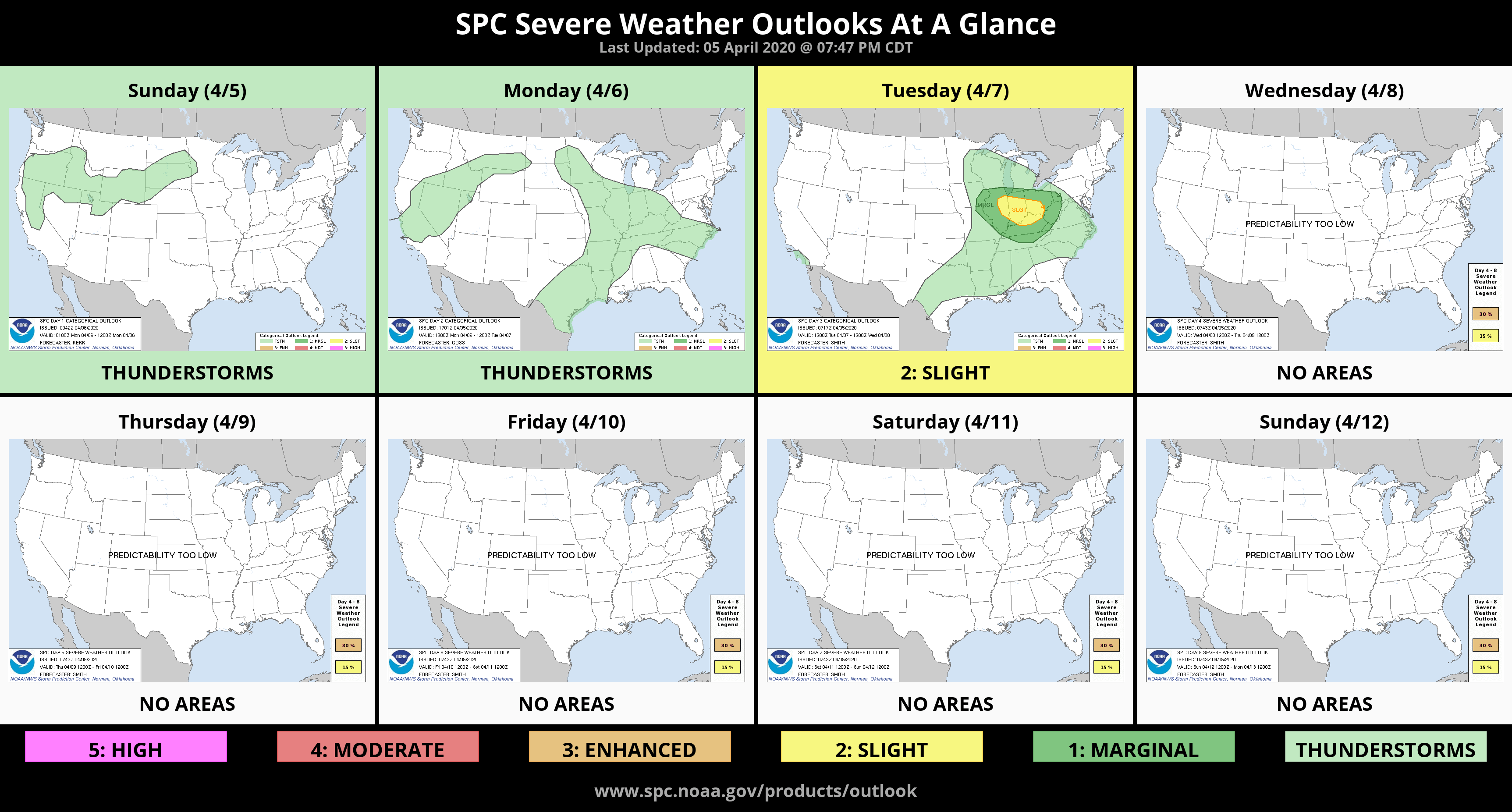
The good news about these strong cold fronts is that the pattern producing them is delaying our severe weather season. We may not get things going around here until we move towards the end of April.
I’ll be updating you on these upcoming temperatures and any changes that could lead to the return of violent weather. -AT