Near Record Heat, Rain, and A Snowy Outlook
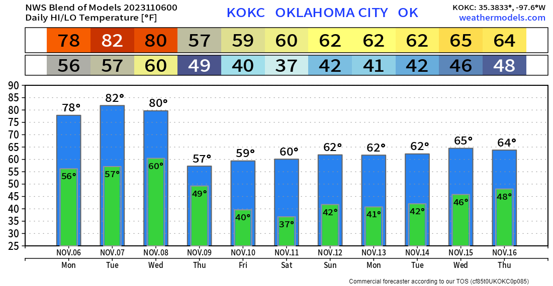
This week’s blog will touch on a few things. We’ll start the week with much warmer temperatures, possibly getting close to a few records across SW Oklahoma. Then some rain will arrive on Thursday with a cool-down to follow. Finally, we’ll take a look at what the long-range European model hints at for our winter.
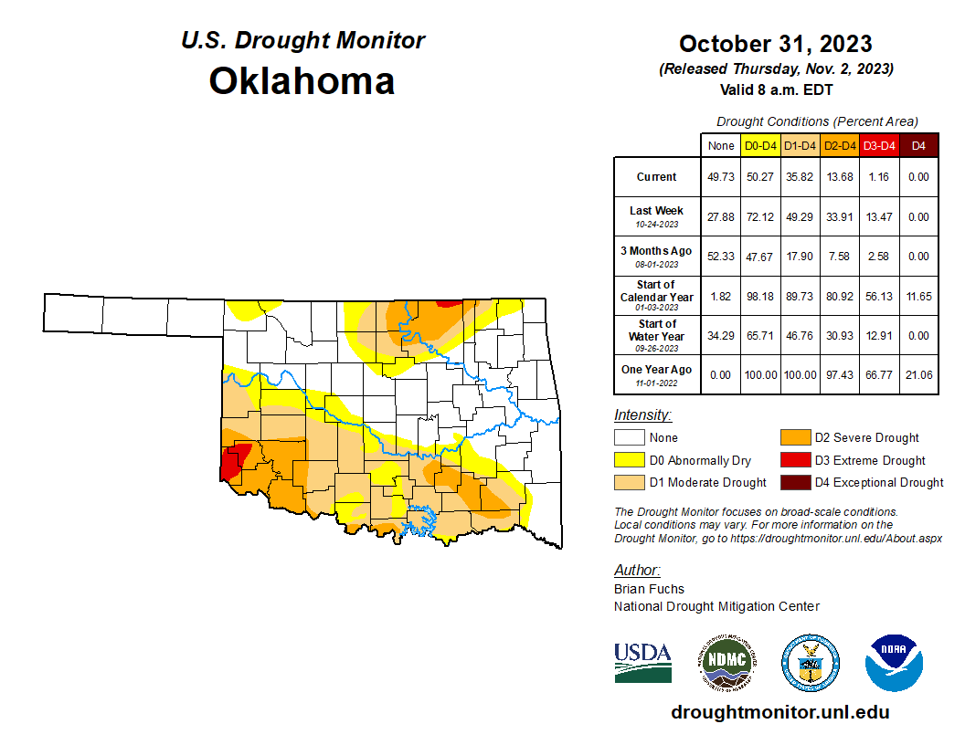
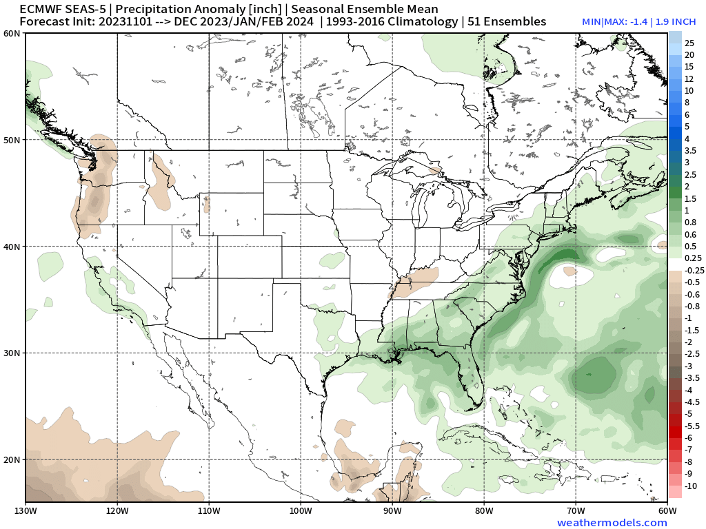
I mentioned the recent rains would help the drought situation in the next update. The latest map shows significant relief. The good news is our winter may end up being a little more on the moist side keeping things under control as we head into next Spring.

Ferguson Roof Systems is offering an AT's Weather special!
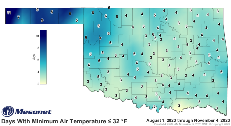
We’ve also had some cold mornings that sent those pesky bugs packing! Yay! Now we get to enjoy some nice evenings squeezing out a few BBQ nights. Every city in the state saw at least two freezes, and even a few records were broken.
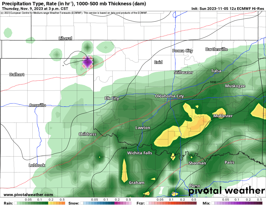
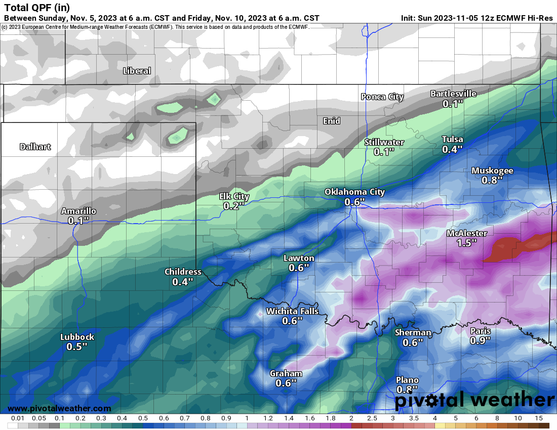
The Jetstream will continue with a zonal flow, which will bring in a weak system for Thursday. Expect rain to move in late morning and continue through the evening. Rainfall amounts look decent according to the European model.
Ferguson Roof Systems is offering an AT's Weather special!
So let’s shift gears and talk about the winter outlook. We’ll use the long-range European climate ensemble data for this forecast. It’s fun to see what it hints at during our El Nino winter. This will be a smoothed (mean) approach, meaning a blend of all of its members for a conservative outlook. We can look at the story it tells us, to see if there is any hope for a decent Oklahoma snowfall.
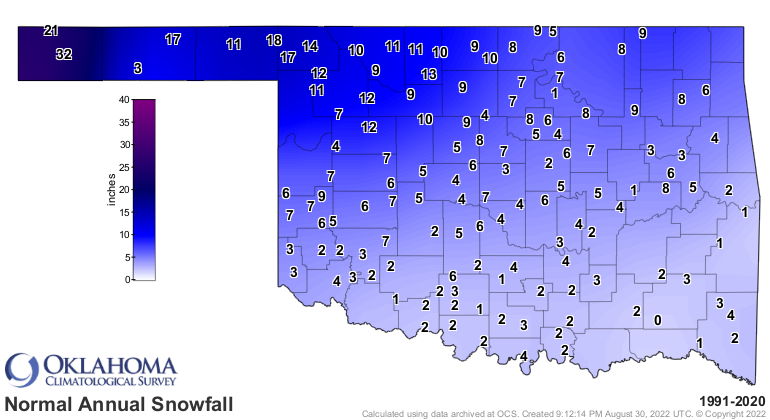
Just for the record, we do get snow across Oklahoma every year. If you were to average them all together, the map would look something like this. Doesn’t mean it sticks around for several days, but at one point it is measurable.

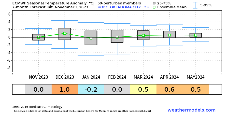
First, let’s take a look at the temperature and precipitation forecast. It appears we’ll have a winter season that’s pretty close to normal. That means a lot of days with average temperatures with a few either warm and cold days thrown in. What does this tell us? It means it will be cold enough to get winter precipitation at times. But it will also be mild enough for just rainfall. There is also a very weak signal for slightly above precipitation, and I mean very weak.
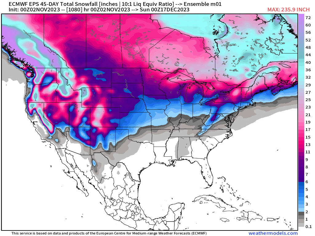
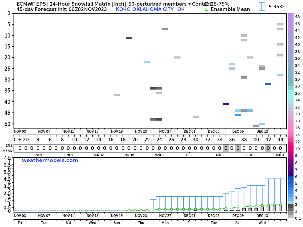
So let’s talk about snowfall. This national map indicates we may be looking at some measurable snow by mid-December across Oklahoma. To narrow that down to which potential days, we’ll look at the OKC gridded data. The ensemble runs hint at a weak cluster around Thanksgiving of all days and again starting the second week of December. What you see is a very weak signal amongst the noise. The key would be to watch for more of these tiny squares to show up in that vertical column over specific days. The more that pop up, the more confidence the model has that measurable snow will occur.

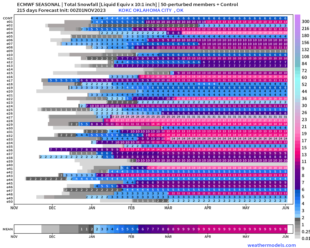
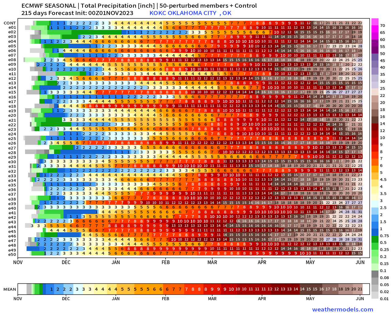
Now let’s talk about the winter overall. How much does the model think we are capable of receiving. As of today, the European thinks we could get an average of 7 inches through February with a couple more through March. It also thinks we’ll be mild enough most of the period to get more of our moisture in the form of just a chilly rainfall. As I stated earlier, that’s good for the drought. The mean value of rain through the winter is around 9 inches.
So there you have it. Expect my winter forecast from a month or so ago to verify. Some mild days, some cold days, some rainy days, dry days, a little snow and yes likely a little ice.
In the meantime expect warm temperatures to kickstart the week but quickly settle back down to Fall-like numbers. Enjoy! -AT