A Clear Air Vortex Hit my House

Say what? Come again? Yeah, it’s one of those rare things.
I believe I might have the first well documented case of a direct hit from a clear air vortex with surface instrumentation. First of all, what is a clear air vortex? Have you ever seen a dust devil? Well, it’s like that minus the dust. Its presence is invisible to the unaided eyes.
So how does a dust devil form? Here are some over simplified graphics:

Ferguson Roof Systems is offering an AT's Weather special!
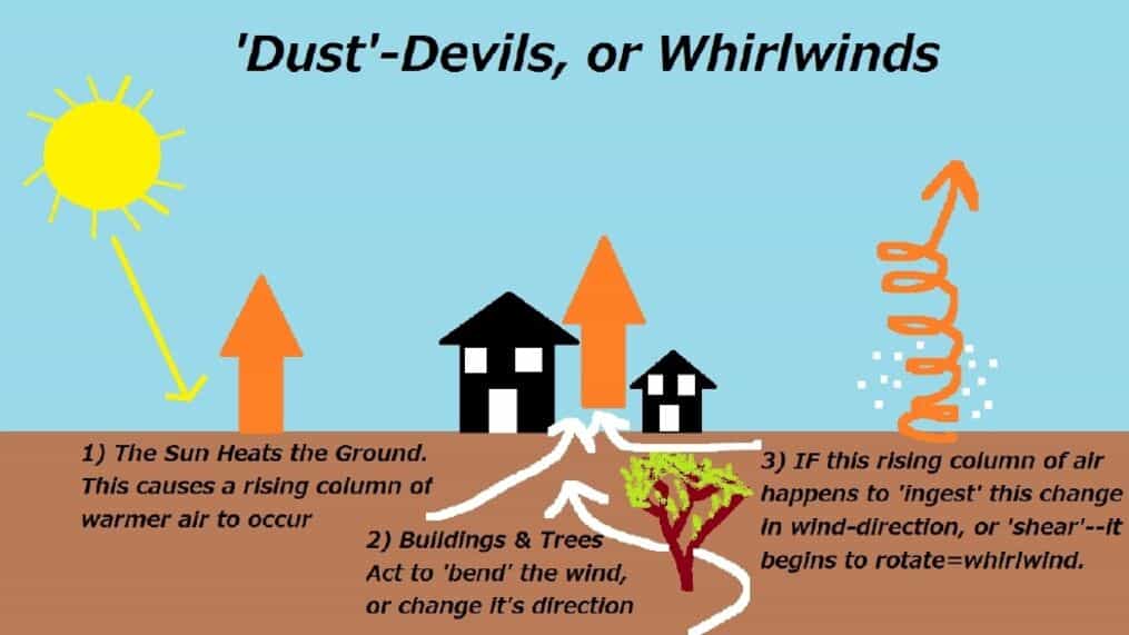
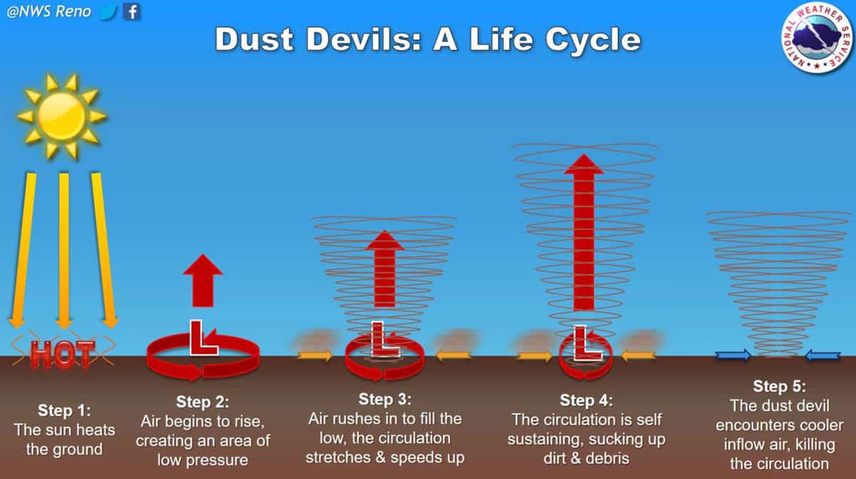
The idea is the sun heats a surface spot (black road in my case), surrounded by cooler temperatures due to grass/trees. That air rises and ingests nearby horizontal vorticity rolls or laminar wind currents between obstacles such as between houses, buildings, trees, etc. At some point the vortex moves over a cooler surface, such as going from the concrete to grass and that cuts off the warm rising air supply.
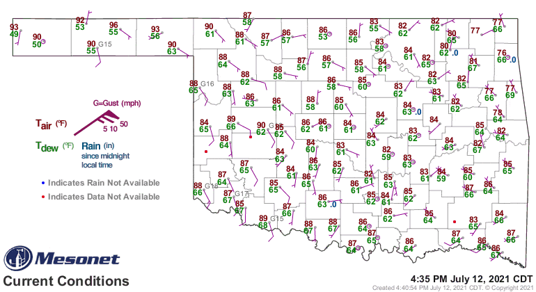
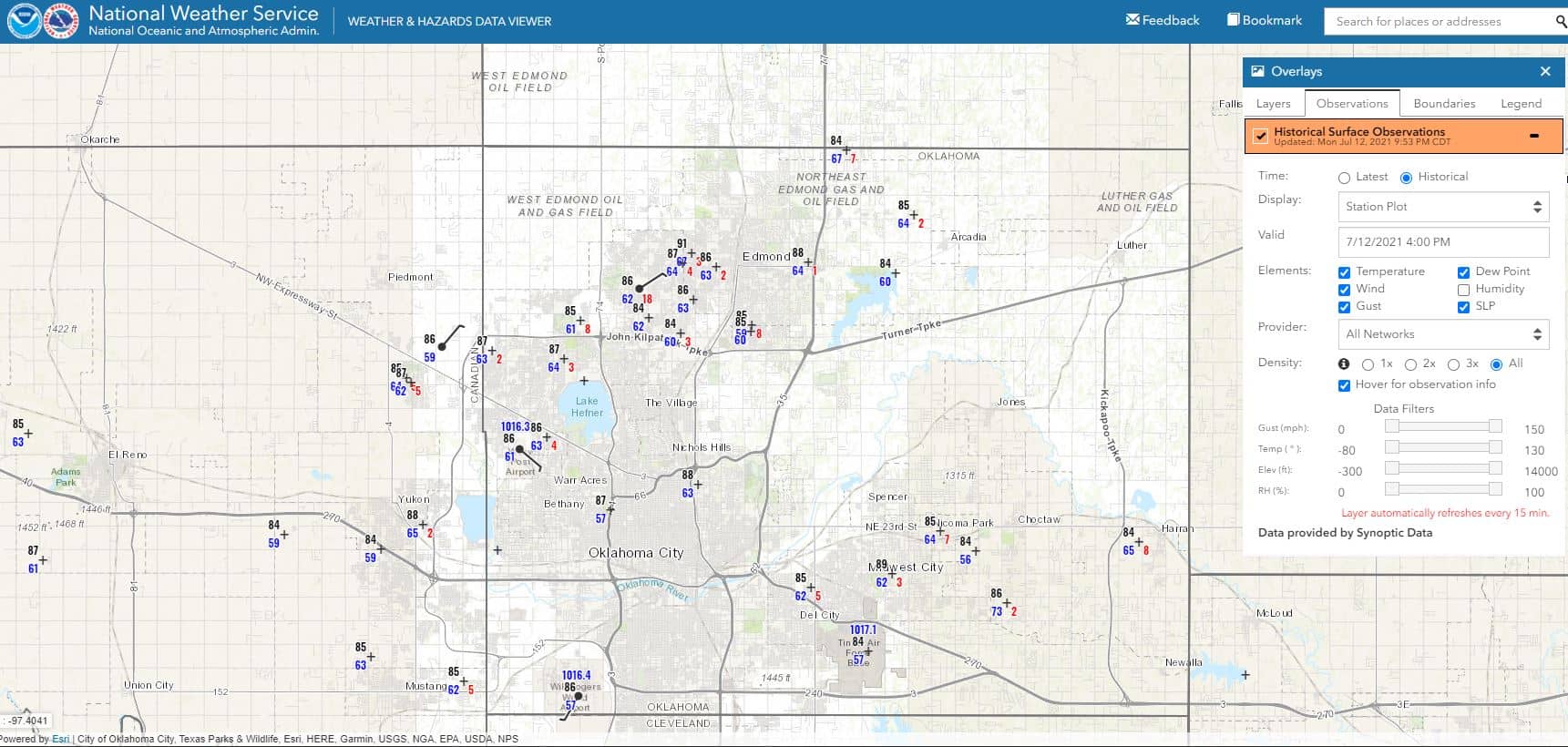
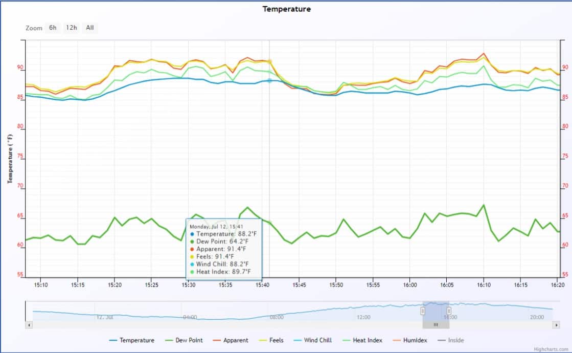
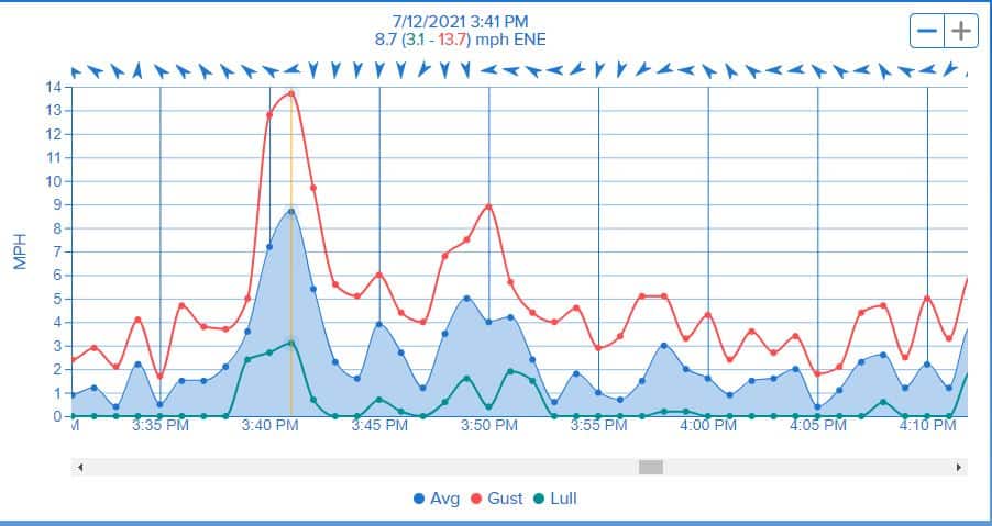
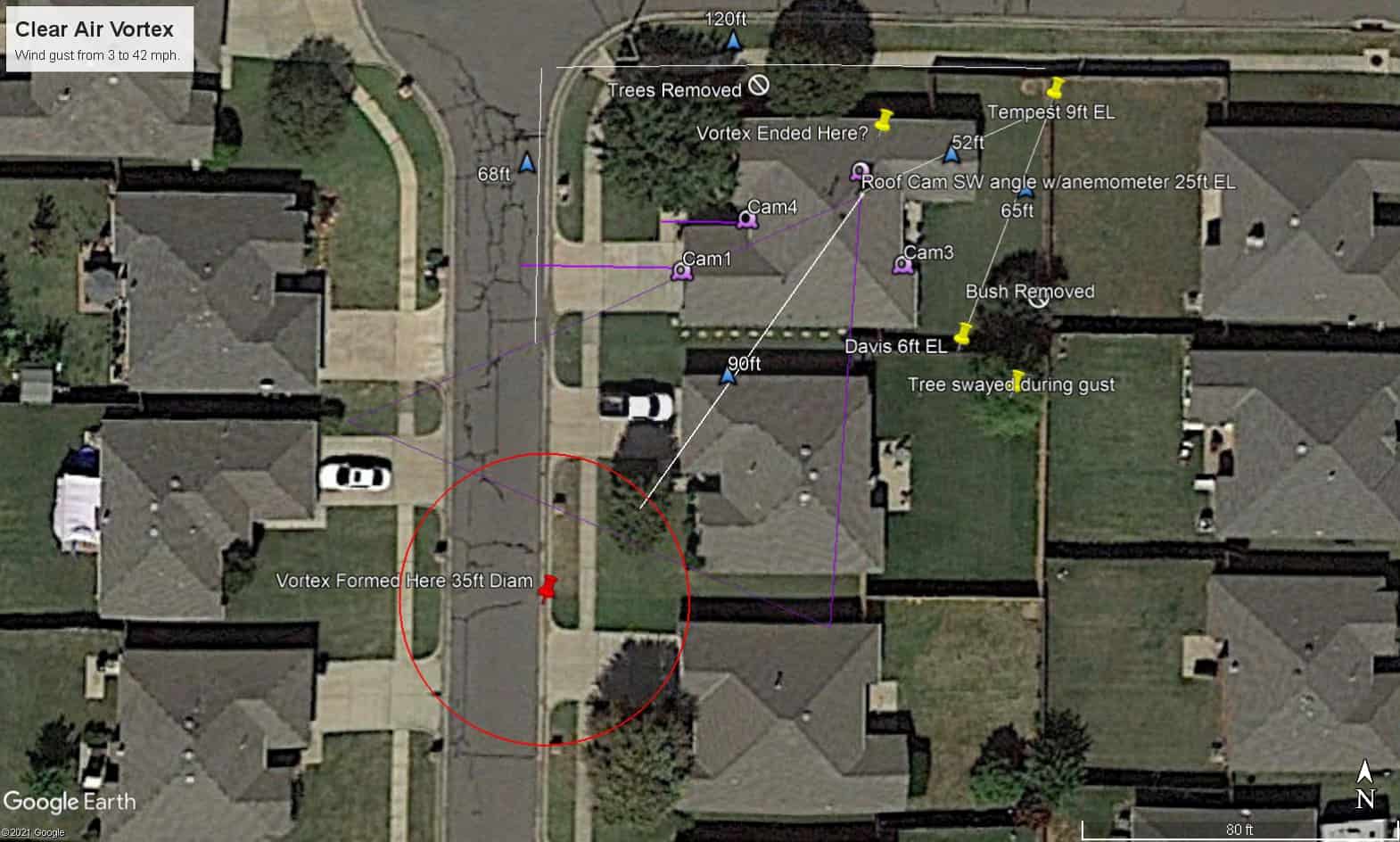
So what happened at my house? One of these guys slammed into it then dissipated. It developed in front of my next door neighbor’s house in the street and expanded to about 35 feet in diameter. Then it grew and moved northeast before dying out on the north side of my home. As it hit the roof, it shook my camera and dropped a 42 mph wind gust. That doesn’t sound all that impressive until you realized winds that afternoon were holding around 3 mph. Take a look at the surface maps across Oklahoma and in Oklahoma county. Notice the lack of any strong wind. The + signs indicate wind less than 5 mph. So this tells us I experienced a freak event. Right place, right time.
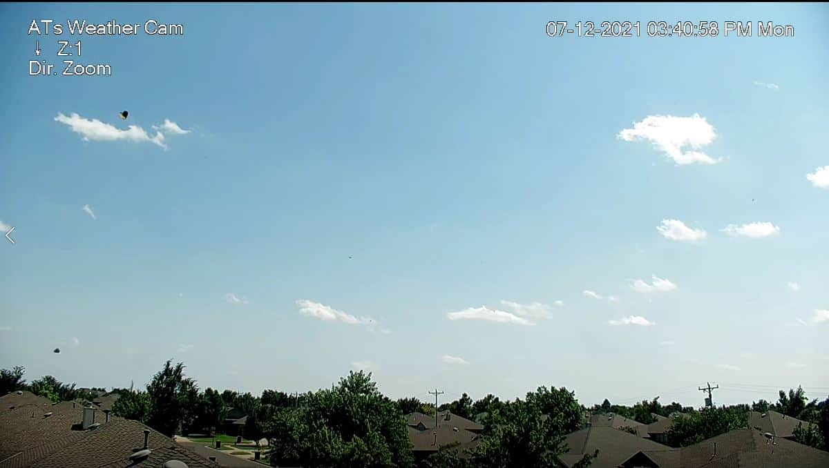
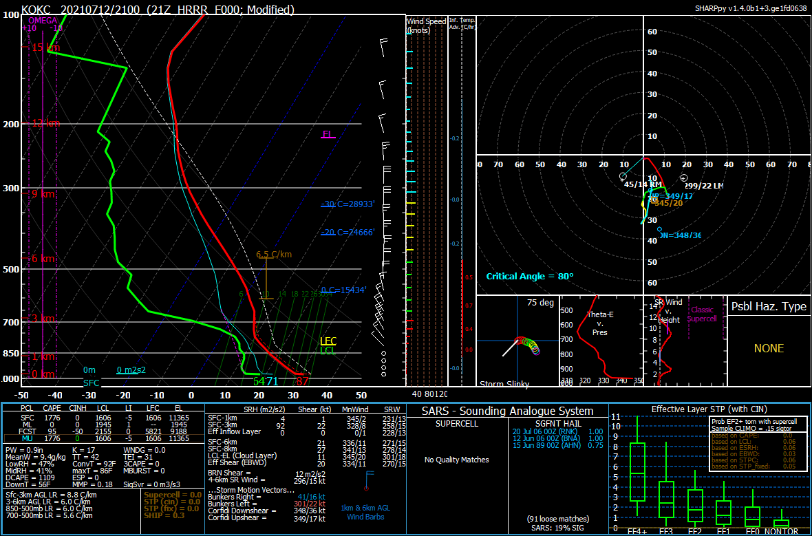
What else do we know? Well, skies were mostly clear, just a few fair weather cumulus clouds around but without bases. Meaning, there was no clouds nearby that had any type of updraft associated with them. Next we have an atmospheric thermodynamic profile from model data showing what conditions looked like. Notice the lack of any wind from the surface up to 1 km, or roughly 3,000 ft, but a nice directional wind above that layer. The temperature profile in red is dry adiabatic, meaning with surface temperatures heating to 87 degrees, lapse rates were through the roof with 8.8 C/km. That means rising vertical motion was intense.
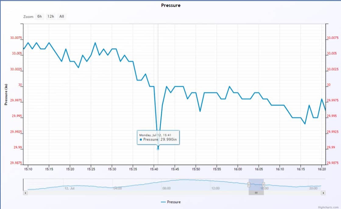
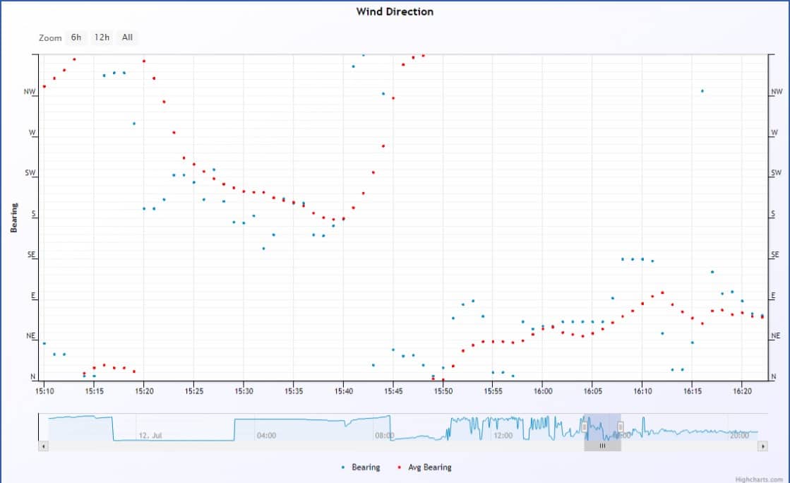
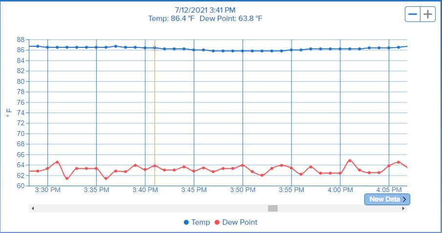
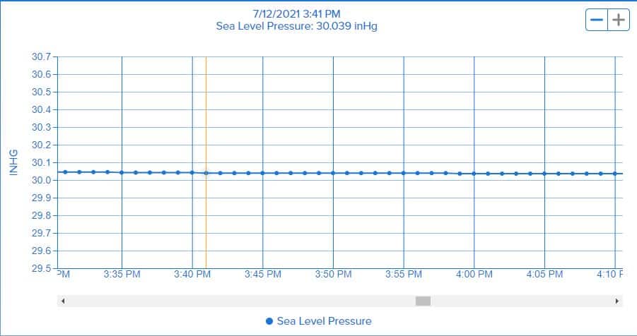
So let’s take a look at the weather information from my Davis Vantage Pro 2 and Tempest. When the peak wind gust hit the roof anemometer at 3:41, notice how it drops the dewpoint and even the temperature slowly over the next several minutes. Even better, look at that pressure drop! Here’s the wild thing. My Tempest located about 52 ft away from the anemometer and 65 ft away from my Davis sensor barely registered the vortex. This tells me it was small and likely dissipated while over the roof or on the north side of the house. I don’t have a picture of this, but when I went outside after hearing a loud thump on the roof when the 42 mph gust occurred, I saw a 2 ft strip of cardboard just tumbling in the air around 75 ft above the house in the residual circulation that was winding down. Note one other thing which has me a little perplexed. The circulation that hit the roof was anticyclonic. Meaning it was rotating clockwise from a S/W/N direction as it hit. I would have expected this to be cyclonic due to low pressure. The Davis pressure sensor located 44 ft to the SE of the anemometer took a low pressure hit. So could this have been a tiny vortices inside the main vortex? The Tempest pressure was also lower, but again barely registered compared to the Davis.

Finally, to give you a better understanding of placement of the vortex along with the sensors used in this summary, I’ve created a Google Earth map. This will help visualize what transpired. I lost both trees and the bush in the back due to the Fall 2020 ice storm, so that’s the only difference. When you watch the videos below you can reference their viewpoint from the map as well.
’ve made you wait long enough for the video evidence, so let’s get to it. We’ll start off with the roof camera pointed SW at my neighbors tree. You can see his was really moving early on with the neighbor’s tree next to his moving just a little. No other tress were moving at this time. This helped me place the start of the vortex and its size. Watch the debris in the form of leaves fly by the camera from right to left, this is the W to E vector flow, meaning anticyclonic. At the 3:41:05 mark the camera starts to shake wildly as the wind gust hits. Be sure to tap the full screen button on each video and preferably on a computer to see better detail.
Next we have the driveway camera. Focus on that tiny evergreen tree next to the mailbox. You’ll see leaves fly by along the ground first then that little guy will go full tilt! 03:40:07
The front door camera captures when that wind from the sidewalk reaches the doorway as the plants go wild. 03:40:15
The back door even gets in on the action with a NE wind vector at 03:40:21.
So the front and back of the house gets inside the wind circulation before the main gust hits almost a minute later. One final part to mention, during the pressure drop and wind gust, my neighbors backyard tree which is very tall was swaying wildly as well. This causes me additional confusion on just how many vortices were present during this event!
I verified the camera times were correct. It’s interesting how things change over the span of a minute as the house gets inside a clear air vortex. I’ve always wanted to run out into a dust devil just to see what it felt like. Looks like I missed my opportunity, but at least my sensors were able to capture it. If you are a fellow met reading this blog and have additional insights or other ideas of what occurred, please reach out to discuss. I would love to talk about it. For example, I’m not sold on the movement or configuration of the vortex structure. In either event, to my knowledge, this is a very rare capture!