CAT 5 Hurricane Melissa, First Freeze, and Very Windy
We’ve got a few things to highlight for the week ahead. A Category 5 hurricane will hit Jamaica, we’ll see our first widespread freeze for Oklahoma, and the winds will get cranking behind a strong cold front on Tuesday.
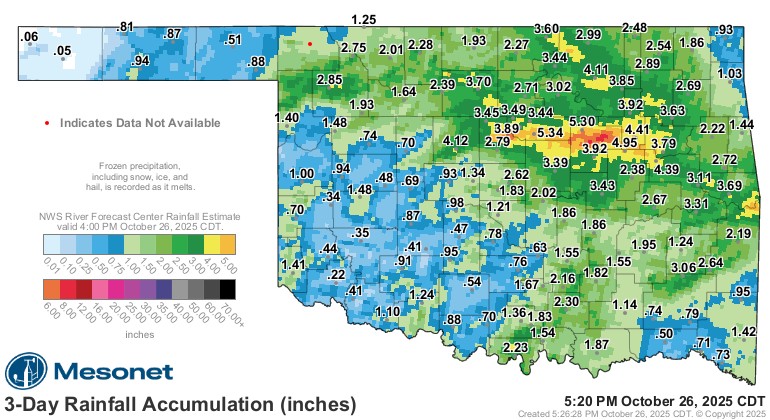
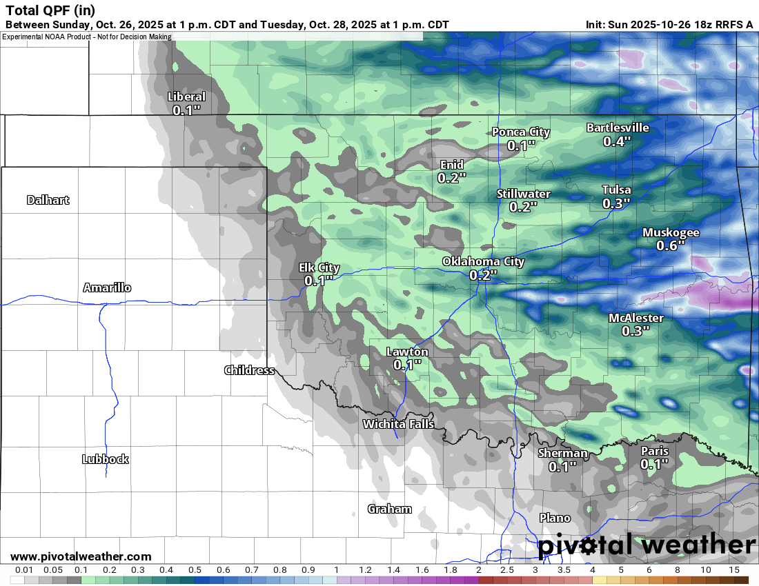
First, I want to show you the recent 3-day rainfall totals. Some brief flash flooding occurred, and of course, we had that nasty hail storm in the OKC metro.

Be sure to mention Aaron Tuttle when you call (405) 820-1193!
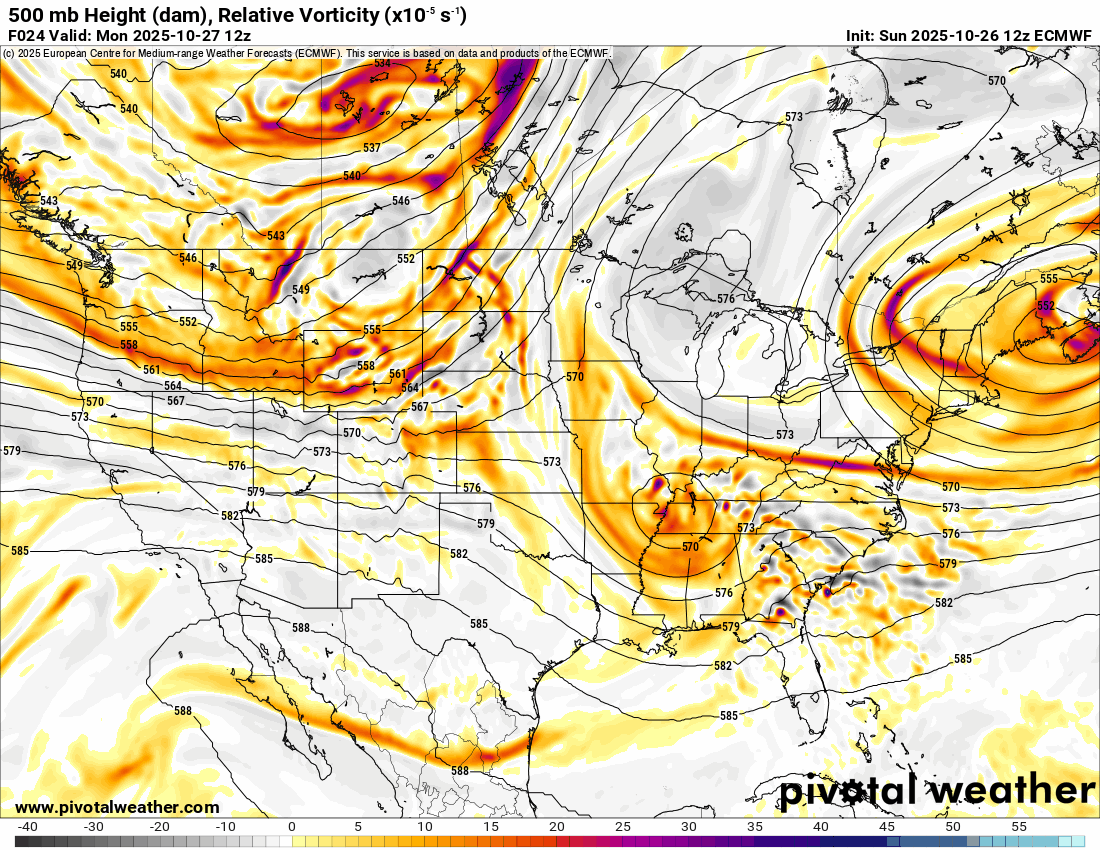
The Jetstream animation shows the next system moving through the nation’s midsection for Tuesday and Wednesday. This will bring rainfall and a strong cold front on Tuesday, and wrap around cloud cover for Wednesday.
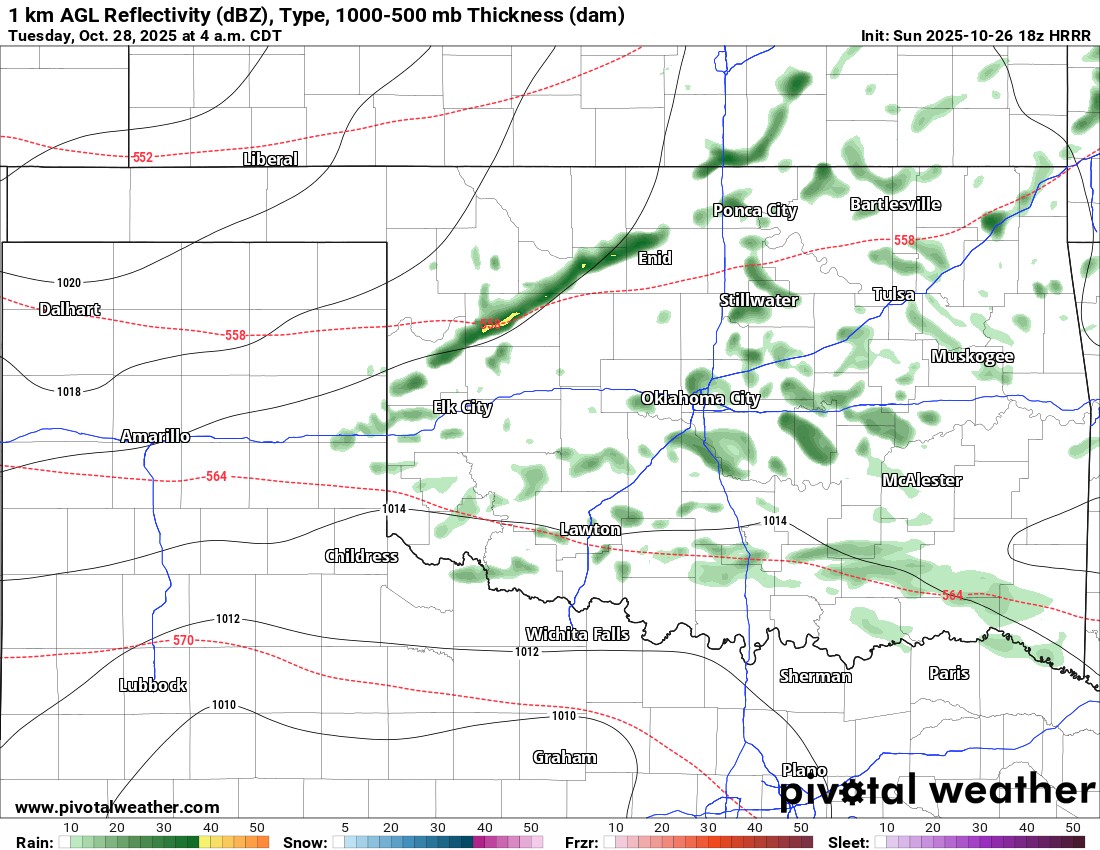
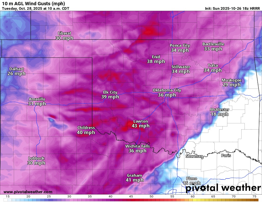
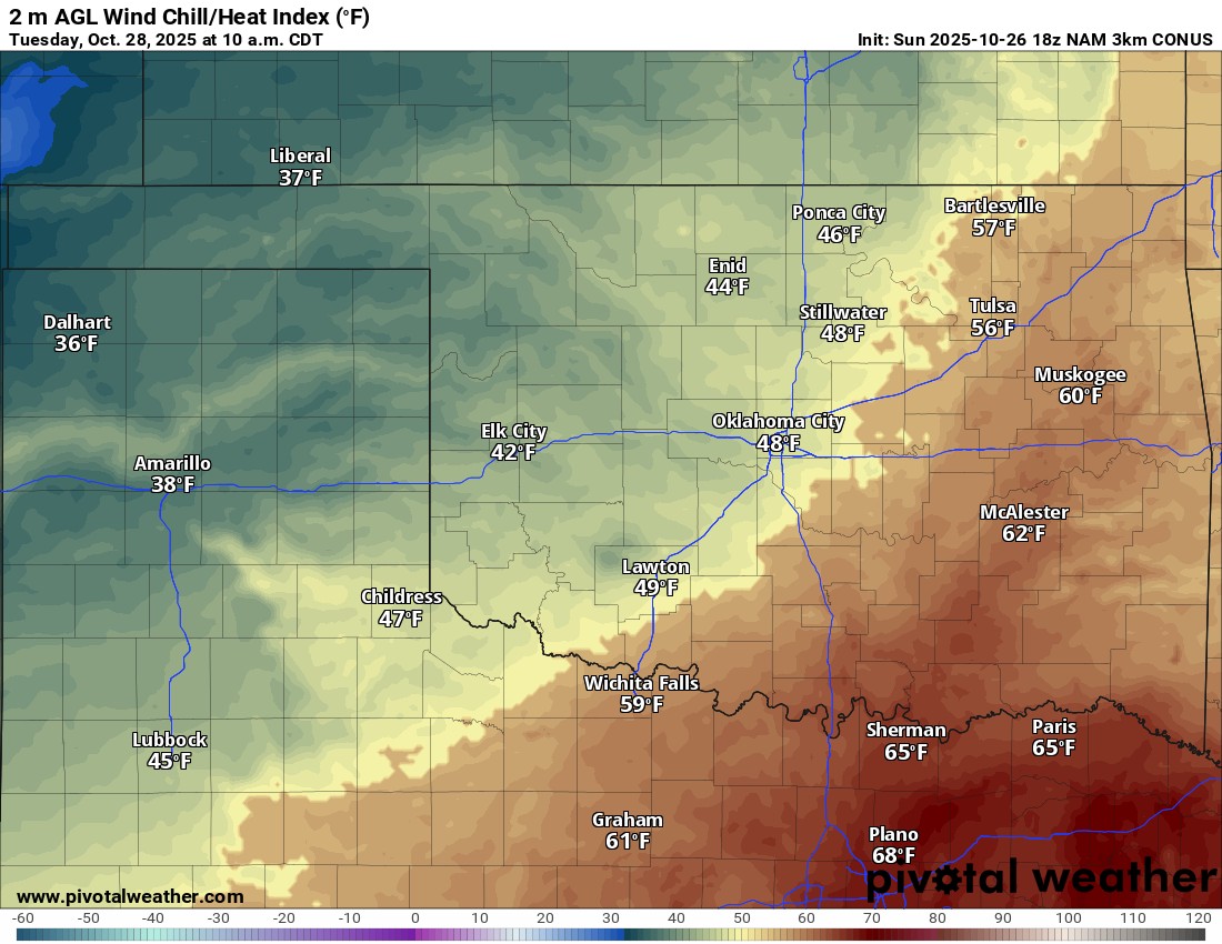
We’ll continue to see low clouds for Monday, along with patchy fog and a few sprinkles or drizzle. The front on Tuesday will help to generate stronger showers across the area. It should move through early morning from west to east. Wind gusts will exceed 40 mph at times, and temperatures will be quite chilly in the morning with the wind. Rainfall amounts on Tuesday could be decent out across the east.
Be sure to mention Aaron Tuttle when you call (405) 820-1193!
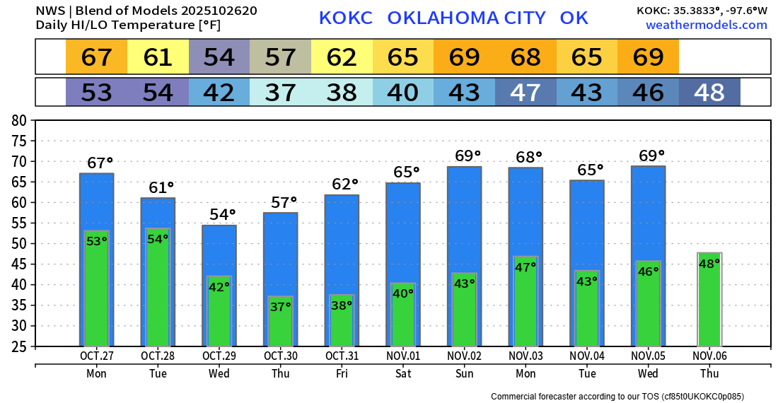
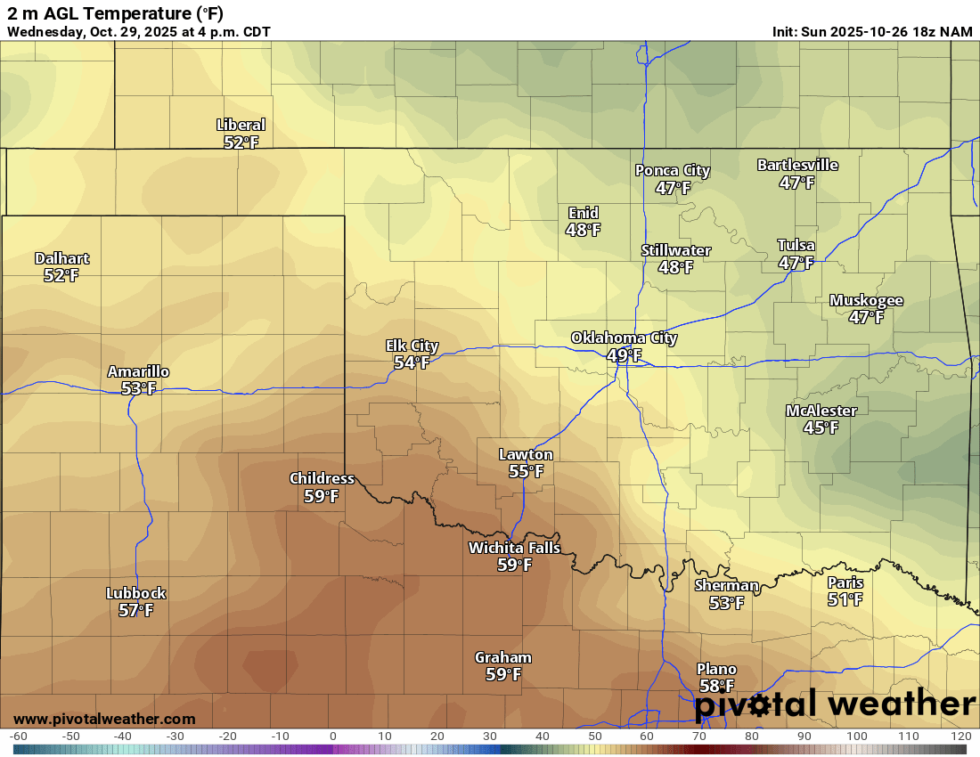
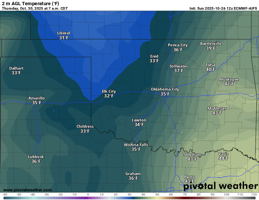
Speaking of chilly temperatures, Wednesday will be our coldest daytime readings across the NE half, assuming those clouds hang tough, and then Thursday morning the freeze moves in. We’ll see how well the European AI model does on this, as other models are a little warmer for W/NW OK.
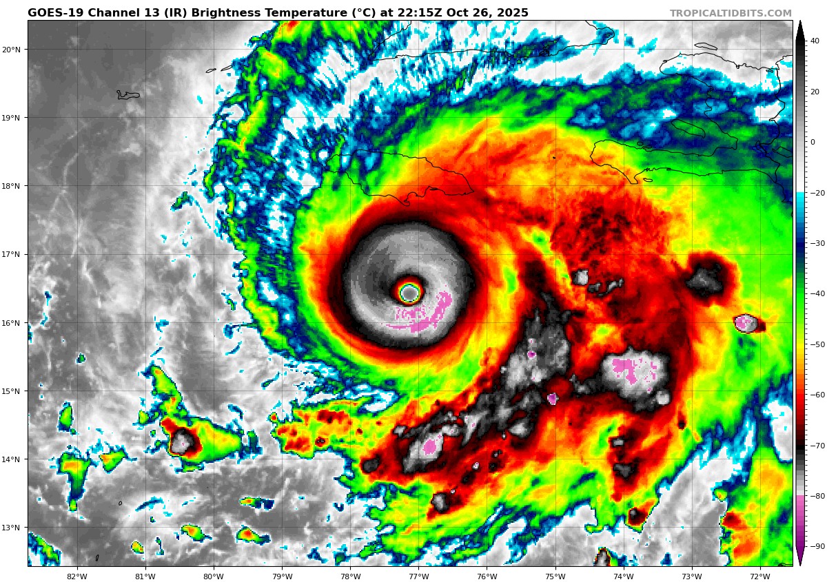
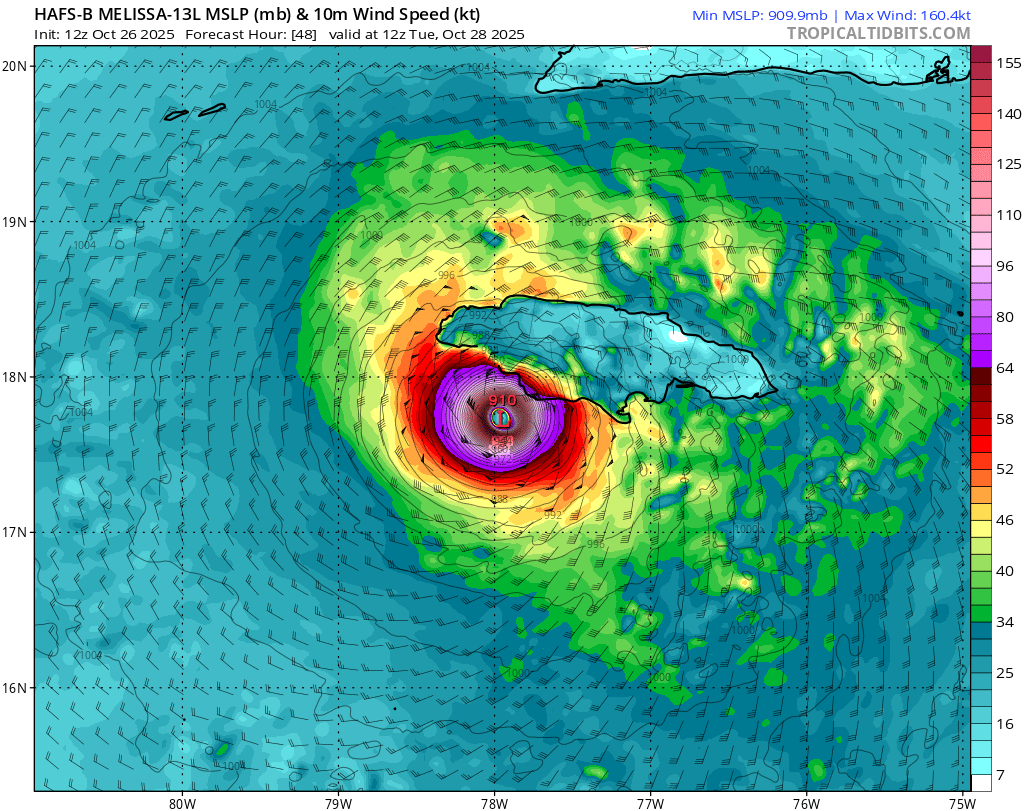
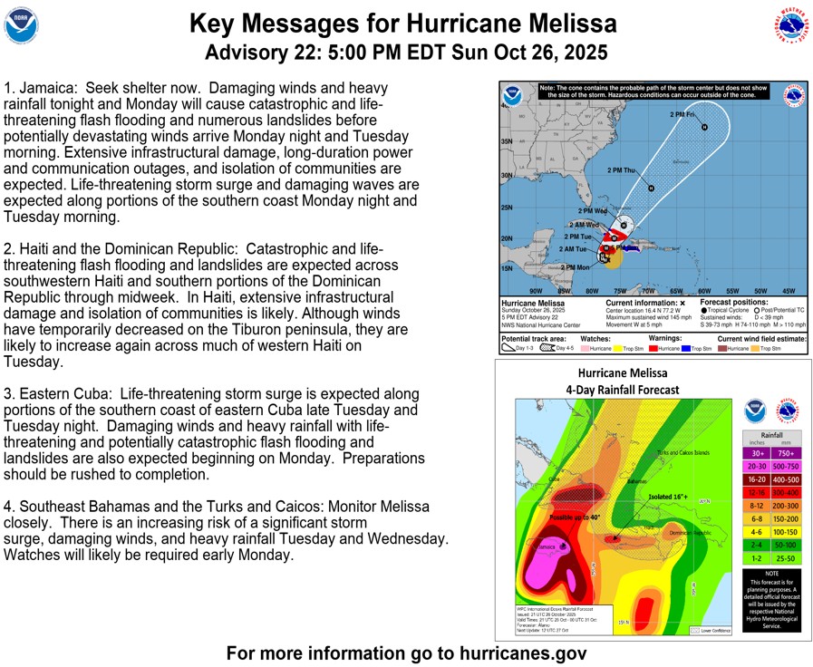
Across the pond, a near Category 5 hurricane has developed over the last 24 hours. Melissa currently contains wind gusts up to 145 mph. It should strengthen tonight and make landfall on the SW Jamaican coast Tuesday morning. Devastating wind and flooding will affect the island.
 Restoration and Disaster Cleanup Service
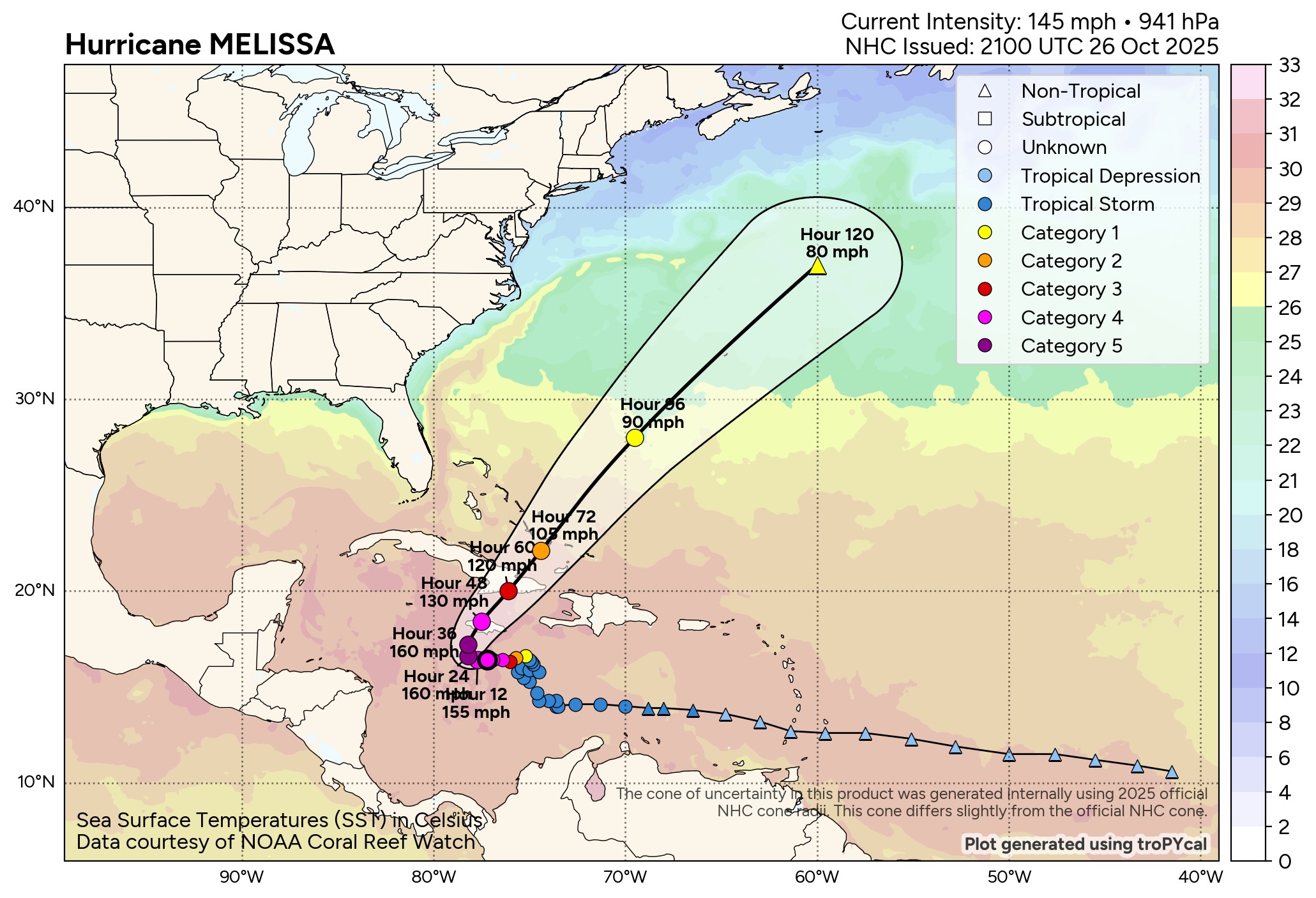
Back home, expect some chilly temperatures in the 7-day forecast. Wednesday has the potential to be a little colder if those clouds can hang tough. Brrr!!! -AT