Quiet Weather into Labor Day and Hurricane Idalia Hits Florida
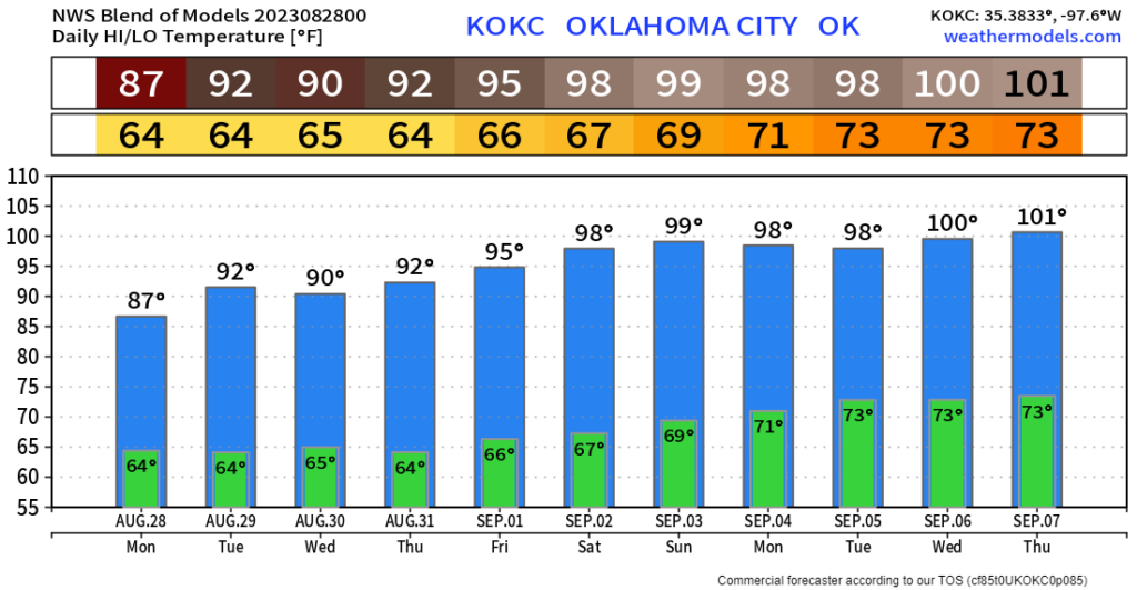
Now that the brutal heat week is over, it’s time to cool our jets with surface high-pressure building in from the northnortheast. This will keep us slightly cooler this week with mostly 90s. There won’t be any significant rain in the state this week, unfortunately.
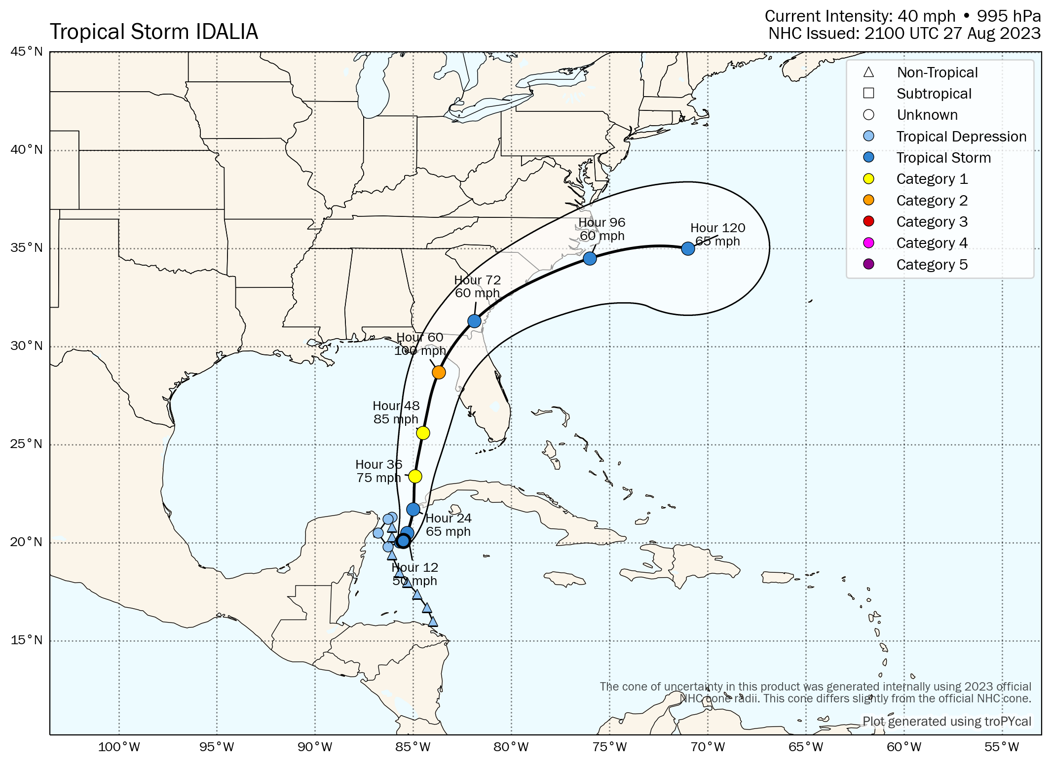
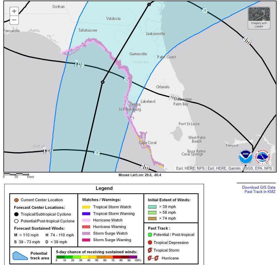
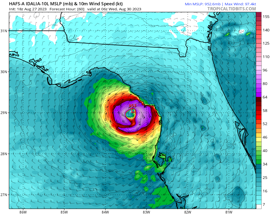
While we see an uneventful week heading into our Labor Day weekend, Florida will be preparing for a strong hurricane landfall late Tuesday. The hurricane guidance models suggest a CAT 2 is likely near the town of Cedar Key. If things were to align just right, a CAT 3 could develop last minute.
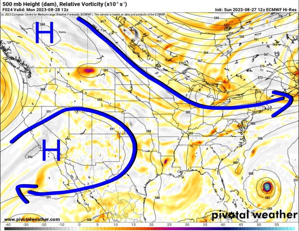
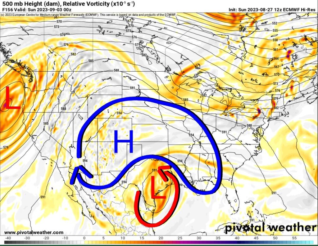
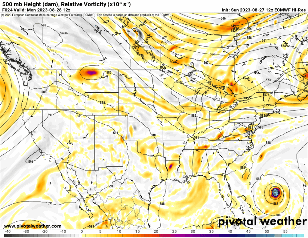
The Jetstream will show the upper ridge way out west try to establish itself back across Oklahoma by the end of the week. However, a tropical tutt low should develop at the same time and undercut the ridge. This will place Oklahoma on the cooler side of the upper high with an easterly fetch. This upper low will bring some good rain to Texas and cooler weather. It probably won’t be able to bring the rain across the Red River though for next weekend.
The official NHC track takes the hurricane into NW Florida. They will expect a storm surge under 10′ with 5-8″ of rainfall and wind gusts to 100 mph as the storm comes onshore Tuesday night.

As far as temperatures go here in OKC, expect something more reasonable. We may not hit 100 anymore. The model blend seems to think we will after Labor Day, but not if that upper low does its job. -AT
